Planning a ghost town road trip to Independence, Montana means committing to 53 miles southwest of Big Timber, a high-clearance 4WD vehicle, and a mindset built for isolation. This 10,000-foot boomtown in the Absaroka Range peaked at 500 prospectors before gold and ambition both ran dry by 1893. You’ll find collapsed cabins, rusted machinery, and zero amenities — just honest, unrestored history. Visit between July and August, pack everything you need, and keep going to uncover everything this forgotten mountain town still has to tell you.
Key Takeaways
- Independence ghost town sits at 10,000 feet in Montana’s Absaroka Range, roughly 53 miles southwest of Big Timber, best visited July through August.
- Drive southwest on MT Hwy 298 to McLeod, then follow Forest Road 6639 for 26 unpaved miles requiring a high-clearance 4WD vehicle.
- No services, hotels, or amenities exist at Independence; nearby lodging includes Hawley Mountain Guest Ranch, 12 miles down Boulder Road.
- Pack layered clothing, rain gear, a paper map, first-aid kit, food, water, and recovery gear before attempting this backcountry road trip.
- Combine Independence with visits to Bannack or Garnet ghost towns for a fuller experience of Montana’s historic gold rush mining legacy.
What Was Independence, Montana?
When gold fever swept the Upper Boulder region in 1891, Independence, Montana roared to life at a breathtaking 10,000 feet in the Absaroka Range.
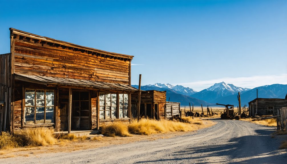
You’re looking at a town that packed four saloons, two general stores, a hotel, and gambling halls into four raw blocks of mountain wilderness. Its mining history burned bright but brief — the Independence mill churned out $42,000 in gold bullion by 1893, then went silent.
At its peak, 400-500 restless souls chased fortune here, answering no one’s rules but the mountain’s. By 1893, they’d scattered to the next dream.
500 wild souls chased gold at 10,000 feet — then vanished, following the next rumor of fortune.
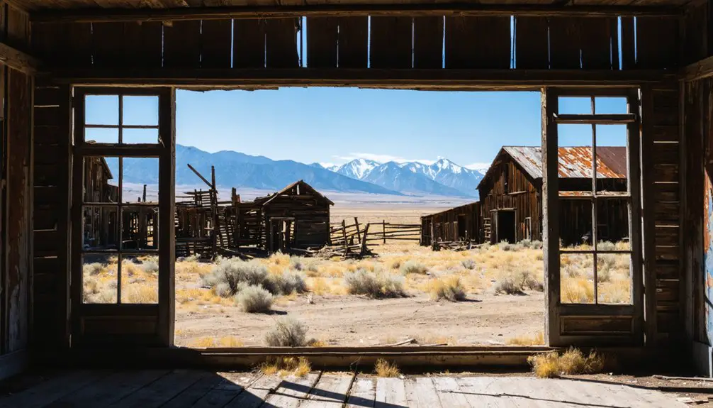
Today, this ghost town offers collapsed cabins and rusted machinery — honest remnants of men who gambled everything on a high-altitude strike and lived completely, fiercely free.
Where Exactly Is Independence Ghost Town?
You’ll find Independence perched at a dizzying 10,000 feet in Montana’s Absaroka Range, straddling Park and Sweet Grass Counties along a fork of Basin Creek, roughly 53 miles southwest of Big Timber.
To reach it, you’ll head southeast on MT Hwy 298 to McLeod, then follow Main Boulder Road and Forest Road 6639 for another 26 miles into increasingly rugged terrain.
Bring a high-clearance vehicle, because the final stretch of dirt and gravel roads that once carried a tri-weekly stage now demands something tougher than the average car.
Geographic Location Details
Tucked high in the Absaroka Range along the border of Park and Sweet Grass Counties, Independence sits at roughly 10,000 feet elevation — a ghost town that once drew hundreds of prospectors to one of Montana’s most remote and unforgiving corners.
You’ll find it nestled along a fork of Basin Creek, about three miles below the Boulder River’s headwaters and 53 miles southwest of Big Timber.
Its isolation isn’t incidental — it’s inseparable from its historical significance.
These mountains kept Independence hidden for years, its mining heritage locked behind terrain that demanded everything from those who pursued it.
That same ruggedness still defines the place today, rewarding the curious traveler willing to venture far beyond paved roads and comfortable conveniences.
Driving Directions Overview
Getting to Independence means committing to two distinct legs of travel, each one pulling you deeper into Montana’s backcountry. From Big Timber, head southwest roughly 27 miles on MT Hwy 298 to McLeod.
Then follow Main Boulder Road and Forest Road 6639 another 26 miles south, climbing toward 10,000 feet.
These scenic routes reward patience but demand respect. Driving challenges intensify on the final gravel and dirt stretches, where high-clearance vehicles aren’t just recommended — they’re practically mandatory, especially after rain softens the road.
You’re tracing the same rough corridor miners once navigated by pack trail, hauling dreams toward silver-laced quartz veins.
No services, no cell signal, no shortcuts. Just open mountain terrain, the Boulder River valley below you, and 53 miles of wild Montana between you and that forgotten boomtown.
Road Conditions for Reaching Independence Ghost Town
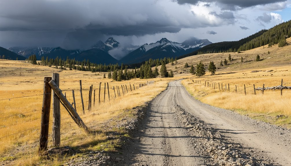
Once you leave the pavement behind and head south from McLeod, you’re retracing the same rugged path that prospectors and supply stages once struggled along to reach Independence’s booming saloons and stamp mills.
You’ll cover roughly 26 miles of dirt and gravel on Forest Road 6639, the kind of road that turns treacherous after rain and demands respect from anyone who underestimates it.
A high-clearance vehicle is strongly recommended, and a 4WD rig will serve you far better than anything built for comfort over capability.
Route Surface Conditions
Reaching Independence means trading pavement for the kind of roads that would’ve challenged even the tri-weekly stage drivers who once hauled mail and supplies to this remote mining camp.
Your road trip shifts considerably once you leave McLeod behind. Main Boulder Road shifts from maintained asphalt to packed dirt and gravel, stretching roughly 26 miles before Forest Road 6639 carries you the final distance.
Surface conditions deteriorate markedly after rainfall, turning loose gravel into something unpredictable and unforgiving. The last stretch demands respect — deep ruts, creek crossings, and shifting terrain remind you that 10,000 feet of elevation earns its solitude.
Those 1890s miners packed in on mule trails. You’ve got an engine, but the mountain still sets the terms.
Vehicle Requirements
Those road conditions aren’t just a warning — they’re a filter, and your vehicle either clears it or it doesn’t. Accessibility challenges here are real, shaped by decades of neglect and elevation. The miners who hauled equipment up these slopes earned every ounce; you should arrive equally prepared.
- High-clearance 4WD handles the final dirt and gravel stretches best, especially after rain turns the road unforgiving.
- Standard sedans and low-clearance vehicle types risk bottoming out miles from any help.
- Post-rain conditions transform passable gravel into something that’ll strand you fast.
Freedom means reaching places others won’t bother. But reaching Independence demands respect for the terrain. Choose your vehicle types wisely — the mountain doesn’t negotiate, and neither do those accessibility challenges waiting on the final stretch.
How to Get to Independence, Montana
Getting to Independence, Montana feels like retracing the steps of gold-hungry prospectors who once navigated these same rugged corridors on horseback.
Local history reminds us these miners hauled equipment through wilderness before any real access routes existed.
From Big Timber, head southwest roughly 53 miles. Take MT Hwy 298 southeast to McLeod, approximately 27 miles, then follow Main Boulder Road and Forest Road 6639 another 26 miles.
Alternatively, approach from Hwy 191, heading south through McLeod, about 37 miles total.
You’ll pass Hawley Mountain Guest Ranch, sitting 12 miles below the townsite — your last landmark before true solitude swallows you whole.
Independence sits at 10,000 feet, where freedom-seekers once chased silver and gold dreams, and where the wilderness still demands your full respect.
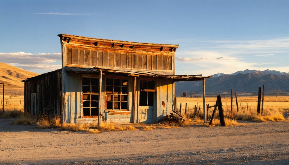
What You’ll Actually See at Independence Ghost Town
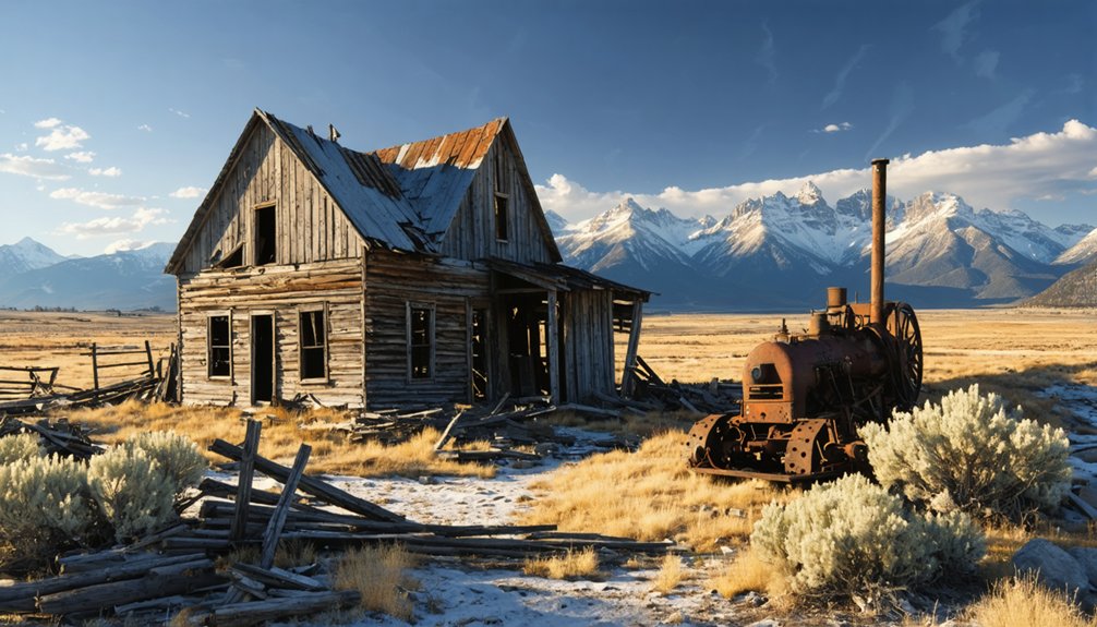
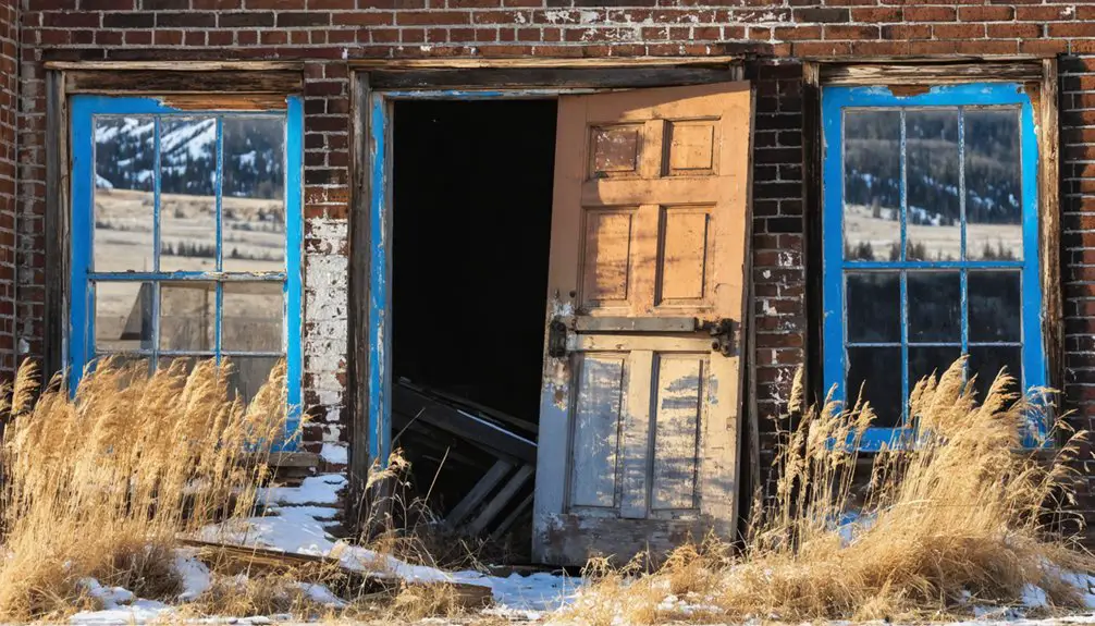
Arriving at Independence, you won’t find a preserved, tidy monument to Montana’s gold rush era — you’ll find the real thing. This ghost town history lives in decay, not restoration.
Collapsed log cabins sag under a century of brutal winters. Rusted mining artifacts dot the landscape like scattered evidence of ambition that once drew 500 men to 10,000 feet.
You’re walking ground where saloons, gambling halls, and a stamp mill once roared with life — then fell silent in 1893.
Look around and you’ll discover:
- Crumbling log cabin ruins slowly reclaimed by the mountain
- Rusted mining machinery frozen mid-operation
- The raw, unmanicured landscape exactly as fortune-seekers left it
No guardrails. No gift shop. Just honest history beneath a wide Montana sky.
Best Time of Year to Visit Independence, Montana
Timing your visit to Independence matters more than it does for most ghost towns, because at 10,000 feet in the Absaroka Range, the mountain decides when you’re welcome.
The best season runs from late June through early September, when snow finally releases its grip on Forest Road 6639 and the high passes open. Weather considerations are serious here — afternoon thunderstorms roll in fast, early snows arrive by October, and spring mud can swallow a lesser vehicle whole.
Those 500 miners who abandoned this place in 1893 understood harsh mountain realities firsthand. You should too.
Hit the road in July or August for the clearest skies and driest trails. Come prepared for sudden temperature drops regardless, because Independence has never offered anyone an easy welcome.
Where to Stay Near Independence, Montana?
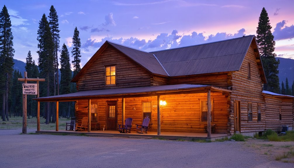
Nobody operated a hotel in Independence for long after 1893, and you won’t find one waiting for you now.
But you’ve got solid lodging options nearby that keep your freedom intact:
- Hawley Mountain Guest Ranch sits just 12 miles down Boulder Road, your closest base camp.
- Big Timber offers standard accommodations 53 miles northeast, near other nearby attractions worth exploring.
- Dispersed camping on surrounding national forest land lets you sleep under the same stars those miners did.
Pack everything you’ll need before leaving civilization.
Cell service disappears, supplies don’t materialize, and the mountain doesn’t accommodate unpreparedness.
The ghost town rewarded self-reliant souls in 1891, and it still does.
Choose your base, load your rig, and earn the view.
What to Pack for This Remote Ghost Town?
Once you’ve picked your base camp, what you load into that rig matters as much as where you park it. Independence’s 10,000-foot elevation and fierce weather don’t forgive the unprepared.
No services exist out here — the tri-weekly stage that once supplied those four saloons and two general stores is long gone.
Pack your hiking essentials: sturdy boots, layered clothing, rain gear, a compass, and a paper map since cell service is unlikely.
Your camping gear should include enough food and water for extended self-sufficiency. Add a first-aid kit, recovery gear for those 50-plus miles of gravel, and a high-clearance 4WD mindset before you even turn the key.
Freedom out here demands preparation.
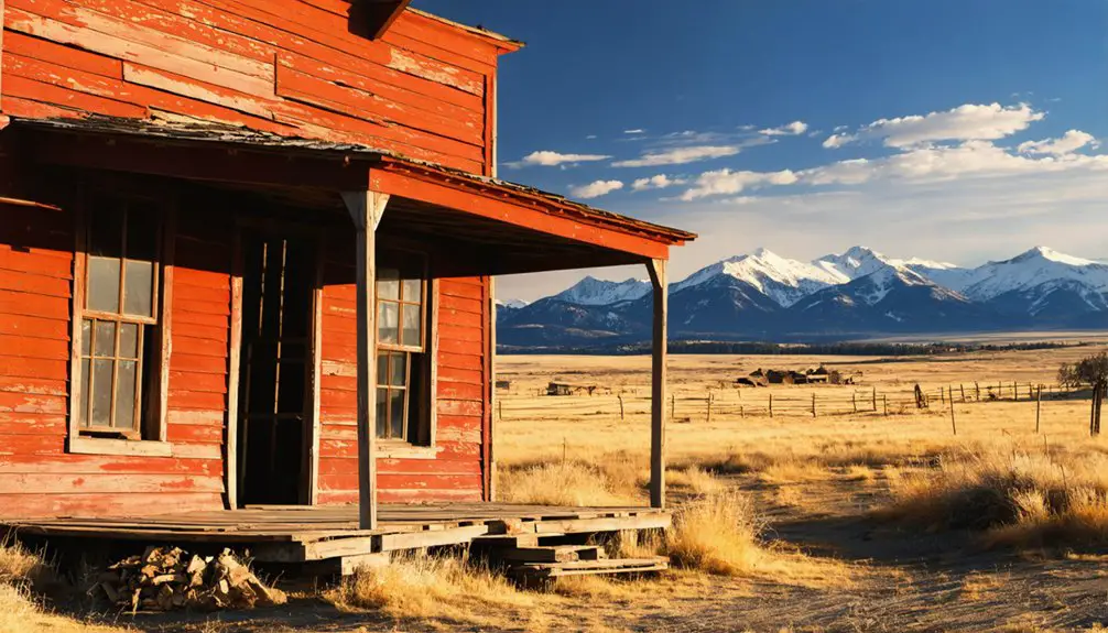
Ghost Towns Near Independence Worth a Stop on the Way
Montana’s ghost town circuit rewards the traveler who plans ahead, and Independence doesn’t have to stand alone on your itinerary.
The state’s mining legacy runs deep, and several haunted husks of ambition sit within reasonable driving distance.
- Bannack – Montana’s first territorial capital, rich in ghost town history, accessible via I-15 south
- Garnet – one of the state’s best-preserved mining camps, reachable off MT-83, still exhaling the 1890s
- Garnet to Independence loop – string them together for a full immersion in Montana’s restless boom-and-bust soul
Each stop layers the story further.
You’re not just visiting ruins — you’re tracing the same desperate optimism that drove men into these mountains chasing silver and gold they’d rarely find.
Frequently Asked Questions
Was Independence, Montana Ever Connected to Telephone Services?
Over 50 miles from civilization, yes — you’d have found a telephone wire stretching from Big Timber, defying Independence’s communication challenges. That lone line represents the town’s remarkable telephone history, connecting rugged, freedom-seeking souls to the outside world.
Did Independence Ever Have a School or Church for Residents?
You won’t find any school history or church community woven into Independence’s rugged past. Saloons, gambling halls, and a brothel defined life there — settlers craved freedom and fortune, not formal institutions, leaving those comforts far behind.
Who Originally Staked the First Mining Claims at Independence?
Like a pioneer chasing destiny’s call, Joe Keeney blazed the trail — he’s the claim staker who ignited Independence’s mining history. You’d find his bold spirit forever etched into Montana’s rugged, free-spirited past.
Is the Independence, Montana Site Preserved Like Other Ghost Towns?
You won’t find historical preservation here like at Colorado’s Independence. As you explore this ghost town exploration site, you’ll discover only tumbling cabins and rusted machinery — raw, untouched remnants whispering freedom’s forgotten promises across Montana’s wild, unforgiving landscape.
How Much Total Gold and Silver Ore Did Independence Produce?
Swipe right on history — you’d have struck it rich! From 1890–1905, Independence’s gold mining and silver production totaled $120,000 in ore, a fortune hard-won by those free spirits who dared those rugged Montana peaks.
References
- https://www.hawleymountain.com/a-montana-ghost-of-yesteryear/
- https://www.youtube.com/watch?v=PEZASHxQoTg
- https://www.legendsofamerica.com/independence-montana/
- https://leisuregrouptravel.com/park-to-park-ghost-town-route/
- https://www.greatfallstribune.com/story/life/my-montana/2018/06/28/these-12-best-ghost-towns-see-montana/736153002/
- https://visitmt.com/trip-ideas/ghost-town-route
- https://www.youtube.com/watch?v=rF5KELLLa00
- https://www.alltrails.com/trail/us/montana/granite-ghost-town
- https://www.rvtravel.com/independence-montana-ghost-town-time-4th-july-rvt-1110/
- https://www.youtube.com/watch?v=JmDCfbC9vq4