If you’re planning a ghost town road trip to Ortley, Oregon, you’ll find an empty plateau in Wasco County where a once-promising apple orchard community completely vanished. Platted in 1911, Ortley collapsed under relentless Columbia River winds and crippling summer drought before it ever truly flourished. Today, only “No Trespassing” signs mark the site. Keep going to uncover everything you need to know before making the trip yourself.
Key Takeaways
- Ortley is located in Wasco County, Oregon, approximately 7 miles southeast of Mosier, with GPS coordinates of 45.655953°N, 121.288128°W.
- No structures remain at the site; open land and “No Trespassing” signs are the only visible features today.
- The entire site is private property, so contact Wasco County officials for legal access permission before visiting.
- Travel through Rowena and Mosier for supplies and scenic Columbia River views; visit in late spring or early fall.
- Nearby ghost towns Shaniko, Hardman, Antelope, and Auburn offer preserved structures and additional historical context for your road trip.
What Is Ortley, Oregon’s Ghost Town Story?
Tucked away on a plateau overlooking the Columbia River in Wasco County, Ortley, Oregon tells a classic boom-and-bust story that ended almost as quickly as it began.
The Hood River Orchard & Land Company platted the town in 1911, envisioning a thriving farming community built around apple orchards. Settlers purchased small home lots alongside five-to-ten-acre orchard parcels, and a post office opened shortly after.
But Ortley history took a harsh turn fast. Brutal winds damaged orchard trees on the river-facing side, and summer water scarcity crippled irrigation efforts. Developers poured over $20,000 into keeping the dream alive before the post office finally closed in 1922.
Today, ghost town preservation is fundamentally moot here — no structures remain, and the land sits behind private “No Trespassing” signs.
Why Ortley Failed: Wind, Water, and Bad Luck
When you look into why Ortley collapsed so quickly, two brutal environmental realities stand out.
The high winds that swept off the Columbia River shredded tree branches on the orchard’s exposed side, crippling the apple crops the entire community depended on.
Then summer arrived, and you’d have found farmers scrambling for water that simply wasn’t there, as the plateau’s chronic irrigation shortages made sustaining the orchards nearly impossible.
Devastating Wind Damage
Perched on a plateau overlooking the Columbia River, Ortley faced a brutal natural enemy from the start: the wind. Powerful gusts consistently hammered the orchard trees, snapping branches on the river-facing side and crippling their ability to produce fruit. Orchard resilience simply couldn’t withstand this relentless wind impact season after season.
Imagine investing everything into a carefully planned farming dream, only to watch nature systematically dismantle it. That’s exactly what settlers experienced here.
The plateau’s elevation, which initially seemed like a strategic advantage offering stunning views and open land, actually exposed every tree to devastating Columbia River Gorge winds.
No amount of determination could fully counteract what geography had already decided. The wind didn’t just damage branches — it slowly dismantled the entire economic foundation Ortley’s founders had carefully built.
Critical Water Shortages
Wind wasn’t Ortley’s only enemy. The plateau’s second fatal flaw struck just as hard — summer water scarcity made sustaining the orchards nearly impossible.
Without reliable water sources, farmers couldn’t implement effective irrigation techniques to keep their apple trees alive through Oregon’s dry summer months. The Hood River Orchard & Land Company poured over $20,000 into solving these problems, desperately searching for water conservation strategies that could rescue their investment.
Nothing worked. The combination of destructive winds and chronic drought fundamentally guaranteed Ortley’s failure before it ever had a real chance.
You can almost picture the frustration of settlers watching their carefully planted orchards wither despite their best efforts. Nature simply refused to cooperate with the developers’ ambitious plans for this windswept Columbia River plateau.
Where Exactly Is Ortley Located Today?
You’ll find Ortley’s ghost town site in Wasco County, Oregon, roughly 1 mile south of Rowena and 7 miles southeast of Mosier — two small towns worth noting for trip supplies since Ortley itself offers nothing.
The site sits on a plateau overlooking the Columbia River, now marked only by “No Trespassing” signs on private land with no visible structures remaining.
Plug GPS coordinates 45.655953°N, 121.288128°W into your navigation app to pinpoint the approximate location before you head out.
Ortley’s Geographic Position Today
Ortley sits roughly 1 mile south of Rowena and 7 miles southeast of Mosier in Wasco County, Oregon, overlooking the Columbia River from a windswept plateau. Its coordinates — 45°39′21″N 121°17′17″W — pinpoint a location that feels both remote and strangely significant once you understand Ortley’s geography and historical significance.
Despite its abandonment, the USGS still classifies it as a populated place, a quiet nod to its former ambitions.
Today, the site rests entirely on private property, marked by “No Trespassing” signs with zero visible structures remaining. Nothing betrays that a planned farming community once stood here.
You’ll want to use GPS coordinates 45.655953°N 121.288128°W to orient yourself, then explore the surrounding landscape from public roads nearby.
Nearby Towns And Landmarks
Tucked between the small communities of Rowena and Mosier, the ghost town of Ortley occupies a plateau in Wasco County that’s easy to miss if you’re not actively looking for it.
Rowena sits just one mile north, while Mosier lies roughly seven miles to the northwest, making both towns your best stops for fuel and supplies before you explore.
The Columbia River defines the landscape below, and the Hood River Valley stretches nearby, where Historic Orchards still thrive as a major regional cash crop — a striking contrast to Ortley’s failed agricultural ambitions.
Ghost Towns like Ortley rarely advertise themselves, and this one certainly doesn’t.
No signage marks the site, so you’ll want GPS coordinates 45.655953°N, 121.288128°W loaded before you arrive.
Where Exactly Is Ortley Located Today?
Pinning down a ghost town takes more precision than you’d expect, and Ortley gives you exactly two reliable coordinates to work with: 45°39′21″N, 121°17′17″W in traditional format, or 45.655953°N, 121.288128°W in decimal degrees for most modern GPS technology and mapping apps.
Before you head out, follow these navigation tips:
- Enter decimal degree coordinates for accurate smartphone routing
- Cross-reference nearby Rowena (1 mile north) as a landmark checkpoint
- Note that Mosier sits 7 miles northwest if you need supplies
- Confirm you’re within Wasco County borders before leaving paved roads
Can You Legally Visit Ortley Without Trespassing?
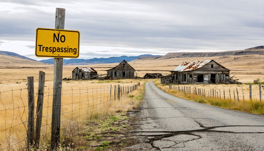
Visiting Ortley today means maneuvering through a frustrating legal reality: the entire townsite sits on private property posted with “No Trespassing” signs, so you can’t simply drive up and explore the grounds.
Ghost town regulations here aren’t suggestions — crossing onto this land without permission exposes you to real legal consequences.
Despite Ortley’s historical significance as a planned farming community with a fascinating boom-and-bust story, no public access exists whatsoever.
Ortley’s compelling boom-and-bust history remains tantalizing yet unreachable — the public simply cannot access this once-thriving planned farming community.
Your best legal option involves contacting Wasco County officials or researching current landowner information to request permission before visiting.
If that fails, you can still appreciate the site from public roadways nearby.
Rowena and Mosier remain accessible stops where you can absorb the surrounding landscape that once inspired developers to build something remarkable here.
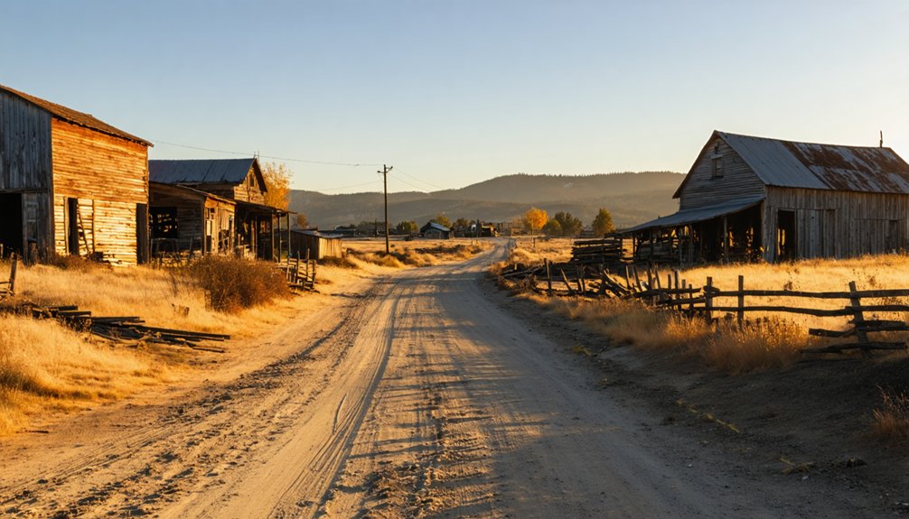
There’s Nothing Left at Ortley: Here’s What You’ll Actually See
If you make it out to Ortley, don’t expect crumbling buildings or weathered foundations — you’ll find nothing but open land where the town once stood.
The Hood River Orchard & Land Company’s grand vision has completely vanished, leaving no physical trace of the homes, orchards, or post office that once defined this plateau community.
What you *will* see are “No Trespassing” signs reminding you that this private property isn’t yours to explore freely.
Empty Land Remains
There are 0 structures left standing at Ortley — no crumbling foundations, no weathered fence posts, no rusted machinery half-buried in the soil. The abandoned structures are completely gone, leaving only open land with historical significance you can’t physically touch.
Here’s what you’ll actually encounter:
- Private property marked with active “No Trespassing” signs
- Open plateau land overlooking the Columbia River with no visible townsite evidence
- High wind exposure that once destroyed orchard trees still sweeps across the terrain
- Surrounding landscape that looks indistinguishable from any other rural Wasco County property
You’re fundamentally visiting coordinates, not a destination. The USGS still classifies Ortley as a populated place, but the land tells a quieter, starker truth — it’s just empty.
No Trespassing Signs Posted
Beyond the empty plateau and the wind cutting across it, the clearest signal that Ortley is off-limits comes posted right at the boundary: “No Trespassing” signs that mean exactly what they say.
Land ownership here is private, and Oregon’s trespassing laws back that claim with real legal consequences.
You won’t find a fence line you can peek through or a public overlook granting a closer view. The signs stand as the final word.
Respecting them isn’t just about avoiding fines — it’s about acknowledging that someone owns this ground, ghost town history and all.
If you’re chasing Ortley’s story, you’ll get closer through research than by crossing that boundary.
The plateau will hold its silence, and the signs will keep holding their ground.
Private Property Only
Even if you somehow got permission to step onto the private land where Ortley once stood, you’d find nothing waiting for you.
Rural exploration enthusiasts and ghost town photography seekers often discover that Ortley offers zero visual rewards. The plateau holds no structures, foundations, or artifacts — just open land reclaimed by nature.
Here’s what you’d actually encounter:
- Empty plateau terrain with no architectural remnants
- Wind-swept ground offering no historical markers
- Private property boundaries enforced by posted signs
- Unobstructed views of the Columbia River below
The land has completely erased every trace of the 1911 settlement. Your camera captures nothing historically significant here — just landscape.
Ortley’s real story lives in records, not ruins.
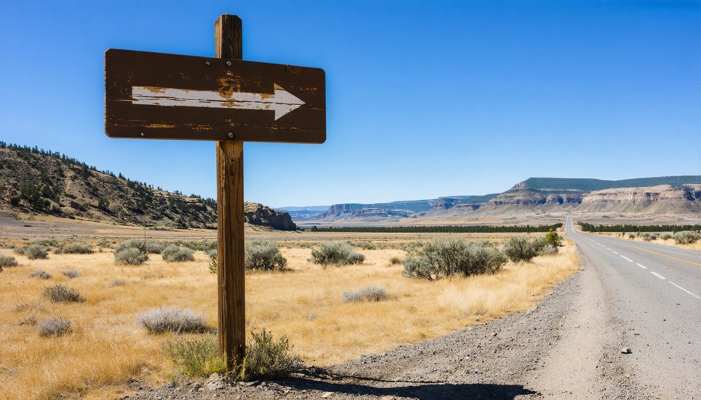
How To Plan Your Route Through Rowena and Mosier
Planning your route to Ortley means passing through two small Columbia River Gorge towns — Rowena and Mosier — that’ll serve as your last real stops for supplies before reaching the ghost town site.
Rowena sits just one mile north of Ortley and offers stunning scenic viewpoints overlooking the Columbia River, giving you a real sense of the dramatic landscape that ultimately doomed the original orchards.
Mosier, seven miles northwest, carries its own local history worth exploring before you head out.
Stock up on anything you need in either town, because you won’t find public facilities at the Ortley site itself.
Use GPS coordinates 45.655953°N, 121.288128°W to navigate accurately, and time your visit during dry seasons for the best road conditions.
When Is the Best Time To Visit Ortley?
When should you schedule your road trip to Ortley? Timing matters here. The site’s history of summer water scarcity and brutal winds means you’ll want ideal weather conditions for a comfortable visit. The best season for exploring this Columbia River plateau ghost town is late spring or early fall.
- Late Spring (April–May): Mild temperatures, green landscapes, and manageable winds.
- Early Fall (September–October): Crisp air, stunning river views, and minimal crowds.
- Avoid Midsummer: Intense heat and water scarcity issues defined Ortley’s downfall—don’t relive them.
- Avoid Winter: High winds along the plateau make conditions unpleasant and potentially dangerous.
Plan your arrival during daylight hours, respect the posted “No Trespassing” signs, and secure landowner permission before approaching the site.
Why Oregon Has So Many Ghost Towns Like Ortley
Oregon didn’t end up with over 200 ghost towns by accident. The state’s frontier history drew waves of Oregon pioneers chasing gold, timber, and fertile land.
When those resources dried up, entire communities simply emptied out. Historian Stephen Arndt documented 256 abandoned settlements — each one carrying its own historical significance and story of ambition gone sideways.
Ortley fits this pattern perfectly. Developers platted a farming community, sold dreams of apple orchards, and watched environmental reality crush those plans within a decade.
High winds, scarce water, and financial losses wrote the ending.
Understanding why Oregon produces so many ghost towns helps you appreciate what you’re actually visiting. These aren’t just abandoned places — they’re physical proof of how quickly fortune can shift when nature refuses to cooperate.
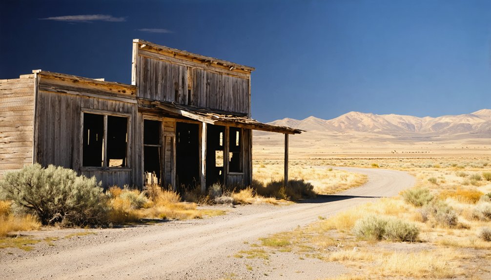
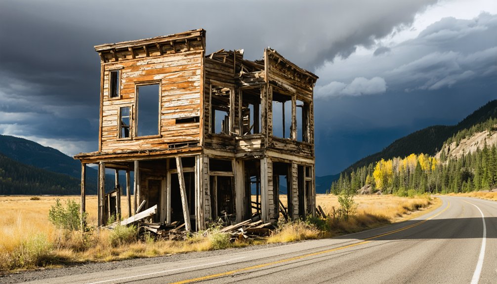
Five Oregon Ghost Towns Worth Visiting Near Ortley
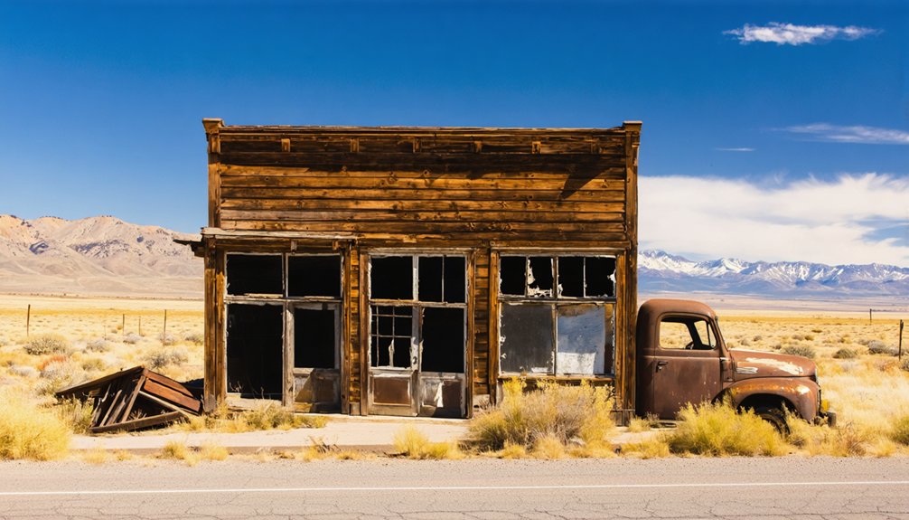
Exploring the Ortley site takes maybe ten minutes since there’s nothing left to see — but the surrounding region rewards curious travelers with several ghost towns that still offer visible remnants and compelling histories.
Pack your road trip itinerary with these stops worth your time:
Pack these ghost town detours into your Oregon road trip for stops that actually reward the drive.
- Shaniko — Oregon’s most famous ghost town features preserved buildings and active historical preservation efforts.
- Hardman — A remote Morrow County ghost town retaining original structures you can photograph freely.
- Antelope — A fascinating community with documented boom-and-bust cycles similar to Ortley’s story.
- Auburn — One of Oregon’s earliest gold rush ghost towns, connecting you directly to frontier history.
These ghost towns deliver what Ortley can’t — tangible evidence of Oregon’s abandoned past that you can actually explore and experience firsthand.
What To Bring for a Remote Oregon Ghost Town Visit
Visiting remote ghost towns like Ortley demands preparation, since you’re heading somewhere with zero public facilities, no cell service, and private land boundaries that make wandering unpredictable.
Pack your ghost town essentials before leaving civilization behind. Bring plenty of water, because summer heat on that Columbia River plateau is unforgiving. Carry detailed paper maps since GPS signals can drop in Oregon’s remote corridors.
Your travel safety depends on sturdy footwear, a first aid kit, and letting someone know your exact route. Pack snacks, extra fuel, and a charged backup battery for your devices.
Respect posted “No Trespassing” signs rather than risking legal trouble for a photograph. Freedom on the road means staying self-sufficient, sharp, and ready for whatever Oregon’s rugged landscape throws at you.
Frequently Asked Questions
Did the Ortley Apple Variety Survive After the Town Was Abandoned?
The Ortley Apple’s apple cultivation outlived the town’s collapse, carrying its historical significance forward! You’ll find this resilient variety still thriving in nearby Hood River, where farmers actively grow apples as a major cash crop today.
How Much Did Individual Land Parcels Sell for in 1911?
Like seeds without price tags, the records don’t reveal what individual land parcels sold for in 1911. Yet their land value and historical significance shaped Ortley’s dream — you’d have received one acre for a home plus five or ten orchard acres.
Who Specifically Founded the Hood River Orchard & Land Company?
The specific founders of Hood River Orchard & Land Company aren’t documented in available records. You’ll find that orchard history and land development shaped Ortley’s local economy considerably, making it a fascinating stop on your ghost town adventure.
Are There Historical Photographs Documenting Ortley Before Its Abandonment?
The available knowledge doesn’t confirm specific historical photographs of Ortley, but you’ll find ghost town photography capturing its historical significance worthwhile to explore through Oregon historical societies, local archives, and Wasco County records documenting this fascinating abandoned community.
How Many Residents Lived in Ortley at Its Population Peak?
The available records on Ortley history don’t confirm a peak population figure. Like many planned farming communities, population dynamics shifted quickly — you’d find early settlers arriving optimistically in 1911, only to abandon their orchards as wind and drought took hold.
References
- https://www.youtube.com/watch?v=DvxL3Eyp0ws
- http://pnwphotoblog.com/ghost-town-of-ortley-oregon/
- https://en.wikipedia.org/wiki/Ortley
- https://en.wikipedia.org/wiki/List_of_ghost_towns_in_Oregon
- https://commons.wikimedia.org/wiki/Category:Ortley
- https://www.hoodriverhistorymuseum.org/ortleys-2/
- https://www.pdxmonthly.com/travel-and-outdoors/2025/10/oregon-ghost-towns-history
- https://www.ghosttowns.com/states/or/oralpha.html
- https://sos.oregon.gov/archives/exhibits/ghost/Pages/logging-valsetz.aspx
- https://sos.oregon.gov/archives/exhibits/ghost/Pages/learn.aspx


