Red Hill, New Mexico sits 7,264 feet high in Catron County, 23 miles southwest of Quemado off US Highway 60. You’ll reach a volcanic ghost town where a dying prospector’s 1836 gold secret never got solved, a post office that closed in 1957, and red pumice slopes that still hold their silence. Pack water, layer your clothing, and bring a paper map — there’s far more to this story than the highway lets on.
Key Takeaways
- Red Hill is located in Catron County, 23 miles southwest of Quemado, accessible via US Highway 60 on standard 2WD roads.
- The ghost town features abandoned remnants including a gem shop, vacant real estate office, and old cattle reservoirs from past ranching activities.
- Red Hill’s distinctive red landscape results from ancient volcanic history and iron-rich minerals, with volcanic activity dating back 23,000 years.
- The area carries the unresolved legend of Adams’ gold, originating from a wounded prospector’s discovery in 1836, adding historical intrigue.
- Travelers should carry ample water, layered clothing, paper maps, sturdy boots, and a first aid kit due to unreliable cell service and extreme weather.
Where Is Red Hill, New Mexico?
Tucked into the high desert of Catron County, Red Hill sits 23 miles southwest of Quemado along US Highway 60, just 8 miles from the Arizona border.
You’ll find it at coordinates 34°13′07″N 108°52′20″W, rising to an elevation of 7,264 feet among striking geological features — scoria cones, silicic domes, and slopes blanketed in red pumice from a volcanic field that last erupted 23,000 years ago.
Standard 2WD roads get you there, though you’ll want to prepare for hot summers and brutal winters.
The surrounding high desert shelters local wildlife across open rangelands and volcanic mesas.
Once home to Anasazi, Zuni, and Acoma peoples, this remote stretch rewards adventurous travelers willing to chase wide-open landscapes far from crowded destinations.
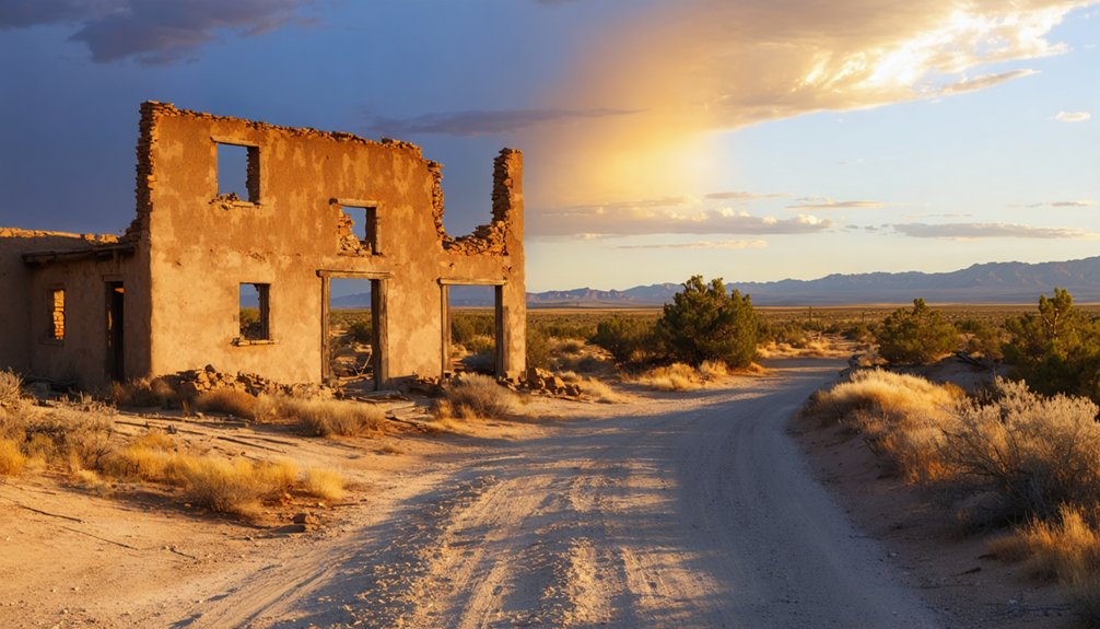
How a Prospector’s Gold Story Turned Red Hill Into a Ghost Town
When a wounded prospector named Adams staggered into Piños Altos in 1836 clutching gold nuggets the size of hen’s eggs, he unknowingly set Red Hill’s fate in motion.
His prospector’s legacy sparked decades of obsession, briefly transforming this volcanic outpost into a living township before ghost town legends swallowed it whole.
A prospector’s dying secret fueled generations of obsession, building a town that legend ultimately reclaimed.
- Adams carried $7,000 in gold, describing a field at a red hill’s base.
- He died before revealing the exact location.
- Searchers combed the region for generations, finding nothing.
- A small 1920s gold discovery reignited hope, birthing a brief community.
- The post office closed in 1957, leaving silence behind.
You’re now walking ground where fortune-hunters once staked everything. The gold may still be out there.
Why Red Hill’s Slopes Are Actually Red
When you first spot Red Hill rising from the high desert, that striking crimson color isn’t a trick of the light — it’s ancient volcanic history written in stone.
You’re walking on red pumice and scoria, the cooled remnants of eruptions that last fired roughly 23,000 years ago, when this volcanic field pushed magma, gas, and fragmented rock across the landscape.
Those scoria cones scattered across the terrain tell you exactly why the slopes burn so red: iron-rich minerals oxidized during eruption, staining everything they touched in shades of rust and burgundy.
Red Pumice Volcanic Origins
The moment you set eyes on Red Hill, the answer to its name is obvious — vivid crimson slopes blanketed in red pumice stones, the volcanic calling card of an eruption that shook this corner of New Mexico roughly 23,000 years ago.
These volcanic formations shaped the landscape, leaving behind striking mineral deposits worth exploring:
- Scoria cones rise dramatically across the terrain
- Silicic domes punctuate the skyline with raw geological power
- Red pumice blankets slopes at 7,264 feet elevation
- The Quemado volcanic field extends across the surrounding region
- Nearby Springerville volcanic field sits just 24 km east
You’re standing on geologically young land — restless, dramatic, and unapologetically ancient.
Every crimson stone beneath your boots tells a story 23,000 years in the making.
Scoria Cones Explain Color
Scoria — porous, bubbly, oxidized volcanic rock — is the real artist behind Red Hill’s blazing color palette. During eruptions, iron-rich lava fragments cooled rapidly, trapping gas bubbles and oxidizing into deep crimson and rust. That’s scoria formation in raw, unfiltered action.
The geological significance runs deeper than aesthetics. These cones signal a volcanic field that last erupted roughly 23,000 years ago, leaving behind a landscape frozen mid-exhale.
When you walk Red Hill’s slopes, you’re stepping across compressed volcanic history — each red pumice stone a timestamp from an ancient eruption.
You’ll notice the color intensifies under afternoon sun. That’s oxidized iron doing exactly what iron does when fire meets atmosphere.
Nature doesn’t need embellishment here. The geology speaks loudly enough on its own.
Ancient Eruptions Left Residue
Red Hill’s slopes aren’t red by accident — ancient volcanic eruptions left behind a residue of iron-rich scoria that’s been oxidizing ever since. This ancient geology tells a raw, unfiltered story of volcanic activity that shaped the landscape 23,000 years ago.
Walk these slopes and you’re reading earth’s own history:
- Red pumice stones blanket the hillsides like scattered ruins
- Iron oxidation deepens the crimson color under direct sunlight
- Elevation reaches 7,264 feet, amplifying the volcanic drama
- Scoria cones rise sharply, remnants of explosive prehistoric venting
- The nearby Springerville volcanic field sits just 24 kilometers east, extending the story
You’re standing inside a frozen moment of geological violence.
That freedom to roam unmarked terrain, unguided, is exactly what Red Hill offers.
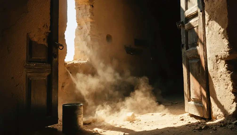
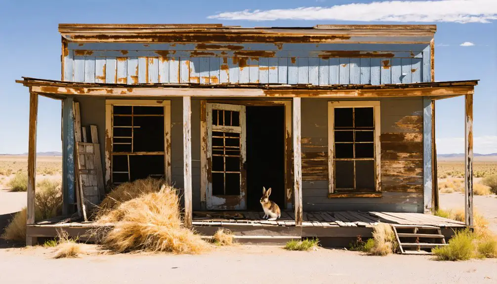
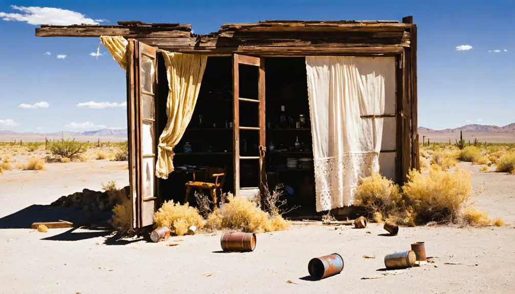
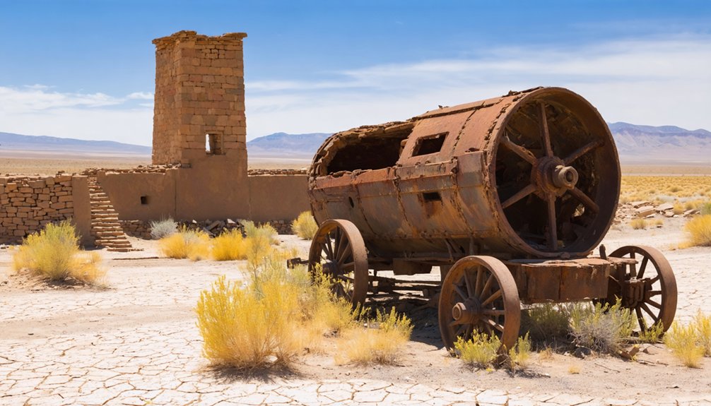
What’s Actually Left at Red Hill Today (And Was the Gold Ever Found?)
What remains at Red Hill today is less a town than a memory pressed into volcanic soil.
You’ll find an abandoned gem shop and a vacant real estate office haunting Highway 60 — classic ghost town remnants for anyone chasing forgotten American corners.
Old cattle reservoirs still hold water, proof that ranching outlasted everything else here.
As for treasure hunting, the Adams gold legend remains stubbornly unresolved.
In 1836, a wounded prospector stumbled out carrying nuggets the size of hen’s eggs, describing a gold field at a red hill’s base. He died without giving directions.
A small 1920s find briefly sparked a township, then silence. Nobody’s cracked it yet.
That unfinished mystery might be Red Hill’s most powerful draw for the freedom-hungry explorer.
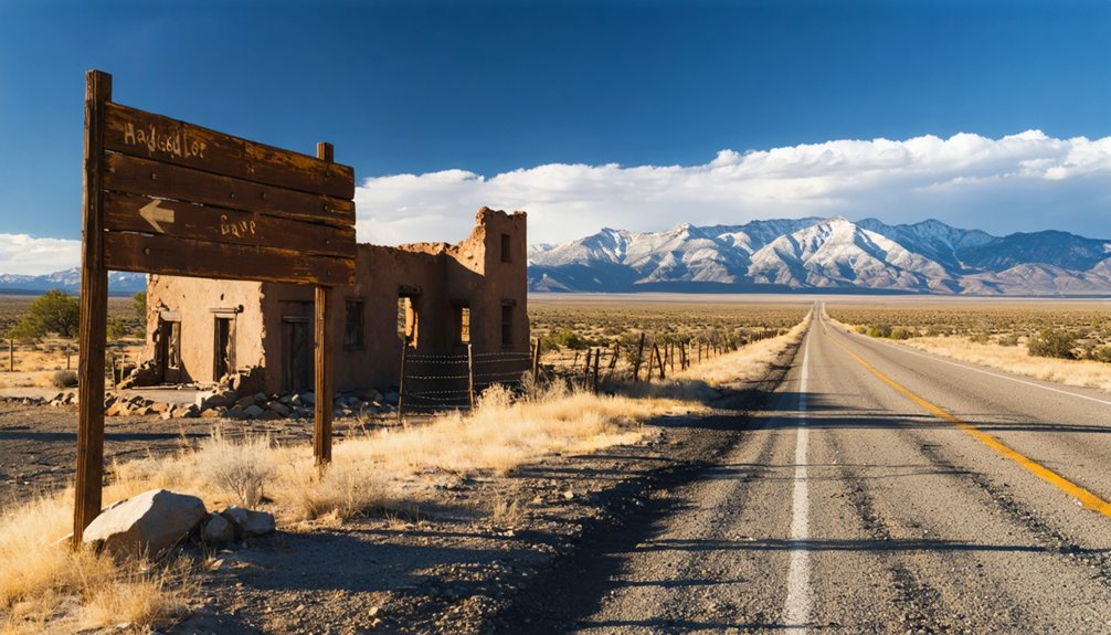
Driving to Red Hill on US 60 From Quemado
You’ll head west out of Quemado on US Highway 60, the same dusty corridor that once carried prospectors chasing rumors of gold the size of hen’s eggs.
The drive covers 23 miles of open high-desert terrain, pulling you steadily toward the Arizona border until Red Hill’s rust-colored slopes rise into view.
It’s a straightforward 2WD route, but the isolation is real — stock your vehicle before you leave Quemado, because there’s nothing waiting for you out there except volcanic rock and old ghosts.
Route Along US 60
Heading west from Quemado on US Highway 60, you’ll cover 23 miles of high desert before the volcanic landscape of Red Hill rises into view, just 8 miles shy of the Arizona border.
The scenic vistas unfold like pages of geological history, and road conditions remain 2WD-friendly throughout.
Watch for these landmarks along your route:
- Quemado serves as your last reliable supply stop before isolation sets in
- Open ranchland stretches alongside the highway, dotted with cattle operations
- Volcanic mesas gradually dominate the horizon as you push westward
- Red pumice slopes signal your arrival at elevation 7,264 feet
- Abandoned roadside buildings, including a gem shop and real estate office, mark the old townsite
Distance From Quemado
Twenty-three miles of high desert highway separate Quemado from Red Hill, and every one of them pulls you deeper into volcanic country where the landscape feels older than memory.
You’ll follow US 60 southwest, watching cinder cones rise against the sky as you close in on the Arizona border. The drive itself carries historical significance — these same roads once drew prospectors chasing Adams’ legendary gold nuggets, men who believed a fortune waited at the base of that red hill.
Treasure hunting still brings visitors out here, though most come now for the freedom of open country rather than riches.
Keep your tank full before leaving Quemado. There’s nothing between you and that volcanic silence except eight miles of road separating you from another state.
Other Stops Worth Combining With Your Red Hill Drive
Since Red Hill sits along US Highway 60 in one of New Mexico’s most sparsely populated stretches, you’d be leaving a lot of history on the table by making it a one-stop trip.
Since Red Hill sits along one of New Mexico’s most desolate stretches, making it a one-stop trip would be a mistake.
This corridor rewards curious travelers willing to chase ghost town history and mining legends across open terrain.
- Quemado’s volcanic field, just 23 miles northeast, offers dramatic crater landscapes
- Zuni Salt Lake, immediately north, carries centuries of Indigenous ceremonial significance
- Piños Altos, connected directly to Adams’ gold rush story, deepens the mining legends trail
- Arizona border crossings, only 8 miles west, open entire new ghost town corridors
- Springerville volcanic field, 24 km east, rounds out the geological storytelling beautifully
Stack these stops deliberately, and US 60 transforms into one unforgettable, freedom-fueled route.
What to Pack for the Red Hill Ghost Town
Red Hill doesn’t forgive the unprepared — you’re stepping into high desert terrain at 7,264 feet, where summers scorch and winters bite hard, with no facilities, scarce rain, and the nearest supplies miles back on US 60.
Your packing essentials start with water — carry more than you think you’ll need. Add sun protection, layers for sudden temperature swings, and a paper map since cell service is unreliable out here.
For hiking gear, sturdy boots are non-negotiable on the volcanic scoria slopes where loose red pumice shifts underfoot. Toss in a first aid kit, snacks, and a charged power bank.
Bring a camera — the crater views and ghost town remnants deserve documentation. Pack light, pack smart, and respect the isolation that’s kept Red Hill’s treasure legend alive for nearly two centuries.
Frequently Asked Questions
Can You Camp Overnight Near Red Hill’s Volcanic Slopes?
Like Adams hauling gold through wild terrain, you can camp near Red Hill’s volcanic slopes! Follow camping tips and safety precautions—prepare for extreme weather, pack supplies, and check local ranch activity before pitching your tent freely.
Are There Any Guided Tours Available at Red Hill?
No guided tours exist at Red Hill, so you’ll forge your own path through ghost town history and local legends. Embrace that freedom—explore volcanic slopes, chase Adams’ lost gold, and write your own adventure independently.
Is Metal Detecting or Gold Prospecting Legally Permitted at Red Hill?
Like a prospector chasing whispers, you’ll need to research local mining regulations before treasure hunting at Red Hill, as federal and state laws typically restrict metal detecting on public lands without proper permits.
What Wildlife Might Visitors Encounter While Hiking Red Hill?
While hiking trails across Red Hill’s volcanic slopes, you’ll encounter mule deer, coyotes, and rattlesnakes roaming ancient lava fields. Bird watching rewards you with hawks, eagles, and ravens soaring freely above red pumice — wildlife untamed since Anasazi times.
Are There Any Nearby Lodging Options Close to Red Hill?
You won’t find lodging options at isolated Red Hill itself, but Quemado’s modest accommodations await 23 miles northeast. From there, you’ll freely explore nearby attractions like volcanic craters, ghost town remnants, and legendary gold country.
References
- https://kids.kiddle.co/Red_Hill
- https://en.wikipedia.org/wiki/Red_Hill
- https://landofentrapment.blog/the-red-hill-treasure/
- https://www.youtube.com/watch?v=MJLcUXBWVtk
- https://www.ghosttowns.com/states/nm/redhill.html
- https://en.wikipedia.org/wiki/List_of_ghost_towns_in_New_Mexico
- https://www.newmexico.org/places-to-visit/ghost-towns/
- https://www.aol.com/mexicos-once-thriving-gold-rush-152500867.html
- https://www.facebook.com/groups/350990901247737/posts/844164715263684/
- https://www.youtube.com/watch?v=pE5PwEfIlZw