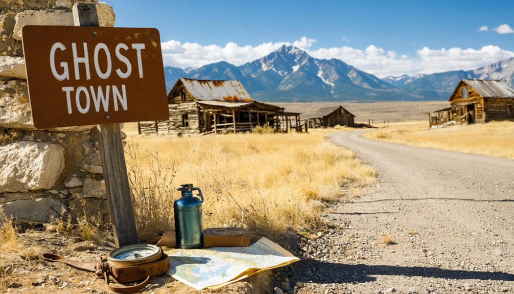
Plan your ghost town road trip to Tarryall Puma City by heading toward Como, Colorado, where County Road 77 winds through open country to a place that once roared with gold fever. You’ll find tailing piles, log ruins, and a schoolhouse that survived the boom-and-bust cycles of the 1860s. Spring through early fall offers the best road conditions. Pack water, wear sturdy boots, and fuel up before you leave—there’s far more to this forgotten mining camp than first appears.
Key Takeaways
- Tarryall Puma City, near Como, Colorado, is a historic gold rush ghost town accessible via County Road 77 from Jefferson or Lake George.
- High-clearance vehicles are recommended for the rough, washboard dirt road, though standard cars can manage if drivers tolerate bumpy conditions.
- Visit between April and September for the best road conditions and clear high-country weather ideal for exploration.
- Key attractions include mile-long tailing piles, log home ruins, a historic schoolhouse, and a commemorative plaque at Tarryall Creek crossing.
- Pack layered clothing, sturdy footwear, extra water, and a full gas tank, as cell service along the route is unreliable.
What Makes Tarryall Puma City Worth the Drive?
When you pull off Highway 285 near Como and follow the dusty county roads toward upper Tarryall Creek, you’re tracing the footsteps of prospectors who once flooded this valley chasing placer gold in the 1860s — and later, a second wave who rushed in after new mineral discoveries rechristened the settlement Puma City in 1896.
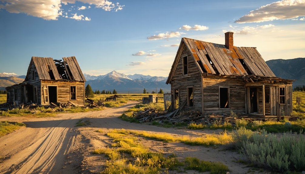
That dual identity is central to this site’s ghost town significance. You’re not visiting one forgotten chapter but two. The schoolhouse still stands, listed on the National Register of Historic Places, anchoring the site’s commitment to historical preservation.
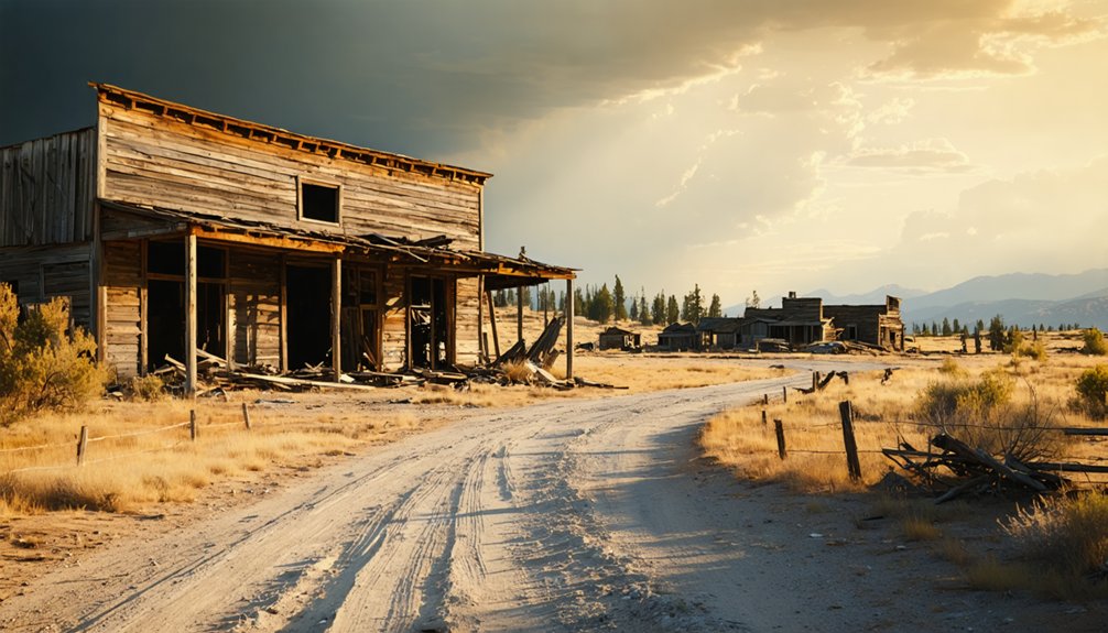
Tailing piles stretch over a mile, and log structures quietly decay against an open sky. This place rewards curious travelers who value raw history over polished tourist experiences — no crowds, no fences, just honest remnants of lives built and abandoned.
The Gold Rush History That Built Tarryall Puma City
When you stand at Tarryall Creek today, it’s hard to imagine the frenzy that erupted here after gold turned up in 1859, drawing waves of prospectors chasing placer deposits in the riverbeds.
The town boomed fast, pulling in thousands and generating over $2 million in gold from the Tarryall diggings alone.
But the deposits ran shallower than anyone hoped, and by the late 1860s, the rush had gutted itself, leaving Hamilton and Tarryall City as little more than memories pressed into the earth.
Gold Discovery Origins
The year 1859 crackled with possibility along Tarryall Creek, where prospectors discovered gold and ignited one of Colorado’s earliest mountain rushes. Early settlers flooded the valley, armed with pans, sluice boxes, and relentless ambition.
Mining techniques centered on placer methods, pulling raw gold directly from riverbeds and gravel beds where it had settled over centuries.
The diggings proved genuinely rich, ultimately producing over $2 million in gold. You can almost feel that frantic energy today when you stand at the creek’s edge, imagining hundreds of men working the water.
A post office opened January 4, 1860, signaling real permanence. By the early 1860s, Tarryall supported a newspaper and thriving businesses — a full community carved from mountain wilderness by determined hands.
Boom And Bust
Thousands of prospectors flooded Tarryall Creek’s banks chasing what locals bitterly nicknamed the “Grab All” rush — a sardonic jab at early settlers who claimed the richest ground and left latecomers scrambling for scraps.
Mining techniques centered on placer methods, pulling gold directly from riverbeds and creek sediment. The diggings produced over $2 million in gold, sustaining a newspaper and thriving businesses through the 1860s.
Then reality hit hard. Population shifts turned dramatic when deposits proved far smaller than rumors promised. Prospectors abandoned claims almost as fast as they’d staked them.
How To Reach Tarryall Puma City by Road
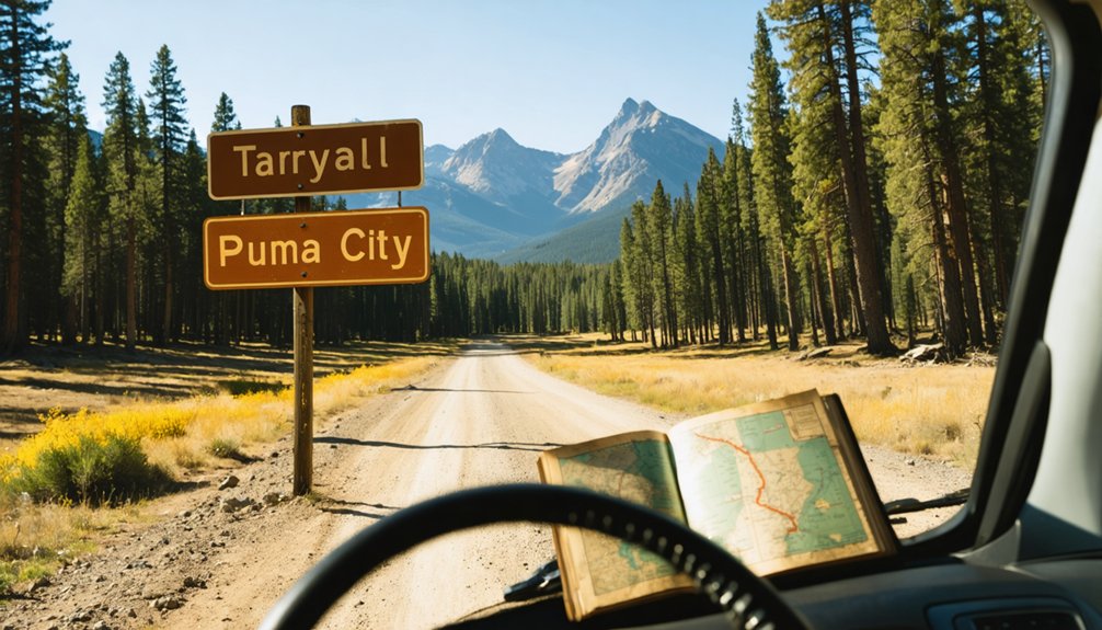
You’ll find Tarryall Puma City most accessible from Jefferson via County Road 77, a 29.3-mile stretch of rough but manageable dirt road that winds through the same rugged terrain prospectors once crossed chasing placer gold.
If you’re coming from Lake George instead, head 1.2 miles west before picking up CR-77 for another 12 miles into the heart of old Park County.
Watch for the commemorative plaque at the Tarryall Creek crossing near Cline Ranch SWA and the marker along Highway 285 east of Como — these landmarks anchor you in the landscape before the ghost town’s tailing piles and log remnants come into view.
Starting Points And Routes
Whether you’re coming from the Denver metro area or the Western Slope, Highway 285 serves as your primary artery toward Tarryall Puma City, threading through South Park’s wide-open ranchlands before delivering you to the ghost town‘s doorstep near Como.
From Lake George, head west 1.2 miles, then north along County Road 77 for approximately 12 miles. From Jefferson, the site sits 29.3 miles away via the same scenic routes that gold-hungry prospectors once traveled desperately.
Watch for historical markers along Highway 285 east of Como, where a commemorative plaque near the Tarryall Creek crossing at Cline Ranch State Wildlife Area quietly anchors you to 1860s history.
Don’t confuse this northwest Park County location with the separate Tarryall community sitting southeast — they’re distinctly different destinations.
Road Conditions And Requirements
Getting there’s half the adventure, and the roads leading to Tarryall Puma City reflect the rugged character of the territory itself.
You’ll navigate County Road 77, stretching 29.3 miles from Jefferson, or approach from Lake George — heading 1.2 miles west before connecting to CR-77 for another 12 miles.
Road maintenance along these routes varies seasonally, so expect washboard stretches and unpredictable surfaces. Vehicle recommendations lean toward high-clearance options, though a standard car can manage if you’re comfortable with bumpy terrain.
April through September offers the most reliable conditions.
Highway 285 provides a smoother initial approach, marked by a commemorative roadside plaque near Como.
Embrace the imperfect roads — they’re gatekeepers filtering the curious from the truly committed explorer.
Key Landmarks En Route
Three landmarks anchor your route to Tarryall Puma City, each marking a change from modern highway travel into genuine frontier territory.
Watch for these historic landmarks as your mile markers into the past:
- Highway 285 commemorative marker near Como — your first signal you’re entering gold rush country
- Jefferson turnoff — you’re now 29.3 miles from Tarryall along County Road 77
- Lake George junction — head 1.2 miles west before connecting to CR-77’s scenic viewpoints
- Cline Ranch SWA crossing — the commemorative plaque at Tarryall Creek signals you’ve arrived
Each alteration strips away another layer of the modern world.
The tailing piles stretching over a mile from the old diggings confirm what no GPS can tell you — you’ve genuinely escaped the ordinary.
What You Can Still See at the Townsite Today
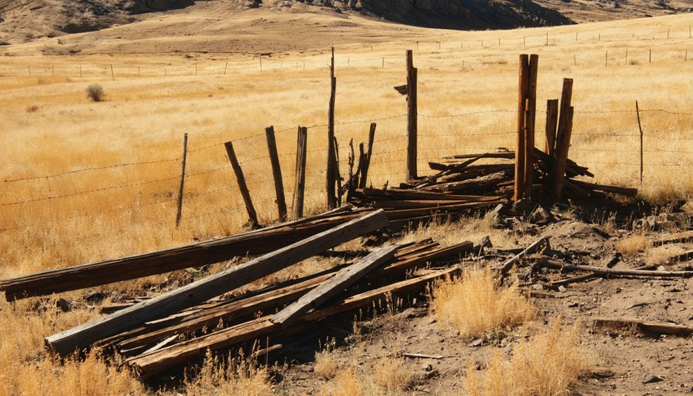
Though little remains of Tarryall-Puma City‘s booming past, what you’ll find at the townsite still tells a vivid story. The historical remnants scattered across this ghost town carry real weight — tailing piles stretching over a mile mark where miners once scrambled for placer gold.
Log home ruins anchor the landscape, quietly holding the memory of a community that once topped 1,000 residents.
You’ll spot a commemorative plaque near the Tarryall Creek crossing at Cline Ranch State Wildlife Area, and the schoolhouse — listed on the National Register of Historic Places — still stands as a rare survivor.
Walk the ground slowly. The earth here was turned inside out by ambition, and if you pay attention, you’ll feel exactly what that cost.
Is Tarryall Reservoir Worth Adding to Your Ghost Town Trip?
Why stop at a ghost town when the land itself keeps pulling you deeper? Tarryall Reservoir State Wildlife Area sits just beyond the old townsite, offering space to breathe after walking through history.
Add it to your trip for these reasons:
Add Tarryall Reservoir for the fishing, wildlife, primitive camping, and unstructured exploration across land that refuses to be tamed.
- Fishing opportunities in cold, open water where prospectors once panned for gold
- Wildlife sightings including elk, deer, and raptors roaming undisturbed terrain
- Primitive camping that puts starlit skies directly above you, no crowds required
- Unstructured exploration across landscape that refused to surrender after the mining bust
The reservoir doesn’t compete with Tarryall’s story — it completes it. You’re standing on ground that outlasted every boom, every bust, and every man who thought he could own it.
When To Go and What To Bring
April through September gives you the best shot at Tarryall without the land fighting back. That’s your best season — roads stay passable, the high country air runs cool and clear, and the remnants of Puma City actually breathe under open skies.
Pack like someone who respects the distance. Your packing essentials should include layered clothing, sturdy footwear for uneven terrain, extra water, and a full gas tank before you leave Jefferson or Lake George.
Cell service disappears fast out here. Bring a camera and enough curiosity to read the commemorative plaque at Tarryall Creek without rushing past it.
The tailing piles stretch a mile. The schoolhouse still stands. You’re not just driving through history — you’re walking ground that gold-hungry men abandoned when the dream ran dry.
Frequently Asked Questions
Was Tarryall Puma City Ever Connected to the Railroad System?
No railroad history ever snaked its iron tentacles into Tarryall Puma City’s ghost town connections. You’d have relied solely on rugged trails and sheer determination to reach this remote, freedom-calling Colorado mining settlement buried deep in Park County’s wilderness.
Are There Any Guided Tours Available at the Tarryall Ghost Town?
No guided tours are officially available, but you’ll discover Tarryall’s historical significance wandering freely through its atmospheric remnants. Explore the schoolhouse, tailing piles, and commemorative plaque at your own pace, letting history’s echoes guide you independently.
Can Visitors Legally Collect Gold or Artifacts From the Tailing Piles?
Like a siren’s call, those tailing piles tempt you—but you can’t legally pursue gold collecting or remove artifacts. Artifact preservation laws protect the site, so you’ll need to admire history’s remnants with your eyes alone.
How Long Did Tarryall City Actually Serve as Park County Seat?
You’ll find Tarryall City’s Tarryall history as Park County seat was remarkably brief — it held that distinction for just over two months, from November 1, 1861 to January 7, 1862, before surrendering that fleeting authority.
Are Pets Allowed at Tarryall Reservoir State Wildlife Area Campgrounds?
The knowledge doesn’t cover pet policies for Tarryall Reservoir State Wildlife Area campgrounds. For accurate camping tips, you’ll want to check directly with Colorado Parks & Wildlife before heading out to this historically rich frontier landscape.
References
- https://kekbfm.com/colorado-ghost-towns-started-as-puma-city-ended-as-tarryall/
- https://www.uncovercolorado.com/activities/tarryall-ghost-town/
- https://www.ghosttowns.com/states/co/tarryall.html
- https://kids.kiddle.co/Tarryall
- https://southparkheritage.org/where-have-all-the-ghost-towns-gone-by-christie-wright/
- https://www.coloradopast.com/index.php?category=ghosttowns&subcategory=central&selection=Tarryall+Diggings


