Plan your Banner Ghost Town road trip between mid-July and October, when the 8,200-foot mountain pass opens for motorized vehicles. Start at Edna Creek Campground on Idaho Highway 21, then drive 1.1 miles to the jeep trail entrance and another 2.9 miles to Banner. You’ll need a high-clearance vehicle and should confirm road conditions with Boise National Forest before heading out. There’s far more to this haunting silver rush relic than meets the eye.
Key Takeaways
- Visit mid-July through October when the 8,200-foot elevation pass is open and weather conditions are most favorable for travel.
- Start your journey at Edna Creek Campground on Highway 21, driving 1.1 miles to the jeep trail entrance before continuing 2.9 miles to Banner.
- A high-clearance vehicle is recommended due to rough terrain on the jeep trail leading to the ghost town.
- Confirm road passability with Boise National Forest beforehand, as fallen trees and storm damage can unexpectedly block access routes.
- Pack water, snacks, sturdy footwear, and a first aid kit while respecting unstable structures and remaining aware of local wildlife.
What’s Left to See at Banner Ghost Town
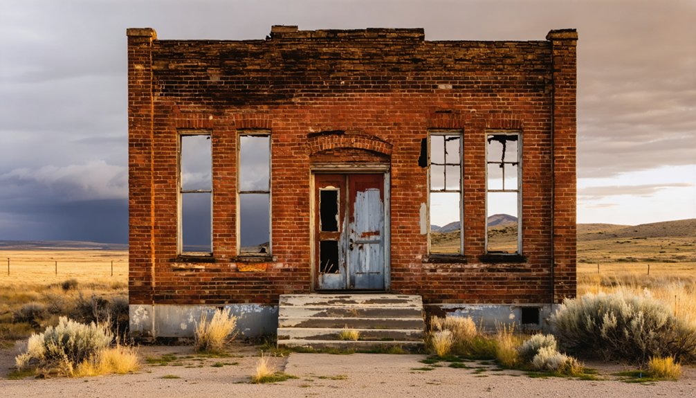
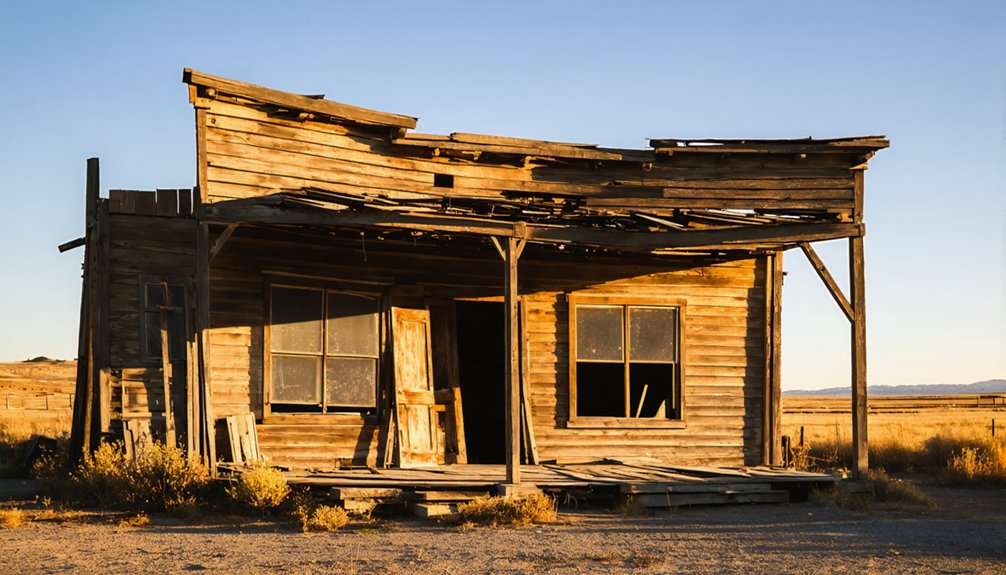
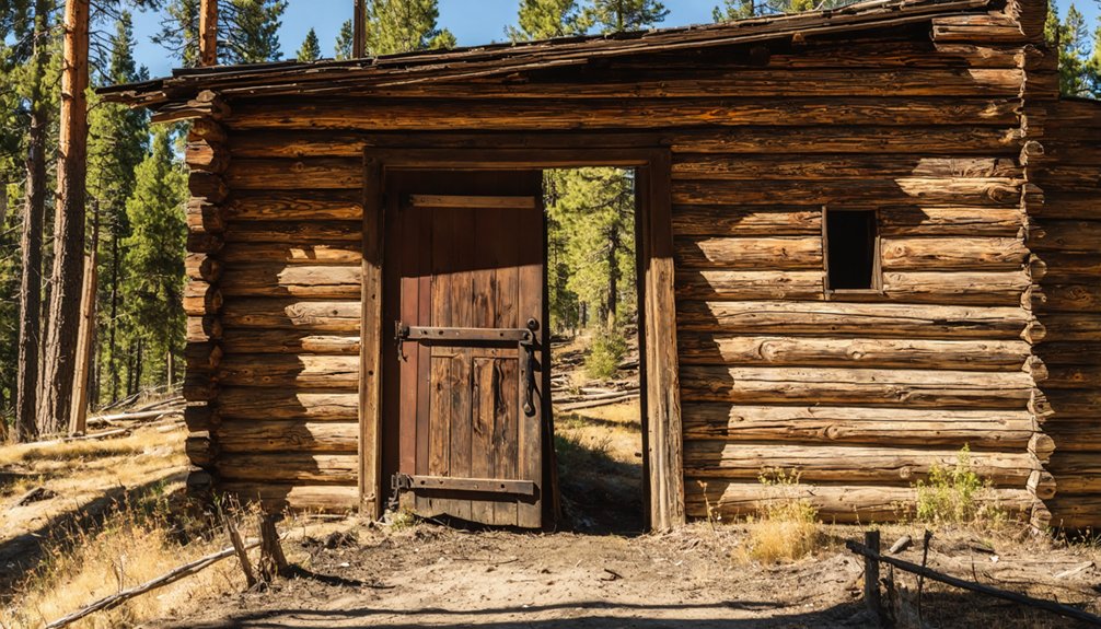
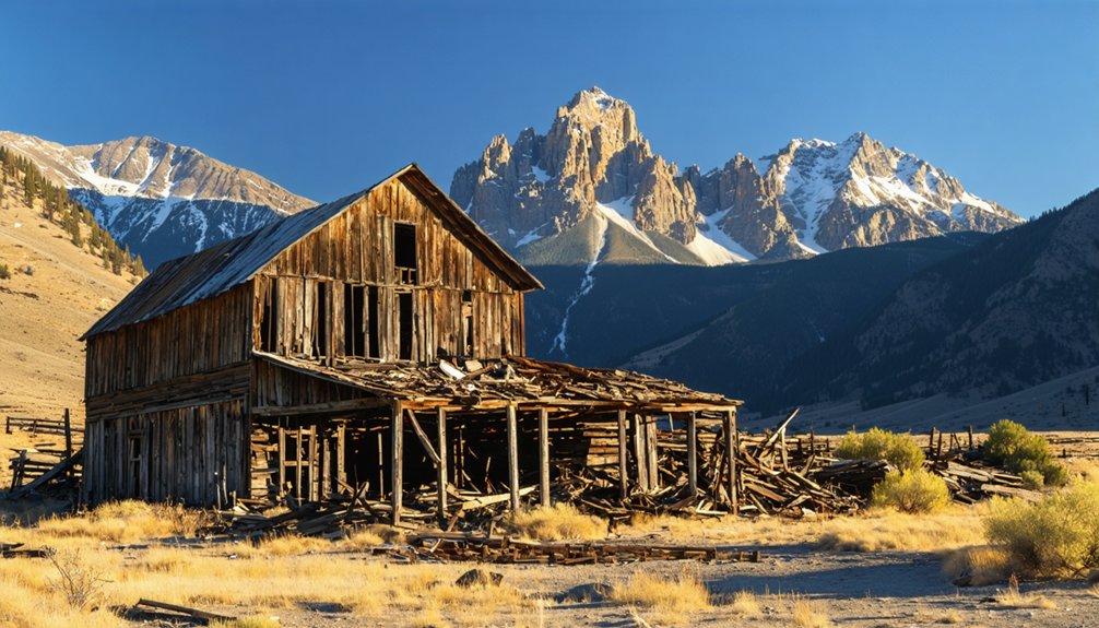
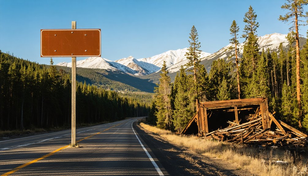
Although time and harsh mountain winters have taken their toll, Banner still offers a rewarding glimpse into Idaho’s mining past. You’ll find roughly 10 buildings scattered across the site, ranging from surprisingly intact cabins to structures mid-collapse. Each one carries historical significance, quietly telling the story of the fortune seekers who carved a community into this remote Idaho wilderness.
The abandoned mine structures stand as the most compelling mining artifacts on the property, giving you a tangible connection to the silver rush that drew over 200 prospectors here in 1864.
Some buildings have already disappeared entirely, so what remains today may not last another decade. Explore carefully, respect the fragile structures, and take your time absorbing what little survives of this once-thriving mountain settlement.
The Best Time to Visit Banner Ghost Town
If you’re planning a trip to Banner Ghost Town, you’ll want to aim for mid-July through October, when the 8,200-foot elevation pass remains open to motorized vehicles.
Late summer and early fall offer the sweetest combination of warm weather, open mountain roads, and stunning autumn color rolling across the landscape.
Outside this window, early snow and road closures can trap you in the backcountry, so checking current conditions with Boise National Forest before you head out is a smart move.
Ideal Visiting Seasons
When planning your visit to Banner Ghost Town, timing is everything. The ideal window runs from mid-July through October, when the 8,200-foot elevation pass remains open for motorized access.
Summer delivers warm, stable conditions perfect for exploring the town’s mining legacy and ghost town history, while autumn transforms the mountain landscape with brilliant color displays that make the journey equally rewarding.
Avoid pushing your luck outside these months. Early snow can close the pass without warning, and winter shuts down sections near Banner Summit entirely.
Spring looks tempting on a map, but the high-elevation route stays dangerously unpredictable until mid-summer.
Whatever season you choose, contact Boise National Forest beforehand to confirm current road conditions — the route has stranded travelers before, and it’ll do it again.
Road Access Windows
Getting to Banner isn’t just about picking a date on a calendar — the road itself decides when you’re allowed in. The 8,200-foot elevation pass along the route stays buried under snow and ice well into summer, making mid-July through October your only reliable window for motorized access.
Outside that range, seasonal closures shut everything down hard.
Even within that window, road conditions can change fast. Fallen trees, storm damage, and early autumn snow have trapped travelers at Graham with no warning.
Before you load up and head out, contact Boise National Forest directly to confirm the route is passable. One phone call could save you from a very long, very unplanned overnight stay in Idaho’s backcountry wilderness.
Why the Road to Banner Closes and When to Expect It
Reaching Banner isn’t just a matter of willingness—the road itself has the final say.
Elevation challenges are your first obstacle, as the route crosses an 8,200-foot pass that stays buried under snow well into summer.
Road closures hit frequently and without much warning, triggered by fallen trees, storm damage, and early autumn snowfall.
Travelers have actually been stranded at Graham when conditions shifted unexpectedly, blocking the only motorized route out.
Your reliable window runs mid-July through October, though even that isn’t guaranteed.
Before you load up and head out, contact Boise National Forest directly to confirm current conditions.
The wilderness doesn’t negotiate, and neither does this road—go prepared or don’t go at all.
How to Get to Banner Ghost Town
The journey to Banner ghost town begins along the Ponderosa Pine Scenic Byway (Idaho Highway 21), a 131-mile stretch running from Boise to Stanley through the heart of Boise National Forest.
Among the best travel tips you’ll find is to start at Edna Creek Campground (43° 57.82′ N, 115° 33.33′ W), your primary access route into the backcountry.
Drive 1.1 miles to the jeep trail entrance at 43° 59.00′ N, 115° 32.92′ W, then continue another 2.9 miles to reach Banner.
The road crosses an 8,200-foot elevation pass, so you’ll need a capable, high-clearance vehicle.
Before heading out, contact Boise National Forest to confirm road conditions — fallen trees and weather damage can shut down your only access route without warning.
Other Ghost Towns and Stops Near Banner on Highway 21
While you’re exploring the Banner area, don’t miss the chance to experience the full Ponderosa Pine Scenic Byway (Idaho Highway 21), a stunning 131-mile route stretching from Boise to Stanley that passes through historic mining towns, pioneer cemeteries, and natural hot springs.
The byway winds through Boise National Forest, climbing past Banner Creek Summit at 7,037 feet, where wide-open alpine views and potential snow-capped ridges reward your effort.
You can complete the full drive in roughly three hours, but setting aside a full day or weekend lets you soak in every stop along the way.
Ponderosa Pine Scenic Byway
Stretching 131 miles from Boise to Stanley, the Ponderosa Pine Scenic Byway (Idaho Highway 21) packs in far more than just the Banner ghost town.
You’ll wind through Boise National Forest, climbing past Banner Creek Summit at 7,037 feet, where scenic viewpoints open up to sweeping alpine ridges, sometimes still dusted with snow.
Along the way, you’ll encounter additional ghost towns, pioneer cemeteries, hot springs, and opportunities to spot local wildlife roaming the mountain terrain.
The full drive takes roughly three hours without stops, but don’t rush it — a full day or weekend lets you genuinely explore everything the byway offers.
It’s an open road through Idaho’s wilderness, and it rewards anyone willing to slow down and take it all in.
Pioneer Cemeteries and Hot Springs
Beyond Banner Creek Summit’s sweeping ridgelines, Highway 21 keeps delivering — and not just scenery. The byway threads past pioneer cemeteries where weathered markers tell stories of those who carved lives from this unforgiving wilderness.
These quiet grounds connect you directly to the region’s pioneer heritage, offering a sobering counterpoint to the ghost towns’ abandoned structures.
You’ll also find natural springs tucked along the route, where hot water seeps from the earth — perfect for unwinding after miles of gravel roads and high-elevation passes.
These stops aren’t detours; they’re essential chapters in the same story Highway 21 tells mile after mile. Pack a lunch, bring a soak bag, and give yourself room to wander. The byway rewards travelers who aren’t rushing anywhere.
What to Pack for a Remote Ghost Town Visit at High Elevation
Packing smart can make or break a remote high-elevation adventure like the Banner ghost town trip. At 5,860 feet and climbing, temperatures shift fast, so layer your clothing for warmth and wind.
Your packing essentials should include plenty of water, high-calorie snacks, a first aid kit, and a paper map since cell service disappears quickly in these canyons. High elevation sun burns faster, so sunscreen and sunglasses aren’t optional.
Bring sturdy hiking boots for uneven terrain around deteriorating structures. Since road closures can trap travelers unexpectedly, pack emergency supplies like a blanket, extra food, and a flashlight.
A camera captures the haunting beauty of Banner’s remaining buildings, while trekking poles help you navigate safely around unstable ground.
Frequently Asked Questions
When Was Banner, Idaho, Originally Founded as a Mining Settlement?
You’ll discover that Banner’s mining history dates back to 1864, when silver was first found there. This ghost town drew over 200 prospectors within just two days, sparking a wild rush into Idaho’s rugged wilderness.
How Many Prospectors Arrived at Banner Within the First Two Days?
Like moths to a flame, over 200 prospectors flooded Banner within two days! You’ll find prospector myths surrounding their primitive mining techniques fascinating as you explore this wild, freedom-calling ghost town where fortune seekers once roamed untamed Idaho wilderness.
What Elevation Is the Banner Ghost Town Located at Exactly?
You’ll find Banner’s ghost town legends waiting at exactly 5,860 feet above sea level, where mining history carved its mark into Boise County, Idaho’s rugged wilderness — a breathtaking elevation perfect for your adventurous spirit.
Has Graham Ghost Town Preserved Any Original Structures From Its History?
Unfortunately, you won’t find any preserved structures exploring Graham’s ghost town history, as fires have completely destroyed the settlement and its mine. No preservation efforts saved anything, leaving zero visible remnants of this once-thriving wilderness community.
How Long Is the Full Ponderosa Pine Scenic Byway From Boise to Stanley?
You’ll drive an endless-feeling 131 miles of breathtaking Ponderosa Pines and stunning Scenic Views along the full byway from Boise to Stanley, treating you to Idaho’s most spectacular mountain landscapes you won’t ever forget!
References
- https://www.owyheejack.com/owyhee-jacks-meanderings/central-idaho/graham-banner-ghost-towns
- https://www.youtube.com/watch?v=RNCaxrY62ZI
- https://www.youtube.com/watch?v=GwSHP92a6pU
- https://www.onlyinyourstate.com/trip-ideas/idaho/haunting-road-trip-id
- https://visitidaho.org/travel-tips/explore-idahos-ghost-towns/
- https://gearjunkie.com/adventure/ghost-town-silver-city-idaho
- https://www.rusticlens.com/2016/11/01/secret-idaho-ghost-town/
- https://westernmininghistory.com/towns/idaho/banner/