Planning a ghost town road trip to Bathsheba, Oklahoma means chasing one of the most disputed settlements in American history. Founded by 33 women after the 1893 Cherokee Strip land run, this women-only utopia vanished within 12 weeks and left almost no physical trace behind. You’ll search north-central Oklahoma’s Garfield County terrain with no confirmed coordinates and plenty of skepticism to navigate. The full story gets even stranger from here.
Key Takeaways
- Bathsheba, a rumored women-only settlement founded after the 1893 Cherokee Strip land run, is located in Garfield County between Enid and Perry.
- No physical ruins or precise coordinates exist, making Bathsheba one of Oklahoma’s most elusive and debated ghost towns to search for.
- Visit in fall for cooler temperatures and thinner vegetation, which improves visibility and makes terrain exploration more manageable.
- Bring navigation tools, sturdy boots, water, and a metal detector, while documenting all observations using GPS coordinates and voice memos.
- Expand your road trip by visiting nearby ghost towns like Deer Creek, Otoe, and Nardin for additional Cherokee Strip frontier history.
The Bizarre True Story Behind Bathsheba, Oklahoma
Tucked somewhere between Enid and Perry in the rolling backcountry of north-central Oklahoma lies one of American history’s most tantalizing mysteries — a town called Bathsheba that may or may not have ever existed.
Just days after the 1893 Cherokee Strip land run, roughly 33 women settlers staked their claim to something radical: a Women’s Utopia where no males — not even roosters or hogs — were permitted. They elected a mayor, appointed a police chief, and built their independent world from scratch.
Then came the Mysterious Disappearance. Within 12 weeks, Bathsheba had vanished entirely. A Kansas reporter who’d visited returned to find nothing. Scholars still debate whether it ever existed, and no one has physically located it since.
What Made Bathsheba Unlike Any Other Town in the Cherokee Strip?
While every other town born from the chaos of the Cherokee Strip land run scrambled to attract settlers, merchants, and speculators, Bathsheba did the opposite — it deliberately locked half the human population out. No men allowed. Not even male animals.
Bathsheba wasn’t just a settlement; it was a bold utopian community built entirely around women’s independence. Roughly 33 women staked their claims in September 1893 and created something radical — a self-governing society with its own mayor and police chief, answerable to no one but themselves.
You won’t find another town from that era that dared to reimagine society so completely. Bathsheba wasn’t running from something. It was running toward a future where women controlled their own land, their own rules, and their own lives.
Where Exactly Was Bathsheba Located?
Finding Bathsheba on a map is where the mystery truly deepens. Historical accounts place this remarkable lost settlement in Garfield County, somewhere between Enid and Perry in north-central Oklahoma. That’s your starting point, but don’t expect precision beyond that.
Reporters who documented this landmark moment in women’s history couldn’t pin down exact coordinates, and neither could Dr. John W. Morris when he researched Oklahoma’s ghost towns decades later.
What you do know is that settlers reached Bathsheba on approximately a three-hour horse ride from Stillwater.
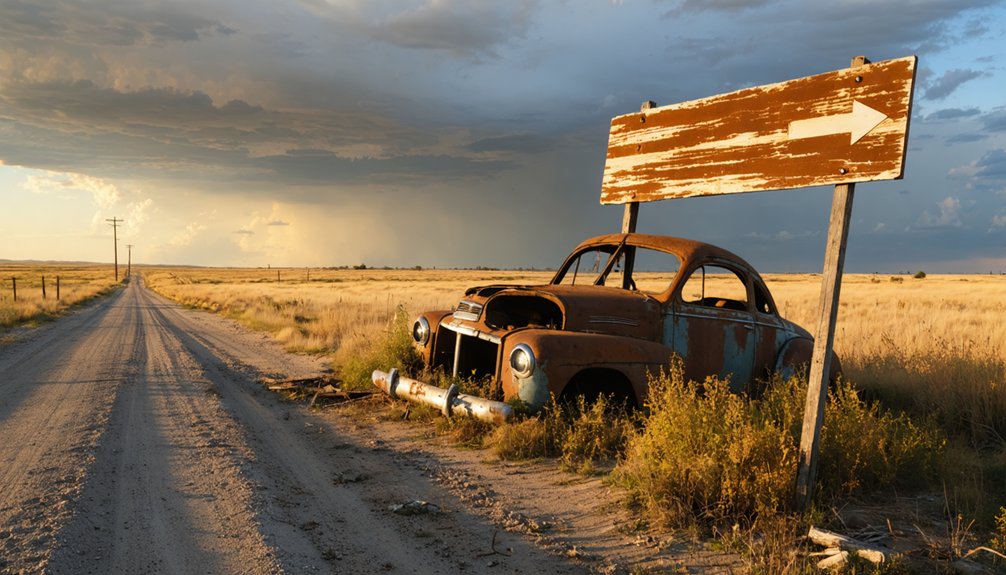
Your search territory spans the backcountry of Garfield and Noble Counties. No ruins mark the spot. No signpost points the way. You’re fundamentally hunting for a town that vanished as quickly as it appeared.
Why Do Historians Still Debate Whether Bathsheba Ever Existed?
Skepticism follows Bathsheba like a shadow because the evidence trail runs remarkably thin. Historians face genuine archaeological challenges when investigating a settlement that allegedly vanished within 12 weeks, leaving behind zero physical remnants. No foundations, artifacts, or verified coordinates exist for researchers to examine.
Historical skepticism intensifies when you consider the original documentation came from a single Kansas newspaper reporter who returned one week later to find nothing. Dr. John W. Morris couldn’t locate Bathsheba while compiling his authoritative *Ghost Towns of Oklahoma*, which speaks volumes.
You’re fundamentally chasing a story built on newspaper accounts from 1893, with Cherokee Strip Museum staff themselves acknowledging limited verification.
Whether Bathsheba was real, mythologized, or purely invented remains an open question that no scholar has definitively answered.
Has Anyone Actually Searched for Bathsheba’s Location?
You’re not the first to chase down Bathsheba’s ghost — Dr. John W. Morris, who compiled *Ghost Towns of Oklahoma*, tried to pinpoint the settlement’s location and came up empty-handed.
The Cherokee Strip Museum staff have acknowledged the town’s existence in their records, but they can’t offer much more than a shrug when it comes to hard verification.
Their collective failure to find a single landmark, ruin, or coordinate should fuel your curiosity rather than kill it.
Dr. Morris’s Failed Search
At least one serious researcher has tried to track down Bathsheba’s exact location — and came up empty. Dr. John W. Morris, while compiling his book *Ghost Towns of Oklahoma*, made a dedicated effort to locate the settlement. Despite his thorough investigation, he couldn’t find a single trace of it.
That failure speaks volumes. If a trained researcher studying Oklahoma’s mysterious disappearances couldn’t pinpoint the site, you’re facing a genuine puzzle. Bathsheba wasn’t just a fleeting experiment in Women’s Utopianism — it may have vanished so completely that even its footprint disappeared.
For road-trippers craving real historical mystery, that’s actually exciting. You’re not retracing someone else’s verified discovery. You’re venturing into genuinely uncharted territory, carrying the same questions Dr. Morris never answered.
Cherokee Strip Museum Acknowledgment
Even the Cherokee Strip Museum — arguably the most reasonable starting point for anyone chasing Bathsheba’s trail — can’t offer much beyond acknowledging the story’s existence.
Staff there recognize the tale but can’t confirm historical accuracy or point you toward any verified location.
That’s not necessarily discouraging. It means Bathsheba remains genuinely open territory, a mystery you’re free to chase on your own terms.
The Cherokee Strip land rush of 1893 was chaotic, fast-moving, and imperfectly documented — exactly the kind of historical moment where a radical women’s settlement could emerge and vanish without leaving a clean paper trail.
You won’t find an exhibit dedicated to Bathsheba.
What you’ll find instead is honest uncertainty, which, depending on your perspective, makes the search far more compelling.
When Is the Best Time to Search for Bathsheba?
When should you hit the road in search of Bathsheba? Fall is your best bet. Historical accounts place the settlement’s brief existence in September through December 1893, making autumn deeply fitting for your search.
Seasonal considerations matter here — fall’s cooler temperatures make trekking through Garfield and Noble County backcountry far more bearable than Oklahoma’s brutal summer heat.
Your best search strategies involve visiting when vegetation thins out, giving you clearer sightlines across the open terrain between Enid and Perry. Dried grasses and bare brush reveal subtle landscape features that summer’s growth conceals.
Pack light, plan for long stretches of unpaved roads, and embrace the uncertainty. You’re not guaranteed to find anything — but that’s exactly what makes Bathsheba worth chasing.
What Should You Bring on a Backcountry Ghost Town Search?
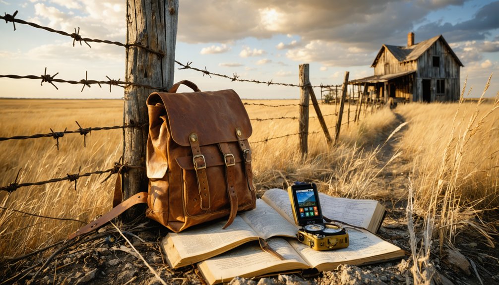
Knowing when to search is half the battle — knowing what to bring is the other half. Your backcountry essentials start with navigation tools — download offline maps of Garfield and Noble County before you lose cell service.
Pack water, snacks, and sturdy boots since you’re covering rough Oklahoma terrain between Enid and Perry.
For effective search strategies, bring a notebook to document anything unusual — soil disturbances, old fence lines, or foundation remnants. A camera captures what memory forgets.
Toss in a first aid kit, sunscreen, and weather-appropriate layers since north-central Oklahoma’s conditions shift fast.
Consider a metal detector for detecting buried artifacts beneath the surface. You’re chasing a town that vanished in twelve weeks — come prepared, stay sharp, and trust your instincts out there.
How Do You Record Your Findings When No Site Has Been Confirmed?
When searching for a ghost town with no confirmed site like Bathsheba, you’ll want to document every observation you make in the field, no matter how minor it seems.
Sketch rough maps of the areas you cover, marking terrain features, soil disturbances, or anything that strikes you as unusual.
Even inconclusive findings deserve careful preservation, since your notes could one day contribute to a broader historical picture that no single searcher has yet been able to complete.
Document Every Observation
Searching for a ghost town that may never have left a trace demands a documentation strategy built around absence as much as presence. When you’re chasing ghost town legends like Bathsheba’s women’s utopian experiment, what you *don’t* find matters just as much as what you do.
Photograph every terrain feature, fence line, depression, and soil discoloration you encounter. Note GPS coordinates for each observation, even when nothing remarkable appears. Record the landscape’s character — drainage patterns, tree clusters, and elevation shifts that might’ve attracted settlers in 1893.
Voice memos work well while driving between locations. Log negative findings explicitly; “searched this area, found nothing” is legitimate field data. Your accumulated observations, however unremarkable individually, could eventually build a meaningful geographic picture of Bathsheba’s possible location.
Map Your Search Area
Documenting your observations only pays off when those records are organized into a searchable, spatial framework — which is where mapping becomes your most powerful tool.
Bathsheba’s historical significance lies somewhere between Enid and Perry in north-central Oklahoma, spanning Garfield and Noble counties. Your search strategies should anchor every noted detail to a precise geographic coordinate.
- Drop pins on your digital map wherever terrain, vegetation, or soil patterns seem unusual or disturbed.
- Cross-reference historical newspaper accounts describing a three-hour horse ride from Stillwater to estimate Bathsheba’s probable radius.
- Create distinct map layers separating confirmed dead ends from unexplored zones, keeping your search organized and efficient.
This spatial thinking transforms scattered field notes into a living investigation you can refine with each return visit.
Preserve Inconclusive Findings
Even if you leave Bathsheba’s territory without a single confirmed structure or artifact, your inconclusive findings carry real investigative value — but only if you record them systematically.
Photograph every landscape anomaly, unusual soil depression, or overgrown clearing you encounter. Log GPS coordinates alongside written observations, noting what you ruled out and why.
Ghost town legends thrive on accumulated detail, and your negative findings help future researchers eliminate dead ends faster. Historical mysteries like Bathsheba don’t yield to single visits — they surrender gradually through layered documentation from multiple independent searchers.
Upload your photos and notes to open-access platforms where other investigators can cross-reference your fieldwork. Even blank pages in the record carry meaning.
Your inconclusive trip isn’t a failure; it’s an honest contribution to an unfinished story.
What Other Ghost Towns Can You Explore Along the Cherokee Strip Route?
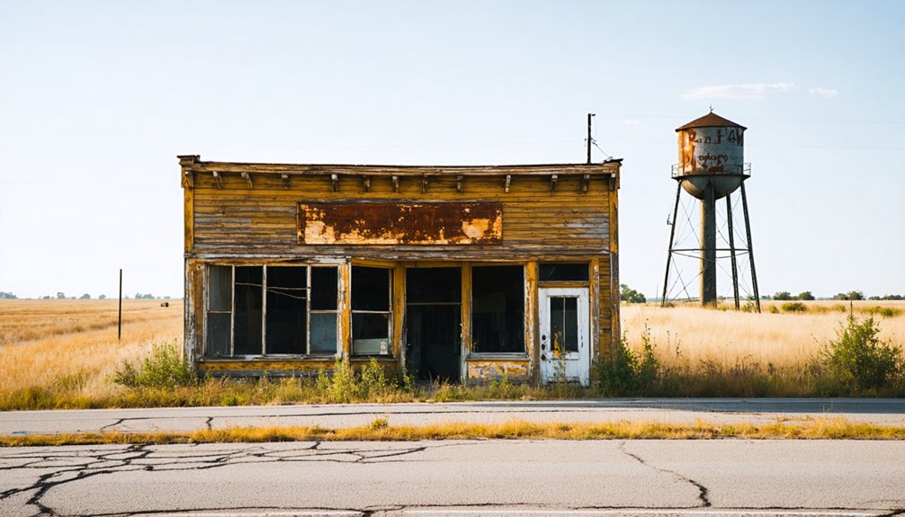
While Bathsheba remains the most elusive ghost town along the Cherokee Strip, you’ll find several other abandoned settlements scattered across north-central Oklahoma that are far easier to track down.
These ghost towns offer tangible proof of the Cherokee Strip’s wild, fleeting history.
- Deer Creek – A once-thriving Garfield County settlement that boomed after the 1893 land run before quietly fading into the prairie.
- Otoe – A Noble County remnant where crumbling foundations still mark where ambitious settlers planted roots.
- Nardin – A small Oklahoma ghost town with surviving structures that let you walk directly through preserved frontier history.
Each stop deepens your understanding of why settlements like Bathsheba vanished so completely, reminding you how brutally unforgiving the Oklahoma frontier truly was.
Frequently Asked Questions
Can I Legally Access Private Farmland While Searching for Bathsheba?
You can’t legally access private farmland without permission. Always respect property rights and seek land access by contacting local landowners beforehand. They’ll often appreciate your historical curiosity and might even share valuable local knowledge!
Are There Guided Ghost Town Tours Specifically Covering the Cherokee Strip Territory?
Dust-swept trails await you! Guided tours covering Cherokee Strip ghost town history exist through regional historical societies and Oklahoma tourism groups. You’ll uncover fascinating Cherokee Strip stories, though Bathsheba’s elusive past demands your own independent adventure.
What Local Oklahoma Historians Specialize in Researching Women’s Settlement Communities?
You’ll want to connect with women historians at the Cherokee Strip Museum in Enid, where staff actively pursue settlement research. Oklahoma Historical Society scholars also specialize in uncovering bold, independent communities like Bathsheba’s remarkable all-women frontier experiment.
Did Any of Bathsheba’s Original 33 Women Settlers Leave Personal Written Accounts?
Like whispers lost to the wind, no personal diaries or historical letters from Bathsheba’s 33 original settlers have surfaced. You’ll find their stories frustratingly silent, leaving you to chase echoes of these bold, freedom-seeking women through fragmented newspaper accounts.
Are There Museums Near Enid Displaying Cherokee Strip Land Run Artifacts?
You’ll find Cherokee artifacts at Enid museums like the Cherokee Strip Regional Heritage Center, where you can explore vivid displays celebrating the bold 1893 land run spirit that shaped this free-spirited Oklahoma frontier region.
References
- https://en.wikipedia.org/wiki/Bathsheba
- https://www.kgou.org/oklahoma-news/2018-10-01/how-curious-an-all-female-ghost-town
- https://www.youtube.com/watch?v=CU42Mk6SKDY
- https://okmag.com/blog/gone-but-not-forgotten/
- https://www.youtube.com/watch?v=Zu1g_kfyy2Y
- https://www.facebook.com/groups/1321800061169511/posts/5407515495931260/
- https://www.youtube.com/watch?v=dErgqf0ildk
- https://www.facebook.com/groups/360170899043588/posts/549395023454507/
- https://www.kswo.com/2026/04/07/bathsheba-legend-oklahomas-all-female-town/
- https://www.ghosttownpod.com/206-the-bathsheba-ghost-town-1/


