Planning a ghost town road trip to Bell, Oklahoma means exploring a region where lead and zinc mining left behind an eerie, contaminated landscape frozen in time. You’ll drive through empty streets lined with crumbling buildings, photograph towering chat piles, and witness nature slowly reclaiming what humans abandoned. Combine your visit with nearby ghost towns like Picher and Cardin for a haunting two-day itinerary. Everything you need to map out your journey is waiting just ahead.
Key Takeaways
- Bell, Oklahoma, is best explored on day two of a ghost town road trip, starting with an early morning drive for quiet exploration.
- The region surrounding Bell contains numerous ghost towns, with Oklahoma estimated to have around 2,000 ghost towns total.
- Nearby towns like Picher, Cardin, and Treece share similar mining histories, making them ideal stops on the same road trip.
- Photographers should frame derelict buildings against Oklahoma skies for striking imagery during visits to Bell and surrounding ghost towns.
- Looping through nearby abandoned towns connects stories of shared industrial history and collapse, enriching the overall road trip experience.
What Makes Picher, Oklahoma the Largest Ghost Town in America?
Perched along the Oklahoma-Kansas border, a dozen miles west of Missouri, Picher stands as the largest true ghost town in America.
Picher’s history reads like a cautionary tale — a boomtown built on lead and zinc mining that eventually consumed itself.
Picher rose fast and fell hard — a boomtown where the mines that built it ultimately buried it.
Mining impact transformed this once-thriving community into America’s most toxic landscape. The mines closed without proper sealing, leaching contaminants into the soil and leaving towering chat piles as monuments to industrial excess.
Community resilience kept residents fighting to stay, even as federal buyout programs pushed them out. Environmental challenges ultimately won — the contaminated ground made survival impossible.
Then a 2008 tornado ravaged twenty city blocks, destroying what little remained. The last resident died in 2015, leaving behind crumbling buildings and empty streets you can still explore today.
The Rise and Fall of Picher: Lead and Zinc Mining’s Toxic Legacy
Picher’s story didn’t start with abandonment — it started with boom. Around the turn of the 20th century, lead and zinc mining transformed this border town into a powerhouse, producing materials that fueled an entire nation.
But that mining impact came at a devastating cost. Operators pulled wealth from the earth without properly sealing the mines behind them, leaving contaminated soil and towering chat piles as their legacy.
Over decades, seeping toxins poisoned the ground, eventually earning Picher the grim title of America’s most toxic place. Federal authorities launched toxic remediation efforts, buying out residents and attempting damage control.
But the contamination ran too deep. The land gave everything it had — and what remained wasn’t livable. Freedom sometimes means knowing when to leave.
Why the Federal Government Paid Residents to Abandon Picher
When the mines finally closed and the contaminated soil began seeping into homes, schools, and water supplies, the federal government faced an uncomfortable reality: Picher couldn’t be cleaned up — it could only be cleared out.
Some places cannot be cleaned — only cleared. Picher’s contamination ran too deep for remediation, leaving relocation as the only answer.
Ranked America’s most toxic place, Picher’s lead and zinc contamination had poisoned the ground beyond remediation. Rather than attempt an impossible cleanup, the government launched a federal buyout program, purchasing properties and compensating residents to relocate permanently.
Most families accepted, trading their contaminated lots for a fresh start elsewhere. You can still drive through streets where entire neighborhoods once thrived, now reduced to empty foundations and overgrown lots.
The federal buyout didn’t erase Picher’s toxic contamination — it simply acknowledged that some damage runs too deep to reverse.
The 2008 Tornado That Finished What the Mines Started
Even after the federal buyout hollowed out Picher’s population, a stubborn few residents refused to leave — until a tornado in 2008 made that choice for them. The storm tore through twenty city blocks, injured over 150 people, and shredded whatever structures still stood.
When you study the tornado aftermath, you see it didn’t just destroy buildings — it destroyed the final thread of community resilience holding the town together. The residents who’d fought to stay had nothing left worth fighting for.
Combined with the toxic soil and crumbling infrastructure, the tornado delivered the killing blow. By 2015, Picher’s last resident had died, completing the town’s transformation into the ghost town you can drive through today, its empty streets whispering a cautionary tale about unchecked industrial ambition.
How to Get to Picher From the Oklahoma-Kansas Border
If you’re heading to Picher from the Oklahoma-Kansas border, you’ll find the town sitting just a dozen miles west of Missouri, making it an easy reach from Highway 69.
You can plug the coordinates into Google Maps and follow a straightforward route through the northeastern Oklahoma plains until the towering chat piles come into view.
Once you’re on the ground, you’ll navigate the crumbling streets by car, keeping a safe distance from the toxic soil while still taking in the haunting scale of what’s left behind.
Crossing into Oklahoma from Kansas puts you just minutes from Picher, and the route couldn’t be simpler. The border crossings along this stretch offer surprisingly scenic views, with open plains rolling out before you as you head west toward the site.
From the Kansas line, follow the main road south and west, keeping an eye out for the unmistakable chat piles rising against the sky — they’re your landmark. No elaborate navigation required. Google Maps handles the route easily, and the roads remain passable for a slow, deliberate drive through what’s left of the town.
You’ll want to take your time here. The emptiness hits differently when you realize those crumbling structures and toxic mounds represent an entire community’s rise and collapse.
Reaching Picher by Road
Once you’re on the Oklahoma side of the border, Picher sits just a short drive away — close enough that you’ll spot the massive chat piles before you even reach the town limits.
These towering mounds of mining waste define the skyline, offering your first raw glimpse into the town’s ghost town history and devastating mining impact.
Follow the roads west from the Kansas line, and the landscape shifts quickly.
Crumbling structures and empty streets replace any sign of ordinary life. Google Maps handles navigation easily, so you won’t lose your bearings amid the eerie silence.
Drive slowly — you’re moving through what experts call America’s largest true ghost town, where lead and zinc extraction once drove prosperity before poisoning everything it touched.
Is It Legal and Safe to Visit Picher Today?
Visiting Picher today sits in a legal gray area — you can drive through the abandoned streets without facing arrest, but the environmental hazards are very real.
Picher Safety concerns stem from decades of lead and zinc contamination that’s soaked deep into the soil, making prolonged exposure genuinely dangerous.
Legal Restrictions don’t prohibit a slow drive-through, but authorities discourage lingering or stepping outside your vehicle.
The ground itself remains unstable — abandoned mine shafts honeycomb the earth beneath the town, creating serious collapse risks.
Keep your windows rolled up, stay in your car, and treat the visit as a scenic drive rather than an exploration.
You’re free to witness this haunting place, but respect the hazards that ultimately drove every last resident away.
Chat Piles, Empty Streets, and Crumbling Buildings: What You’ll Actually See
As you cruise through Picher’s empty streets, you’ll immediately notice the towering chat piles — massive mounds of gray mining waste that loom over the landscape like eerie monuments to the town’s industrial past.
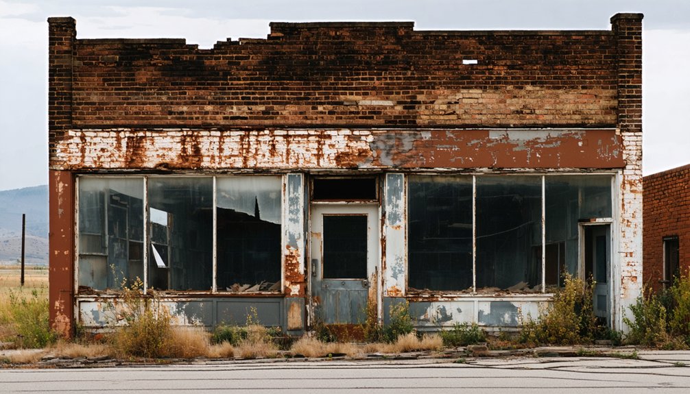
Crumbling buildings line the roads in various states of decay, their broken windows and collapsing walls telling the story of a community that simply gave up and walked away.
You won’t find much left standing, but what remains creates an oddly haunting backdrop that makes Picher unlike any other ghost town you’ve ever visited.
Towering Chat Piles
When you roll through Picher’s empty streets, the first thing that’ll grab your attention is the towering chat piles — massive gray mountains of mining waste that dwarf everything around them.
These chat pile formations are the byproduct of decades of lead and zinc extraction, left behind when operators abandoned the mines without a second thought. Some rise several stories high, casting long shadows over crumbling foundations below.
They’re eerily beautiful in a post-apocalyptic way, yet deeply toxic — the contaminated soil surrounding them is exactly why the federal government eventually bought out residents.
You can drive past them safely from your vehicle, taking in their scale without stepping foot on poisoned ground.
They’re a raw, unfiltered reminder of industrial ambition gone unchecked.
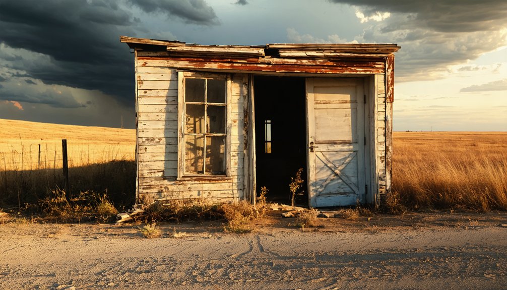
Crumbling Abandoned Structures
Beyond the chat piles, Picher’s abandoned structures tell an equally haunting story. You’ll cruise past crumbling buildings frozen in time, their broken windows and collapsing roofs reflecting decades of neglect.
The abandoned architecture speaks volumes about what happens when industry vanishes overnight, leaving entire neighborhoods hollow and silent.
Empty streets stretch before you, lined with structures that once housed families, businesses, and community life. Nature’s reclaiming everything now — weeds pushing through cracked pavement, vines creeping up deteriorating walls.
This haunting history isn’t just visually striking; it’s a powerful reminder of how quickly thriving communities can unravel.
You’re witnessing America’s largest true ghost town from the safety of your vehicle, experiencing raw, unfiltered history that no museum could replicate.
Ghost Towns Near Picher Worth Combining Into One Drive
While Picher makes for an unforgettable destination on its own, the surrounding region hides several other ghost towns worth folding into a single drive. Oklahoma’s estimated two thousand ghost towns mean you’re never far from another abandoned chapter of history.
The tri-state corner where Oklahoma, Kansas, and Missouri meet is dense with mining folklore and ghost town legends tied to the same lead and zinc boom that built and ultimately destroyed Picher. Towns like Cardin and Treece sit nearby, each carrying their own scars from the same extractive era.
Mapping a loop through these communities turns a single stop into a full day of exploration. You’ll cover serious ground while connecting the dots between communities that shared one industry, one collapse, and one haunting silence.
A Two-Day Northeast Oklahoma Ghost Town Driving Itinerary
Stretching that single-day loop into two full days reveals even more of northeast Oklahoma’s abandoned past.
You’ll move at your own pace, giving ghost town photography the attention it deserves while honoring historical preservation through thoughtful documentation.
Day One:
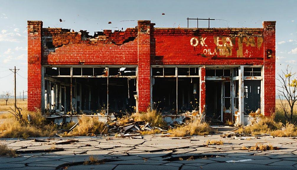
1. Morning at Picher — capture chat piles glowing in early light, then explore crumbling storefronts along empty streets.
2. Afternoon at nearby abandoned communities — photograph collapsed structures and overgrown lots before sunset.
Day Two:
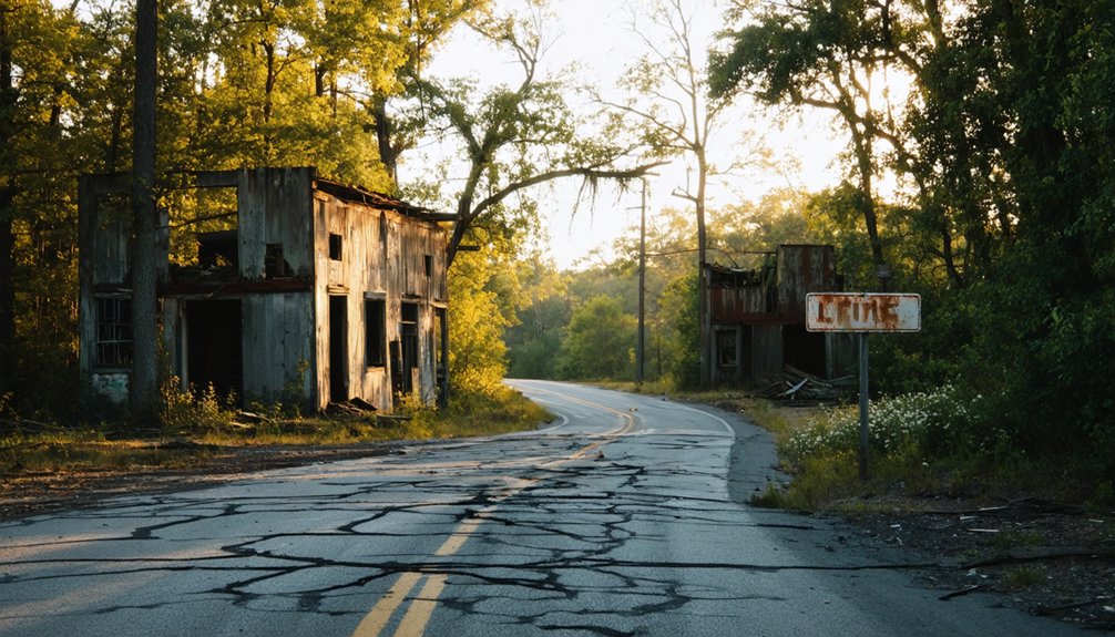
3. Early drive toward Bell — walk quietly through what remains, letting the silence tell its story.
4. Final stop at surrounding ghost towns — frame derelict buildings against wide Oklahoma skies before heading home.
Two days. Dozens of stories. Complete freedom to uncover northeast Oklahoma’s haunting, forgotten corners on your own terms.
Why Picher Belongs on Every Oklahoma Road Trip List
Few ghost towns in America hit as hard as Picher — a place where lead and zinc mining once drove a booming economy, only to leave behind poisoned soil, crumbling buildings, and towering chat piles that now define its eerie skyline.
Picher’s history stretches back to pre-statehood Oklahoma, when the town exploded with industry along the Oklahoma-Kansas border. Its toxic legacy earned it the title of America’s most contaminated place, triggering a federal buyout program before a devastating 2008 tornado finished what the poison started.
By 2015, the last resident was gone. You can still drive those haunting streets today, witnessing firsthand what unchecked industrial ambition leaves behind.
By 2015, Picher stood empty — its streets silent, its story a haunting reminder of industry’s unchecked cost.
It’s unsettling, unforgettable, and absolutely worth adding to your Northeast Oklahoma ghost town itinerary.
Frequently Asked Questions
Can You Enter Picher’s Abandoned Buildings During a Visit?
Like a forbidden treasure chest, Picher’s abandoned architecture tempts you, but you shouldn’t enter. Safety precautions exist for good reason—toxic contamination makes it genuinely dangerous. You’re better off exploring from your vehicle instead.
What Other Toxic Ghost Towns Exist Along the Oklahoma-Kansas Border?
While Picher’s the most notorious for its toxic landscapes and historical significance, you’ll find similar lead and zinc mining remnants scattered across the Tri-State Mining District, where Kansas and Oklahoma’s borders share comparable contaminated ghost towns.
Are There Guided Tours Available Specifically for Picher Ghost Town?
You won’t find official guided tours for Picher’s ghost town, but you can self-explore its haunting streets and abandoned mines via Google Maps driving routes, uncovering rich Picher history through your own independent adventure.
What Camera Gear Works Best for Photographing Picher’s Ruins?
For Picher’s ruins, you’ll want a wide-angle lens among your best lenses to capture sprawling chat piles. Key photography tips: bring a telephoto for distant details and shoot during golden hour for dramatic, moody lighting.
Does Picher Appear on Any Official Oklahoma State Tourism Maps?
Like a scar on Oklahoma’s landscape, Picher’s dark legacy keeps it off official state tourism maps. Its Picher history and severe environmental impact make it too hazardous for you to find promoted through standard travel resources.
References
- https://www.youtube.com/watch?v=xg8SpCG-wDg
- https://en.wikipedia.org/wiki/List_of_ghost_towns_in_Oklahoma
- https://www.youtube.com/watch?v=1UptjVmgvOw
- https://www.youtube.com/watch?v=_8awCKdJVag
- https://www.youtube.com/watch?v=ipGA2T4OS9E


