You’ll find Bland squeezed impossibly into a 60-foot canyon slash in the Jemez Mountains, where blackened stone walls and blast-carved platforms tell stories of $1 million in silver fever. The entire ghost town sits on private property behind locked gates, so you can’t legally explore the ruins that survived both abandonment and 2011’s Las Conchas wildfire. Your best bet? Scout elevated viewpoints along nearby public roads where compressed sightlines reveal fragments of this 1890s boomtown’s explosive rise and sudden collapse.
Key Takeaways
- Bland sits on private property with gated access roads, requiring permission from landowners before visiting to avoid trespassing violations.
- The ghost town occupies a narrow 60-foot canyon, limiting visibility and requiring multiple elevated viewpoints to see structures.
- Founded in 1893 as Eagle City, Bland peaked at $1 million production by 1904 before mines failed within two years.
- The 2011 Las Conchas Fire damaged remaining structures, leaving blackened walls and heat-fractured rocks exposed to further deterioration.
- Property “For Sale” signs indicate potential future development may affect long-term accessibility to this historic mining site.
The Rise and Fall of a Jemez Mountains Silver Boomtown
While prospectors had been poking around Bland Canyon since 1880, it wasn’t until a decade later that serious mining fever gripped these remote Jemez Mountains. By 1893, Eagle City exploded into existence at 7,703 feet elevation, quickly renamed Bland when the post office arrived in 1894.
You’d have witnessed a staggering transformation—3,000 fortune-seekers flooding in, creating wealth disparity in Bland’s boom and bust as some struck it rich while others barely survived. The environmental impacts of mining operations scarred the landscape: four sawmills running nonstop, stamp mills crushing 175 tons daily, over fifty mines gouging mountainsides.
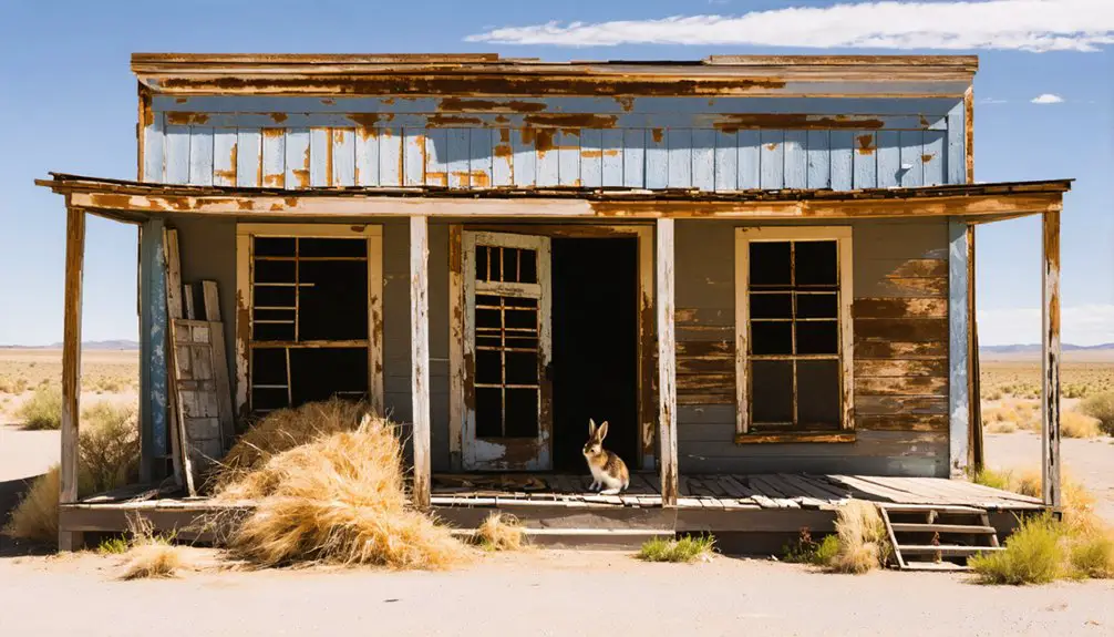
Peak production hit $1 million by 1904, but freedom’s promise proved fleeting. Within two years, the mines played out, and Bland’s residents scattered, leaving just three adobe buildings standing today.
Why Richard Parks Bland’s Namesake Town Matters
When that first postmaster stamped letters in 1894, he chose “Bland” not for the canyon’s appearance but to honor a Missouri congressman who’d become the silver movement’s fiercest champion. Richard Parks Bland‘s nickname—”Silver Dick”—wasn’t ironic. He’d lived through Nevada’s Comstock rush, understood mining’s boom-bust cycles, and fought Washington’s gold-standard grip with rare intensity.
Bland’s role in congressman’s career peaked with the 1878 Bland-Allison Act, overriding a presidential veto to mandate federal silver purchases. Silver advocacy‘s national impact echoed through Western mining camps, where his name meant economic survival against Eastern bankers’ control.
This ghost town represents more than abandoned buildings—it’s physical evidence of common people backing a politician who challenged consolidated power. You’re standing where idealism met harsh reality.
The canyon grabs you before the history does—sixty feet of compressed reality where a town’s ambitions slammed against vertical rock walls. You’ll see how terrain impacted planning when residents blasted platforms from slopes just to build homes. One desperate homeowner even stuck his outhouse in front of his house—there wasn’t anywhere else to put it.
This confined infrastructure somehow squeezed in two banks, an opera house, a stock exchange, and over fifty buildings during a four-month construction frenzy. The single main street ran straight through that sixty-foot bottleneck while boarding houses, saloons, and the red-light district stacked wherever dynamite could carve space.
Stand here and you’ll understand why frontier ambition couldn’t defeat geography—it just adapted explosively.
What Remains Standing After the 2011 Las Conchas Fire
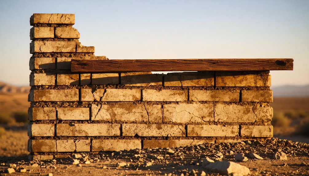
The Las Conchas Fire swept through here in 2011, leaving Bland’s already-crumbling structures even more scarred by flame and heat. As you pick your way through the ruins, you’ll notice blackened stone walls that somehow endured both a century of abandonment and a wildfire that consumed 156,593 acres at nearly an acre per second.
The hillside jail, perched above the canyon, still stands as proof to what stone and mortar can survive—its cells now open to sky darkened by char marks that track up the remaining walls.
Fire-Damaged Stone Structures
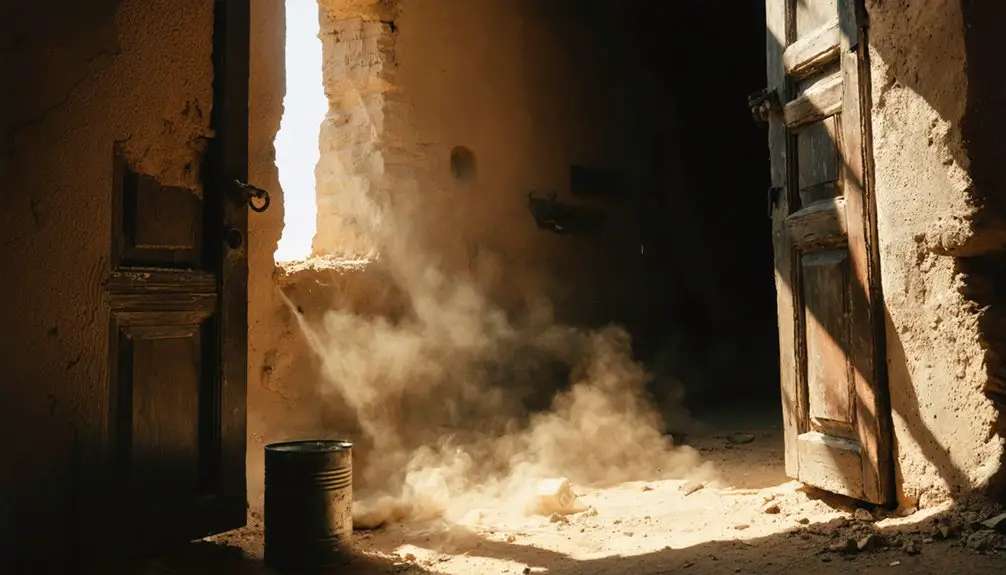
Standing among the blackened ruins today, you’ll find stone walls that survived the 2011 Las Conchas Fire bearing deep scars—surfaces spalled and cracked, once-smooth masonry now fractured like shattered glass. The inferno coated everything in thick soot and waxy residue from vegetation burning at extreme temperatures.
I’ve traced my fingers along pueblo walls where heat-induced fractures split rocks that stood intact for centuries. Native pottery fragments lie scattered nearby, their original colors and patterns rendered unrecognizable by the flames.
Small fieldhouses—those humble 1-2 room structures where ancient farmers once sought shelter—show the worst damage. What’s equally devastating? Protective vegetation impacts left these sites completely exposed. Without trees and brush shielding them, monsoon rains now hammer directly onto vulnerable stonework, accelerating deterioration that fire began.
Preserved Hillside Jail Ruins
Tucked into the hillside above Bland’s main scatter of ruins, the old jail clings to its rocky perch—a roofless stone chamber that outlasted both abandonment and wildfire. You’ll spot the barred window first, still intact despite decades of exposure.
The structure was carved directly into the hillside and reinforced with mortared stone walls, a design that ironically saved it when the 2011 Las Conchas Fire swept through.
Approach carefully—structural integrity concerns are real here. The weathered construction materials have endured over a century of freezing winters and scorching summers, plus fire damage. The roof’s long gone, leaving walls open to the elements.
You can peer through the bars into the cramped space where lawbreakers once waited, imagining what freedom meant to those who’d lost it in this remote mountain settlement.
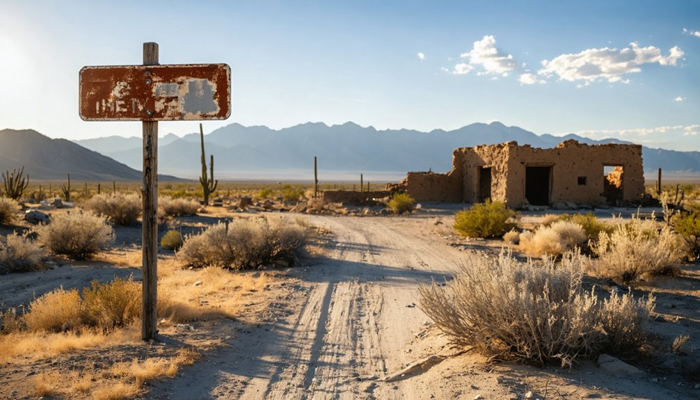
Current Access Restrictions and Private Property Boundaries
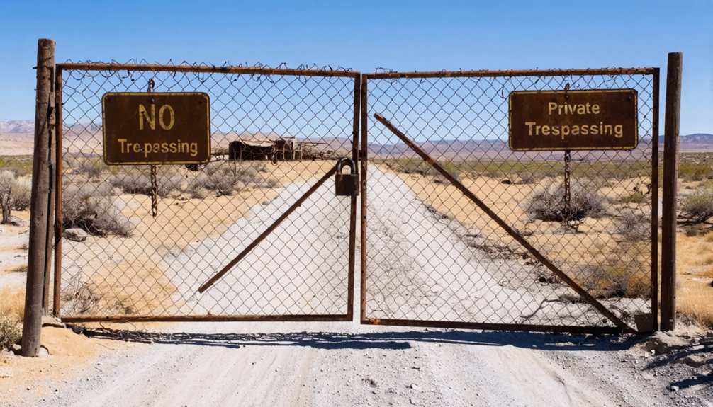
Before you pack your gear for Bland, you’ll need to accept a hard truth: the entire ghost town sits squarely on private property, and its current owners aren’t rolling out any welcome mats. Gates block the access road—a gnarly, rocky climb that’ll test your vehicle’s limits even if you’d permission. Recent visitors report being turned away at the perimeter, and “For Sale” signs hint at potential future development plans that could change everything.
Until then, ARPA protections and trespassing laws apply, making unauthorized exploration risky business. Your best bet? Contact real estate agents handling the property to discuss permissioned restoration strategies or legitimate access. Otherwise, you’re stuck admiring those hillside ruins from a respectful distance, binoculars in hand.
Best Vantage Points for Viewing the Historic Townsite
Since the 2011 Las Conchas fire reduced Bland to little more than a lonesome chicken coop and a few picnic tables, your vantage points now capture absence rather than architecture—but the canyon itself remains a dramatic storyteller.
Where thriving settlements once stood, Bland now offers something rarer—the haunting poetry of what fire claimed and memory preserves.
The narrow sixty-foot canyon aperture creates compressed sightlines that once framed 3,000 residents. Hike to the historical lookout post above town for unspoiled panoramic vistas across the entire ghostly layout.
Houses clinging to canyon slopes offer elevated perspectives—each perch revealing different angles of what’s vanished. The blasted terraces from mining days provide natural observation platforms where you’ll gain unobstructed views of ruins and remaining foundations.
You’ll need multiple positions to understand Bland’s full story. The terrain refuses single-point comprehension, demanding you scramble between slope levels like the original prospectors who carved this vertical community from stubborn rock.
Essential Gear for Your Jemez Mountain Ghost Town Adventure
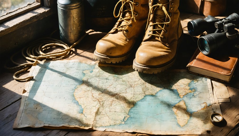
Preparing for Bland requires different thinking than your average ghost town jaunt—this isn’t some roadside ruin where you’ll park and snap photos through your car window. Your essential packing checklist starts with a high-clearance 4×4, sturdy boots, and trekking poles for traversing blast-cut slopes.
Pack layered clothing for variable elevations, waterproof gear for sudden storms, and a first-aid kit for emergencies on isolated terrain. Responsible visitation practices mean bringing trash bags, documenting stone structures from respectful distances, and honoring private property boundaries at the locked gate.
Don’t forget offline maps—cell service vanishes in this narrow canyon. I’ve learned the hard way that water, energy bars, and a headlamp transform challenging exploration into unforgettable discovery among those roofless jails and forgotten mine shafts.
Nearby Historic Sites and Alternative Destinations
Your Jemez Mountain adventure doesn’t end at Bland’s crumbling foundations. Within this rugged canyon system, you’ll find stone remnants from the broader Cochiti Mining District scattered along mountain streams—the Iron King, Monster, and No Name mines waiting with their colorful histories.
If you’re craving more ghost town atmosphere, consider detours south to Madrid’s revitalized mining streets or Cerrillos’ dusty turquoise trail storefronts, both offering easier access and more substantial structures than Bland’s weathered remains.
Other Jemez Mountain Ghosts
The Jemez Mountains hold more than just Bland’s weathered remains—they’re layered with centuries of resistance, faith, and survival that echo through stone walls and empty plazas. Before gold seekers arrived, this landscape witnessed the fierce Jemez Pueblo resistance against Spanish colonization. The Towa-speaking warriors guarded their sacred springs and mountain trails so fiercely that Spanish friars deemed them “indomitable” in 1626.
You’ll find this spirit preserved at Giusewa village ruins, where 700-year-old stone foundations stand alongside the 1621 mission church remains. The 1,400-foot interpretive trail winds through San Diego Canyon near Jemez Springs, telling stories through the pueblo people’s own words. It’s a short drive from Albuquerque—freedom seekers who abandoned one world colliding with those who refused to surrender theirs.
Madrid Mining Town Detour
Just forty miles south of Bland, Madrid clings to a hillside where coal dust once blackened the sky and 3,000 miners carved thirty square miles of tunnels beneath your feet.
The mining town history stretches from 1880s coal camps to 1928’s peak production of 180,000 tons annually. Oscar Huber built this company town with schools, hospitals, and wood-framed Kansas cabins hauled in by rail.
Cerrillos Turquoise Trail Stop
Continue north on Highway 14, and sixteen miles beyond Madrid’s coal-blackened hillsides you’ll spot Cerrillos’ sun-bleached storefronts scattered along a single dirt road. This sleepy settlement sits atop America’s oldest mining district, where prehistoric turquoise mining operations carved Mount Chalchihuitl’s slopes around 900 CE.
You’ll find remnants of colonial era mining operations near the original Real de Los Cerrillos, where Spanish settlers extracted silver alongside Pueblo laborers until the 1680 revolt. The American Turquoise Company later shipped robin’s egg blue gems to Tiffany’s New York headquarters in cigar boxes.
Stop by Cerrillos Hills State Park to hike past ancient turquoise pits and San Marcos Pueblo ruins. Small private mines still operate here, keeping New Mexico’s turquoise legacy alive without corporate interference.
Connecting With Local Historical Societies for Research
Before setting out for Bland, I spent an afternoon scrolling through the Jemez Valley Historical Society’s digital archives, coffee growing cold beside my laptop as I discovered details no guidebook would ever mention. Connecting with area historical societies revealed stories about Hofheinz’s intricate stone work and the roofless jail cut into the hillside—tangible landmarks I could actually seek out upon arrival.
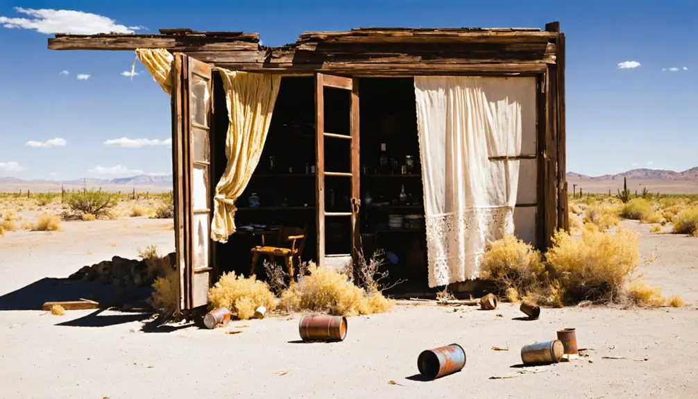
The archived resources on Bland’s mining operations revealed production numbers, mill schedules, and even a grasshopper plague that threatened water supplies in October 1900. You’ll find photographs of canyon-blasted building sites and letters from caretakers confronting trespassers shotgun-in-hand. This pre-trip research transforms your visit from aimless wandering into purposeful exploration, connecting you with ghosts who once slept in $1-per-night tent cots along overcrowded streets.
Photography Tips for Capturing Bland’s Remaining Structures
When you’re framing Bland’s weathered stone walls, get close enough to see how precisely those masons fitted each rock—the bank’s remaining corners still show craftsmanship that’s outlasted a century of abandonment. Natural light becomes your collaborator here, especially when afternoon sun rakes across the masonry to reveal texture, or when it filters through empty window frames to paint geometric patterns on dark interior floors.
I’ve found the storage room’s cool shadows offer the most dramatic contrast, where bright doorway light gradually yields to blackness, perfectly illustrating how these structures exist between preservation and decay.
Stone Architecture Detail Shots
The three remaining buildings in Bland stand sun-dried and baked the color of gingersnaps, their stone walls offering photographers a masterclass in capturing architectural decay. You’ll find gnarled masonry textures everywhere—from the bank’s two remaining walls to the storage room where closely fitted stones create dramatic chiaroscuro interior lighting in the darkness within.
Focus your lens on these details:
- Canyon-blasted pockets where builders carved building sites from solid rock when the 60-foot canyon width proved insufficient
- Weathered wall chinks at the bakery site, now sprouting dandelions amid oak overgrowth
- Cedar post contrasts against aged stone at the makeshift corral
Each structure echoes the mineral-rich mountains surrounding this narrow aperture, their locally quarried stones bearing witness to boom-era ingenuity.
Natural Light Through Ruins
Light becomes your collaborator at Bland’s ruins, transforming weathered stone into a photographer’s canvas where every passing hour rewrites the scene. You’ll catch magical hour lighting at sunrise when warm rays filter through the roofless jail, casting dramatic shadows across canyon walls. Position yourself for those god-ray moments—shoot through barred windows with your lens angled toward the low sun, bracketing exposures ±2 stops to nail high-contrast scenes.
Overcast days reveal different treasures. You’ll appreciate how diffused conditions soften the bakery’s weathered masonry without harsh shadows. Post-rain visits add misty depth to your shots. Set white balance at 5000K for color cast correction under forest canopy, then bump clarity 20-30% in post-processing. Your wide-angle lens captures those narrow canyon gaps perfectly, framing freedom in stone.
Frequently Asked Questions
Are There Any Guided Tours Available to Access the Private Property?
Unfortunately, you’ll hit a brick wall—guided tours aren’t available for Bland’s private property. Restricted access means you’re facing potential legal concerns with trespassing. Respect those boundaries; freedom doesn’t mean ignoring property rights that’ll land you in trouble.
What Are the Nearest Gas Stations and Restrooms to Bland?
The nearest gas stations are in Gallup (7 options) and Grants (4 stations), both offering restrooms. You’ll find nearest grocery stores and local diner options there too—stock up before heading into Bland’s remote, freedom-filled high desert terrain.
Can I Camp Overnight Near the Bland Townsite Area?
Picture tumbleweeds rolling past your parked Tesla: you can’t legally camp at Bland itself due to camping regulations and local landowner policies. You’ll need Valley of Fires Recreation Area, 70+ miles south, for your nearest legitimate overnight spot.
What Wildlife Should I Watch for When Visiting the Jemez Mountains?
You’ll encounter massive elk herds grazing mountain meadows at dawn, while bird watching opportunities reveal peregrine falcons soaring overhead. Black bears, mountain lions, and coyotes roam freely here—stay alert, respect their space, and you’ll witness nature’s untamed beauty.
Is Cell Phone Service Available in the Bland Area?
Cell phone service in Bland’s spotty at best. You’ll find weak cell signal strength from major carriers since towers cluster near populated areas. Don’t count on reliable data coverage in this remote corner—download maps beforehand for true off-grid freedom.