To road trip to Boyd, Kansas, head four miles west of Hoisington along NW 40 Avenue in Barton County, where scattered foundations and empty lots mark what was once a thriving Missouri Pacific Railroad stop. Spring and fall offer the best weather for exploring. Bring water, download offline maps since cell service is unreliable, and pair the stop with nearby ghost towns like Dunlap. There’s far more to uncover about Boyd’s rise, fall, and forgotten neighbors ahead.
Key Takeaways
- Boyd, Kansas, sits four miles west of Hoisington along NW 40 Avenue in Barton County, once serving as a Missouri Pacific Railroad community.
- From Great Bend, drive roughly twelve miles northwest on US-56 to reach Boyd, making Great Bend an ideal base camp.
- Visit during late April through early June for mild temperatures, wildflowers, and manageable road conditions on rural Kansas routes.
- Bring paper maps, extra water, and prepare for unreliable cell service when navigating Boyd’s flat, open surrounding landscape.
- Combine Boyd with nearby ghost towns like Dunlap and abandoned Missouri Pacific rail stops for a fuller regional road trip.
What Was Boyd, Kansas Before It Disappeared?
Before it faded into Kansas history, Boyd was a functioning railroad community that served Barton County’s agricultural and commercial needs for over six decades. Originally called Maherville when its post office opened in June 1874, the town earned its permanent name in January 1904.
Before fading into history, Boyd served Barton County for over six decades as a vital railroad community.
Boyd’s significance stretched beyond its small footprint. Positioned along the Missouri Pacific Railroad in Eureka Township, it functioned as an essential shipping point connecting local farmers and merchants to broader markets.
By 1878, the settlement had grown enough to support its own physician, reflecting genuine community development.
Historical landmarks and daily life coexisted here until economic shifts and dwindling population gradually eroded the town’s vibrancy.
When the post office finally closed in 1937, Boyd’s story as a living community quietly ended.
How Boyd Faded From Railroad Stop to Ghost Town
Once the Missouri Pacific Railroad brought life to Boyd, its fate became tied entirely to the railroad’s economic changes. Railroad significance kept Boyd breathing through its early decades, but shifting commerce slowly drained its liveliness.
By 1937, the post office closed, signaling Boyd’s final exhale.
Here’s what drove Boyd from a bustling stop to silence:
- Railroad dependency left Boyd vulnerable when freight patterns changed
- Population drift accelerated as residents chased better opportunities elsewhere
- Economic changes beyond agriculture gutted small railroad communities statewide
- No diversification meant Boyd couldn’t survive once its railroad purpose weakened
You’re now walking through history when you visit Boyd’s empty lots. That quiet emptiness isn’t abandonment — it’s a raw, honest snapshot of frontier ambition meeting unstoppable economic reality.
Where Boyd, Kansas Sits in Barton County Today
Understanding where Boyd once stood helps you appreciate just how purposeful its placement was. You’ll find it in Eureka Township, tucked into Barton County geography along NW 40 Avenue, south of NW 110 Road. It sits four miles west of Hoisington and twelve miles northwest of Great Bend, positioning it squarely within the county’s agricultural and railroad corridor.
That location wasn’t accidental. Boyd’s historical significance comes from its role as a Missouri Pacific shipping point, strategically placed to serve surrounding farms and communities.
Today, the site holds empty lots and little else, but the landscape still reflects why settlers chose this spot. When you drive out, you’re fundamentally tracing the same routes that once carried goods, livestock, and people through a thriving, now-vanished Kansas village.
How to Reach Boyd From Hoisington or Great Bend
If you’re starting from Hoisington, you’ll head west on NW 110 Road and turn south onto NW 40 Avenue to reach the old Boyd site in just about four miles.
Coming from Great Bend, you’ll drive roughly twelve miles northwest, making it an easy half-day detour from a larger base town.
Watch for the intersection of NW 40 Avenue and NW 110 Road as your primary landmark, since no signs or active structures will announce your arrival.
Starting From Hoisington
Whether you’re setting out from Hoisington or Great Bend, reaching Boyd is a straightforward drive through Barton County’s flat, open landscape.
From Hoisington, you’ll head west along NW 40 Avenue, covering roughly four miles before arriving at this site steeped in Boyd history and railroad significance.
- Watch for NW 110 Road as your northern landmark when traversing the area.
- Drive slowly—unpaved stretches reward patience with authentic rural scenery.
- Note the Missouri Pacific Railroad’s former corridor shaping the surrounding terrain.
- Bring a paper map since cell service can be unreliable in remote Barton County.
The drive itself feels like stepping back in time, letting you imagine freight cars rolling through what was once a thriving shipping point connecting local farmers to wider markets.
Approaching From Great Bend
Twelve miles to the southeast, Great Bend serves as an ideal base for your Boyd ghost town adventure. Head northwest on US-56, then navigate toward NW 40 Avenue to reach the site directly. This route cuts through open Kansas countryside, giving you a genuine feel for the isolation that once defined Boyd’s existence.
Boyd’s railroad significance shaped its early community growth, attracting settlers, a physician, and steady commerce along the Missouri Pacific line. Without that railroad energy, the town wouldn’t have survived as long as it did.
Today, you’re fundamentally retracing the same corridors that freight wagons once traveled.
Approaching from Great Bend also positions you perfectly to combine Boyd with other nearby extinct Barton County settlements, maximizing your ghost town exploration efficiently.
Key Roads And Landmarks
Depending on your starting point, you’ll take slightly different routes to reach Boyd, though both are straightforward.
From Hoisington, head four miles west. From Great Bend, drive twelve miles northwest. Either way, you’re converging on NW 40 Avenue, just south of NW 110 Road in Barton County’s Eureka Township.
Watch for these landmarks as you navigate:
- NW 40 Avenue – your primary access road leading directly into Boyd’s former footprint
- NW 110 Road intersection – your orientation point confirming you’ve arrived
- Missouri Pacific Railroad corridor – reminders of Boyd’s railroad impact on regional commerce
- Empty lots and foundations – subtle but powerful markers of Boyd’s historical significance
The landscape is open and honest, letting you read the land’s story without distraction.
What Survives at Boyd, Kansas Today
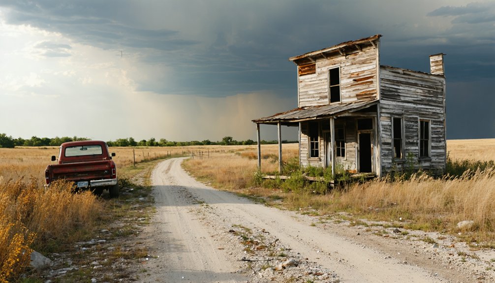
When you arrive at Boyd today, you’ll find little more than empty lots and open Kansas sky where a once-active railroad community stood.
No active structures or businesses remain, leaving ghost town explorers with raw, undisturbed land that carries its own quiet historical significance. You’ll notice scattered foundations if you look carefully, silent remnants of a village that once supported a physician, a post office, and Missouri Pacific rail traffic.
Local legends surrounding Boyd’s brief but purposeful life add depth to what appears, at first glance, like empty prairie.
Bring your camera, your curiosity, and a healthy respect for the land. Walking these grounds connects you directly to Kansas history in a way that no museum exhibit ever could.
Boyd rewards those willing to seek it out.
The Best Time of Year to Drive Out to Boyd
Spring and fall offer you the most comfortable conditions for exploring Boyd’s open, exposed terrain, where mild temperatures make wandering empty lots and scanning for remnants far more enjoyable.
You’ll want to avoid midsummer visits, when Kansas heat can turn a simple road trip into an exhausting ordeal under an unrelenting sun.
Winter trips aren’t impossible, but frozen or muddy rural roads along NW 40 Avenue can make reaching this remote ghost town more trouble than it’s worth.
Ideal Visiting Seasons
Kansas’s wide-open plains shift dramatically with the seasons, and timing your visit to Boyd can make the difference between a rewarding ghost town experience and a miserable one. The ideal months for exploring this Barton County relic are spring and fall, when temperatures stay manageable and seasonal activities like photography and hiking feel genuinely enjoyable.
- Spring (April–May): Wildflowers bloom across empty lots, softening Boyd’s stark landscape.
- Fall (September–October): Crisp air and golden light create dramatic ghost town photography.
- Summer: Viable but brutal—carry extra water and start early.
- Winter: Avoid unless you enjoy frozen gravel roads and bitter Kansas winds.
You’re chasing history here, so don’t let uncomfortable conditions cut your exploration short.
Weather Considerations For Travel
Driving out to Boyd rewards you most when the weather cooperates, and in Barton County, that window is narrower than you’d expect. Kansas weather patterns shift fast, turning rural roads into muddy traps after spring rains or icy hazards in winter.
Late April through early June offers mild temperatures and manageable conditions, though you’ll want to check forecasts before heading out on NW 40 Avenue. September and October deliver crisp, clear days ideal for exploring open terrain without summer’s punishing heat.
Travel safety depends heavily on your preparation — carry water, a spare tire, and a paper map since cell coverage thins past Hoisington. Avoid storm season if you can; exposed ghost town sites offer zero shelter when Kansas skies turn angry.
Other Barton County Ghost Towns Near Boyd Worth Visiting
While Boyd makes for a rewarding ghost town stop, Barton County has nearly two dozen extinct towns worth adding to your itinerary. These forgotten communities tell the larger story of Kansas settlement, railroad expansion, and eventual decline.
Pair your Boyd visit with these nearby ghost towns:
- Dunlap – Another Barton County relic offering quiet, open exploration
- Eureka Township settlements – Small communities that once supported local farming economies
- Missouri Pacific corridor towns – Follow the old rail line to discover additional abandoned stops
- Hoisington outskirts – Check surrounding areas for remnants of early homesteading communities
Great Bend serves as your ideal base camp, putting you within easy striking distance of multiple ghost towns across Barton County’s wide, open landscape.
Other Ghost Towns to Combine With a Boyd, Kansas Day Trip
Beyond Boyd, Kansas rewards ghost town hunters with an entire region of forgotten communities worth weaving into a single day trip.
Dunlap sits nearby, offering its own ghost town history and abandoned settlements that echo Boyd’s quiet decline. You can trace these vanished towns across Barton County, moving from empty lot to empty lot, piecing together what frontier life once looked like here.
Great Bend makes a practical base, sitting just twelve miles southeast of Boyd, letting you range outward freely without backtracking. Pack a map, fuel up, and plot a loose route connecting multiple extinct communities.
Each stop deepens your understanding of Kansas’s rural past and rewards curious travelers willing to leave the highway behind for unpaved roads leading somewhere history nearly forgot.
Frequently Asked Questions
Was Boyd, Kansas Ever Officially Incorporated as a Town?
Like many Kansas settlements, Boyd likely wasn’t officially incorporated — it functioned as a village and railroad stop. You’ll find its ghost town history reflects small communities that thrived briefly, then faded without formal incorporation records.
Who Was Boyd, Kansas Named After When Renamed in 1904?
The available Boyd history records don’t reveal who the town origins honor with that 1904 name change. You’ll find the renaming from Maherville to Boyd remains a compelling mystery worth uncovering on your ghost town adventure!
Did Boyd Have a School During Its Peak Years?
Ah yes, Boyd’s school history—because every thriving metropolis of a railroad stop needs community education! The available records don’t confirm a school existed during Boyd’s peak years, though a physician served residents by 1878.
Are There Any Historical Photographs Documenting Boyd’s Early Existence?
You won’t find widely available historical photographs documenting Boyd’s early existence, but you can explore local Barton County archives, where images capturing early settlers and the town’s historical significance may await your discovery.
Is Boyd, Kansas Privately Owned Land Today?
Boyd’s land ownership isn’t fully documented, but like most Kansas ghost towns, you’ll likely encounter privately owned land. Always respect boundaries, get permission before exploring, and honor landowners’ rights as you chase your freedom-loving adventures.
References
- https://www.hhhistory.com/2019/05/ghost-towns-of-kansas.html
- https://thewanderingpigeon.com/2015/10/03/day-of-kansas-ghost-towns/
- https://legendsofkansas.com/barton-county-extinct-towns/
- https://www.wikiwand.com/en/articles/Boyd
- https://www.youtube.com/watch?v=8dtIPX7pIqI
- https://baxterspringsmuseum.org/research


