You’ll find Coke County’s ghost towns scattered across 928 square miles of Edwards Plateau, accessible via US Highway 277 and State Highways 158 and 208. Silver’s oil boom ruins sit alongside weathered Sanco ranch buildings and frozen-in-time Edith at the intersection of Highway 158 and Dripping Springs Road. Each settlement tells stories through abandoned schoolhouses, rusted derricks, and crumbling foundations dating from the 1870s through the 1942 oil rush. Proper planning means understanding both the routes and the remarkable history waiting beyond the asphalt.
Key Takeaways
- Access Coke County via US Highway 277 through Robert Lee, with State Highways 158 and 208 connecting to ghost towns across 928 square miles.
- Visit Silver to see oil boom remnants including weathered foundations and rusted equipment from the 1940s petroleum era.
- Explore Sanco, named for Comanche Chief Sanaco, featuring 1870s ranch headquarters and structures from 1880s range wars.
- Tour Edith at Highway 158 and Dripping Springs Road to find abandoned schoolhouses and buildings from the 1890s settlement.
- Bring proper safety equipment and a buddy when exploring abandoned sites with Native American petroglyphs and frontier-era remains.
Understanding Coke County’s Frontier Heritage
Before settlers ever dreamed of establishing towns in this rugged landscape, Coke County belonged to the Comanche, Tonkawa, Lipan Apache, Kickapoo, and Kiowa tribes who competed fiercely for dominance of the Edwards Plateau and Colorado River valley from approximately 1700 to the 1870s.
For nearly two centuries, five powerful tribes battled for control of Coke County’s plateaus and river valleys.
You’ll find their legacy preserved in rock shelters along creek valleys, where Native American rock art, petroglyphs, and burial sites tell stories of centuries-long habitation.
By 1852, the frontier shifted when military outposts like Fort Chadbourne emerged, establishing a defensive chain stretching to the Rio Grande. The telegraph lines connecting these forts intimidated tribal movements until 1862, when Confederate troops pushed the defense line fifty miles east.
This wild territory remained contested ground where freedom meant survival.
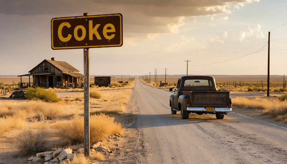
Silver: From Oil Boom to Abandoned Ruins
The town of Silver materialized almost overnight in 1942 when Amerada Petroleum Company struck oil just north of the settlement, transforming empty ranchland into a bustling industrial camp practically before the drilling crews could pack their tools. Derricks sprouted across the landscape while workers flooded in, following boom era employment patterns that characterized Texas petroleum rushes.
The oil production infrastructure—pumping stations, service facilities, and pulling units—created opportunities for drillers, roughnecks, equipment operators, and entrepreneurs chasing wartime petroleum demand.
But oil towns live and die by their wells. When production declined, workers migrated to fresher strikes, leaving Silver’s buildings to the relentless West Texas wind. Today you’ll find skeletal remains of that frenzied chapter: weathered foundations, rusted equipment, and silence where thousands once pursued their fortunes beneath a haze of crude and ambition.
Sanco and the Legacy of Early Ranchers
While Silver thrived on petroleum’s volatile promise, Sanco’s roots stretched deeper into Coke County soil—back to the 1870s when ranchers like J.J. Austin established headquarters on these open ranges. You’ll find this settlement nine miles northwest of Robert Lee along Yellow Wolf Creek, named for the significance of Chief Sanaco, a respected Comanche leader who once camped here.
The ranching families in Sanco—Bibles, Breedloves, Gosses, and Coles—carved freedom from wilderness, battling fence-cutters who destroyed thousands in wire and posts during the 1880s range wars.
Sanco’s Pioneer Timeline:
- 1875: J.J. Austin’s ranch established
- 1878: Jim Weathers started first sheep operation
- 1888: First post office opened
- 1907: Community relocated near water source
- 1920s: Cotton gin closed, ending settlement’s viability
Exploring Edith and Other Forgotten Communities
Eight miles west of Robert Lee along Texas State Highway 158, Edith sits frozen at the intersection with Dripping Springs Road—a ghost town that once hummed with three schools, a cotton gin, and the daily clatter of a blacksmith’s anvil. You’ll find the historical marker at coordinates 31°54′13″N 100°36′38″W, though the original settlement stood a mile north.
Established in 1890 when cattlemen and homesteaders carved out lives on open range, Edith supported 25 residents until the 1970s exodus to cities emptied it completely. The abandoned schoolhouses and local architecture styles tell stories of tabernacle gatherings and general store transactions.
Today’s deserted buildings stand as your portal to frontier resilience—just watch your step around unstable structures while exploring this time capsule of West Texas determination.
Essential Travel Routes and Highway Access
Reaching Coke demands attention to geography, as two distinct Texas communities share this name across 400 miles of prairie and pine. You’ll find one Coke at FM 515 and FM 69’s intersection in Wood County’s forested east, ten miles north of Quitman.
The other occupies Coke County’s windswept western ranchlands, where community amenities vanished decades ago but transportation connectivity remains intact through:
- US Highway 277 running north-south through Robert Lee
- State Highway 158 spanning east-west across the county
- State Highway 208 accessing central plateau areas
- County roads reaching abandoned sites like Sanco
- FM routes connecting Wood County’s eastern ghost settlements
You’ll navigate 928 square miles of Edwards Plateau terrain or dense Piney Woods, depending on your destination. Choose your Coke wisely—each offers distinct solitude.
What to Expect When Visiting Abandoned Sites
Your vehicle’s GPS coordinates settle on your chosen destination, but the real journey begins when you step from asphalt onto cracked foundations where communities once thrived. Structural hazards assessment starts before you enter—walk the perimeter, spotting collapsed ceilings, rusted metal, and hidden pits obscured by shadows.
Proper safety equipment usage isn’t optional: N95 respirators filter asbestos from old pipes, sturdy boots prevent punctures from debris, and headlamps illuminate elevator shafts that could swallow you whole. You’ll smell decay before seeing rotted floorboards, feel humidity warning of black mold colonies. Never explore solo; your buddy system becomes lifeline when floors give way.
Test surfaces with rocks, stick near load-bearing walls, and share your route with someone who’ll notice if you don’t return.
Respecting History and Private Property Guidelines
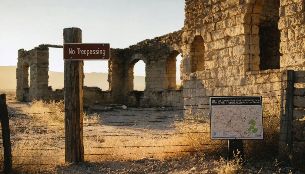
Before you photograph that weathered schoolhouse or step through a sagging doorframe, understand that Coke’s ghosts still have owners. The same restoration efforts that saved the schoolhouse from decay prove these sites aren’t abandoned—they’re protected.
Texas Historical Commission’s historical preservation guidelines demand respect, but so does common sense.
Navigate responsibly:
- Barbed wire fencing around Thurber remnants signals restricted access—honor it
- County roads lead to Sanco without trespassing on ranch land
- Coal deposits beneath ghost towns remain under corporate legal claim
- Original structures require permission before entry or photography
- Nature-reclaimed areas in Cole Ridge pose safety hazards beyond legal concerns
Private property boundaries aren’t suggestions. The families who donated land and the owners restoring these sites deserve your courtesy. Document what’s visible from public access, leave artifacts untouched, and preserve these fragments of East Texas history through observation alone.
Frequently Asked Questions
Are There Any Hotels or Accommodations Near Coke County Ghost Towns?
You’ll find limited lodging directly at Coke County ghost towns, but nearby bed and breakfasts in surrounding communities offer comfortable bases. The closest campgrounds to Coke provide rustic alternatives where you’ll camp under endless Texas skies, embracing true frontier freedom.
Exploring ghost town attractions in Texas reveals a fascinating glimpse into the state’s history and culture. While wandering the remnants of these once-thriving communities, visitors can appreciate the unique architecture and stories that linger, making each location a captivating stop on their journey. Many tourists find themselves drawn to the eerie beauty that encapsulates the allure of the Old West.
What Time of Year Is Best for Visiting Ghost Towns?
You’ll find early spring and late fall ideal for exploring Coke County’s ghost towns. Temperatures stay comfortable for wandering abandoned streets, while avoiding summer’s scorching heat and winter’s unpredictable storms that limit your freedom to roam.
Can I Bring My Dog to Explore the Abandoned Sites?
You can bring your dog, but don’t expect dog-friendly amenities in these wild ruins. Keep them leashed—off-leash regulations don’t apply where rattlesnakes lurk in crumbling doorways and jagged metal waits beneath overgrown paths.
Are There Guided Ghost Town Tours Available in Coke County?
No formal guided ghost town tours operate in Coke County, but you’ll find self-guided exploration available at sites like Sanco and Fort Chadbourne. Local resident tour guides aren’t advertised, giving you complete freedom to explore independently.
What Photography Equipment Works Best for Capturing Abandoned Structures?
Frozen moments await your lens in forgotten places. You’ll need full-frame mirrorless cameras with wide-angle 16-35mm camera lenses for sprawling decay, plus tripod stability for low-light exposures. Don’t forget spare batteries—cold drains power fast.


