
You’ll find Coltharp approximately 1.2 miles southeast of Kennard in Houston County, though virtually nothing survives of Eli Coltharp’s 1850s settlement beside Cochina Bayou. Start your journey in Crockett, following Highway 7 to County Road 4700, then FM 513 toward Forest Service Road 521 A. Nearby ghost towns like Alabama, Larissa, and Antioch offer additional exploration opportunities along East Texas’s reclaimed wilderness corridors. Bring maps, water, and respect for private property as you trace these fading routes through authentic pioneer landscapes where archival records divulge stories the terrain no longer reveals.
Key Takeaways
- Coltharp lies 1.2 miles southeast of Kennard via State Highway 7, County Road 4700, and Farm to Market Road 513.
- No structures or markers remain at the site, now reclaimed by wilderness along Cochina Bayou’s corridor.
- Begin at Crockett’s Visitor Center and Museum for historical context about Houston County’s settlement era and cotton farming.
- Nearby ghost towns include Alabama, Larissa, Antioch, and Pleasant Hill for extended exploration of East Texas history.
- Bring water, maps, and insect repellent for unpaved roads; respect private property and refuel in Kennard or Crockett.
The Story Behind Eli Coltharp’s Settlement on Cochina Bayou
In the late 1850s, Eli Coltharp carved out his piece of the Texas frontier beside Cochina Bayou, establishing what would become one of Houston County’s essential early communities. You’ll find this settlement emerged during Texas’s pre-Civil War expansion, when frontier transportation challenges demanded strategic outposts along stage routes west of Nacogdoches.
Coltharp’s entrepreneurial ventures combined a general store and post office, serving merchants and settlers who traversed these critical corridors. The bayou’s water resources sustained both agricultural potential and commercial operations, while the stage route positioning guaranteed steady westbound traffic. This dual-function establishment centralized community services where wilderness once dominated, transforming isolated terrain into organized commerce.
Located approximately 1.2 miles southeast of present-day Kennard, Coltharp’s settlement exemplified how determined individuals forged networks that connected isolated territories.
What Remains at the Coltharp Ghost Town Site Today
Virtually nothing survives at the Coltharp site today—this Houston County ghost town has surrendered entirely to East Texas’s reclaiming wilderness. You won’t find standing structures, historical markers, or even documented foundations near Cochina Bayou. No archaeological evidence remains of Eli Coltharp’s settlement—no schoolhouse ruins, no commercial buildings, nothing but overgrown terrain where a community once thrived.
Unlike ghost towns with preserved dance halls or grain elevators, Coltharp exists only in archives and genealogical records. There’s no dedicated signage directing you to the exact location, and recent redevelopment plans haven’t materialized for this barren site. If you’re planning a visit, you’re fundamentally exploring unmarked rural land, searching for a place that’s vanished completely. Bring historical research, your imagination, and respect for what’s been lost to time.
Getting to Coltharp: Directions and Route Details

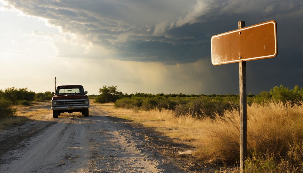
Tracking down Coltharp requires traversing a web of rural East Texas back roads that wind through Houston County’s reclaimed wilderness. You’ll navigate 20 miles northeast from Crockett, following the Cochino Bayou corridor where pre-1860 settlers once established their community.
Your primary route begins on State Highway 7, turning onto County Road 4700 before connecting with Farm to Market Road 513. The ghost town materializes at the intersection with Forest Service Road 521 A, roughly 2 miles northeast of Kennard. Don’t expect historical signage marking this forgotten settlement—the Texas terrain has reclaimed most evidence of habitation.
As you venture further into the region, you’ll discover more ghost towns to explore in Texas, each with its own unique story etched in the remnants of abandoned buildings and dusty streets. It’s a haunting experience that transports you back in time, allowing you to imagine the lives once led in these now-desolate places. Be sure to have your camera ready; the eerie beauty of these landscapes is truly captivating.
What abandoned buildings remain stand hidden among dense pine forests, accessible only to those willing to venture beyond paved highways into territory where GPS signals fade and self-reliance becomes essential.
Other Historic East Texas Ghost Towns Worth Visiting Nearby
Houston County’s vanished settlements form a constellation of forgotten communities that once dotted the pine-covered landscape radiating from Coltharp. You’ll find Antioch, Pleasant Hill, and Prairie Point within easy driving distance, each representing rural community histories that shaped this region’s character.
Alabama, a Trinity River steamboat stop from the 1830s, demonstrates how early transportation networks determined settlement patterns before completely disappearing from the map. Cross into neighboring Cherokee County to explore Larissa, where a weathered cemetery and scattered ruins offer tangible connections to pioneer life.
These sites reward your curiosity with solitude and authentic discovery—no commercialized tourism, just raw landscapes where you’re free to trace fading roads and imagine the ambitious souls who carved homesteads from wilderness, then vanished.
Essential Tips for Exploring Rural Houston County Landmarks
Before setting out into Houston County’s backcountry, you’ll need to ground yourself in Crockett’s practical resources and historical context. Start at the Visitor Center and Museum on South First Street, where museum exhibits documenting cotton farming history through antique gin machinery and ox bows provide essential orientation to the region’s vanished agricultural economy. These artifacts tell the story of communities like Coltharp that once thrived then faded.
Prepare for unpaved roads and wildlife encounters by carrying water, maps, and insect repellent. Check hours before visiting Mission Tejas State Park or venturing into Davy Crockett National Forest‘s vast acreage. Respect private property boundaries near historic sites.
The Moosehead Cafe and TX Burger offer refueling stops, while rural scenic drives reveal the landscape that shaped these forgotten settlements.
Frequently Asked Questions
What Caused the Post Office in Coltharp to Close?
Population decline and lack of economic activity sealed Coltharp’s fate in 1909. You’ll find the post office couldn’t survive when residents dwindled from 115 souls, leaving insufficient mail volume to justify federal service in this isolated East Texas settlement.
Are There Any Photographs of Coltharp From Its Active Years?
Unfortunately, no historic photos of Coltharp from its active years survive in archives. You’ll find only whispers in records—the remains of Coltharp’s commercial buildings have vanished, leaving your imagination to reconstruct this vanished frontier community.
What Goods Did Eli Coltharp’s Store Sell to Local Residents?
Eli Coltharp’s store stocked everything you’d need for frontier independence: food staples, clothing, farm equipment for working your land, and household supplies like nails and paint. He’d negotiate prices based on your crops or cattle.
Can Visitors Access the Cochina Bayou Waterway Near the Site?
Picture yourself machete-whacking through impenetrable brush like some delusional explorer—you’ll find no marked access to Cochino Bayou near Coltharp. Abandoned railroad tracks and nearby wildlife habitats guard this waterway, keeping freedom-seekers perpetually landlocked on private property.
Were There Any Notable Events in Coltharp During the Civil War?
The mills ran day and night supporting Confederate families, though no major battles occurred here. You’ll find the real story in post-war economic decline that destroyed prosperity, not early settler conflicts during wartime.


