Your Missouri ghost town road trip should prioritize Columbia Bottom Conservation Area‘s 4,300 acres of reclaimed floodplain, where municipal airport speculation transformed into wilderness after 1993’s catastrophic flooding. Route through Times Beach, evacuated in 1985 when dioxin contamination exceeded safety thresholds by 300-fold, then proceed to Jewell Cemetery‘s half-acre enclosure preserving forty descendants alongside twenty enslaved people’s graves from 1822 onward. Van Horn Tavern‘s documented paranormal activity ceased after 1914 conversion, though archival records preserve these testimonies. The following sections provide flood-zone safety protocols and detailed historical context.
Key Takeaways
- Columbia Bottom Conservation Area spans 4,300 acres of Missouri River bottomland with hiking, birding, fishing, and hunting opportunities.
- Times Beach, evacuated in 1985 due to dioxin contamination, was a ghost town where 2,000+ residents fled hazardous conditions.
- Jewell Cemetery features Cynthia E. Jewell’s 1822 grave and memorializes over forty descendants plus approximately twenty enslaved people.
- Van Horn Tavern, built circa 1829, had a haunted room with supernatural sightings until residential conversion in 1914.
- Flooding challenges persist, with Missouri River flooding 279 days in 2019 causing periodic closures and trail obscuration.
Columbia Bottom Conservation Area: A Failed City Dream Turned Wetland Wilderness
Columbia Bottom Conservation Area occupies 4,300 acres of Missouri River bottomland in northeastern St. Louis County, representing a remarkable transformation from municipal speculation to preserved wilderness. The City of St. Louis held this property for decades, reserving it for potential airport expansion—a dream that never materialized.
Following the devastating 1993 flood, the Missouri Department of Conservation acquired the land in 1997, establishing an urban conservation area at the confluence of the Mississippi and Missouri Rivers. You’ll discover conservation area history woven into every trail and waterway, where failed development plans yielded unexpected ecological benefits.
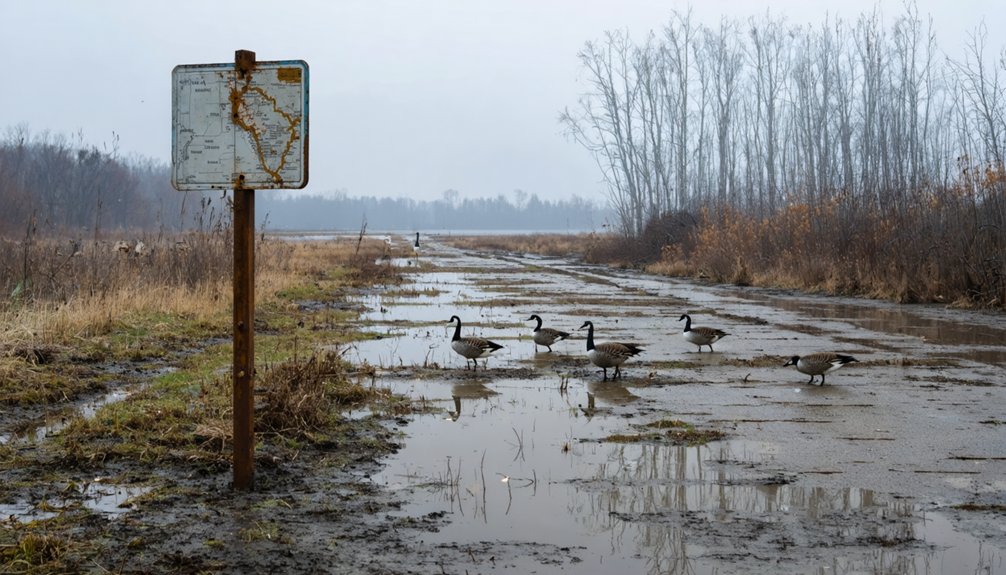
Today’s recreational opportunities include hiking, birding, fishing, and hunting across diverse habitats—wetlands, forests, prairies, and croplands—accessible from sunrise to sunset for unrestricted exploration. Birders have documented 285 species at this location, establishing it as one of Missouri’s premier birding destinations. The property features a five-mile paved road alongside a five-mile limestone biking trail for cyclists and outdoor enthusiasts.
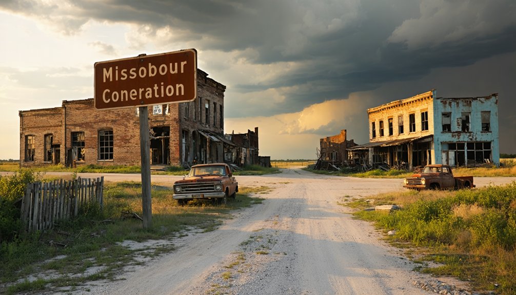
Times Beach: The Dioxin-Contaminated Town That Vanished Overnight
You’ll find Times Beach’s catastrophic contamination originated from waste hauler Russell Bliss’s 1971-1976 road-oiling operations, which mixed dioxin-laden industrial waste from NEPACCO’s Agent Orange production facility with regular oil spray.
When December 1982 soil samples revealed dioxin concentrations of 100-300 parts per billion—exponentially exceeding the CDC’s 1 ppb safety threshold—federal authorities mandated immediate evacuation of the town‘s 2,000+ residents.
The contamination resulted in numerous illnesses and miscarriages throughout the community, along with widespread animal deaths that had been occurring since the initial spraying began in 1971.
The EPA confirmed the dioxin contamination, leading to the complete evacuation of all residents by 1985 and the designation of Times Beach as a Superfund site.
Dioxin Contamination and Buyout
When Russell Bliss accepted a contract in the early 1970s to dispose of dioxin from tanks at NEPACCO (Northeastern Pharmaceutical and Chemical Company)—a facility that had produced Agent Orange for the Vietnam War—he made a decision that would seal Times Beach‘s fate. He mixed dioxin-contaminated waste oil with recycled oil and sprayed it across Missouri roads from 1972 to 1976.
Times Beach officials paid him $2,400 in 1972, unknowingly introducing tetrachlorodibenzo-p-dioxin into their community. The compound’s tight soil binding created severe soil remediation challenges. The contamination at one site, Shenandoah Stables, proved so deadly that over 40 horses died from exposure to the toxic mixture.
After December 1982 flooding and EPA testing revealed contamination 300 times above safety standards, long term health implications prompted a federal buyout in February 1983. You’ll find approximately 2,000 residents permanently relocated, ending the town’s existence. The cleanup ultimately required 240,000 tons of dioxin-contaminated soil and debris to be removed from the site.
Final Residents and Disbandment
Despite the EPA’s December 23, 1982 announcement—a “Christmas surprise” declaring dioxin levels too dangerous for habitation—Acting Mayor Sidney Hammer initially refused evacuation, stating his family would leave only by force. However, February 1983’s federal buyout offer of 800 properties and 30 businesses swiftly changed resistance to acceptance.
The December flood had already trapped residents, requiring boat rescues through contaminated waters. By 1985, all 2,242 residents relocated, facing immeasurable relocation challenges as 800 families abandoned their lives. Governor John Ashcroft’s April 2, 1985 executive order officially disincorporated the town.
The psychological trauma proved incalculable—residents reported dogs bleeding to death, children with birth defects, and cancers. Before official confirmation, a reporter’s November 1982 investigation revealed that nearly every household reported major medical issues. Attorney Mark Bronson represented 400 ex-residents predicting future health consequences, while state studies dismissed concerns. Over 1,200 people filed claims for physical and emotional injury or property loss, though the responsible company denied any injuries had occurred.
Haunted Grounds: Jewell Cemetery and the Mystery of Cynthia E. Jewell
Tucked between the roar of Providence Road traffic and the shadows of Faurot Field, Jewell Cemetery occupies less than half an acre at 2800 S. Providence Road. You’ll find Cynthia E. Jewell’s 1822 grave—the first burial that transformed George Jewell’s private land into consecrated ground.
Stone walls erected between 1841-1852 enclose over forty descendants alongside approximately twenty enslaved people burials marked with native limestone along the western perimeter. Colonial architectural styles persist through elaborate headstones and above-ground box tombs. Recent flowers suggest ongoing remembrance of these marginalized graves.
Missouri acquired the site in 1970, designating it a state historic property under Department of Natural Resources stewardship. In 2022, 4,296 visitors came to witness this compact memorial ground. This tree-shaded sanctuary preserves uncomfortable truths about antebellum Missouri—where civic founders like William Jewell and Governor Charles Henry Hardin coexisted with bondage’s brutal legacy.
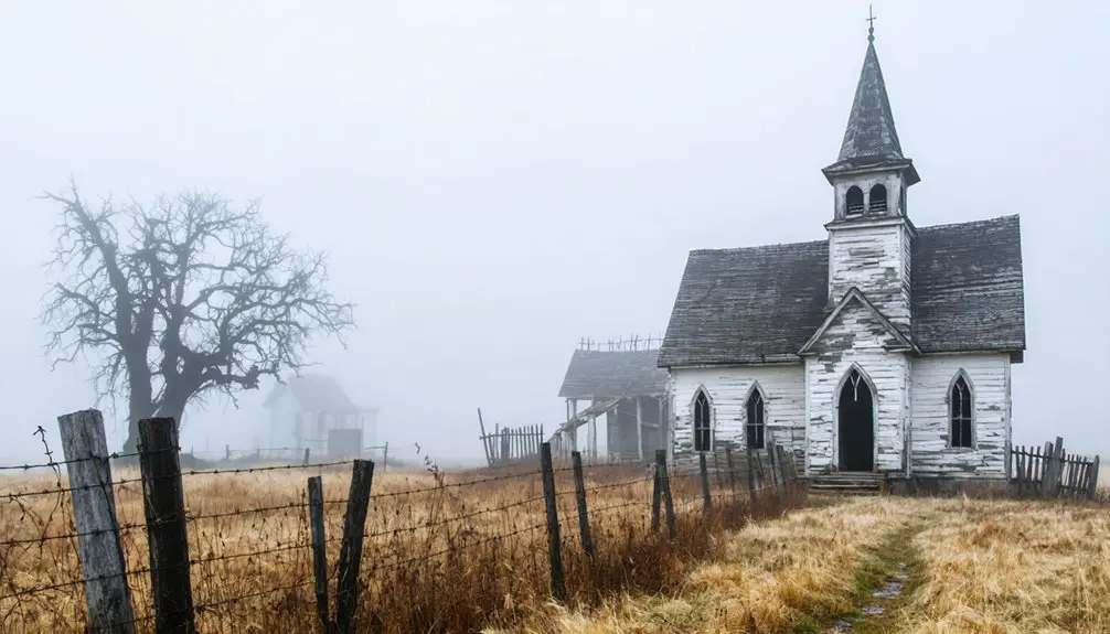
Van Horn Tavern’s Dark Secret: The Ghost That Found Peace
From Jewell Cemetery’s marginalized graves, the preservation trail leads north to another contested space where Missouri’s antebellum violence left spectral traces. Van Horn Tavern, built circa 1829, operated until the 1880s under Unionist Ishmael Van Horn’s management.
During the Civil War, guerrillas ransacked the property in July 1864, seizing abandoned belongings and imprisoning males present. Van Horn subsequently refused to rent one specific room where supernatural sightings prevented guests from completing full nights. You’ll find this haunted chamber documented in regional ghost registries, its disturbances ceasing after the tavern’s residential conversion in 1914.
The building’s persistence within historical records demonstrates how archival evidence preserves both physical structures and their paranormal testimonies, offering you tangible connections to Missouri’s contested Reconstruction-era landscape where political violence generated lasting spiritual disruptions.
Three Creeks Conservation Area and the False Freedom Narrative
While Van Horn Tavern’s spectral disturbances found resolution through architectural transformation, Three Creeks Conservation Area presents a different preservation problem: the erasure of Black land ownership through sanitized narrative. Missouri’s official interpretation claims freed slaves “received” land post-Civil War—a paternalistic fiction contradicting archival evidence of African American land stewardship through direct purchase and century-long cultivation.
The documented reality reveals:
- African Americans independently purchased 40-80 acre parcels, farming until Depression-era economic pressure forced sales
- Seven identifiable house sites occupied the 685 acres Missouri acquired in 1983 after generations of Black stewardship
- Official trail descriptions perpetuate racial land dispossession mythology, suggesting charitable grants rather than acknowledging purchased property
This narrative erasure transforms autonomous land acquisition into dependency, obscuring how systemic economic pressure—not voluntary relinquishment—transferred African American-owned land to state control.
Understanding the Manhattan Project Connection to Local Contamination
Between 1942 and 1957, Mallinckrodt Inc.‘s downtown St. Louis facility processed uranium for the Manhattan Engineer District, producing one ton daily for atomic weapons development.
From 1942 to 1957, Mallinckrodt’s St. Louis plant produced one ton of uranium daily for Manhattan Project atomic weapons.
The legacy of Manhattan Project extends beyond wartime necessity into decades of environmental contamination affecting St. Louis City and North County. Radioactive waste—radium, thorium, uranium, and decay products—leaked from deteriorating barrels at storage sites near the airport, contaminating Coldwater Creek’s watershed through systematic runoff.
Over 100 vicinity properties documented radiological materials exceeding safety thresholds. The 2019 DHHS study linked 1960s-1990s exposures to elevated cancer risks, with residents showing 85% higher odds near contaminated zones.
Ongoing remediation efforts under FUSRAP, managed by the U.S. Army Corps of Engineers through 2038, continue addressing thorium-230 exceedances in accessible floodplains and sediment deposits.
What to Expect at Abandoned and Neglected Conservation Sites

When you arrive at Columbia Conservation Area, you’ll encounter physical infrastructure in advanced stages of abandonment—visitor centers engulfed by vegetation, directional signage pointing to nonfunctional facilities, and conspicuous absence of closure notifications despite operational cessation.
The site’s 4,256 acres present challenging conditions including overgrown trail networks obscured by wetland encroachment, persistent flooding characteristic of the Missouri-Mississippi confluence floodplain, and wildlife habitat that has superseded any maintained recreational amenities.
This deterioration represents a documented departure from Missouri Department of Conservation standards, with visitor-reported conditions declining substantially between the area’s 1997 establishment and present-day abandonment.
Overgrown Trails and Signage
Though Columbia Conservation Area remains officially open, significant flood damage since 2019 has transformed this site into a landscape of restricted access and altered ecology. You’ll navigate semi-open corridors where trees and brush dominate the one-mile walk, with weedy trails extending past buried pit toilets toward the observation platform.
The former boardwalk among willows, though badly damaged, offers excellent passerine habitat. Overgrowth removal efforts haven’t kept pace with nature’s reclamation, while signage limitations mean you’ll need to download the area map online before arrival.
Current Trail Conditions:
- Bottomland forests recreated after the 1993 flood now flourish with native species
- Four-foot silt deposits have buried roads and parking lots
- The observation platform remains accessible despite missing guardrails
You’re restricted to foot traffic only, with access permitted thirty minutes surrounding sunrise and sunset.
Flooding and Wet Conditions
The overgrowth obscuring Columbia Bottom’s trails represents only the visible symptom of a deeper environmental upheaval—one driven by catastrophic flooding that has reshaped this conservation area’s fundamental character. You’ll encounter landscapes transformed by Missouri River flooding that persisted 279 days in 2019, surpassing even the 1993 Great Flood‘s five-month duration.
Management agencies now reassess flood mitigation strategies as waters arrive with unanticipated frequency, forcing periodic closures. The 1993 deluge overtopped every levee, creating scour holes and wetlands restoration opportunities where native aquatic plants now thrive.
Yet standing water lingers into winter months, complicating access and challenging infrastructure repair decisions. This perpetual saturation defines your experience—abandoned trails, questionable levees, and ecosystems reclaiming flood-scarred bottomlands beyond conventional conservation timelines.
Wildlife Over Human Amenities
As conservation priorities shift decisively toward ecosystem management, Columbia Bottom’s abandoned visitor center exemplifies a nationwide recalibration where wildlife habitat preservation supersedes public amenities maintenance.
You’ll find functioning observation platforms and restrooms near the confluence despite facility deterioration elsewhere. The Department of Conservation’s resource allocation prioritizes seasonal waterfowl protection through October-March closures rather than infrastructure restoration.
Active wildlife management features include:
- Volunteer-maintained bird feeders attracting reliable Eurasian Tree Sparrow populations for observing endangered species documentation
- Refuge designation protecting southern portions for monitoring conservation efforts during critical migration periods
- Bottomland forest and wetland habitats supporting herons, egrets, rails, and bitterns without visitor infrastructure interference
This approach grants you unmediated access to ecological processes while accepting reduced comfort amenities.
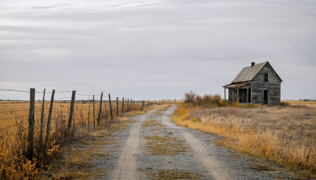
Mapping Your Ghost Town Route: From Columbia to St. Louis

Before setting out on this archival journey through Missouri’s vanished settlements, you’ll need to establish Columbia Bottom Conservation Area as your northeastern anchor point. This former St. Vrain townsite, where the Missouri and Mississippi Rivers converge, serves as your gateway to understanding rapid environmental reclamation and unique local folklore surrounding complete settlement erasure.
From there, you can venture deeper into the ghost towns of Missouri, each telling a haunting story of life that once thrived but is now reclaimed by nature. As you explore these desolate places, you’ll encounter remnants of past communities and gain insights into the reasons behind their abandonment. The landscape, dotted with crumbling buildings and overgrown streets, offers a poignant testament to the passage of time and the ephemeral nature of human settlement.
Chart your southwestern trajectory through St. Charles County’s Katy Trail corridor, where Hamburg, Howell, and Toonerville await documentation. These WWII-era casualties offer concentrated exploration opportunities within endangered wildlife habitats that’ve overtaken ordnance works infrastructure.
Your route culminates at Times Beach in St. Louis County—dioxin contamination’s most notorious victim. Follow I-44 westward to catalog additional Route 66 casualties: Arlington’s riverside remnants, Bloodland’s Fort Leonard Wood displacement, and Possum Trot’s ecclesiastical fragments near Nixa.
Safety Precautions for Visiting Flood-Prone and Contaminated Areas
Before venturing into abandoned settlements near Columbia, you must consult real-time flood advisories through NOAA Weather Radio and the MoDOT Traveler Information Map, as these historically flood-prone bottomlands can inundate within minutes of upstream precipitation.
You’ll need to identify all documented contamination zones—particularly those containing dioxin, industrial waste, or compromised septic systems—by reviewing environmental assessment records from county health departments and the Missouri Department of Natural Resources.
Establish multiple evacuation routes from each site you intend to document, ensuring your primary and alternate paths avoid low-water crossings, stream beds, and areas susceptible to rapid water accumulation.
Check Current Flood Warnings
Vigilant monitoring of flood warnings remains essential when planning visits to Columbia Conservation Area and surrounding Missouri Basin sites. The National Weather Service provides 120-hour flood forecast updates through Significant River Flood Outlook products, though minor flooding events typically aren’t included due to minimal property damage expectations.
You’ll find greater than 25% probability of exceeding flood stage across multiple basin locations through mid-May 2026, with moderate flooding projected for Big Creek, Grand River, and Blackwater River.
Critical monitoring protocols include:
- Checking current streamflow conditions at elevated stations, such as Platte River at Louisville registering 8,520 CFS versus normal 7,380 CFS
- Monitoring water levels during spring thunderstorm activity, the primary flooding driver for eastern Kansas and Missouri regions
- Reviewing local NWS office products for official river forecasts and precipitation-dependent flood potential assessments
Recognize Dioxin Contamination Zones
Beyond hydrological hazards, visitors to Columbia Conservation Area must understand the region’s legacy of industrial contamination, particularly dioxin dispersal across eastern Missouri. Between 1972 and 1976, Russell Bliss sprayed waste oil contaminated with Agent Orange byproducts across 27 sites, creating persistent environmental hazards.
Identifying nearby contaminants requires awareness that dioxin concentrations reached 2,000,000 ppb in storage facilities, while residential soils measured 100-300 ppb—far exceeding EPA’s 1 ppb threshold. Understanding dioxin health impacts is essential: this compound causes chloracne, reproductive damage, immune system dysfunction, and developmental abnormalities.
Though remediation removed 240,000 tons of contaminated material by 1997, you’ll benefit from consulting EPA archival records before exploring surrounding areas. Your freedom to access these landscapes depends on informed risk assessment and historical awareness.
Prepare Emergency Exit Routes
How should you navigate an area where flood cycles repeatedly transform terrain and infrastructure? Evacuation planning demands precise knowledge of Columbia Bottom’s access hierarchy.
From Interstate 270 Exit 34, you’ll travel 2.8 miles north on Columbia Bottom Road to reach the conservation area entrance. Document multiple emergency access routes before venturing inward, as standard roads wash out during flood events.
Critical routing considerations include:
- Primary egress via Parking Lot L: Designated staging point where vehicle access terminates, requiring 0.9-mile foot evacuation to confluence
- Service road alternatives: Conservation atlas identifies secondary vehicle routes for flexible extraction
- 45 mph speed limit: Constraints affecting emergency departure timing throughout conservation area
Map emergency access routes meticulously. Contact Missouri Department of Conservation for current road status, as closures persist months beyond initial flooding events.
Combining Historical Sites With Modern St. Louis Ghost Tours
Modern St. Louis ghost tours integrate Times Beach’s dioxin disaster with Columbia Bottom’s transformation from failed 1870s settlement into 4,318-acre conservation area. You’ll discover how flood mitigation plans—including the $27 million setback levee funded through $12M MDC and $15M ARP appropriations—reshape landscapes repeatedly damaged by 2008-2019 flooding events.
Rebranding conservation areas connects Three Creeks’ post-Civil War freedmen community with the MKT Trail’s 1977-1985 rails-to-trails conversion, purchased for $275,000. Tours document authentic evacuation histories: Times Beach’s 1982 federal buyout and Columbia Bottom’s ghost town origins in uninhabitable bottomland.
You’ll traverse Turkey Creek’s 3-mile interpretive loop through abandoned fields, examining how Superfund remediation transformed toxic sites into Route 66 State Park while preserving archival evidence of environmental catastrophe and emancipation narratives against bureaucratic historical distortions.
Frequently Asked Questions
Are Overnight Camping or Extended Stays Allowed in These Conservation Areas?
Overnight tent camping is permitted only where specifically listed, with 14-day consecutive limits and 30 annual days total. Extended RV stays follow identical restrictions, though you’ll find no hookups available at any conservation area.
What Wildlife Species Are Most Commonly Seen at Columbia Bottom Today?
You’ll observe abundant waterfowl populations including herons and egrets, alongside diverse grassland bird species such as Red-winged Blackbirds in massive flocks, Horned Larks, and Dickcissels. Bald Eagles, mammals like coyotes, and various pollinators thrive here year-round.
Can I Bring My Dog to These Historical Sites?
Like a faithful companion on historical expeditions, your dog’s welcome at Columbia Bottom’s trails under leashed pet policy. Conservation accessibility guidelines permit dogs at these open-air ghost town remnants, letting you explore Missouri’s vanished settlements freely together.
Are Guided Tours Available at Any of These Ghost Town Locations?
Guided tours available at these ghost town sites are nonexistent; however, self-guided tours offered through walking trails and accessible remnants let you explore independently. You’ll discover preserved landscapes and structures at your own pace, embracing unrestricted historical investigation.
What’s the Best Season to Visit These Flood-Prone Areas?
You’ll find absolutely perfect conditions visiting late spring through early fall, when rainy season conditions subside and flood mitigation efforts maintain accessibility. This window grants you unrestricted exploration freedom between October’s waterfowl closures and inevitable seasonal inundations.
References
- https://www.youtube.com/watch?v=3ElM_xAtbAY
- https://insidecolumbia.net/entertainment/haunted-history-a-peek-into-columbias-ghostly-past/
- https://www.stlmag.com/news/new-plan-for-columbia-bottom-missouri-department-of-conservation/
- https://www.tripadvisor.com/Attraction_Review-g44881-d12847545-Reviews-Columbia_Bottom_Conservation_Area-Saint_Louis_Missouri.html
- https://uucomo.org/wp-content/uploads/2022/11/Presentation-2022-10-30.pdf
- https://mdc.mo.gov/magazines/conservationist/1998-03/urban-wildlife-mystery
- https://environmentalecho.com/2021/04/24/epa-region-7-feature-a-town-a-flood-and-superfund-looking-back-at-the-times-beach-disaster-nearly-40-years-later/
- https://stlouisaudubon.org/birding-site-spotlight-columbia-bottom-conservation-area/
- https://www.confluencegreenway.org/locations/cb.php
- https://quintascott.wordpress.com/tag/columbia-bottoms-conservation-area/