You’ll need a high-clearance vehicle and forty minutes to reach Como, an 1860s silver camp perched at 7,116 feet in Nevada’s Pine Nut Mountains. Drive eleven miles south from Dayton along a rough wagon road that climbs through canyons, where you’ll discover fire-scarred mill ruins, collapsed mine shafts, and the distinctive greenish-stone post office foundation scattered across sagebrush flats. Winter demands four-wheel drive, while summer opens access to two-wheel-drive SUVs brave enough to tackle the under-maintained surface and spotty cell service that guards Como’s secrets.
Key Takeaways
- Como lies 11 miles south of Dayton at 7,116 feet elevation, requiring a high-clearance vehicle and preferably four-wheel drive.
- The 40-minute route follows an old freight wagon road with under-maintained surfaces and intermittent cell service throughout.
- Dry months need only 2WD high-clearance SUVs, but winter conditions demand 4WD with off-road snow-rated tires.
- Key landmarks include the 1860s post office foundation, scattered stone ruins, and fire-exposed mining artifacts from the 1938 mill fire.
- Explore ore carts, mill remnants, collapsed mine portals, and Captain Truckee’s burial site on the ridge above town.
From Gold Rush Camp to Ghost Town: Como’s Story
While thousands rushed to California’s goldfields in 1849, a handful of Mormon emigrants paused in Nevada’s Gold Canyon and discovered placer deposits that would set the stage for Como’s brief existence.
You’ll find Como’s real story began in June 1860, when prospectors struck richer quartz veins in the Pine Nut Mountains, establishing the Palmyra Mining District.
Peak Years of Prosperity in the 1860s
Within months of the June 1860 gold strike in the Pine Nut Mountains, prospectors established Camp Palmyra, though growth came slowly at first. By 1862, Palmyra reached 400 residents before neighboring Como overshadowed it completely, reducing the original camp to merely a hotel and three saloons.
Como’s key infrastructure developments transformed the camp into a legitimate mining hub by 1863. J.D. Winters constructed a steam-driven mill in 1864, while the Como Sentinel newspaper launched that same year, chronicling the town’s meteoric rise.
Mining and economic drivers pushed Como’s population to 700 people during peak prosperity in 1863-1864. Optimism over the Palmyra District’s gold deposits fueled rapid expansion. You’ll find Como was proclaimed as Nevada’s future major mining center—a prediction that would prove devastatingly short-lived.
The Rise and Fall of Como’s Mining Operations
Despite the euphoric predictions of 1863-1864, Como’s mining foundations cracked almost immediately. You’ll find the operating challenges were brutal—J.D. Winters’ mill couldn’t even cover basic costs after processing local ore for just one year.
The rock simply didn’t contain enough precious metal to justify the effort.
Getting to Como: Directions and Vehicle Requirements
You’ll find Como about 11 miles south of Dayton, nestled at 7,116 feet in the Pine Nut Mountain Range—but don’t let that short distance fool you. The 40-minute journey demands a high-clearance vehicle, preferably with four-wheel drive, as you’ll navigate rocky, rutted roads that climb steep terrain and wind through a confusing maze of interconnecting paths.
Leave your sedan at home and pack patience along with your sense of adventure, because this bumpy ride requires both proper equipment and careful navigation.
Dayton to Como Route
From Dayton’s dusty crossroads along Highway 50, the old freight wagon road to Como stretches 19.9 miles into the Pine Nut Mountains, following the same rugged path that once carried supplies to Aurora and Bodie’s mining camps. You’ll climb gradually from 4,367 feet to 7,128 feet through canyons like Hackett, Eureka, and Sullivan, where cobblestone rocks embedded in the graded dirt create a bumpy, bone-rattling ride.
Vehicle requirements shift with the seasons. During dry summer and fall months, your 2WD high-clearance SUV handles the wide, full-width road fine. Winter demands 4WD with off-road snow-rated tires. Spring brings shallow water crossings through washes.
Accessibility challenges include intermittent cell service and under-maintained surfaces, though you’ll avoid serious ledges or camber issues along this historic freight route.
Vehicle and Terrain Considerations
Two essential factors determine whether you’ll reach Como without trail damage: ground clearance and suspension strength. Football-sized boulders litter every foot of this serpentine climb, half-buried and ready to punish undercarriages. Road hazards encountered include constant embedded rocks, deep ruts carved by rain, and a relentless 11-mile gauntlet testing every weld and component. Standard vehicles won’t survive this beating—you’ll need high clearance above all else. Even ATVs suffer damaged sprocket protectors and racks on this punishing route.
Vehicle maintenance requirements extend beyond pre-trip checks. Components fail regularly from sustained jarring. The rockiest sections demand constant vigilance, crawling speeds, and strategic line selection. Your suspension endures thousands of impacts climbing from Dayton’s 4,400 feet to Como’s 7,200-foot elevation. This isn’t casual weekend driving—it’s mechanical warfare against Nevada’s most unforgiving terrain.
What You’ll Find at the Townsite Today
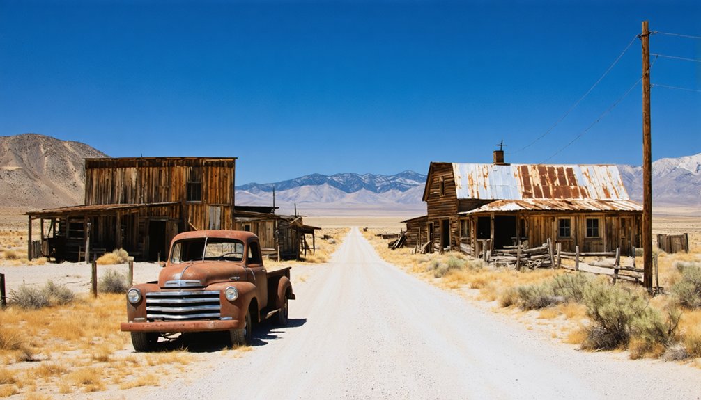
When you arrive at Como’s windswept townsite, you’ll spot the rock foundation of the 1860s post office standing as the most recognizable landmark among the scattered ruins.
Stone foundations and partial cellars create a mosaic across the sagebrush, marking where saloons, mills, and miners’ shanties once thrived during the gold rush.
Fire-scarred artifacts—ore carts, whim wheels, and rusting tanks—lie exposed where the last mill burned in 1938, leaving behind skeletal evidence of the extraction operations that once drove this 5,500-foot mountain settlement.
Standing Stone Post Office
Scattered across the desert floor, Como’s remnants tell the story of a post office that shuttered its canvas flap for the last time on January 3, 1881. You’ll spot distinctive greenish stone construction materials among the scattered foundations—characteristic architectural design elements of government postal facilities from that era. The rectangular building once funneled letters and supplies from Carson City, 20 miles north, serving as the mining camp’s lifeline during Como’s boomtown years.
Today, broken pottery, weathered glass, and rusted cans mark the site where this essential outpost operated intermittently until 1905. Navigate carefully around the straight-down mine shafts that dot the landscape. Recent brush clearing has exposed artifacts hidden for decades, offering you glimpses into the daily lives of prospectors who called this remote settlement home.
Scattered Foundations and Cellars
Across Como’s windswept hillside, greenish stone foundations emerge from the desert soil like skeletal remains of a vanished civilization. You’ll spot these scattered ruins atop the pass and throughout the townsite, with recent brush fires exposing structures previously hidden beneath decades of growth. Stone foundation stability varies considerably—some walls stand firm while others crumble dangerously, particularly near the mining shafts.
The cellars’ accessibility makes them easier to explore than the vertical mine workings, though you’ll still need to watch your footing. Rock-walled cellars dot the landscape alongside rusted broilers and collapsed wooden sheds. You’ll find concentrated debris across from the post office ruins, with trash, pottery shards, and glass fragments scattered along the half-mile road leading through this remote Pine Nut Mountains ghost town.
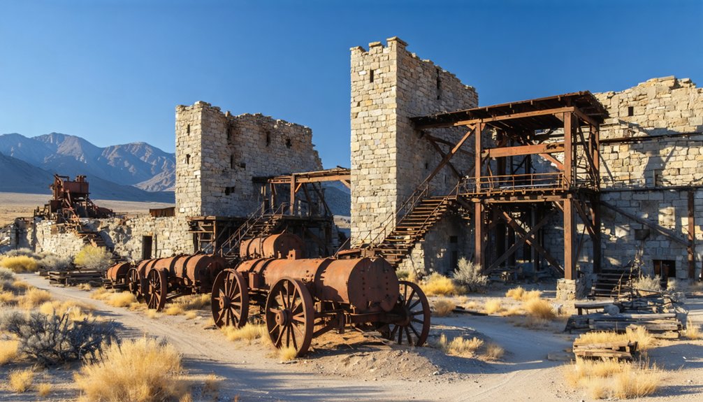
Fire-Exposed Mining Artifacts
Recent wildfires have stripped away Como’s protective brush cover, revealing a treasure trove of mining artifacts that haven’t seen daylight in decades. You’ll spot charred timber framing from the 1936 flotation mill, its beams twisted and blackened but still standing as evidence of Como’s final boom.
The calcined metal artifacts tell their own story—warped cyanide tank rings, heat-oxidized belt chains, and melted windlass mounts scattered near collapsed shafts.
Look for the hoist room remnants where temperatures reached extreme levels, leaving crushing equipment components bent into surreal shapes. Fire-deformed ore processing vats display distinctive low spots where metal buckled. Even blasting cap tins somehow survived the inferno. These heat-altered relics offer you an unfiltered glimpse into Como’s violent abandonment—a preservation through destruction you won’t find elsewhere.
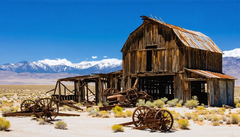
Exploring the Mill Ruins and Mining Structures
When you arrive at Como’s main site, the skeletal remains of the 1935 flotation mill dominate the landscape—rusted tanks and steel pylons rising from the piñon scrub like monuments to failed ambition. This 300-ton capacity mill represents the final Depression-era gamble, operating barely eight months before Como Mines Company walked away.
You’ll find stone foundations from the 1863-1864 steam mills scattered across the terrain, alongside collapsed mine portals and ore carts. These mining artifacts tell Como’s complete story—from Solomon Davis’s oxen-hauled steam mill crossing the Sierra to the doomed flotation experiments.
Two mine-fed ponds reflect the desert sky near the ruins. The historical significance becomes visceral when you’re standing among the wreckage, realizing how quickly prosperity vanished and freedom-seekers moved on.
Nearby Palmyra District and Points of Interest
You’ll find scattered foundations marking where saloons and merchants once thrived during the early development phases.
The promising cave ore discovered east of Palmyra triggered Como’s birth in late 1862, drawing most of Palmyra’s population to the new strike. By 1863, only a hotel and three saloons remained.
Trek up the ridge outside town to locate Captain Truckee’s burial site—he reportedly died from a tarantula bite in October 1860, a fitting end for Nevada’s unforgiving frontier.
Best Times to Visit and Safety Considerations
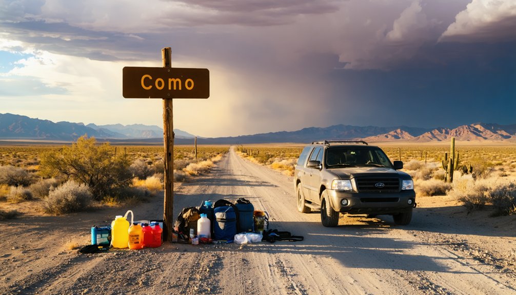
Planning your Como expedition requires careful attention to Nevada’s seasonal extremes and the mountain’s unforgiving terrain. Fall through spring offers ideal visiting conditions, though you’ll need different wet season travel precautions for each period.
Exploring the history of Hot Springs, Nevada can provide valuable insights into the region’s unique climate and geological features. Many visitors are drawn to the area not only for its natural beauty but also for its historical significance linked to early settlers. Understanding this context can enhance your experience as you navigate the diverse landscapes during your trip.
Spring delivers wildflower blooms and high grass around the mine ponds, but recent rains create treacherous mud that can strand vehicles for days in this isolated range. Summer provides stable weather and clear visibility, while winter snow renders the rocky roads potentially impassable.
Backcountry emergency preparedness isn’t optional here—it’s survival. No cell service exists, and you’re hours from help. Notify someone of your travel plans and expected return. Two-wheel-drive vehicles can make it, but expect slow going on Nevada’s rockiest terrain. Check current conditions before departure, especially late March through early April.
Frequently Asked Questions
Can I Camp Overnight at the Como Ghost Town Site?
Yes, you can camp overnight at Como using dispersed camping rules. You’ll find a quiet location with scenic views, but you must stay on disturbed surfaces, pack out all trash, and follow the 14-day limit.
Are There Any Guided Tours Available for Como and Palmyra?
Commercial guided walking tours don’t operate at Como due to its remote location and challenging access. You’ll need to explore independently—no self-guided audio tours exist either. It’s pure backcountry adventure, giving you complete freedom to discover ruins at your own pace.
Is Cell Phone Service Available in the Pine Nut Mountains Area?
Cell coverage reliability vanishes like ghost town residents—spotty at best in Pine Nut Mountains. Local network providers T-Mobile, Verizon, and AT&T serve nearby Gardnerville, but you’ll find minimal signal near Como. Download maps beforehand for true off-grid freedom.
What Permits or Fees Are Required to Visit Como?
You won’t need permits or pay fees to explore Como—it’s on BLM land with open public access. Nearby land ownership remains federal, and permitted activities include photography, picnicking, and respectful exploration of these weathered ruins.
Are There Restrooms or Facilities Available at the Townsite?
No facilities exist at Como’s ruins—you’ll find no restrooms, portable or otherwise, and no drinking water sources. Pack everything you need for this remote adventure. Bartley Ranch Regional Park offers your nearest toilet option before heading out.


