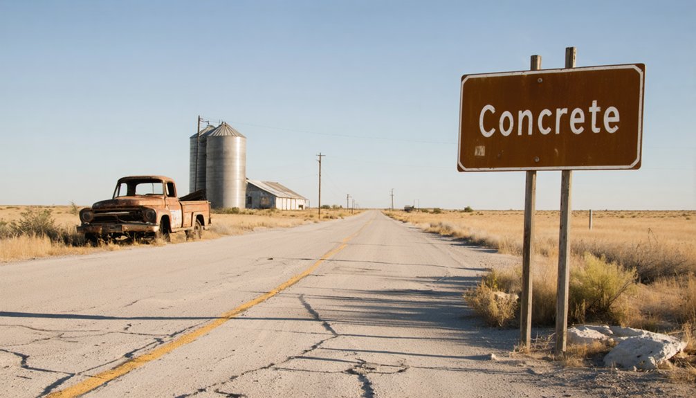
You’ll find Concrete eight miles north of Cuero on U.S. Highway 183, where a solitary concrete schoolhouse stands among the mesquite. From San Antonio, take I-10 East and US-181 North for 80 miles—just remember to program those coordinates (29°14’17” N, 97°17’34” W) before you lose cell service. Winter‘s your best bet, with 50-70°F days perfect for exploring the nearly 7-acre cemetery where pioneers and Confederate soldiers rest. Pack layers, sturdy boots, and plenty of water for your journey into this community that chose industrial pride over spiritual heritage.
Key Takeaways
- Located 8 miles north of Cuero on U.S. Highway 183, program coordinates 29°14’17” N, 97°17’34” W before departure.
- From San Antonio, drive 80 miles southeast via I-10 East and US-181 North with minimal cell service expected.
- Visit during winter for ideal 50-70°F temperatures; bring layers, sturdy boots, water, and download offline maps beforehand.
- Explore the 7-acre Concrete Cemetery featuring pioneer burials dating to 1855 and a Texas Historical Marker.
- The town was renamed from Bethesda to Concrete after residents built a distinctive concrete schoolhouse and community hall.
Getting to Concrete: Directions and Route Planning
Finding Concrete requires a deliberate departure from Texas’s well-traveled highways into the weathered heart of DeWitt County, where ranch roads narrow and the GPS coordinates 29°14’17” N, 97°17’34” W become more reliable than any faded road sign.
In DeWitt County’s forgotten corners, coordinates speak louder than signposts—navigation by numbers where roads refuse names.
From San Antonio, you’ll drive 80 miles southeast via I-10 East and US-181 North—roughly two hours through cattle country where cell service becomes spotty.
Houston travelers face a longer westward trek: 180 miles along I-10 West to TX-72, then threading through Yoakum on county roads that test your vehicle’s suspension.
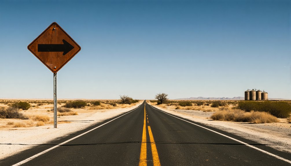
The geographic isolation is absolute here, with minimal amenities for miles. Program those exact coordinates into your phone before leaving civilization. Once you arrive on U.S. Highway 183, you’ll find Concrete positioned eight miles north of Cuero, the county’s modern hub. For reference, nearby Waxahachie sits at 32.392719 latitude and -96.843880 longitude in the northern part of the state. Pack water, fuel up completely, and download offline maps. This isn’t a detour—it’s a pilgrimage to places maps forget.
The Story Behind the Name: From Bethesda to Concrete
The community that would become Concrete started out as Bethesda—a Hebrew name meaning “House of Mercy” that settlers borrowed from the biblical Pool of Bethesda in Jerusalem. The religious significance of Bethesda name reflected pioneers’ deep faith as they carved out lives in southwest Guadalupe County.
By 1858, everything changed. Settlers erected a sturdy building from concrete construction materials—a rare sight in frontier Texas where wood dominated. This multipurpose structure housed their school, church, and Masonic Hall, becoming the community’s beating heart. The building’s durability impressed residents so much they ditched their spiritual name for something decidedly earthbound: Concrete.
You’ll find the cemetery still bears this pragmatic moniker today, marking where settlers chose utility over poetry when naming their slice of Texas freedom. Much like how postmaster Robert Franck consulted with residents before choosing a name, the Concrete community made a collective decision that reflected their most prominent landmark. Like its Washington State namesake where two cement factories dominated the community in the early 1900s, the Texas town embraced an industrial identity that celebrated building materials over biblical references.
What Remains: Exploring Concrete Cemetery
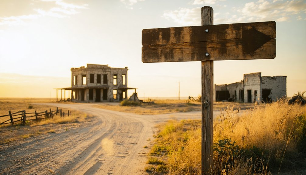
Today, Concrete Cemetery spreads across nearly seven acres just north of La Vernia off F.M. 775, standing as the community’s most tangible connection to its vanished past. You’ll find it two miles north of downtown on New Berlin Road, where haunting beauty meets history among intricate stone carvings weathered by over 160 years.
The notable burials tell Concrete’s pioneer story—Joel Newton, whose 1856 death prompted his brother James to establish the cemetery, rests here alongside families like the Bakers, whose losses in 1867 and 1868 mark the settlement’s harsh realities. The oldest recorded burial is Maria Madden Dial in 1855, predating even the cemetery’s official designation. Among the graves rest 33 Confederate soldiers and one Union soldier, their service remembered during a 2011 memorial ceremony attended by Wilson County dignitaries and historical organization representatives. A Texas Historical Marker awarded in 1997 recognizes this sacred ground, while the 2011 Sons of Confederate Veterans memorial adds another historical layer. Walk freely among these stones; they’re your unfiltered connection to Texas’s frontier past.
Adobe Architecture and Early Building Techniques
Long before settlers laid their first graves at Concrete Cemetery, Spanish missionaries were shaping Texas’s architectural destiny with sun-baked earth. You’ll find adobe’s fingerprints throughout the region—from Mission Concepción to countless vanished homesteads where pioneers mixed earth, grass, and water into blocks that cured under relentless sun.
Adobe mixing techniques evolved from simple puddling layers to precise brick dimensions, with builders adding straw binders for strength. They’d source materials from their own backyards, transforming dirt into shelter through sweat and ingenuity. Cultural groups incorporated adobe into living and storage structures, with evidence of use traced to 700 A.D. in the desert Southwest. These builders understood that proper content verification ensured structural integrity would last generations.
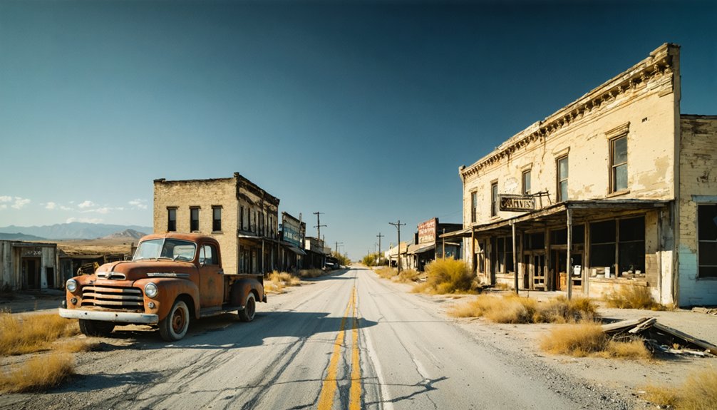
Today’s adobe preservation challenges mirror those early settlers faced: protecting earthen walls from rain and structural decay. When you explore ghost towns like Concrete, you’re walking through an architectural rebellion—folks who built freedom from whatever lay beneath their boots.
Best Time to Visit and What to Bring
When should you tackle Concrete’s dusty streets and crumbling foundations? Winter’s your ticket to freedom—crisp 50-70°F days let you roam without that brutal summer furnace exceeding 104°F. Travel during off peak seasons means you’ll wander solo through abandoned structures, no crowds blocking your shots of decaying adobe walls.
Pack layers for 30-degree nights under star-scattered skies. Throw sturdy boots, sunscreen, and gallons of water in your high-clearance vehicle—these roads don’t forgive city cars. Dust masks aren’t optional when West Texas winds kick up. Download offline maps; cell service vanishes out here. The region’s lack of rainfall and wildfire risks make proper hydration and fire safety awareness critical for any desert exploration.
Since accommodations for overnight stays are nonexistent in Concrete itself, base yourself in nearby Marfa or Alpine. Don’t confuse this destination with other places named Indianola, as disambiguation is important when planning your route. Bring emergency supplies—you’re gambling with isolation, but that’s exactly what makes this ghost town worth chasing.
Nearby Ghost Towns and Historical Sites to Explore
The ghost towns surrounding Concrete form a constellation of abandonment across Guadalupe and Comal counties, each crumbling settlement within a thirty-minute drive of the next. You’ll find Mill Creek’s barren site near Farm Road 775, while New Berlin retains fragments of its Cibolo Creek heritage. Local transportation options remain straightforward—your vehicle and the county roads connecting these forsaken places.
Plot your route strategically:
- Start at La Vernia (two miles south) for supplies and fuel
- Head to Neighborsville across the Comal County border
- Detour to Honey Creek for late afternoon exploration
- Return via New Berlin’s historical markers
Regional environmental factors—scorching summers, unpredictable Hill Country weather—dictate your timeline. These settlements share DNA: early promise, gradual decline, eventual silence. Drive between them freely, answering to nobody’s schedule.
Understanding Why Concrete Became Abandoned
You’ll find that Concrete’s demise wasn’t dramatic—no single catastrophe wiped it from the map. Instead, economic changes pulled residents toward La Vernia’s growing opportunities just two miles south, where better jobs and services concentrated as rural Texas consolidated in the early 20th century.
The town simply bled population as families followed work and modern conveniences, leaving behind only the cemetery and memories etched in local histories.
Economic Shifts and Decline
Standing at the crumbling edge of Concrete’s abandoned main street, you’ll witness the tangible aftermath of Texas’s economic roller coaster—a story written in rusted rebar and shuttered cement plants.
The town’s fate mirrors broader construction material availability crises that plagued Texas. When oil prices collapsed in the mid-1980s, real estate values plummeted, forcing operations like Texas Industries to suspend construction. You’re looking at what happens when economic forces converge:
- Ready-mix concrete markets contracted at -1.5% annually
- Commercial construction declined 25% during downturns
- Supply chain bottlenecks strangled lumber and concrete availability
- Labor force trends showed persistent skilled worker shortages
These weren’t abstract statistics—they were death sentences for single-industry towns. Each economic shock stripped away another layer of Concrete’s viability, leaving behind this haunting monument to boom-and-bust cycles.
Rural Population Consolidation
When railroads carved their iron paths through Texas in 1873, they simultaneously sealed Concrete’s fate and rewrote the state’s settlement patterns. You’ll find this consolidation mirrored across seventy-five Texas counties that lost population between 2022 and 2023. The High Plains alone saw twenty-seven counties hemorrhage residents to urban centers like Celina, which exploded from 6,000 to 43,000 souls in just thirteen years.
DeWitt County’s story illustrates these shifting land use patterns—its population peaked at 27,941 in 1920, then steadily declined as agricultural adaptations couldn’t compete with city opportunities. By 1950, only 22,973 remained. Towns like Concrete vanished entirely when commerce followed the rails elsewhere, leaving behind adobe ruins and memories. You’re witnessing freedom’s double edge: mobility that builds metropolises while creating ghost towns.
Resource Depletion Impact
Unlike the oil-boom collapses that left Best, Texas gasping with a population drop from 3,500 to under 300, Concrete’s abandonment tells a quieter story—one without depleted mines or exhausted wells. You won’t find evidence of resource-based economies crumbling here.
Instead, the town simply faded when residents chose mobility over stagnation.
What distinguishes Concrete from typical ghost towns:
- No documented mining operations or oil fields
- No quarries or cement plants within town limits
- No industrial collapse triggering mass exodus
- Gradual population drift rather than sudden abandonment
The real killer was isolation. Without alternative livelihoods emerging, families packed up for La Vernia’s better schools and New Berlin’s steadier work. Transportation routes shifted. The young left first. Eventually, even the church closed—a death sentence for any rural Texas community.
Photography Tips and Respectful Exploration Guidelines
Every successful ghost town photography expedition hinges on preparation—and Concrete, Texas, rewards those who arrive equipped for its harsh, unforgiving landscape. Pack wide-angle lenses for sweeping main street vistas, backup batteries for extended golden hour sessions, and cleaning kits—West Texas dust shows no mercy on glass.
Master photographic composition through long-exposure shots capturing cloud movements over skeletal structures. Frame silhouettes against fading doorways, seek window latticing for complex geometry, explore black-and-white contrasts that emphasize decay’s poetry.
You’re archiving local history, not pillaging it. Leave abandoned tools, bottles, and furniture untouched. Respect private property boundaries and cemetery grounds. Document crumbling facades without contributing to their destruction—tightened access rules stem from careless visitors who forgot they’re guests in someone’s faded dreams.
Frequently Asked Questions
Are There Any Restaurants or Gas Stations Near Concrete, Texas?
You’ll find limited options in Concrete itself, but nearby Corpus Christi offers restaurants like Hoegemeyer’s Barbeque and Water Street Oyster Bar. Nearby lodging options and local food specialties require advance planning since gas stations aren’t documented locally.
Is Concrete Cemetery Open to the Public Year-Round?
Concrete Cemetery is open year-round, but there aren’t published Concrete cemetery hours or formal Concrete cemetery policies. You’ll need landowner permission since it’s on private property, though Texas law grants reasonable access to family cemeteries during daylight hours.
Can I Camp Overnight Near the Concrete Ghost Town Site?
No official camping exists at Concrete’s ghost town site due to camping regulations. You’ll find nearby accommodations at Terlingua Ghost Town’s RV spots or Study Butte campgrounds near Big Bend, where desert stars ignite your wanderlust freely.
Are Guided Tours Available for Concrete and Surrounding Ghost Towns?
No guided tours exist at Concrete, but you’ll find freedom in self-guided exploration options among the 1858 ruins. Nearby Granbury offers structured ghost tours if you’d prefer, though visitor information center details remain limited for this remote site.
Is Cell Phone Service Available in the Concrete Area?
Cell phone coverage limitations plague Concrete’s remote location, with connectivity challenges common throughout West Texas ghost towns. You’ll likely face dropped calls and weak signals due to the area’s isolation, so plan accordingly before venturing out.
References
- https://www.ghostsandgetaways.com/blog-1/27-fascinating-ghost-towns-in-texas
- https://justapedia.org/wiki/Concrete
- https://en.wikipedia.org/wiki/Concrete
- https://www.texasstandard.org/stories/best-texas-the-ghost-town-with-the-worst-reputation/
- https://www.npca.org/articles/1935-spooky-beautiful-photos-of-abandoned-park-towns
- https://www.texasescapes.com/CentralTexasTownsSouth/ConcreteTexas/ConcreteCemeteryTx.htm
- https://www.tshaonline.org/handbook/entries/concrete-tx-dewitt-county
- https://www.latlong.net/place/waxahachie-tx-usa-14023.html
- http://decaturtx.org/DocumentCenter/View/914
- https://www.martin.fl.us/resources/list-martin-county-reefs


