You’ll find Dudley at coordinates 41.0878° N, -92.5919° W in northwestern Wapello County, though nothing physical remains of this vanished coal mining settlement. Navigate scenic country roads from Ottumwa, then shift onto gravel paths through agricultural land where nature has completely reclaimed the townsite. Only an 1902 map proves Dudley existed, making your exploration pure archaeological detective work rather than traditional ghost town tourism. Nearby communities like Competine, Comstock, and Dahlonega offer additional context for understanding this region’s mining heritage and the forces that erased entire settlements from Iowa’s landscape.
Key Takeaways
- Dudley’s exact location is 41.0878° N, -92.5919° W in northwestern Wapello County, accessible via paved highways then rural gravel roads.
- No structures remain at Dudley; the site has been completely reclaimed by nature, making exploration purely archaeological detective work.
- Download offline GPS navigation and prepare for rural isolation, as the area is sparsely developed agricultural countryside with seasonal road conditions.
- Combine your trip with nearby ghost towns: Competine, Comstock, Dahlonega, and Godfrey to maximize historical exploration in the region.
- Extend to Marion County’s Lake Red Rock submerged towns or Buxton in Monroe County for diverse abandoned community experiences.
Understanding Dudley’s History as a Wapello County Settlement
Long before Charles Dudley claimed his 167 acres in 1843, the land that would become Wapello County witnessed centuries of indigenous presence along the Des Moines River. You’ll discover Native American history in the region through Chief Wapello’s village, established south of Ottumwa in 1838, and the Indian agency built near Agency City where General Joseph Street arrived in 1839.
The treaties of 1832, 1836, and 1837 systematically stripped the Sacs and Foxes of their ancestral lands. By May 1843, pioneers like Dudley entered what had just become Iowa Territory.
Charles Dudley’s political role emerged later—he’d serve in Iowa’s House Assemblies from 1866 through 1870, representing the county he’d helped settle decades earlier.
Locating Dudley on Your Iowa Road Trip Map
You’ll find Dudley in northwestern Wapello County, where 1902 maps and early twentieth-century surveys pinpoint its exact location among Iowa’s abandoned settlements. The ghost town‘s coordinates place it within a cluster of former coal mining communities, making it accessible via modern GPS when you overlay historical plat data from the 1908 and 1920 surveys.
Your route through Wapello County will lead you to where the old post office once anchored this vanished community, now marked only by the landscape and fading cartographic records.
Wapello County Geographic Position
Nestled in southeastern Iowa’s rolling agricultural heartland, Wapello County anchors itself around Ottumwa, the county seat that serves as your primary landmark when plotting a course to the ghost town of Dudley. The county boundary geography positions you at coordinates 41°01′46″N 92°24′32″W, where 720 square miles of territory stretch across Central Standard Time.
You’ll find yourself bordered by five counties—Mahaska northwest, Keokuk northeast, Jefferson east, Davis south, and Monroe west—creating a distinctive crossroads in Iowa’s regional transportation network. The Des Moines River carves southeast to northwest through 715 square miles of land, while secondary roads like Jefferson Wapello Rd guide you through township precincts toward Dudley’s forgotten remains, accessible through Iowa DOT maps and county GIS resources.
GPS Coordinates and Access
Pinpointing Dudley’s exact location requires entering coordinates 41.0878° N, -92.5919° W into your GPS device or smartphone navigation app—these decimal degrees will guide you to this unincorporated community tucked within Wapello County’s northeastern quadrant. You’ll find this ghostly settlement along rural roads where conventional signage doesn’t exist, making precise coordinates essential for your exploration.
Before venturing into Iowa’s backcountry, cross-reference these coordinates across multiple mapping platforms—verifying coordinate accuracy prevents frustrating detours through unfamiliar countryside. Download offline navigation resources since cellular coverage weakens considerably in these remote agricultural regions. Your GPS receiver should achieve accuracy within five to ten meters under open skies, directing you through county road networks connecting Dudley to state highways.
Plan alternative routes, check seasonal road conditions, and prepare for authentic rural isolation.
Best Routes and Driving Directions to Reach Dudley
Your journey to Dudley begins where Iowa’s numbered highways meet rural gravel roads in northwestern Wapello County. From Ottumwa, you’ll navigate a 10-15 mile route combining Highway 137 with unmarked county roads that wind through agricultural flatlands toward the ghost town’s remnants.
Since no official signage marks this abandoned settlement, you’ll rely on GPS coordinates, local landmarks, and careful attention to branching paths that disappear into Iowa’s forgotten corners.
Major Highway Access Points
Finding your way to Dudley requires a bit of detective work, as this Wapello County ghost town doesn’t appear on modern GPS systems or current road maps. Located in northwestern Wapello County, you’ll need to chart your own course using historical references from that 1902 map as your guide.
Your adventure begins on paved highway routes leading into Wapello County, where you’ll shift onto scenic country roads that wind through Iowa’s rural heartland. These backroads become your portal to the past, taking you off the beaten path where adventure-seekers thrive.
Without specific GPS coordinates readily available, you’re free to explore the northwestern reaches of the county, following intuition and local landmarks. It’s old-school navigation at its finest—embracing uncertainty and discovering forgotten places.
Local Roads and Landmarks
When traversing to Dudley’s ghost town site, travelers should begin their journey from Ottumwa, the county seat, and head northwest toward Summit Township where historical records place this vanished community. You’ll navigate rural gravel and dirt roads through sparsely developed countryside that’s remained largely unchanged since 1920. Road conditions vary considerably, so prepare for unpaved surfaces that demand careful attention. Seasonal access becomes challenging during Iowa’s wet months when these backroads turn muddy and treacherous.
Along your route, you’ll pass near Durham’s hamlet site along the Des Moines River and skirt Liberty Township’s Elm Grove area. Watch for historical markers indicating abandoned settlements like Fountain Spring and Competine. The landscape reveals remnants of Iowa’s pioneer past—old mill foundations, forgotten cemeteries, and overgrown homestead traces that tell stories of communities time forgot.
Modern navigation technology makes pinpointing Dudley’s precise location straightforward: enter coordinates 41.0878°N, -92.5919°W (or 41°05′16″N, 92°35′31″W in degrees-minutes-seconds format) directly into your GPS device or smartphone mapping application. This GPS precision eliminates guesswork when hunting for remnants in rural Wapello County’s section 22, Benton Township.
Coordinate accuracy becomes essential since you’ll find no highway signs pointing toward this vanished settlement. Double-check you’re targeting Iowa’s Dudley—Connecticut has an identically-named location with completely different coordinates. Google Maps’ satellite view confirms these numbers place you in southeastern Iowa farmland, not New England. Input these coordinates into Garmin units or smartphone apps before departing, ensuring you’ve got offline maps downloaded. You’re directing toward history that exists only in records and landscape traces now.
What Remains at the Dudley Ghost Town Site Today
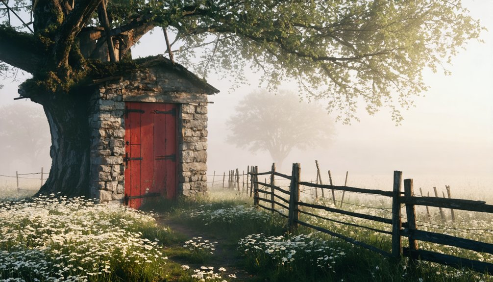
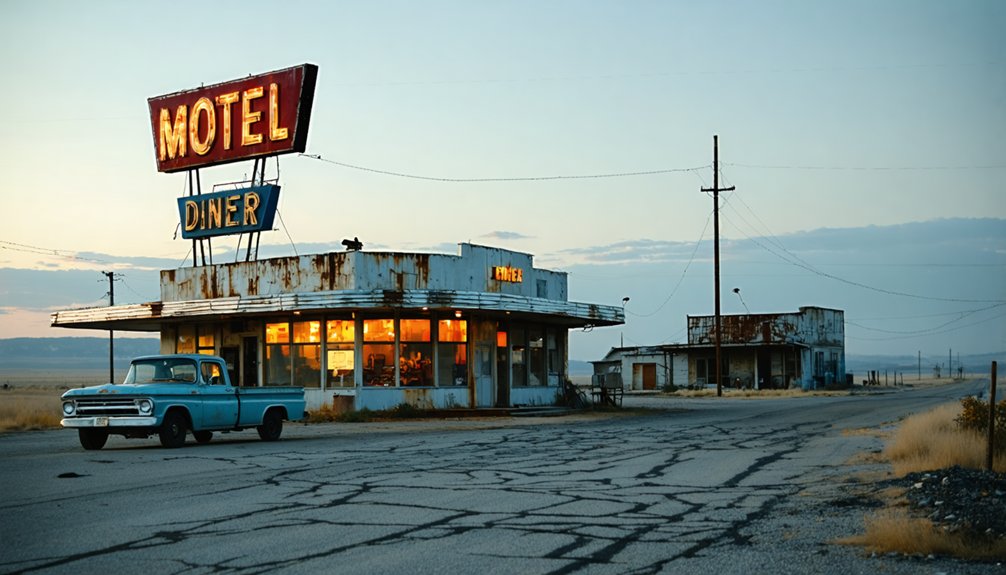
Unlike many ghost towns that leave behind crumbling foundations or weathered structures, Dudley has vanished almost entirely from Iowa’s landscape. You’ll find no standing buildings, deteriorating walls, or forgotten artifacts marking where this settlement once thrived. The lack of physical evidence is striking—nature has reclaimed the site through complete environmental restoration, erasing nearly every trace of human habitation.
When you visit northwestern Wapello County today, you’re traversing through farmland and rural terrain where homes and a post office once stood. Only the 1902 map and early 20th-century surveys prove Dudley existed at all. This complete disappearance makes your exploration more archaeological detective work than traditional ghost town tourism. You’re seeking whispers of history rather than tangible ruins.
Nearby Ghost Towns and Historic Sites Worth Exploring
Wapello County harbors several ghost towns beyond Dudley, offering you multiple destinations for a single road trip through southeastern Iowa’s forgotten settlements. Explore Competine, Comstock, Dahlonega, and Godfrey to understand the historical significance of Dudley within this broader pattern of abandonment.
Venture into Monroe County to discover Buxton, a former coal mining town that showcased remarkable cultural diversity of ghost town residents from multiple backgrounds. Clayton County’s Elkport, Littleport, and Motor provide northern destinations, while Marion County’s submerged towns—Coalport, Cordova, Dunreath, Fifield, and Oradell—rest beneath Lake Red Rock’s waters, victims of dam construction.
Wayne County’s Big Spring, Ringgold County’s Knowlton, and Adams County’s Queen City extend your journey across Iowa’s abandoned landscape, each revealing stories of communities that once thrived.
Essential Supplies and Gear for Your Ghost Town Adventure

Your journey through Iowa’s abandoned settlements demands thoughtful preparation, transforming potentially hazardous explorations into safe, documented adventures. Pack useful emergency essentials like first aid supplies, flashlights with extra batteries, and plenty of water for unpredictable situations. Your vehicle needs jumper cables, spare tire equipment, and automotive fluids since ghost towns rarely offer roadside assistance.
In addition to your preparations, consider mapping out several ghost towns to explore in Iowa, as each offers a unique glimpse into the state’s history. Research the stories behind these settlements to enrich your visit and enhance your understanding of the area’s past. Always remain respectful of the sites, as many of these locations hold significant historical value and remnants of their former lives.
Versatile camping gear proves invaluable when exploring remote Wapello County locations. Include weather-appropriate clothing layers, sturdy hiking boots, and rain protection for Iowa’s changeable climate. Stock non-perishable snacks, a multi-tool, and navigation equipment in case cell service disappears. Don’t forget sunscreen, bug spray, and hand sanitizer for outdoor comfort. A compass, whistle, and reflective vest enhance safety while you’re documenting crumbling foundations and forgotten streets far from civilization’s reach.
Photography Tips for Capturing Abandoned Iowa Landscapes
When photographing Dudley’s weathered structures, mastering light becomes your most critical skill. Bracket your exposures to capture HDR-ready images that balance shadows and blown-out windows. Time of day considerations matter—early morning sidelight separates crumbling buildings from Iowa’s flat horizons, while midday creates dramatic interior contrasts.
Embrace composition diversity by shooting wide-angle scenes at 10-20mm, then switching to macro for rust patterns and peeling paint details. Crouch low or climb high for perspectives that break conventional viewpoints. Give these forgotten spaces room to breathe in your frame, emphasizing their isolation against endless fields.
During post-processing, desaturate slightly to evoke contemplation while enhancing those complex, faded tones. Don’t rearrange what decay has positioned—photograph objects exactly as abandonment left them, preserving authentic stories.
Accommodations and Dining Options in Wapello County
After capturing Dudley’s haunting beauty through your lens, you’ll need a comfortable base for exploring Wapello County’s ghost towns. Ottumwa anchors your adventure with options ranging from AmericInn’s budget-friendly $110 nightly rate to the historic Hotel Ottumwa downtown.
If you’re camping near Lake Wapello State Park, Cobblestone Inn in Bloomfield sits just 9.6 miles away, while Centerville’s Continental Hotel offers spacious rooms at 16.9 miles out.
Budget-friendly travel tips: Wapello County accommodations span $61 to $264 nightly across 81 properties, giving you flexibility to match your road-tripping style. Dining options near Wapello County center around Ottumwa’s downtown district, where Hotel Ottumwa’s restaurant and lounge fuel your ghost town explorations.
Whether you’re choosing cozy cabins or quick motels, you’ll find freedom-loving authenticity throughout Iowa’s abandoned heartland.
Respecting Private Property and Preservation Ethics
Behind every ghost town’s crumbling facade stands a legal reality that transforms curiosity into criminal trespass. Dudley’s landscape remains private property where local families live without supernatural disturbances, viewing their land as protected forest rather than paranormal playground. Your freedom to explore ends where property rights begin—trespassers face immediate arrest after years of ghost hunters leaving fires, litter, and disrespect in their wake.
Respecting family histories means acknowledging these aren’t abandoned ruins but generational homesteads with owners monitoring every intrusion. Avoiding environmental damage preserves both natural beauty and authentic historical character that vandalism destroys. Iowa’s quiet title laws protect against exploitation, while residents maintain zero tolerance for boundary violations. True adventure respects these limits, understanding that preservation ethics demand observation from proper distances, not boots trampling through someone’s backyard.
Frequently Asked Questions
Is Cell Phone Service Available Near Dudley Ghost Town?
Like a flickering campfire in the wilderness, you’ll find decent cell phone signal strength near Dudley. With 97-98% county coverage from major carriers, accessibility of mobile data remains strong, letting you explore freely while staying connected.
Are There Restroom Facilities Accessible During the Road Trip?
Restroom availability at Dudley’s ghost town is nonexistent, so you’ll need to plan stops in Ottumwa beforehand. Nearby amenities are limited in this rural area—pack essentials and embrace the off-grid adventure with proper preparation.
What Time of Year Offers the Best Weather for Visiting?
Late spring and early fall offer ideal conditions, balancing comfortable seasonal temperature fluctuations with lower precipitation levels. You’ll enjoy mild weather in the 50s-60s°F, avoiding summer’s humidity and winter’s harsh freezing temperatures while exploring freely.
Can I Bring My Pet to the Ghost Town Site?
Unfortunately, there’s no documented information about on site pet policies at Dudley’s ghost town. You’ll need to contact Wapello County authorities directly to verify pet friendly amenities and whether your furry companion can explore these abandoned ruins.
Are Guided Tours of Dudley Available for Visitors?
No guided tours are offered at Dudley—you’ll embrace complete freedom here. Instead, craft your own self-guided walking tour through this forgotten landscape, exploring remnants at your own pace without schedules or restrictions holding you back.