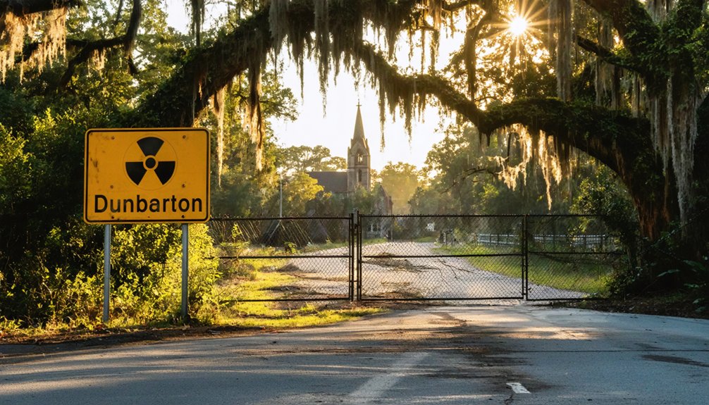
You’ll need federal clearance to visit Dunbarton, the South Carolina railroad town erased in 1950 for a Cold War nuclear facility. Start by contacting the Savannah River Site‘s Public Affairs Office to arrange a guided tour, then bring your U.S. Passport or REAL ID-compliant driver’s license for background screening. Expect vehicle inspections and leave firearms at home—this is federal property. Once inside, you’ll discover cracked streets, concrete foundations, and relocated cemetery markers reclaimed by forest, haunting reminders of 1,500 displaced families whose community vanished for nuclear weapons manufacturing.
Key Takeaways
- Dunbarton is located within the Savannah River Site, a restricted 300-square-mile federal nuclear facility in South Carolina.
- Visitors need a U.S. Passport or REAL ID-compliant driver’s license for mandatory background screening and security clearance.
- Secure Department of Energy clearance through the Savannah River Site’s Public Affairs Office before planning your visit.
- All vehicles undergo inspection by Centerra-SRS and K-9 units; firearms are prohibited on federal property.
- Arrange guided tours to explore remnants including cracked streets, concrete foundations, and relocated cemetery sites.
The Rise and Fall of a South Carolina Town
Dunbarton’s story begins around 1800, when settlers first established roots in what would become a thriving Barnwell County community. You’ll discover that growth exploded in 1899 when the Atlantic Coast Line Railroad connected Denmark to Robins, transforming this rural settlement.
By 1910, the town earned official status, named for the Dunbar family who shaped its character.
The booming trading economy centered on farming, sawmills, and commerce along the rail lines. Jesse Sanders’ pre-Civil War mill operated under slavery, providing necessary bread for area residents throughout the War Between the States.
Railroad improvements—from wooden rails to steel tracks and enhanced roadbeds—kept goods flowing and prosperity growing.
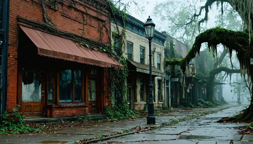
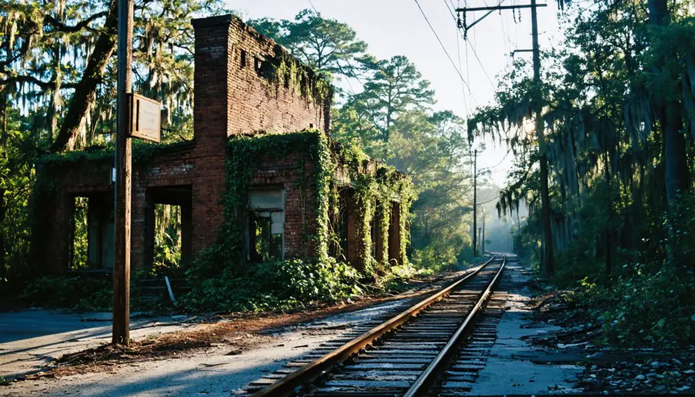
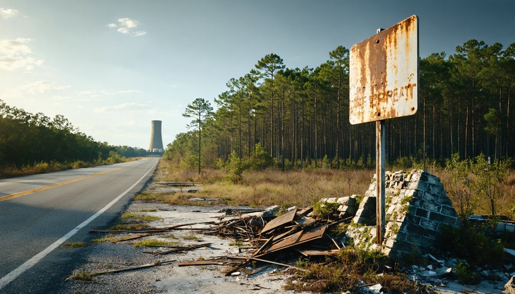
Yet Dunbarton’s dynamism proved fleeting. Today, only streets and sidewalks remain as silent witnesses to this once-busy regional hub.
Why Dunbarton Disappeared: The Savannah River Plant Story
The federal government’s 1950 announcement that Dunbarton would vanish came with Cold War urgency—the nation needed tritium and plutonium for nuclear weapons, and it needed them fast. Within days of selecting the site, officials informed roughly 6,000 residents across multiple communities that they’d have to leave their homes, churches, and family cemeteries behind.
You’ll find that while the government compensated landowners for their property, no amount of money could replace the generations of history buried in those 310 square miles along the Savannah River.
Cold War Nuclear Urgency
When atomic bombs obliterated Hiroshima and Nagasaki in August 1945, they didn’t just end World War II—they launched an arms race that would reshape America’s landscape in ways few could imagine.
By the late 1940s, Soviet threats had Americans demanding serious bomb production capabilities. The government’s answer? Rapid industrialization of nuclear weapons manufacturing on an unprecedented scale.
Shifting national priorities meant sacrificing small towns for strategic advantage. On November 28, 1950, the Atomic Energy Commission announced the Savannah River Plant—a sprawling 300-square-mile facility dedicated to producing plutonium and tritium for hydrogen bombs. Your freedom, officials argued, required this sacrifice. The site would become one of the world’s largest nuclear facilities, but first, entire communities like Dunbarton had to vanish.
Mass Relocation and Compensation
On November 28, 1950, families across Aiken, Barnwell, and Allendale counties learned their homes would soon cease to exist. The government’s announcement gave 1,500 families just over one year to abandon everything they’d built. You’ll find that promises of fair compensation rang hollow, especially for those already marginalized.
The displacement revealed harsh realities:
- Black tenant farmers faced inadequate compensation while white landowners controlled most property transactions
- Racial discrimination meant Black residents received payments insufficient to replace their farms
- Government funds rarely covered actual relocation costs
- Many families couldn’t afford to rebuild elsewhere
Whether families moved houses to nearby Barnwell and Williston or relocated to distant states, they left behind more than homes—they surrendered their autonomy to Cold War priorities.
What Remains: Exploring the Ghost Town Remnants
When you visit Dunbarton today, you’ll find a landscape where nature wages a slow war against human memory. Cracked streets and concrete foundations peek through decades of vegetation growth, marking where homes and businesses once thrived.
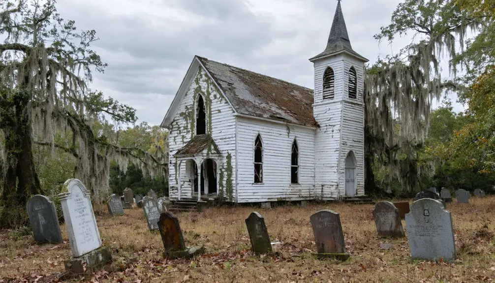
The relocated cemeteries left behind faint depressions and scattered markers—silent testimony to the 6,000 graves that were moved when the government claimed this land.
Streets and Foundations Left
As you approach the former site of Dunbarton today, you’ll find a landscape stripped of nearly every structure that once housed its community. The government’s 1950-1951 evacuation left behind only the skeleton of what was once a thriving town. What you can still discover includes:
- Curb patterns that trace the original street grid where families once drove home
- Driveways and walkways marking individual property boundaries
- Concrete foundations hidden beneath decades of soil accumulation
- Vegetation remnants slowly reclaiming the abandoned infrastructure
These archaeological traces form a ghost map of the displaced community. Streets outline neighborhoods where 6,000 residents lived before relocation, while weathered foundations peek through undergrowth. It’s tangible evidence of lives interrupted—a town erased but not completely forgotten.
Cemetery Markers and Memories
While streets and foundations hint at Dunbarton’s physical layout, the town’s most profound displacement story lies in its scattered burial grounds. You’ll find that 150 graveyards were excavated when the government condemned this land, relocating approximately 6,000 graves from Dunbarton and surrounding communities. These headstones and epitaphs now rest in cemeteries far from their original locations, disrupting generations of family genealogies and burials.
African-American farmers and sharecroppers faced particularly devastating losses, as their family burial plots were uprooted alongside their homes. The government’s $19 million purchase couldn’t compensate for severed ancestral connections. Today, descendants must travel beyond the plant’s 300-square-mile boundary to honor their dead—a haunting reminder that nuclear ambitions displaced not just the living, but the dead too.
Nature Reclaims the Town
The forest has swallowed what government bulldozers left behind. You’ll discover nature’s powerful forest regeneration as you explore Dunbarton’s ghostly remnants. Where 300 residents once lived, wildlife habitats now flourish among abandoned infrastructure.
As you walk these phantom streets, you’ll find:
- Crumbling concrete – curbs, driveways, and walkways leading nowhere
- Overgrown foundations – barely visible beneath decades of undergrowth
- Reclaimed pathways – former roads now deer trails through dense woods
- Thriving ecosystems – where homes and businesses once stood
The government removed nearly everything—buildings trucked away, 150 graveyards relocated, $28 million worth of timber harvested. Yet they couldn’t erase the town’s footprint completely. Today’s silent landscape tells two stories: one of displacement, another of nature’s persistent reclamation of territory once hers.
Getting Access to the Savannah River Site
Visiting Dunbarton requires traversing one of America’s most secure facilities, and that means playing by strict federal rules. You’ll need restricted site access requirements including a U.S. Passport or REAL ID-compliant driver’s license—that gold circle with a white star matters here. Background screening protocols demand U.S. citizenship verification, and there’s no wiggle room on expired documents.
Your vehicle faces inspection by Centerra-SRS and K-9 units at the barricade. Bring your driver’s license, current insurance, and registration. Leave firearms home; even concealed carry permits don’t apply on federal property.
Check in at the Applied Research Center, 301 Gateway Drive in Aiken, to arrange tours. If you’re staying longer than ten days annually, you’ll complete General Employee Training. Freedom here comes with accountability.
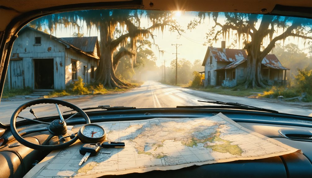
Planning Your Visit: Tours and Permits
Before you can explore Dunbarton’s eerie remnants, you’ll need to secure Department of Energy clearance through the Savannah River Site’s Public Affairs Office. Unlike Charleston’s accessible ghost hunting experiences with licensed tour guides, Dunbarton requires advance permits since it’s within restricted federal property.
Your planning checklist includes:
- Submit permit requests 30-60 days before your intended visit
- Provide identification for background checks and security clearance
- Specify your group size and exploration objectives
- Confirm escort requirements as unaccompanied access is prohibited
Tours aren’t regularly scheduled like commercial operations, so expect a customized arrangement. You won’t find the convenient booking platforms or money-back guarantees typical of traditional ghost tours. Patience and persistence pay off—this abandoned townsite offers authentic abandonment without theatrical embellishments, rewarding those who navigate the bureaucratic process.
Nearby Atomic Towns and Heritage Trails
Dunbarton wasn’t the only casualty of Cold War nuclear ambitions—three other communities vanished alongside it when the U.S. Atomic Energy Commission seized 210,000 acres for the Savannah River Plant. Ellenton, the largest town displaced, saw its buildings trucked away while residents relocated to government pre-fab homes in New Ellenton. Meyers Mill and Leigh, unincorporated settlements in Aiken and Barnwell Counties, disappeared alongside them.
The racial impacts were significant—African-American farmers and sharecroppers comprised a substantial portion of the 6,000 displaced residents, their properties condemned for nineteen million dollars.
Today, grassroots preservation efforts keep these stories alive. You’ll find the Ellenton Heritage Trail documenting this forced exodus through photo archives titled “Movin’ On,” where displaced families gather annually to remember their vanished hometowns.
Connecting With Former Residents and Community History
Though seventy years have passed since the government ordered their evacuation, former Dunbarton residents haven’t let their community fade into obscurity. Since 1952, they’ve gathered annually to share family displacement experiences and keep their town’s memory alive. These reunions span multiple generations, creating living archives of oral history preservation.
Seventy years later, annual reunions transform displacement into legacy, proving that forced evacuation cannot erase the bonds of community.
You can connect with this displaced community’s legacy through:
- Annual reunion attendance where descendants share stories of forced relocation
- Online photographic archives documenting the town’s final days
- Cemetery visits at relocated gravesites honoring 150+ moved burial grounds
- Historical society records preserving accounts from the 6,000 relocated residents
Their persistent gatherings prove that communities can’t be erased simply by bulldozing buildings. The bonds formed in Dunbarton transcend government intervention and geographic dispersal.
Frequently Asked Questions
What Happened to the Students Who Attended Dunbarton High School?
Students relocated to New Ellenton’s schools when you’d understand their forced displacement. Surviving alumni experiences included losing their hometown forever, creating long-term psychological impacts from uprooted communities, demolished memories, and government-mandated evacuation for nuclear development.
Are Any Original Dunbarton Buildings Preserved in New Ellenton Today?
No original Dunbarton buildings stand in New Ellenton today. You won’t find preserved historic structures there—everything was demolished or relocated elsewhere. The original town layout vanished completely when the government displaced residents for the Savannah River Site.
Can Descendants Visit Specific Family Homesites Within the Restricted Area?
Unfortunately, you can’t visit your family’s former homesite within the Savannah River Site boundaries. The active Department of Energy facility prohibits public access, with no permitted access or restricted visitation programs available for descendants seeking their ancestral properties.
How Do I Find Records of Relocated Graves From Dunbarton?
You’ll find relocated grave records through Barnwell County’s cemetery survey, Find a Grave’s Joyce Branch listings, and the SC Department of Archives’ Savannah River Site reports. Cross-reference land ownership records with historical cemetery data for detailed family documentation.
What Compensation Did Dunbarton Residents Receive Beyond Property Payment?
You’ll discover Dunbarton residents received residential relocation assistance capped at $50,000 beyond property payments—though ironically inadequate given the community displacement impact. The government provided pre-fabricated homes and established New Ellenton, but many families remained financially devastated.