You can’t visit original Ellenton—it’s buried beneath the Savannah River Site’s restricted perimeter, guarded by federal security and contaminated by decades of nuclear weapons production. Instead, you’ll find New Ellenton eight miles north along Highway 278, where displaced residents rebuilt their community in 1952. Walk among relocated churches, read historical markers telling stories of forced exodus, and stand where 6,000 graves were moved. The town’s true history lies in understanding what Cold War urgency destroyed and what determined survivors managed to salvage from government seizure.
Key Takeaways
- Original Ellenton is inaccessible—located within the restricted 310-square-mile Savannah River Site, a highly contaminated nuclear facility with armed checkpoints.
- Visit New Ellenton instead, located eight miles north on Highway 278, where displaced residents rebuilt their community in 1952.
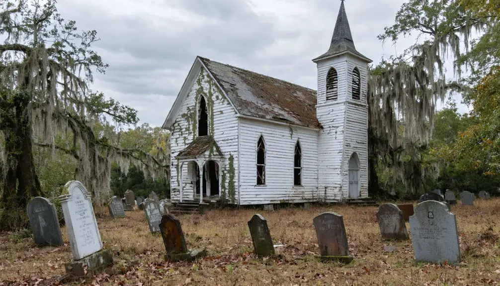
- Explore relocated churches like Zion Fair and Bean Pond Baptist, which were physically moved from the original town site.
- The Ellenton Memorial commemorates the 6,000 displaced residents and serves as the primary historical marker for the vanished community.
- Plan trips during daylight hours as New Ellenton is small; nearby Aiken offers additional lodging and Cold War historical sites.
The History Behind Ellenton’s Disappearance
While most American towns fade slowly into history, Ellenton vanished in a single, devastating sweep. In the early 1950s, the federal government seized 300 square miles along the Savannah River for hydrogen bomb production. You’ll find that nearly 700 Ellenton residents—along with thousands from surrounding communities—were forced from their homes with little warning. Buildings were demolished, 6,000 graves exhumed, and an entire landscape erased for the Savannah River Plant.
The long lasting impacts devastated those displaced. Over half of residents above fifty died within a decade of eviction. Younger generations scattered across state lines, leaving community memories preserved only through annual reunions, commemorative songs, and occasional heritage walks through what’s now a contaminated radioactive zone.
Understanding the Cold War Evacuation of 1950
On November 28, 1950, the U.S. Atomic Energy Commission shattered Ellenton’s existence, announcing a plutonium and tritium production facility that demanded 300 square miles of your South Carolina landscape. President Truman’s fears of Soviet power transformed this peaceful community into collateral damage in the hydrogen bomb race.
Land acquisition challenges emerged as the government seized property through condemnation or purchases of $10 per acre—a fraction of the $28 million in lumber value alone. By April 1, 1952, 746 residents faced forced exodus, their 6,000 ancestral graves relocated alongside them.
The resident displacement aftermath left only concrete skeletons: sidewalks, curbs, foundations marking where freedom once flourished. A handwritten protest sign stood defiant as Ellenton became what locals called the H-bomb’s first American victim.
What Happened to the 6,000 Displaced Residents
The government’s $19 million payment for three towns and 210,000 acres couldn’t mask the mathematical cruelty—timber alone was worth over $28 million, yet your neighbors received a fraction of their property’s value. This government compensation failed the 6,000 displaced souls, particularly African-American farmers and sharecroppers who’d worked this land for generations.
The long term demographic impacts tell a grimmer story than abandoned streets. Younger residents scattered, never returning. Over half of those past fifty died within a decade of eviction—unable to adjust, forbidden from visiting their ancestral grounds. New Ellenton’s dwindling population of 2,500 proves what forced relocation destroys: community bonds that sustained lives. Meanwhile, 6,000 graves were unearthed and moved, a final indignity for families already dispossessed.
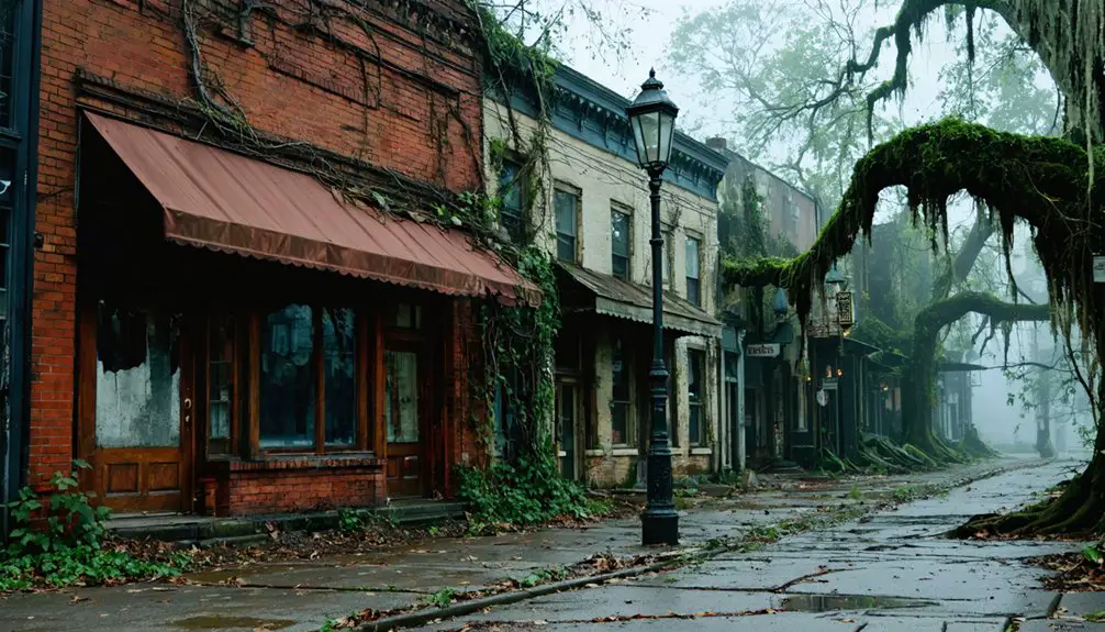
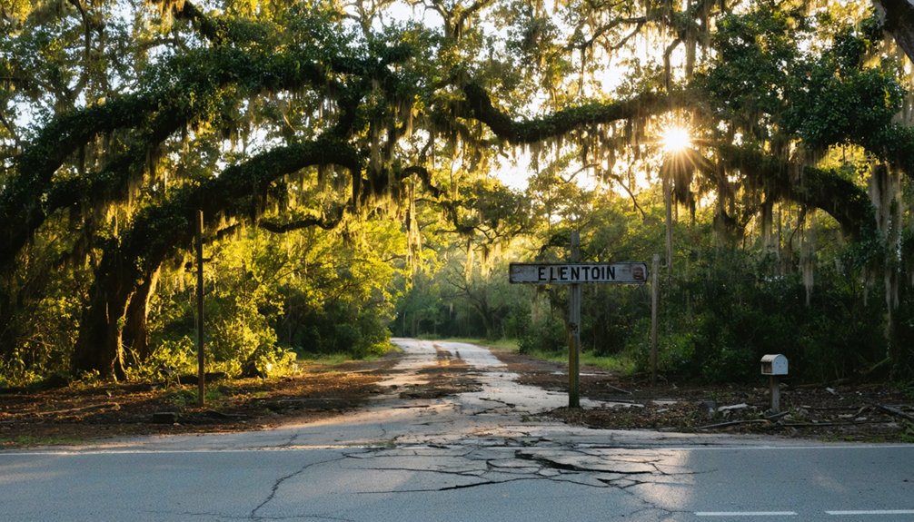
New Ellenton: Where the Community Relocated
Eight miles north along U.S. Highway 278, you’ll find New Ellenton—a testimony to displaced citizens refusing to let bureaucracy erase their community identity. When the government seized their land in 1950, residents didn’t scatter passively. They relocated their homes, churches, and businesses, reconstructing their town on their own terms rather than accepting government-planned settlements.
Today, Highway 278 bisects small stores and a shopping mall where determined residents rebuilt. Churches like Zion Fair and Bean Pond found new ground. Yet the economic impact proved devastating—younger generations departed, and over half the residents above fifty died within ten years of eviction.
New Ellenton stands as both memorial and warning: communities can survive forced displacement, but they’ll never truly recover what government power strips away.
The Savannah River Site and Its Radioactive Legacy
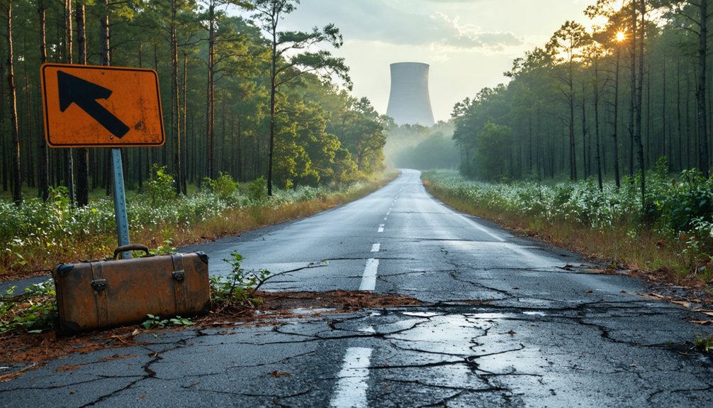
The land where Ellenton once stood now sits within the Savannah River Site’s restricted perimeter, where decades of nuclear weapons production left behind 35 million gallons of radioactive waste stored in underground tanks and enough plutonium to fill 50 bombs.
You can’t walk through the old town’s streets—security checkpoints and radiation monitoring stations guard access to what became one of Earth’s most contaminated places, with cesium-137 detected at 1,000 times background levels in nearby creeks.
Environmental testing continues around the clock, tracking tritium releases and sampling air, water, and soil where a community once thrived before atomic secrecy erased it from the map.
Contamination Levels and Testing
Since opening in the early 1950s to produce plutonium pits during the Cold War, the Savannah River Site has generated a staggering 165 million gallons of liquid nuclear waste—enough to fill over 250 Olympic-sized swimming pools. While evaporation reduced this volume to 34 million gallons stored in aging underground tanks, contamination testing requirements reveal the site’s persistent radioactive footprint.
A wasp nest discovered near waste tanks measured 100,000 dpm/100 cm² beta/gamma radiation—ten times federal limits. Employees conduct routine radiation checks across the 310-square-mile facility, where historical environmental monitoring documents toxic emissions including tritium, mercury, and volatile organic compounds. Air samples collected at the perimeter consistently detect pollutants drifting beyond site boundaries, reaching towns and rural communities in all directions across hundreds of square miles.
Access Restrictions Today
Radioactive contamination keeps curious travelers permanently locked out of the 310-square-mile Savannah River Site, where Department of Energy security protocols enforce absolute prohibition on public access. You’ll find no entry procedures for casual visitors—perimeter fencing, armed patrols, and 24/7 surveillance guarantee the ghost town of Ellenton remains sealed behind Cold War-era barriers.
Security clearance requirements exist solely for authorized personnel managing radioactive waste and nuclear materials, not for road-trippers seeking abandoned landscapes. Multi-layered safeguards include physical barriers, cybersecurity systems, and regular performance tests that verify the site’s impermeability. Your Ghost Town Road Trip must detour around these restricted boundaries, where DOE mandates override any wanderlust.
The roads leading to Ellenton’s former location remain forever closed to those without federal authorization and official badges.
Environmental Impact Documentation
Beyond those locked gates and armed checkpoints lies a landscape bearing invisible scars from America’s nuclear ambitions. South Carolina now holds more high-level radioactive waste than any known place on earth—fifty-one underground tanks containing plutonium equivalent to fifty bombs.
Ongoing environmental monitoring has documented cesium-137 at 1,000 times background levels in nearby waterways, while radioactive wasp nests discovered in 2025 exceeded federal limits tenfold. The cleanup stretches into the 2060s, a generations-long commitment to address what three decades of weapons production left behind.
Long term waste disposal remains an unresolved challenge as corrosion attacks aging tanks. You can’t visit Ellenton’s streets, but you’ll inherit its atomic legacy—whether through contaminated groundwater seeping toward the Savannah River or tritium drifting downwind.
Finding the Ellenton Marker on Highway 125
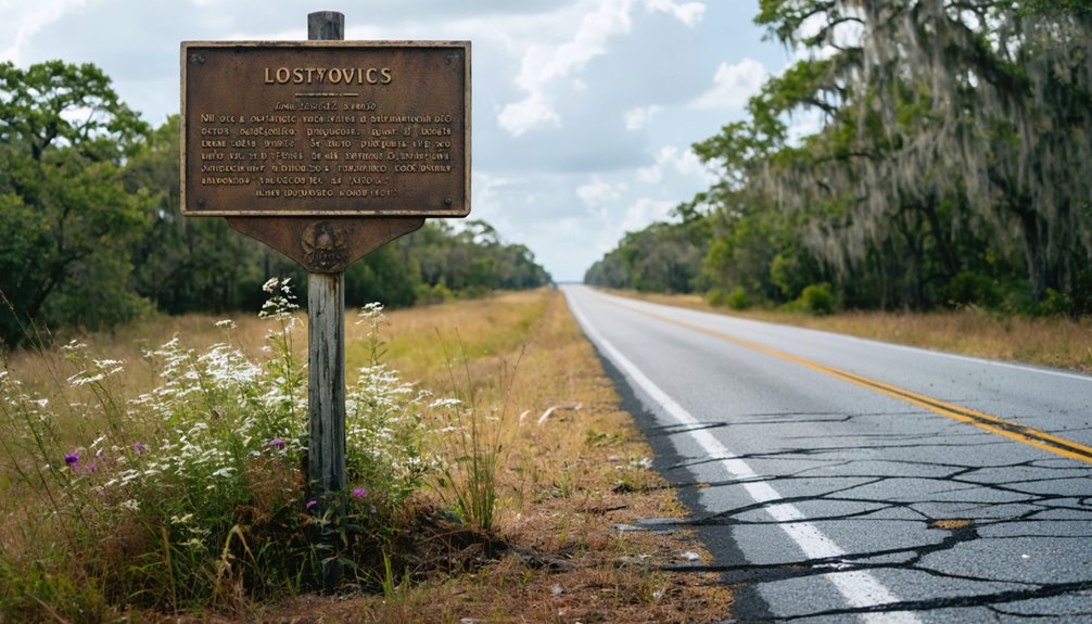
You’ll spot the historic marker along SC Highway 125’s two-lane stretch as it cuts through the Savannah River Site, roughly 17 miles past the Barnwell County entrance. The unassuming roadside monument stands near the Aiken County line, marking ground where Ellenton once thrived before vanishing in 1950.
Pull over carefully—this rural section sees little traffic, but the narrow shoulder demands attention as you step out to read the words memorializing 6,000 displaced souls.
Driving Directions to Marker
The Ellenton marker stands along SC Highway 125, a 56-mile ribbon of asphalt that cuts northwest through South Carolina’s rural heartland from Allendale to the Georgia border. You’ll find this monument where freedom and tragedy intersect—positioned between the old CSX railroad tracks and the highway near coordinates 33°13’15” N, 81°43’53” W.
Parking accessibility remains straightforward: pull off the two-lane road onto the shoulder without needing special permits or Site credentials. The marker description captures a vanished community, standing sentinel where Barnwell and Aiken counties once met.
As you travel this route—formerly U.S. Highway 278—you’re retracing the path that 6,000 displaced residents took when the government claimed their homeland in 1950 for Cold War purposes.
What You’ll See
Standing at this precise spot—33° 13.507′ N, 81° 43.834′ W—you’re confronting one of America’s most haunting atomic-age relics. The lone marker on Highway 125’s shoulder marks where 700 souls once thrived before Cold War machinery erased their world.
At this marker location, you’ll encounter:
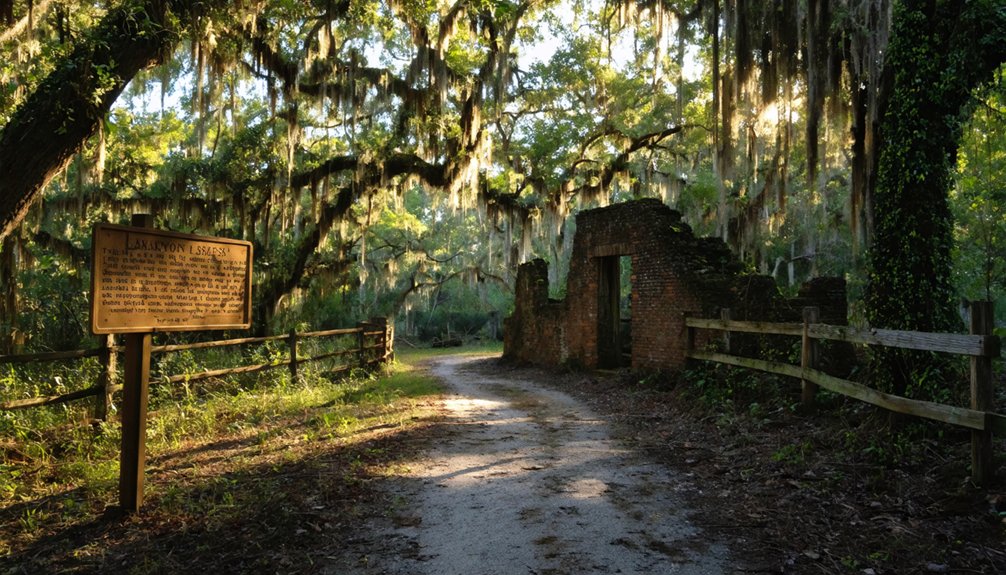
- A metal historical plaque erected by displaced residents in 1993
- Bonner Smith’s defiant 1950 shoe-polish sign lamenting governmental overreach
- Endless fencing blocking the 300-square-mile radioactive exclusion zone
- Silent woods where Ellenton’s automatic telephone system once hummed
- The closest public access point to a vanished American town
The community impact reverberates across decades. Beyond these roadside remnants, nothing remains accessible. SRS’s contaminated grounds stretch toward the horizon, a toxic monument to what citizens surrendered—willingly or not—for national security’s insatiable appetite.
Department of Energy Tours and Access Requirements
Visiting Ellenton’s ghostly remnants requires advance planning through the Savannah River Site’s structured tour program. You’ll need to be a U.S. citizen aged 18 or older—visitor restrictions exist due to radiation exposure risks at this active nuclear facility.
Registration opens online at www.srs.gov/general/tour/public.htm, with over 750 seats available across 22 tours annually. Tours depart from the SRS Badge Office near New Ellenton at noon for historic routes, accommodating 34 participants on a first-come basis. Your journey through Cold War history is free, though booking ahead is essential.
Six specialized historic tours partner with preservation groups to explore Ellenton’s abandoned streets, C Reactor’s imposing structures, and archived artifacts. For registration assistance, call (803) 952-8994.
Walking the Ellenton Heritage Trail
Beyond the guided bus tours, you’ll find a more intimate connection to Ellenton’s past along the 2.5-mile Heritage Trail winding through Greenwood’s forgotten industrial landscape. This paved path follows abandoned railroad tracks past idle textile mills and crumbling foundries, creating an eerie atmosphere that honors displaced residents’ sacrifices.
Trail highlights include:
- Quarter-mile markers perfect for pacing your exploration
- Passes century-old Panola and Mathews mills standing as community memorials
- Historic Abney Mills and Greenwood Mills sites showcasing textile heritage
- Scenic overlooks of open fields where homes once stood
- Abandoned Grede Foundry ruins along the western stretch
You’ll traverse mostly flat terrain with abundant greenery, starting at South Main Street where Palmetto Bank offers free parking. The well-maintained surface accommodates walking, biking, or skating through this ghost town’s haunting remains.
Safety Considerations When Visiting the Area
You’ll encounter serious hazards when exploring the original Ellenton townsite, which lies within the Department of Energy’s Savannah River Site—a restricted nuclear facility where unauthorized entry is prohibited and potentially dangerous.
Radiation contamination from decades of nuclear materials production makes wandering off designated paths a genuine health risk, not just a legal issue.
Always stick to authorized heritage tours led by SRS personnel, who know which areas remain safe for civilian access and which zones you must never enter.
Restricted Access Zones
When exploring the remnants of Ellenton, you’ll quickly discover that much of the area’s haunting history remains locked behind federal security barriers. The ghost town’s southernmost portions now fall within SRS boundaries, where restricted land ownership and controlled pedestrian movement define your journey.
Access Limitations You’ll Encounter:
- Security clearance and photo badges required for SRS territory—the Eastern United States’ largest protected natural area
- Swampy floodplains restrict main channel access to bridge crossings only
- Primary roads circle the basin’s perimeter, but direct routes remain off-limits
- No pedestrian infrastructure along SC 19—high-speed traffic creates dangerous conditions
- Federal protection preserves 10% of the basin, permanently sealing these lands from public exploration
Navigate carefully. The government’s grip on this landscape means freedom-seekers must chart alternative paths.
Radiation Contamination Risks
The ghost town’s invisible threat lurks far more dangerous than crumbling foundations or restricted fences. Decades of plutonium and tritium production left South Carolina with Earth’s highest concentration of high-level radioactive waste. You won’t see the contamination blanketing 90+ acres of soil, or the tritium migrating through groundwater at levels that once reached a thousand times drinking water standards.
Radiation doses to area residents hit fifty times predicted levels, yet officials still downplay health risks to nearby residents.
While ongoing site remediation efforts target permanent removal of nuclear materials, contaminated groundwater continues spreading beyond control zones. The DOE monitors consumed wildlife, acknowledging residual hazards won’t disappear until cleanup completes—assuming it ever does. Your freedom to explore ghost towns shouldn’t include unwitting exposure to invisible radioactive particles that’ll outlive your grandchildren.
Authorized Tours Only
Given these legitimate dangers, visiting Ellenton isn’t a matter of simply driving up and wandering through abandoned streets. The Department of Energy maintains strict oversight and access requirements for the entire Savannah River Site. You’ll need to navigate DOE protocols to experience this ghost town legally:
- Tour registration and reservations through the official SRS Tour Program are mandatory—no exceptions
- The SRS Heritage Foundation holds exclusive authorization under a 5-year DOE license granted in 2015
- Escorted access only—you’ll follow designated paths like Main Street with trained guides
- Independent exploration is prohibited to protect archaeological and historic resources
- The Cold War Historic Preservation Program and Savannah River Archaeological Research Program jointly manage all visitor experiences
Your freedom to explore requires working within these parameters, not against them.
Books, Songs, and Plays That Preserve Ellenton’s Memory
As federal bulldozers razed Ellenton’s churches, homes, and storefronts in 1950, artists and historians began capturing what concrete couldn’t preserve—the soul of a vanished community. “The Death of Ellenton,” a mournful composition performed at annual reunions along Georgia’s Savannah River, transforms grief into melody, honoring the 700 residents who scattered when hydrogen bomb production demanded their sacrifice.
You’ll discover the cultural significance through Lawrence Holofcener’s play “I Don’t Live There Anymore: The Ellenton Story,” featured in Carolina Ghost Towns podcasts. Samuel Ritchie’s “That Others May Live” documents how 6,000 people and 6,000 graves vanished within a 300-square-mile perimeter, focusing on displaced African-American farmers. These artistic representations echo the hand-printed protest signs that once defied government seizure, keeping Ellenton alive through words and music.
Frequently Asked Questions
Are There Any Restaurants or Accommodations Near the Ellenton Marker?
You’ll find five restaurants in New Ellenton, led by Carolina Barbecue’s stellar 4.1 rating, though lodging options remain scarce nearby. For dining recommendations, savor smoky pulled pork and hash—authentic SC barbecue that’s worth the detour into ghost town territory.
Can I Bring My Children to Visit the Contaminated Site?
Given the severe environmental concerns and documented health hazards at this radioactive site, bringing children isn’t advisable. The contaminated soil, water, and wildlife pose serious risks. You’ll want to protect your family’s well-being above nostalgic exploration.
How Long Does a Typical Department of Energy Tour Last?
DOE tour durations typically span 3.5 to 4 hours of immersive exploration. You’ll find tour scheduling varies by site—Oak Ridge runs morning expeditions while Hanford offers seasonal adventures. Nevada’s day-long journeys and Trinity’s rare openings provide unique freedom-seeking experiences.
Is Photography Allowed at the Original Ellenton Site?
Photography rules aren’t explicitly stated, but you’d need federal authorization just to access Ellenton’s original site. The location’s historic significance and potential archaeological exploration remain locked behind Savannah River Site’s restricted boundaries, limiting your creative freedom.
What’s the Best Time of Year to Visit New Ellenton?
You’ll find spring (March-May) and fall (October-November) ideal for exploring New Ellenton. These seasons offer comfortable temperatures, vibrant scenery, and engaging local festivals. You’ll enjoy seasonal events celebrating the town’s heritage while experiencing perfect weather for your independent adventure.