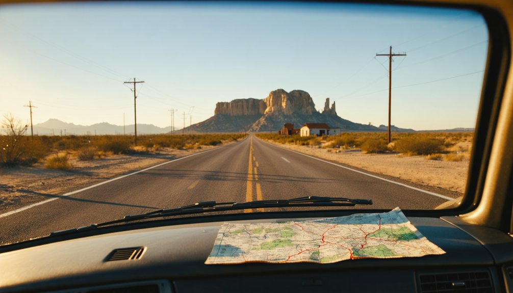
You’ll find Etholen eighty miles southeast of El Paso, where crumbling railroad station walls still stand against the Chihuahuan Desert four miles west of Sierra Blanca. Bring a high-clearance vehicle, updated GPS, and plenty of water to navigate the unmaintained roads snaking through creosote flats toward this former Southern Pacific stop that never housed more than 25 souls. Mission-style arches and granite blocks mark where trains once paused in Hudspeth County’s unforgiving expanse, and there’s considerably more to this forsaken outpost’s story.
Key Takeaways
- Access Etholen from El Paso, 80 miles northwest, using high-clearance vehicles and GPS through unmaintained roads across creosote flats.
- Explore four crumbling structures including Southern Pacific station foundations with mission-style arches and brick-petrified wood walls.
- Location sits in Hudspeth County’s Chihuahuan Desert, four miles west of Sierra Blanca near the Mexican border.
- Bring backup navigation, adequate supplies, and prepare for extreme isolation in one of Texas’s most sparsely populated regions.
- Expect minimal remains: foundation stones, concrete rubble, fading murals from a 25-person railroad stop abandoned since the 1960s.
Getting to Etholen: Routes and Highway Access
Finding Etholen requires equal parts determination and desert savvy, as this remote Hudspeth County ghost town sits at 31°11’32″N, 105°25’28″W in the high Chihuahuan Desert approximately 4,646 feet above sea level. You’ll navigate West Texas’s vast emptiness where limited tourism infrastructure means self-reliance isn’t optional—it’s survival.
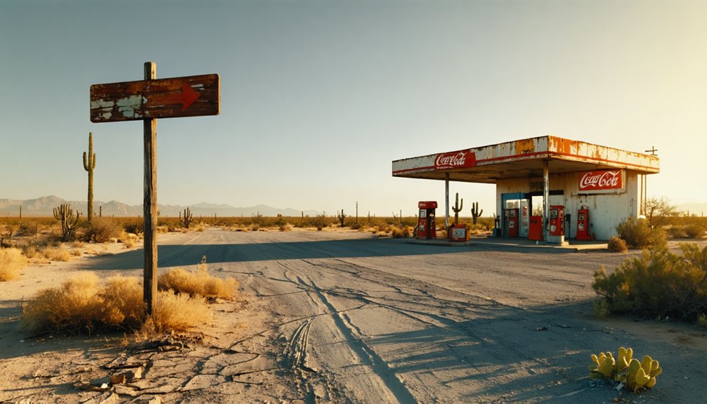
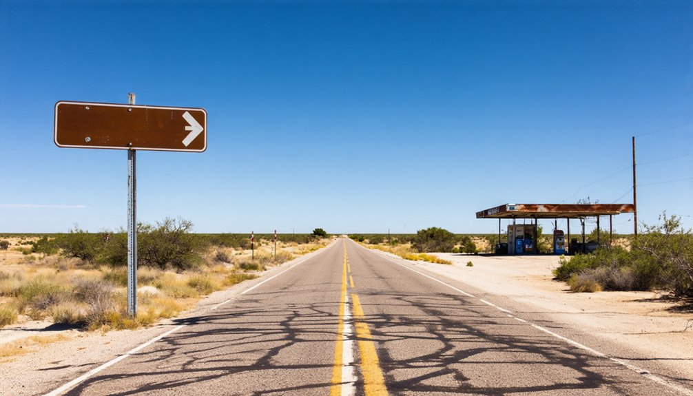
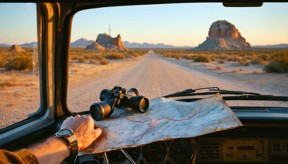
The nearest major access point is El Paso, roughly eighty miles northwest, where you’ll stock up before heading southeast toward Fort Hancock. From there, nearby unmaintained roads snake through creosote flats and alkali basins toward Etholen’s coordinates. Don’t expect highway signs or pavement; these backcountry routes demand high-clearance vehicles, updated GPS coordinates, and backup navigation.
The Mexican border lies just miles south, adding another layer of isolation to your approach through the Lasca quadrangle’s unforgiving terrain. The site falls within Hudspeth County’s 229 numeric designation, marking it officially in one of Texas’s most sparsely populated regions. Like many settlements in West Texas, Etholen eventually succumbed to the harsh conditions that make this region so challenging to traverse.
What Remains: Exploring the Abandoned Structures
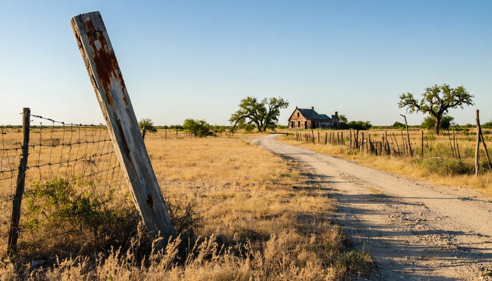
When you arrive at Etholen’s coordinates four miles west of Sierra Blanca, you’ll find precious little standing—just scattered foundation stones and the faint outline of where the Southern Pacific station once anchored this 25-soul settlement.
The desert’s reclaimed most everything, with creosote and mesquite pushing through crumbled rubble that’s been weathering under the relentless West Texas sun since the 1960s. Like many abandoned settlements, the structures struggle against nature’s pull back to wildness, their remnants slowly dissolving into the landscape. Similar to Longfellow in Pecos County, Etholen functioned as a railroad station rather than a fully developed town.
What railroad remnants you can identify require a careful eye and patience to distinguish from the surrounding landscape, as decades of abandonment have reduced this 1880s depot town to archaeological whispers in the dust.
Empty Buildings Stand Today
Four crumbling structures mark what’s left of Etholen’s physical presence in the Quitman Mountains, their weathered profiles standing against the stark West Texas landscape like forgotten sentinels. You’ll find hand-poured concrete walls that’ve outlasted their wooden counterparts, now collapsed into memory.
The crumbling interiors reveal decades of abandonment—roofless shells open to relentless sun and wind. Fading wall murals peek through peeling plaster, ghostly remnants of lives once lived here near the fort.
These empty buildings stand fully uninhabited across the 80-acre parcels, their structural decay telling stories of railroad bypasses and dried-up water sources that drove settlers away. Like countless other settlements across the state, Etholen joined the ranks of Texas’s numerous ghost towns, scattered from the Panhandle to the Rio Grande. Similar to Sherwood, another forgotten settlement, Etholen became a town bypassed by railroads, sealing its fate as the tracks carried prosperity elsewhere. No restrictions bind this land anymore—just raw, unvarnished history waiting for those brave enough to explore its unrestricted territory near the Rio Grande.
Railroad Station Remnants Visible
- Brick and petrified wood blend together in walls that refused to surrender completely to six decades of west Texas weather
- Original double-hung windows with intact weight pockets frame views of empty desert where trains once stopped
- Granite blocks, iron oxide streaks, and quartz-studded ground surround concrete that’s cracked in just one spot despite zero maintenance
- The Hudspeth County settlement sits at coordinates that place it firmly in the Chihuahuan Desert’s unforgiving expanse
- Mission-style arches sweep across the facade, designed by architect Grant Norman who created multiple structures throughout Glenrose
These architectural preservation challenges haven’t stopped the structure from defying abandonment.
The concrete bows slightly upward but holds remarkably firm—a proof, evidence, or demonstration of 1880s construction that modern developers can’t replicate.
The Story Behind the Name: Etholen Knobs and Local Geography
The name Etholen carries a peculiar mystery across West Texas’s high desert, where the ghost town sits at 4,646 feet above sea level amid the rugged topography of Hudspeth County. You’ll find the settlement’s identity intertwined with the nearby Etholen Knobs—geological formations that dominate this stark landscape four miles west of Sierra Blanca.
Unlike many Texas towns bearing Spanish colonial settlement history, Etholen’s origins remain obscure, with conflicting 1880s foundation dates suggesting railroad transportation impacts drove its brief existence. The USGS Lasca map area captures this unforgiving terrain where elevation meets isolation. Standing here at coordinates 31.19222°N, -105.42389°W, you’re witnessing geography that defeated permanence—a hamlet reduced to coordinates and memories, yet still commanding respect from those who value untamed Western landscapes.
Peak Railroad Era: When Etholen Thrived Along Southern Pacific
Standing at what’s left of Etholen today, you’d never guess this dusty crossroads once hummed with the daily rhythm of Southern Pacific trains thundering past on their transcontinental runs between Houston and El Paso. The little station served as a strategic water and fuel stop where crews could rest and locomotives could refresh, transforming a lonely stretch of Texas prairie into a genuine railroad town complete with section houses, a depot, and enough commerce to keep families fed. The Southern Pacific had built its reach south through California, arriving in Bakersfield by 1874, before pushing its iron rails eastward across the Southwest to create the vital corridor that gave life to places like Etholen. By 1883, the tracks from Los Angeles had met the Galveston, Harrisburg and San Antonio Railway, completing a crucial transcontinental link that cemented the importance of stations like Etholen along the route.
Southern Pacific’s Strategic Stop
- Strategic watering station for oil-fired locomotives experimenting with new technology since 1879
- Standard gauge tracks laid with the best steel rails and rock ballast the GH&SA could procure
- Junction proximity to the transcontinental line spanning Ogden to New Orleans through Texas
This unincorporated settlement never housed more than twenty-five souls, but it served thousands of passengers rolling westward toward freedom.
Daily Life During Boom
Railroad crews and station workers rose before dawn in Etholen’s heyday, their routines synchronized to the iron heartbeat of Southern Pacific’s transcontinental schedule. You’d have found sparse accommodations here—no bustling saloons or civic structures like neighboring Sierra Blanca offered. Life centered on train arrivals, water stops, and occasional freight transfers beneath the stark Etholen Knobs.
Workers gathered around the station platform for communal activities: swapping stories during shift changes, monitoring telegraph lines, and maintaining track through desert heat. Unlike typical boomtowns, Etholen never developed beyond its railroad function. The two dozen souls who called it home knew freedom meant mobility—hopping freights westward or accepting isolation’s harsh terms.
Why Etholen Became a Ghost Town
Like so many whistle-stop dreams scattered across West Texas, Etholen’s fate was sealed from the moment the Southern Pacific laid its tracks through this lonesome stretch of Hudspeth County desert.
Etholen was born of the railroad and died with it—another West Texas town that never outlived its single purpose.
You’ll find Etholen’s demise wasn’t dramatic—just inevitable. Three forces strangled this railroad siding:
- Lack of economic opportunities beyond servicing trains meant no sustainable income when rail traffic dwindled
- Remote geographic isolation four miles west of Sierra Blanca left fewer than 25 souls clinging to existence by mid-century
- Railroad dependence proved fatal as highways replaced steel rails for freight and passenger transport
Best Time to Visit and What to Bring
Planning your pilgrimage to Etholen means respecting the brutal honesty of Hudspeth County’s desert climate—this isn’t forgiving country, even for ruins that can’t complain anymore. Spring and fall deliver your sweetest windows, with temps hovering between 70-85°F, while summer’s 100°F+ furnace will test your resolve.
Seasonal weather advisories matter less here than common sense: pack a gallon of water per person hourly, sunscreen, wide-brim protection, and snake-proof boots for terrain conditions around the crumbling remnants.
Your 2WD vehicle handles access roads fine, but bring spare tires, full fuel from Sierra Blanca, and offline GPS—no signage points wanderers home. Add first-aid supplies, emergency satellite communication, and respect for Leave No Trace principles. This ghost town doesn’t coddle visitors; it rewards the prepared.
The Etholen Knobs: Natural Landmarks Worth Seeing
Rising from the Hudspeth County flats like geological sentinels, the Etholen Knobs command attention with their weathered profiles of marlstone, limestone, and ancient conglomerate—a 700-foot-thick chronicle to when shallow Cretaceous seas lapped against this now-parched borderland.
These natural landmarks reveal 140-million-year-old secrets you won’t find in any museum:
- Marlstone Layers (Pm Formation): Dark bands of compressed mud that once carpeted a tropical seafloor
- Limestone Outcrops (Pl Formation): Fossil-bearing rock deposited during the Neocomian age, visible throughout Sierra Blanca surveys
- Etholen Conglomerate: Coarse breccia beds marking violent coastal upheavals
You’re standing where the Chihuahua Tectonic Belt meets the Diablo Platform—geological provinces that shaped Texas itself. These geologic formations thin northward from 4,500 to 2,500 feet, creating the distinctive knobs visible for miles.
Other Hudspeth County Ghost Towns to Add to Your Journey
Beyond Etholen’s weathered remnants, Hudspeth County harbors a constellation of abandoned settlements that trace the boom-and-bust cycles of West Texas’s unforgiving frontier. Salt Flat, ninety miles east of El Paso, emerged in the 1920s when Edwin W. Hammack bet on highway traffic to Carlsbad Caverns—its population peaked at 125 before collapsing to ghost status.
Acala tells the story of cotton farming industries that thrived until the 1970s drought struck its Rio Grande Valley fields. Fort Quitman stands as a crumbling record to 1850s military outposts, while Birchville marks the old San Antonio-El Paso Road where geographic landscape features challenged early settlers. Each site reveals how ambition met desert reality, leaving sun-bleached evidence of dreams that couldn’t outlast the harsh terrain.
Property and Land Information for the Curious
Could you actually own a piece of Etholen’s sun-scorched history? Ghost towns like this former railroad station aren’t always locked away—some parcels are surprisingly available for purchase, though you’ll navigate complex ownership webs and generations of unclear titles.
What you’re looking at:
- Raw frontier land – 80-acre lots with seasonal creeks and road frontage, power available in the Quitman Mountains area
- Water rights considerations – Essential for any homesteading dreams in this arid country where the Rio Grande flows nearby
- Future development opportunities – Unrestricted zoning on select parcels means you’re free to divide, build, or preserve
Expect owner financing options (comparable 40-acre lots run $55,000), but banks won’t touch these high-risk properties. You’ll need self-reliance when utilities and infrastructure are ghosts themselves.
Frequently Asked Questions
Are There Any Guided Tours Available for Etholen Ghost Town?
Want to explore West Texas’s forgotten corners on your own terms? Guided tours aren’t offered for Etholen Ghost Town, but self-guided tours are possible—you’re free to roam this windswept Hudspeth County relic independently.
Is It Legal to Enter the Abandoned Buildings in Etholen?
No, entering Etholen’s abandoned buildings isn’t legal without permission. You’ll face trespass charges regardless of abandonment. Explore legal implications by consulting local authorities or Hudspeth County landowner records first. Photography from public roads keeps you lawful and free.
Are There Any Overnight Accommodations Near Etholen, Texas?
You’ll find overnight options at Shiloh on the Lake’s local RV camping sites along Cedar Creek Lake, or book nearby bed and breakfasts like Inn on the River. Wills Point’s Merica Inn offers budget-friendly rooms just miles from Etholen’s abandoned streets.
What Cell Phone Coverage Can I Expect in the Etholen Area?
You’ll find cellular network availability vanishes like tumbleweeds in West Texas wind out here. Expect virtually no signal strength in Etholen’s remote territory—download maps beforehand, embrace the digital detox, and savor your complete disconnection from civilization’s constant buzz.
Are There Rattlesnakes or Dangerous Wildlife Around Etholen?
You’ll encounter rattlesnakes, venomous spiders, and aggressive feral hogs around Etholen’s abandoned terrain. The remote Trans-Pecos brushland harbors prairie rattlers and copperheads. Stay alert, pack proper gear, and you’ll navigate this untamed country just fine.
References
- https://kids.kiddle.co/Etholen
- https://ummahcom.com/product/etholen-texas-80-acre-quitman-mountains-lot-w-seasonal-creek-road-frontage-power-in-the-area/
- https://www.ghosttowns.com/states/tx/tx_ghst_twns_sect1345.doc
- https://en.wikipedia.org/wiki/List_of_ghost_towns_in_Texas
- https://www.texasescapes.com/WestTexasTowns/Etholen-Texas.htm
- https://familypedia.fandom.com/wiki/Hudspeth_County
- https://www.tshaonline.org/handbook/entries/etholen-tx
- https://en.wikipedia.org/wiki/Etholen
- https://tt.maptons.com/1150733
- https://geodata.us/usa_populated_places/usapop.php?featureid=1379738&f=usa_pop_168


