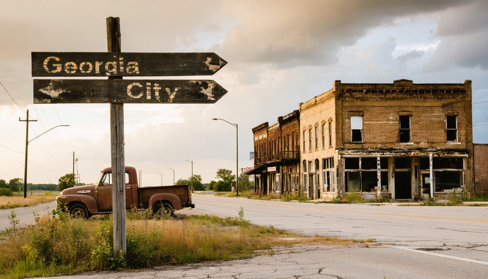
Plan your Georgia City expedition for April through November when township roads north of Joplin remain passable. You’ll navigate 15 miles through Jasper County’s backroads using satellite imagery, as traditional GPS often fails. Document the site’s two chimneys, stone foundations, and the vintage automobile frozen among ruins since 1972’s closure. Bring proper footwear for uneven terrain and respect the fragile structures—they’re irreplaceable records of Missouri’s lead mining heritage. This guide covers ideal routes, photography techniques, and nearby ghost towns worth combining into your historical circuit.
Key Takeaways
- Georgia City lies 15 miles north of Joplin; navigate using satellite imagery and GPS coordinates through Jasper Township’s backroads.
- Visit April through November for optimal access; spring and fall offer moderate temperatures and manageable road conditions.
- Expect to see two chimneys, house foundations, a rock basement, and an abandoned early automobile among reclaimed woods.
- Bring detailed navigation tools and document your route; local transportation is nonexistent and GPS is more reliable than memory.
- Combine your trip with nearby ghost towns like Monark Springs and Arlington along the old Route 66 corridor.
The Rise and Fall of Georgia City’s Mining Era
French explorers began extracting lead along Old Mines Creek at Cabanage de Renaudiere in the early 1700s, establishing Missouri’s first mining operations that would shape the region’s economy for over two centuries.
You’ll find that Moses Austin revolutionized these methods in Potosi during the late 18th century, before Anglo-Americans expanded operations post-1800. By 1897, northern St. Francois County employed 10,000 men under grueling labor conditions, producing wealth exceeding Alaska’s gold rush. The St. Joseph Lead Company dominated through 1933, operating 1,000 miles of tunnels.
However, environmental impacts mounted as unregulated coal mining scarred 100,000 acres after the 1840s. Vein depletion ultimately forced the Federal Mill’s closure in 1972, ending the Old Lead Belt’s two-century reign.
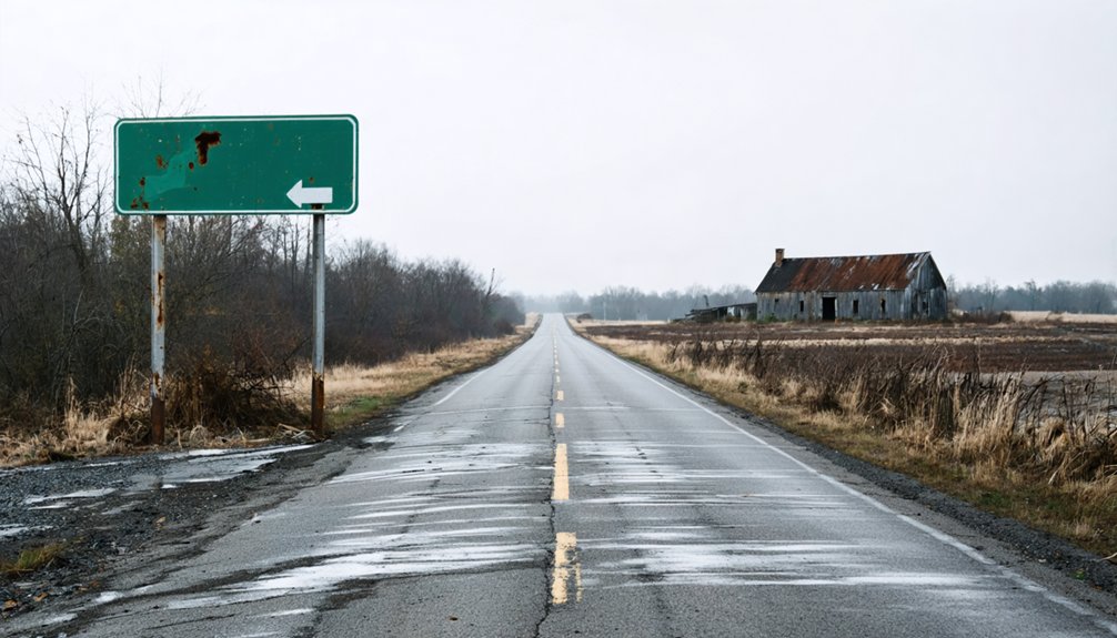
What Remains at the Abandoned Site Today
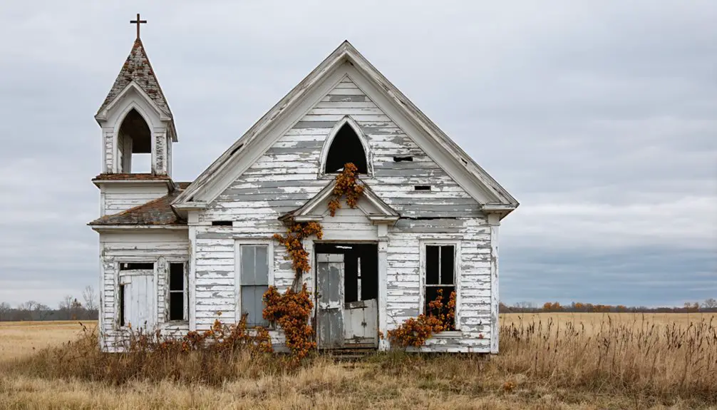
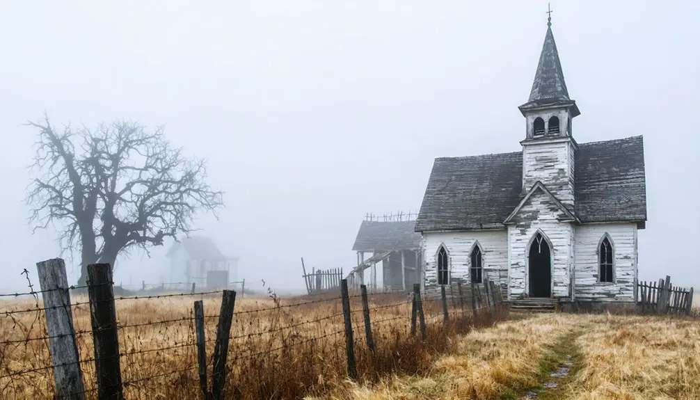
The Federal Mill’s 1972 closure marked the end of large-scale operations, yet Georgia City’s physical remnants tell a more gradual story of erasure. You’ll navigate by 1900 maps to locate remnant homeplaces—two chimneys standing in illogical low ground, preserved house clusters with visible yard outlines, and one site reduced to broken glass scattered across soil.
A rock basement near the old ferry crossing raises questions about site abandonment factors: was departure economic, environmental, or mandated? The most intact ruins feature an early automobile frozen in time at their rear. Nothing suggests active habitation.
Woods reclaim former farms and churches, leaving only foundations, stone structures, and mysterious features that defy easy explanation when you explore this authenticated ghost town.
Getting There: Routes and Access Information
Reaching Georgia City requires traversing 15 miles north from Joplin through Jasper County’s network of township roads, where standard highway markers give way to rural routes that demand careful attention to historical coordinates rather than contemporary signage. You’ll navigate Jasper Township’s backroads independently, as local transportation options remain nonexistent in this depopulated zone. Satellite imagery and open map data become essential navigation tools when physical landmarks disappear.
Seasonal accessibility challenges intensify during winter months, when deteriorating dirt roads transform into impassable mud tracks or snow-covered obstacles requiring alternative vehicles. Government projects haven’t maintained these forgotten corridors, leaving exploration dependent on your vehicle’s capabilities and weather conditions. Document your route meticulously—GPS coordinates prove more reliable than memory when foundation remnants and subtle terrain irregularities constitute your only wayfinding reference points in this reclaimed landscape.
Exploring Nearby Ghost Towns and Historic Sites
Your exploration of Georgia City can extend to several documented ghost towns within southwestern Missouri’s network of abandoned settlements.
Monark Springs in Newton County represents the region’s mining heritage, while Arlington’s remaining structures along the old Route 66 corridor demonstrate transportation-driven decline.
Joplin’s preserved mining sites offer physical evidence of the extractive industries that shaped settlement patterns across Jasper, Newton, and surrounding counties.
Monark Springs Ghost Town
Nestled five miles east of Neosho in Newton County, Monark Springs stands as a documented ghost town with profound religious and public health significance. Founded by Truman Elmore, this settlement hosted Church of God camp meetings that drew hundreds of faithful travelers via the Missouri and North Arkansas Railroad.
The 1940 tabernacle designed by Brother John Stretch served as a spiritual gathering place where saints arrived by rail car from distant states.
The 1956 typhoid outbreak and aftermath transformed this thriving campground into a cautionary tale. Sixteen cases emerged when a carrier unknowingly contaminated the drinking well during a national camp meeting. CDC investigators documented the water-borne transmission that effectively ended Monark Springs’ religious community.
Today, you’ll discover minimal remains: one house, a possible school site, and the nearby historic mill preserved on the national registry.
Route 66 Historic Landmarks
Beyond the remnants of religious settlements and abandoned camps, Missouri’s Route 66 corridor preserves five major landmarks that document America’s mid-century migration westward.
You’ll find the Gateway Arch commanding St. Louis’s skyline at 630 feet, offering scenic views spanning 190 meters from its observation deck. The Old Chain of Rocks Bridge stretches one mile across the Mississippi with its distinctive 22-degree bend, now exclusively pedestrian access.
Route 66 State Park’s visitor center occupies the 1935 Bridgehead Inn, where neon sign restoration projects preserve roadside advertising artifacts. Meramec Caverns near Stanton remains operational since Route 66’s inception, its billboard-promoted cave system unchanged. In Carthage, the Boots Court Motel and functioning 66 Drive-In Theatre maintain original Mother Road infrastructure, documenting authentic mid-century roadside architecture.
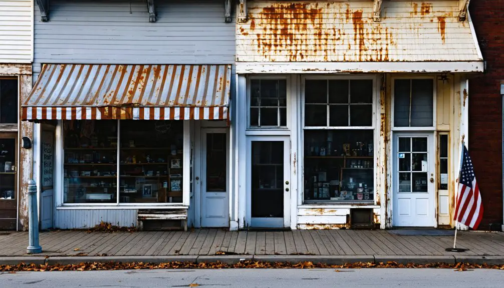
Joplin’s Mining Heritage Sites
While Route 66’s roadside attractions draw most visitors to southwest Missouri, the region’s ghost towns reveal a century of extractive industry that transformed Jasper County’s landscape. You’ll find Georgia City’s foundations and mine entrances documenting mineral wealth accumulation that produced over 500 million ounces of lead since the 1840s. Joplin’s museums preserve artifacts exposing mining labor conditions from 1870s-1920s operations.
The Tri-State District’s environmental legacy remains visible across 30 square miles of chat piles and thousands of abandoned shafts. Nearby ruins at Monark Springs, Plew, and Radical offer additional evidence of boomtown cycles. Walking tours connect you to hydraulic operations at Grand Falls, while annual festivals demonstrate original equipment that extracted $2 billion in minerals before ore exhaustion ended this chapter.
Best Times to Visit Southwest Missouri’s Mining Region
Several distinct factors determine ideal visiting windows for southwest Missouri’s mining region, with seasonal temperature ranges and precipitation patterns creating markedly different exploration conditions throughout the year.
You’ll find prime access from April through November when weather fluctuations remain manageable and roads stay passable. Spring’s 65-75°F temperatures invite early exploration, though you’ll contend with mud on unpaved routes.
Fall presents the premier window—comfortable 60-80°F days minimize heat stress while providing extended daylight for documenting deteriorating structures. Seasonal visitation trends show peak crowds May through October, yet fall’s mid-October foliage draws fewer visitors than summer’s family-oriented months.
Winter’s frost-damaged gravel roads and shortened days restrict your movement, while summer’s 90°F+ heat indexes demand careful hydration during strenuous hikes through Jasper County’s abandoned mining camps.
Tips for Photographing and Documenting Your Adventure

Early morning and late afternoon provide ideal lighting conditions for documenting Georgia City’s weathered structures, with reduced contrast that preserves architectural details in your photographs.
When capturing overgrown mining buildings, position yourself to show the relationship between deteriorating infrastructure and encroaching vegetation—this documents the site’s ongoing transformation.
Always verify property boundaries before photographing, as many mining-era structures remain on private land requiring owner permission for access and documentation.
Best Times for Lighting
Capturing Georgia City’s crumbling structures requires strategic timing to preserve their architectural details through photography. You’ll want to arrive during golden hour—the first hour after sunrise or the final hour before sunset—when soft, directional light reveals texture in weathered wood and brick without harsh shadows that obscure structural elements.
Seasonal light conditions in Missouri affect your documentation approach. Winter’s lower sun angle provides extended shooting windows, while summer’s intense midday light often washes out detail. Spring and fall offer moderate conditions with dynamic cloud patterns.
Daily lighting patterns shift dramatically throughout your visit. Overcast days produce even illumination ideal for recording interiors through broken windows. You’re documenting history, so prioritize clarity over drama. Scout locations beforehand to determine conducive sun positioning for each structure’s orientation.
Capture Overgrown Mining Structures
When documenting Georgia City’s overgrown mining structures, you’ll encounter foundations and equipment where nature has reclaimed industrial spaces through decades of abandonment. Your photographs serve dual purposes: preserving historical records while raising preservation awareness for these fragile sites.
Essential Documentation Techniques:
- Frame shots contrasting decayed timber frameworks against encroaching vines to showcase nature’s persistence
- Log GPS coordinates and vegetation types overtaking structures for future researchers
- Use wide-angle lenses positioned low to capture roots climbing foundation walls
- Record material degradation levels through detailed measurements and timestamps
- Watch for unstable floors and concealed rusted edges hidden beneath foliage
Practice minimizing environmental damage by avoiding unnecessary vegetation removal and limiting foot traffic on moss-covered surfaces. Document without disturbing—your records become indispensable historical archives for generations seeking these forgotten spaces.
Respect Private Property Boundaries
Before you photograph Georgia City’s remnants, understand that property rights remain intact regardless of abandonment status. You’ll need to negotiate landowner permission before accessing structures or land parcels. Contact the county assessor’s office to identify current owners, then reach out directly with your documentation plans. Many property holders grant access when approached respectfully with clear intentions.
Once permitted, understand permitted activities explicitly. Some owners allow photography from designated areas only, while others restrict equipment setup or extended visits. Document these boundaries precisely—use GPS coordinates to mark accessible zones. Position yourself within agreed parameters, employing telephoto lenses if necessary to capture distant features. Always disclose property status when sharing images, omitting exact coordinates to prevent unauthorized trespassing by others following your documentation.
Frequently Asked Questions
Do I Need Permission From Landowners to Explore Georgia City Ruins?
Yes, you’ll need permission before exploring private property at Georgia City’s ruins. Visiting with landowners protects your legal rights and respects ownership boundaries. Research county records to identify owners, then request access to explore these historical sites responsibly and freely.
Are There Any Safety Hazards Like Mine Shafts at the Site?
No mine shafts exist at Georgia City, but you’ll face unstable buildings with crumbling walls and potential wildlife encounters. Document structural conditions carefully before entering deteriorating structures, and respect the site’s fragile state for preservation.
What Equipment Should I Bring for Exploring the Abandoned Town?
Bring sturdy footwear for unstable terrain, a thermal camera to detect structural weaknesses, flashlight, first-aid kit, and documentation tools. You’ll need navigation equipment and protective gloves. Always respect preservation efforts—take only photographs, leave only footprints.
Can I Camp Near Georgia City or Find Nearby Accommodations?
You’ll find your basecamp easily—scenic camping locations like Osage Campground Retreat and Binder Park sit within 15 minutes of Georgia City, offering budget friendly lodging with full hookups. Reserve ahead through Campspot to secure your exploration headquarters.
Are There Guided Tours Available for Jasper County Ghost Towns?
No guided tours operate in Jasper County’s ghost towns currently. You’ll explore independently, though local tourism initiatives occasionally offer events. Historic preservation efforts focus on documentation rather than commercial tours, giving you authentic freedom to discover these abandoned sites yourself.