You’ll find Grover between Waconia and Cologne in Carver County, accessible via Minnesota Highway 5 or County Highway 10 past the historic Zoar Moravian Church. This vanished settlement leaves only whispers—foundation stones, cellar depressions, and scattered artifacts hidden among active farmland. There aren’t any signs marking the spot, so you’ll navigate by coordinates near 44.8°N latitude and instinct alone. Plan your visit between Memorial Day and late October when roads remain passable, and bring high-clearance vehicles for uneven gravel routes that lead to Minnesota’s most thoroughly erased ghost town.
Key Takeaways
- Grover is located between Waconia and Cologne in central-western Carver County, accessible via Minnesota Highway 5 or County Highway 10.
- Visit between Memorial Day and late October; winter conditions make rural routes treacherous with snow drifts and frozen ruts.
- No buildings remain; look for foundation stones, cellar depressions, and archaeological artifacts like rusted nails and pottery shards.
- Bring topographical maps, GPS devices, and a high-clearance vehicle to navigate unmarked locations and uneven gravel roads safely.
- Combine your visit with nearby attractions or explore Minnesota’s hundred-plus ghost towns resulting from railroad bypasses and economic centralization.
Discovering the Location and Access Routes to Grover
Nestled in the rolling farmland of central-western Carver County, Grover exists today as little more than a whisper among the Swedish and Moravian settlements that once dotted this prairie landscape.
You’ll find this vanished community between Waconia and Cologne, where coordinates cluster around 44.7° to 44.9°N latitude. To reach Grover’s ghost, take Minnesota Highway 5 west from Waconia, using it as your primary artery through the county’s rural settlement patterns.
County Highway 10 offers an alternative route past the 1863 Zoar Moravian Church. These backroads wind through terrain that reveals Grover’s historical significance—part of that broader tapestry of immigrant communities that carved homesteads from Minnesota prairie. No signs mark the spot; you’ll navigate by instinct and neighboring landmarks.
The Rise and Fall of Grover’s Community
Standing on these quiet crossroads today, you’d never guess that Grover once hummed with the daily rhythms of frontier commerce. Between 1890 and 1915, this settlement thrived on reliance on agricultural economy, with farmers trading goods and neighbors building businesses along this gravel road. Yet the railroad’s path chose different ground, sealing Grover’s fate before it truly began.
You’ll find no dramatic tragedy here—just the slow, inevitable retreat of opportunity. As farming operations centralized and distribution networks favored larger towns, steady population decline emptied homes and shuttered storefronts. Families packed wagons and left for places the rails actually reached. By mid-century, silence had reclaimed these fields. What remains isn’t ruins, but absence—a reminder that sometimes communities simply fade when progress charts another course.
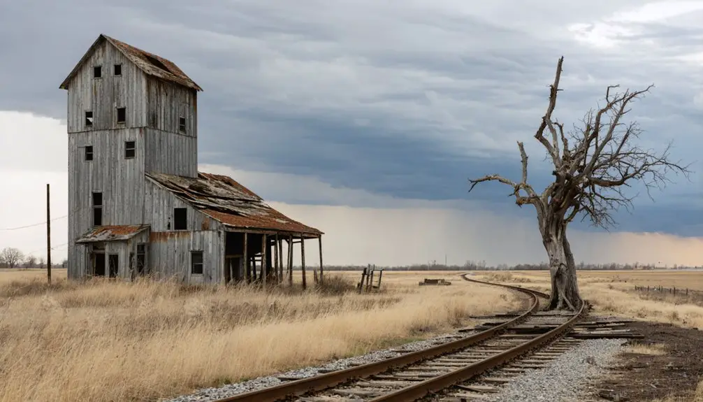
What You’ll Find at the Abandoned Townsite Today
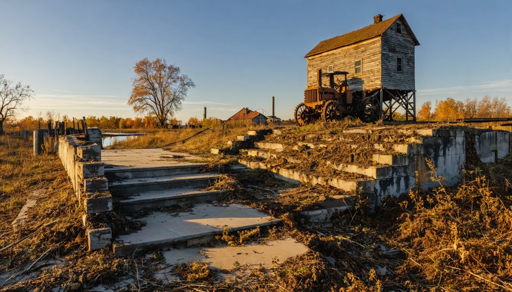
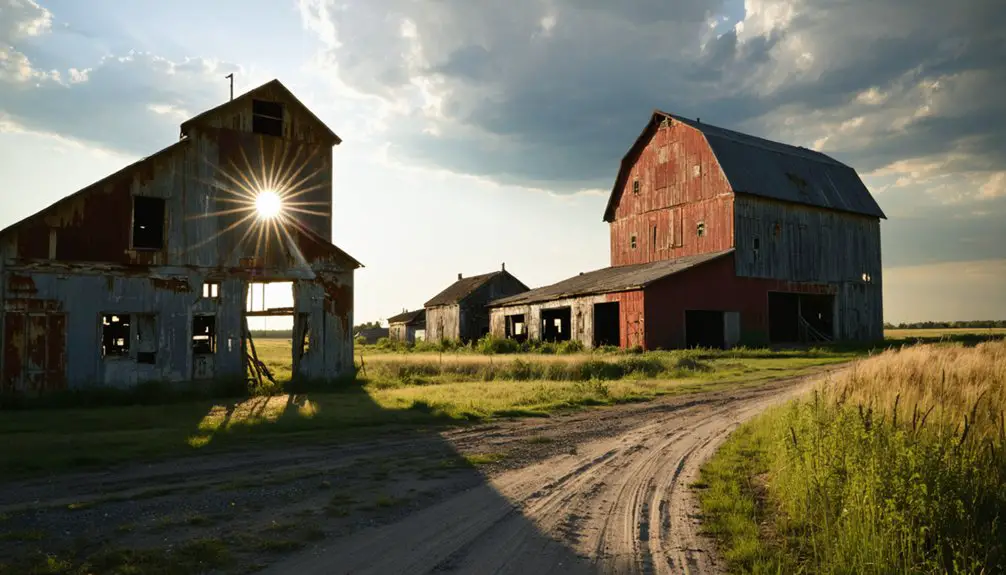
Unlike Minnesota’s more preserved ghost towns, Grover offers little for the eye to catch. You won’t find intact buildings like Historic Forestville‘s frozen-in-time structures or purposeless storefronts lining empty streets like Carrick’s. No tour group experiences await here—just you, the landscape, and whispers of what once stood. The townsite exists primarily in history books and museum photographs now, its physical traces nearly vanished into farmland and forest.
What remains are subtle clues: foundation stones jutting from overgrown grass, depressions where cellars once sheltered families, perhaps a weathered fence post marking forgotten property lines. Archaeological artifacts present themselves to patient observers—rusted nails, pottery shards, glass fragments catching sunlight. Grover demands you read the land itself, interpreting absence rather than presence. It’s ghost-town exploration stripped to its essence.
Best Times to Visit and Weather Considerations
You’ll want to plan your Grover expedition between Memorial Day and late October, when southern Minnesota’s warm weather keeps the gravel roads passable and pairs perfectly with nearby attractions like Forestville State Park.
Summer brings hot, humid days ideal for exploring the remnants of this ghost town, though you should expect dry spells that kick up dust along the winding county roads.
Winter transforms these rural routes into treacherous passages—snow drifts and frozen ruts make the site fundamentally, basically, virtually inaccessible until spring thaw arrives.
Optimal Summer Travel Season
When should you plan your expedition to Grover’s ghostly remnants? Memorial Day weekend through October’s end offers prime photography opportunities when Winona County’s hot summers bathe abandoned farmsteads in golden light. You’ll navigate gravel roads best during these dry months, avoiding winter’s snow-choked passes and spring’s muddy ruts.
Summer tourism trends reveal why warm weather matters—nearby Forestville draws crowds despite housing zero residents, with visitors from Iowa exploring 170 years of preserved history. You’ll find southeastern Minnesota’s ghost towns most accessible June through August when interpretive programs run daily.
The region’s climate works in your favor: hot, occasionally humid conditions beat snow-impeded access roads. Scout Grover’s remains while Root River flows steadily and Pioneer Cemetery’s weathered markers stand visible against summer’s vibrant backdrop.
Winter Road Access Challenges
While summer’s golden light makes ghost town photography effortless, winter transforms your Grover expedition into a genuine adventure demanding preparation and caution.
Northern Minnesota’s brutal storms dump 1-2 feet of snow, turning bare pavement into ice-crusted hazards within hours. You’ll need to monitor conditions obsessively:
- Check 511mn.org for real-time weather advisories and plow locations before departure
- Watch for road closures marked by barricades—ignoring them risks fines and danger
- Maintain 10 car-lengths behind snowplows on Highway 61’s lake-effect corridors
- Pack emergency gear: scraper, shovel, blankets, charged phone
- Avoid cruise control on partially covered roads where ice lurks beneath fresh powder
MnDOT deploys over 100 plows across the region, but conditions shift rapidly. Expect whiteouts, multiple crashes, and potential no-travel advisories that’ll strand you miles from Grover’s frozen ruins.
Understanding Minnesota’s Ghost Town Phenomenon

Minnesota’s landscape holds over a hundred ghost towns, each one a monument to dreams that couldn’t outlast economic reality.
You’ll find these abandoned settlements scattered across the state—former mining camps, railroad stops, and trading posts that once buzzed with miners’ pickaxes and merchants’ voices. Their stories follow familiar patterns: railroads that chose different routes, mines that ran dry, diseases that swept through, or simply larger towns that swallowed up their commerce and left behind empty streets.
Origins of Abandoned Towns
The abandoned towns scattered across Minnesota’s landscape didn’t simply vanish overnight—they emerged from distinctly different origins that would ultimately seal their fates.
You’ll discover these ghost towns were born from five distinct catalysts:
- Treaty-driven speculation – Land grabbed cheaply after 1851 treaties spawned “paper towns” that existed only on developers’ maps, never materializing beyond ambitious plats
- Immigrant settlements – Close-knit communities like Swede Lake (Gotaholm) and Swede Hollow preserved cultural traditions in geographic isolation before eventual abandonment
- Mining operations – Company towns like Elcor and Taconite Harbor thrived alongside iron ore extraction, their fates tied directly to mining profitability
- Trade route stops – Forestville and Old Wadena flourished as stagecoach stations and trading posts along critical transportation corridors
- Religious communities – Faith-based settlements established remote outposts that couldn’t sustain long-term populations
Factors Behind Town Abandonment
Once bustling communities transformed into silent streetscapes when critical lifelines severed their connection to prosperity. You’ll discover that railroad infrastructure implications devastated countless Minnesota settlements—when tracks bypassed a town, wealth vanished overnight as families chased new shipping routes.
Resource extraction impacts proved equally ruthless: quarries exhausted their stone, mines depleted their ore, and entire populations scattered when paychecks stopped. Dorothy’s post office closure in 1956 triggered unstoppable decline, while Finland’s nearby airbase shutdown decimated its population.
Agricultural consolidation redirected commerce toward bigger regional centers, leaving smaller farming communities economically hollow. Geographic disadvantages—flooding, poor navigation, unfavorable locations—combined with infrastructure failures to accelerate abandonment. These weren’t gradual declines but systematic erasures of community purpose.
Combining Grover With Other Winona County Destinations
Since Grover offers limited above-ground remnants, you’ll want to anchor your visit around Forestville Mystery Cave State Park, located just a scenic drive away in southeastern Winona County. This abandoned town legacy features restored 1890s buildings including the fully-stocked Meighen General Store, where preserved farmstead relics transport you to frontier commerce.
Enhance your Winona County exploration:
- Trek to Pioneer Cemetery’s 30+ settler graves dating from 1852
- Explore Minnesota’s longest cave system with underground formations
- Hike to Zumbro Hill Cemetery foundation and schoolhouse ruins
- Follow oxcart trail routes connecting historic settlement sites
- Visit nearby pioneer cemeteries documenting covered wagon era settlers
These integrated stops transform your quick Grover visit into a full-day adventure through southeastern Minnesota’s vanished communities, revealing settler sacrifices through authentic artifacts and tombstones.
Essential Resources for Ghost Town Exploration
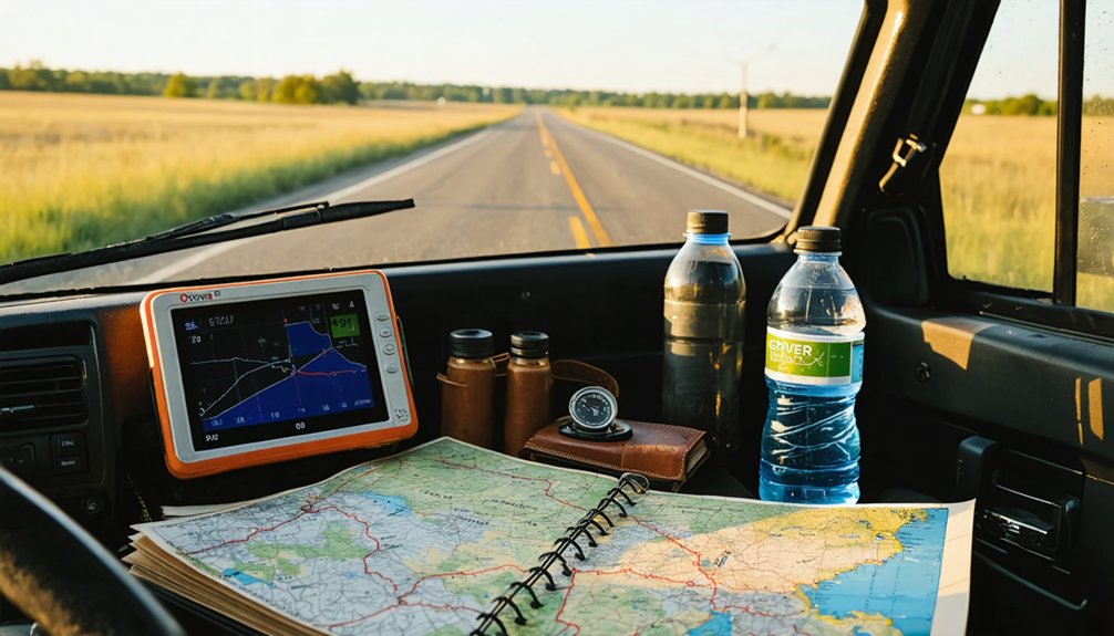
Planning your ghost town expedition requires reliable maps and historical documentation to locate sites that exist only as cemetery markers and foundation stones. You’ll need topographical maps showing old wagon roads and property plats from Winona County archives. Pack GPS devices alongside traditional compasses—cell service disappears quickly in rural Minnesota.
As you explore different ghost towns to visit in Minnesota, consider stopping at places like Elmore or Glyndon for a deeper glimpse into the past. Each site has its own stories to tell, often reflected in the remnants of old buildings and artifacts left behind. Bring a camera to capture the haunting beauty of these forgotten landscapes, where time seems to stand still.
Your necessary packing considerations include sturdy boots for traversing overgrown foundations, water supplies, and first-aid kits. Document everything with cameras and journals to preserve what you discover.
Understand the potential risks to avoid: unstable structures can collapse without warning, and private property boundaries demand respect. Trespassing charges aren’t worth the photograph. Connect with local historical societies before venturing out—they’ll share access permissions and stories that maps can’t reveal. Knowledge protects your freedom to explore responsibly.
Vehicle Requirements and Road Conditions
Gravel crunches beneath your tires as you navigate State Highway 74’s seven-mile unpaved stretch between Weaver and the ghost town of Beaver—Minnesota’s last remaining gravel state highway. Your off road vehicle suitability determines whether you’ll conquer this rugged terrain or struggle through dust-coated windows and loose surfaces.
Essential Vehicle Considerations:
- High-clearance vehicles handle uneven gravel and spring thaw conditions best
- Four-wheel drive proves invaluable during wet periods and road breakup
- Dust mitigation strategies include closing vents and maintaining distance from other vehicles
- Avoid low-profile tires that can’t withstand frequent blading and loose roadbed
- Check Minnesota 511 for real-time closures during spring flooding
Standard passenger cars manage this low-traffic route, but swampy surroundings and seasonal challenges demand preparation for true freedom on Minnesota’s wildest state highway.
Frequently Asked Questions
Are There Any Safety Concerns When Exploring the Grover Townsite?
You’ll face deteriorating structures that could collapse without warning, uneven terrain hidden by overgrowth, and potential wildlife hazards in this remote location. Bring sturdy boots, stay alert, and pack emergency supplies since help’s far away.
Can Visitors Take Artifacts or Souvenirs From the Abandoned Site?
Tempted to pocket a piece of history? Don’t—souvenir legality is strict, and artifact ownership belongs to the landowner. You’ll face trespassing charges and heritage theft penalties. Instead, capture memories through photographs and respectful exploration of Minnesota’s vanishing past.
Is Camping Permitted Near the Grover Ghost Town Location?
Camping’s permitted if you’re in Minnesota State Forest lands, with dispersed sites available following state regulations. You’ll find nearby campgrounds offer seasonal accessibility, though winter camping extends your stay limits. Always verify you’re outside posted restricted zones before settling in.
Are There Any Guided Tours Available for Grover Ghost Town?
No guided tour availability exists for Grover—you’ll need to explore this forgotten place independently, like pioneers charting unmarked territory. Stillwater’s ghost walks offer the nearest alternative, though nearby accommodation options remain limited for your solo adventure.
What Photography Restrictions Exist at the Grover Townsite?
You’ll find no documented photography restrictions at Grover, though drone photography restrictions may apply countywide. Historical building preservation concerns suggest respecting structures while shooting. Always check for private property postings before exploring freely.