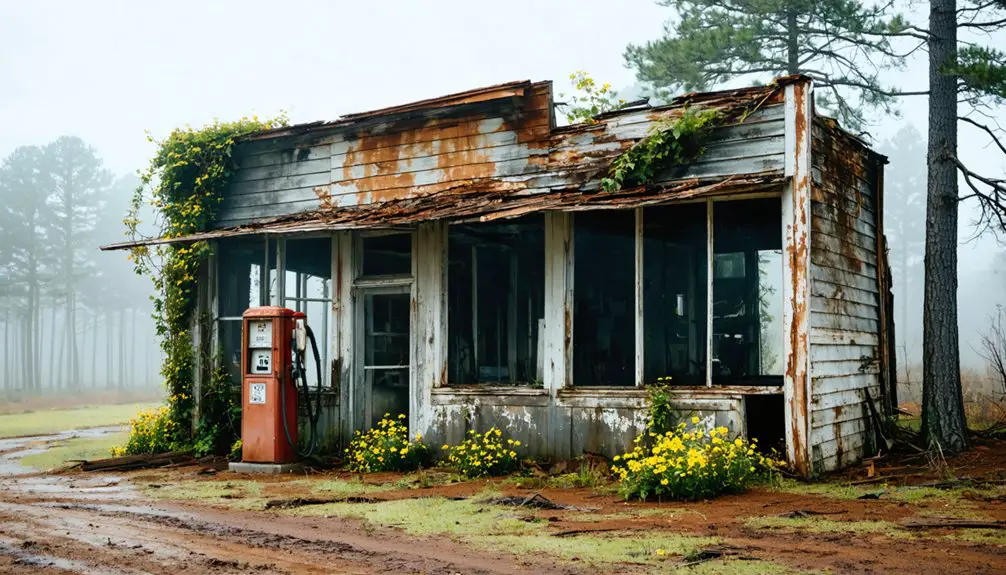
Planning a road trip to Holcut, Mississippi means visiting a town that simply doesn’t exist anymore. The U.S. Army Corps of Engineers bought the entire community in 1975 or 1976, bulldozed it completely, and replaced it with the Tennessee–Tombigbee Waterway’s Divide Cut. What was once a thriving settlement—named by combining the Holder and Callicutt family names—is now a quiet canal corridor in Tishomingo County. A roadside memorial marks the spot, and there’s far more to this vanished town’s story.
Key Takeaways
- Holcut, Mississippi, was a thriving 1907 community erased in the mid-1970s when the U.S. Army Corps of Engineers bought and demolished the entire town.
- The town was cleared to build the Tennessee–Tombigbee Waterway’s Divide Cut, leaving no original structures, roads, or buildings standing today.
- The Holcut Memorial Site in Tishomingo County marks the location with a roadside plaque near the canal at approximately 34.72972°N, 88.30583°W.
- Expect a quiet, rural stop with minimal parking, no trails or facilities, and limited nearby services, so pack water and essentials.
- Nearby attractions like Tishomingo State Park and Bear Creek Mound offer additional historical context to enrich your road trip experience.
What Was Holcut, Mississippi?
Tucked into Tishomingo County, Mississippi, Holcut was a tight-knit rural community that grew its roots in 1907 when the J.C. Rorie Road opened the area to settlement.
Holcut took root in 1907, quietly carved into Tishomingo County when a single road made settlement possible.
The town’s name itself carries community memory, blending the Holder and Callicutt family names into one identity.
You’d have found real small-town life here — a merchant, a doctor, a cotton gin, a blacksmith shop, and a gristmill all operating within a close community.
Churches like Sardis Missionary Baptist kept residents connected, while a local school served students until 1960.
Holcut wasn’t extraordinary by outside standards, but it was whole.
Understanding what stood here before the bulldozers arrived matters deeply to historical preservation efforts and reminds you that ordinary communities carry irreplaceable stories worth remembering.
How a Federal Canal Project Erased Holcut, Mississippi
When you look into what happened to Holcut, you’ll find a story that’s hard to shake — the U.S. Army Corps of Engineers bought out the entire town around 1975 or 1976 to make room for the Tennessee–Tombigbee Waterway‘s 29-mile Divide Cut canal.
Residents didn’t have much of a choice; they sold their homes and relocated while crews moved in to demolish everything, reportedly taking the town “dirt and all.”
What had once been a living community with churches, a cotton gin, and a blacksmith shop simply ceased to exist, swallowed up by one of the largest federal waterway projects in American history.
Army Corps Buys Out
By the mid-1970s, the U.S. Army Corps of Engineers had made its decision — Holcut had to go. In 1975 or 1976, they bought out the entire town, forcing residents to sell their homes and relocate. You have to imagine what that felt like: families tied to land their grandparents had worked, suddenly handed a check and shown the door.
The Corps needed the space for the Divide Cut, a 29-mile artificial canal central to the Tennessee–Tombigbee Waterway. Holcut’s community legacy — its churches, its cotton gin, its neighborhood roots — didn’t factor into the equation.
The environmental impact reshaped not just the land but the lives attached to it. Roads moved. The railroad disappeared. The town came down, dirt and all.
Demolition For The Canal
Once the buyout was complete, demolition moved fast. The Army Corps of Engineers didn’t just clear a few structures — they removed Holcut *dirt and all*. Homes, businesses, churches, roads, even the railroad serving the town got moved or erased entirely.
What had taken generations to build disappeared in the name of a 29-mile artificial canal.
You might expect some effort toward historical preservation, but the priority here was pure urban development — connecting river systems and moving commerce. The Tennessee-Tombigbee Waterway’s Divide Cut demanded that Holcut simply cease to exist.
Standing near the canal today, that reality hits differently. An entire community — its cotton gin, blacksmith shop, gristmill — swallowed by federal infrastructure. Freedom-loving folks forced off land their families had worked since 1907.
A Town Erased Forever
Holcut didn’t just lose its buildings — it lost its entire identity. The cultural impact here runs deep. You’re not looking at a town that faded naturally or emptied out over generations.
This was community displacement by federal order, swift and permanent. Families who’d built lives around the cotton gin, the blacksmith, the church pews — they were bought out and pushed out. The roads moved. The railroad moved. The land itself got reshaped into something unrecognizable.
Local accounts describe it as being taken “dirt and all,” which tells you everything. No slow decline, no second chances. When the government needed that corridor for the Tennessee–Tombigbee Waterway, Holcut simply ceased to exist.
That’s the part that should stay with you long after you leave the memorial.
What Life in Holcut Looked Like Before the Buyout
Before the U.S. Army Corps of Engineers arrived, Holcut was a self-sufficient community rooted in daily life and hard work. You would’ve found a merchant, a doctor, a cotton gin, a blacksmith shop, and a gristmill all operating within this small Tishomingo County town.
Community memories from longtime residents paint a picture of neighbors who knew each other, worshipped together at churches like Sardis Missionary Baptist, and sent their kids to the local school until it closed in 1960.
The town traced its name back to two founding families — the Holders and the Callicutts — who helped shape it from 1907 onward.
The environmental impact of the Tennessee–Tombigbee Waterway didn’t just reshape the land; it permanently erased a living, breathing community that people once called home.
When Did the Corps of Engineers Buy Out Holcut?

When you trace Holcut’s disappearance back to its turning point, you land on 1975 or 1976, when the U.S. Army Corps of Engineers bought out the town to clear the way for the Tennessee–Tombigbee Waterway’s Divide Cut.
Residents didn’t have much choice — they were forced to sell their homes and relocate, leaving behind the churches, schools, and family roots that had held the community together since 1907.
Once the buyout was complete, crews didn’t just clear the land — they demolished the town entirely, removing it, as locals described it, “dirt and all.”
The 1975–1976 Buyout
By the mid-1970s, the U.S. Army Corps of Engineers had made its decision — Holcut had to go. In 1975 or 1976, they bought out the town entirely, forcing residents to sell their homes and relocate. You can imagine what that felt like: families who’d built lives there, suddenly told their community no longer fit the federal blueprint.
This moment of community displacement effectively ended Holcut’s story as a living place. No amount of historical preservation could stop the demolition that followed.
The Corps needed the land cleared for the Tennessee–Tombigbee Waterway’s Divide Cut, a 29-mile artificial canal demanding significant real estate.
When you visit today, remember that the quiet canal landscape you see replaced an entire town — homes, roads, and all.
Forced Relocation Of Residents
Although exact records differ slightly, the U.S. Army Corps of Engineers forced Holcut’s residents to sell their homes and relocate in 1975 or 1976. You’re looking at a textbook case of community displacement — families who’d built lives there for generations had to pack up and leave, not by choice, but by federal mandate.
The government needed the land for the Tennessee–Tombigbee Waterway’s Divide Cut, and Holcut simply stood in the way.
Local accounts describe the town being removed “dirt and all,” which tells you everything about how thorough that erasure was.
When you visit today, that historical memory is really all that survives. The Corps did establish a memorial nearby, giving you a quiet but meaningful place to reflect on what once stood there.
Demolition For The Waterway
The buyout itself happened fast once the federal government set its sights on the land. The U.S. Army Corps of Engineers purchased Holcut around 1975 or 1976, clearing the way for the Tennessee–Tombigbee Waterway’s 29-mile Divide Cut. You won’t find much left to stand on — they took it all, dirt and all, as locals described it.
Roads got rerouted, the railroad disappeared, and the homes your neighbors once built from scratch came down. The cultural impact hit hard because community stories don’t survive demolition. Families who’d lived there since the town’s 1907 roots had no say in preserving what they’d built.
The federal project prioritized navigation and commerce, and Holcut paid the price with its entire physical existence.
What the Demolition of Holcut Actually Looked Like
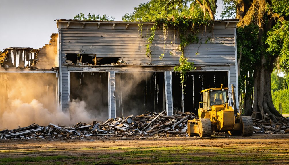
When the U.S. Army Corps of Engineers moved in, they didn’t just relocate a few buildings — they erased Holcut completely. Local accounts describe the town being removed “dirt and all,” which tells you everything about how thorough the demolition actually was. Roads got moved. The railroad vanished. Homes where families had lived for generations were bulldozed without ceremony.
Community nostalgia runs deep here because residents didn’t leave voluntarily — they were bought out and forced to rebuild their lives elsewhere. The environmental impact reshaped the entire landscape, replacing a living town with an artificial canal corridor.
Standing near the memorial today, you’re looking at ground that once held a blacksmith shop, a cotton gin, and a church. That’s a powerful thing to sit with.
What’s Left to See at the Holcut Memorial Today?
Driving up to the Holcut memorial, you’ll find a quiet roadside stop rather than any preserved town grid — and that contrast is exactly what makes it hit so hard. The Corps of Engineers established the memorial next to the canal, close to where the town once stood.
It’s a small gesture toward historical preservation for a community that was bought out, demolished, and absorbed into a waterway landscape.
You won’t find original buildings or street layouts. Roads and the railroad were moved or removed entirely.
What you’ll find is a marker that acknowledges community resilience — proof that people lived, worked, and built something real here before federal infrastructure erased it.
Pair the stop with other Tishomingo County history sites and give yourself time to just stand there and think.
How Do You Get to the Holcut Memorial Site?

You’ll find the Holcut memorial site in Tishomingo County, Mississippi, near the Tennessee–Tombigbee Waterway’s Divide Cut, with coordinates around 34.72972°N, 88.30583°W to guide your GPS.
The canal itself serves as your most reliable landmark once you’re in the area, since the original roads and railroad that once served the town were moved or removed entirely.
Expect a quiet roadside pull-off rather than a formal parking lot, so plan for a brief stop where you can step out, take in the canal view, and let the memorial tell the rest of the story.
Locating The Memorial Site
Since Holcut no longer exists as a town you can walk through, the memorial the Corps of Engineers established near the canal is your best—and really only—anchor point for the visit. It sits near the former town site along the Tennessee–Tombigbee Waterway, a quiet reminder of community resilience swallowed by federal progress.
When you’re locating it, keep these realities in mind:
- The original roads serving Holcut were moved or removed entirely
- The environmental impact reshaped the land so completely that nothing familiar remains
- You’re orienting toward coordinates 34.72972°N, 88.30583°W in Tishomingo County
Pull up those coordinates before you leave home. Cell service gets thin out there, and the last thing you want is to miss the one marker honoring everything that disappeared.
Nearby Landmarks And Roads
Getting to the Holcut memorial takes some deliberate navigation, because the roads that once connected this community to the outside world were relocated or erased entirely when the Corps of Engineers reshaped the land. The railroad lines and local routes that carried families, cotton, and community stories for decades simply vanished with the town itself.
Today, you’ll find the memorial sitting beside the Tennessee–Tombigbee Waterway canal in Tishomingo County. Use the canal itself as your landmark.
The cultural impact of that waterway is visible everywhere you look, from the engineered banks to the absence of any town grid beneath your feet. Pair your stop with other Tishomingo County historical sites to build a fuller picture of what this region lost and what replaced it.
Parking And Site Access
Once you’ve oriented yourself using the canal as your guide, actually pulling up to the Holcut memorial is straightforward. Parking tips are simple — roadside pull-off space sits near the memorial, so you won’t need a lot. Site accessibility is easy for most travelers; no trails or gates block your way.
But stepping out of your car here hits differently when you remember what this ground once held:
- A community’s entire history, bought out and bulldozed
- Families who’d no real choice but to leave
- A town erased so completely locals say it went “dirt and all”
You’re standing where streets and neighbors once existed. Take your time. That quiet roadside stop carries more weight than it looks.
Tishomingo County History Sites Worth Combining With Your Holcut Visit

Tishomingo County quietly holds more history than most travelers expect, and pairing a few nearby stops with your Holcut visit turns a short detour into a fuller picture of this corner of Mississippi.
Tishomingo State Park offers rugged terrain and Civilian Conservation Corps stonework that speaks directly to cultural memory and what earlier generations built with their hands. The park’s trails and pavilions represent historic preservation at a tangible, walkable scale.
Bear Creek Mound reminds you that this land carries layers of human story reaching back centuries. Each stop adds context to Holcut’s loss rather than competing with it.
You’re not just visiting a ghost town — you’re tracing how communities rise, endure, and sometimes disappear entirely to serve someone else’s larger plan.
What to Pack Before You Drive Out to Holcut
Holcut isn’t a destination with a gift shop, a parking lot, or a roadside diner waiting to revive you after the drive, so you’ll want to come prepared. You’re heading into quiet Tishomingo County to stand where community memories once lived, and the land won’t offer many conveniences.
Pack with intention:
- Water and snacks — no services exist near the canal memorial, and the drive through rural Mississippi can stretch longer than expected
- A notebook or voice recorder — local legends deserve to be captured while you’re standing in the place that inspired them
- A fully charged phone — for photos, navigation, and documenting what remains before you leave
Come ready to absorb the silence. It tells you more than any signpost could.
Other Mississippi Towns Erased by Federal Infrastructure Projects
Mississippi didn’t lose just one town to federal ambition. Waterway engineering and dam projects swallowed entire communities across the state, erasing community legends, family cemeteries, and local economies in exchange for navigation routes and flood control.
Pickwick Landing’s development displaced residents along the Tennessee River. Sardis Lake’s construction in the 1940s consumed farmland and settlements in Panola County.
These weren’t abandoned places that faded naturally — the government bought them out, bulldozed them, and moved on. When you visit Holcut, you’re standing at one example inside a much larger pattern.
Federal infrastructure repeatedly treated small communities as acceptable losses. Knowing that history changes how you see the memorial beside the canal.
You’re not just visiting a ghost town — you’re visiting a decision someone in Washington made for people who never asked.
Frequently Asked Questions
Is There Cell Service at the Holcut Memorial Site Near the Canal?
Cell service isn’t guaranteed where whispers of Historical significance linger. You’ll likely find spotty connectivity at the Holcut memorial, so download Local legends and maps beforehand — embrace the freedom of disconnecting beside this haunting, forgotten canal.
Are Pets Allowed at the Holcut Memorial and Canal Overlook Area?
The knowledge doesn’t confirm pet policies or animal restrictions at the Holcut memorial, so you’ll want to check with the U.S. Army Corps of Engineers directly before bringing your furry travel companion along.
What Time of Year Is Best for Visiting the Holcut Memorial?
Spring or fall’s your best bet for visiting the Holcut memorial, where seasonal weather stays mild and comfortable. You’ll soak in the historic preservation story of this lost community without summer’s brutal heat slowing you down.
Is the Holcut Memorial Site Accessible for Visitors With Mobility Limitations?
Like pioneers charting new land, you’ll find the Holcut memorial’s accessibility features and wheelchair pathways aren’t well-documented, so call the Corps of Engineers ahead to confirm you can freely explore this quiet, nostalgic riverside site.
Are There Restroom Facilities Near the Holcut Memorial Along the Waterway?
Restroom facilities aren’t documented at the Holcut memorial, so you’ll want to plan ahead. Given its historical significance and local legends, it’s a freedom-lover’s raw, nostalgic stop where nature’s your only neighbor.
References
- https://en.wikipedia.org/wiki/Holcut
- https://mississippifolklife.org/articles/haunted-by-a-ghost-town-the-lure-of-rodney-mississippi
- https://www.readbrightly.com/growing-up-ghost-town/
- https://www.youtube.com/watch?v=MV9UdeoVVoc
- https://raregoldnuggets.com/?p=3890
- https://en.wikipedia.org/wiki/List_of_ghost_towns_in_Mississippi
- https://msgw.org/tishomingo/holcut.html