
You’ll find Jonesboro approximately 6 miles northwest of Blakeney in Red River County, where Farm Road 410 intersects with the area’s well-maintained county roads. This once-thriving 1819 river settlement that welcomed Sam Houston and Davy Crockett was completely erased by the catastrophic 1843 Red River flood. Today, you’ll discover only six cottonwood stumps, a weathered tombstone, and historical markers among open farmland—a haunting reminder of nature’s power to reshape history. The complete story reveals even more fascinating details about this vanished frontier community.
Key Takeaways
- Located 6 miles northwest of Blakeney in Red River County at the intersection of Highway 36 and FM 1602.
- Accessible via well-maintained paved county roads; standard two-wheel drive vehicles can reach the site without difficulty.
- No structures remain; only six cottonwood stumps, one weathered tombstone, and historical markers along Farm Road 410.
- Site was completely destroyed by an 1843 Red River flood that shifted the river’s course and erased all buildings.
- Rich frontier history includes hosting Sam Houston and Davy Crockett when it served as Miller County seat.
The Rise and Fall of a Red River Settlement
The story of Jonesboro begins with a hunter named Henry Jones, who stalked game along the Red River as early as 1815. By 1817, pioneers like Adam Lawrence and Caleb Greenwood had carved out homesteads on this wild frontier. You’ll find this settlement shared the distinction with Pecan Point as Texas’s first Anglo-American foothold.
Jonesboro’s agricultural productivity attracted planters who built thriving operations south of the river. When it became Miller County‘s seat in 1832, strategic trading networks flourished at the head of steam navigation. Merchants established profitable enterprises, and luminaries like Sam Houston, Davy Crockett, and Stephen F. Austin passed through its gateway.
But prosperity proved fleeting. A devastating flash flood erased Jonesboro in the 1840s, leaving only a roadside monument along FM 410.
Where Henry Jones Built His Ferry Crossing
Long before Jonesboro earned its status as Miller County’s seat, Henry Jones recognized the strategic value of a bend in the Red River just above Little Pine Creek’s mouth. After arriving by flatboat transportation in 1817, he established one of Texas’s first frontier ferry crossings by 1819. This location marked the head of steam navigation, making it your gateway to freedom in Mexican Texas.
Where the Red River narrowed and steamboats stopped, Henry Jones built the gateway to Mexican Texas in 1819.
You’ll find the strategic advantages that drew Jones here:
- Port of entry for Anglo-Americans entering Texas
- River access at navigation’s uppermost point
- Trade route connecting to Nacogdoches and southeastern colonies
- Natural crossing where the Red River narrowed
- Territorial boundary between United States and Mexico
Today, FM 410 marks the old crossing site, eight miles north of Woodland.
Historic Moments: Sam Houston and David Crockett’s Gateway to Texas
Two legendary figures of American frontier history passed through this remote Red River crossing on their way to destiny in Texas. Sam Houston arrived in late 1832, establishing his presence years before revolution erupted.
David Crockett followed in winter 1835-36, departing Tennessee on November 1st with three companions, drawn by promises of 4,600 acres for his service.
The crossing significance can’t be overstated—Jonesboro served as Texas’s primary gateway when these revolutionary heroes entered what was still contested territory claimed by both Mexico and the United States. From here, they followed well-known roads southeastward through Nacogdoches to the colonies beyond.
Houston would lead Texas armies to independence. Crockett would make his stand at the Alamo just months after crossing, arriving February 8, 1836.
When the River Moved: The 1843 Flood That Changed Everything
Just twenty-eight years after Henry Jones established his ferry crossing in 1815, nature dealt Jonesboro a death blow from which it would never recover. The catastrophic 1843 Red River flood released waters that didn’t just inundate the settlement—they fundamentally rewrote the landscape itself.
The flood aftermath revealed devastating river channel changes that shifted the Red River’s course approximately one mile north, leaving Jonesboro completely landlocked. What was once a thriving waterfront hub became isolated from its lifeblood.
The flood’s irreversible impacts:
- Destroyed all town structures and commercial operations
- Eliminated Jonesboro’s strategic position as a river crossing
- Severed the settlement from steam navigation routes
- Forced fifty families to abandon their established community
- Erased the town so completely that no traces remain today
You won’t find Jonesboro on any modern map—the river guaranteed that.
What Remains at the Former Townsite Today
What greets visitors to the former Jonesboro townsite today? Virtually nothing. You won’t find abandoned structures or crumbling former homesteads—the landscape’s been completely reclaimed by nature. Six cottonwood stumps lean over the old riverbank where steamboats once tied up between 1832 and 1843, but that’s about it. No foundations, no building remnants, just overgrown terrain marking where a community once thrived.
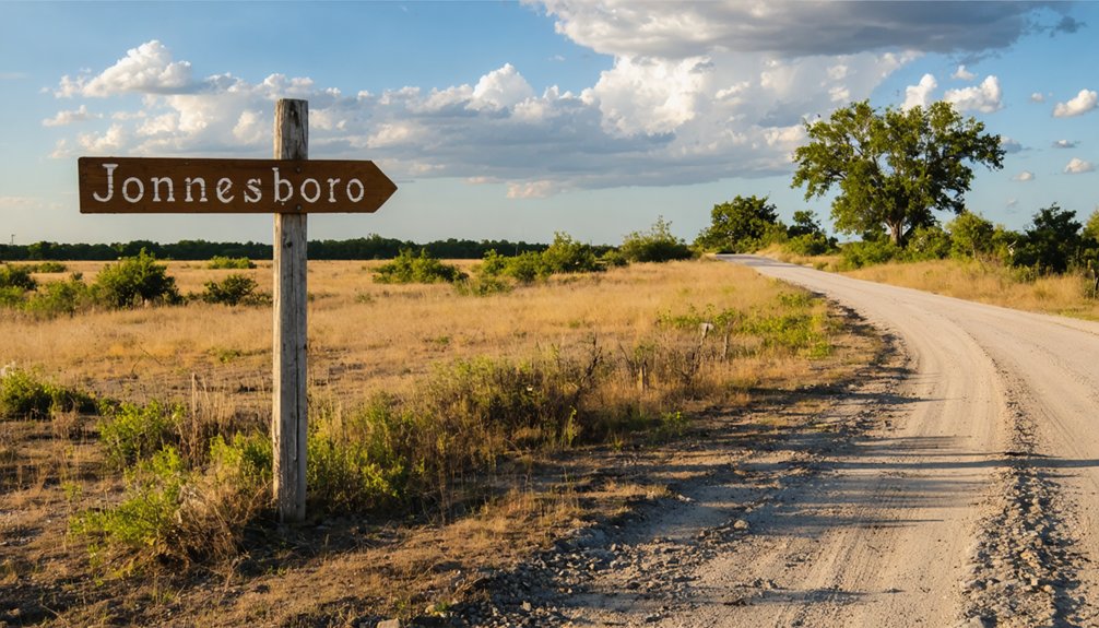
Historical markers along Farm Road 410, six miles northwest of Blakeney, pinpoint the exact location. A single weathered tombstone stands as your primary on-site reminder, silently confirming the flash flood that wiped everything out in the 1840s. The river itself changed course, leaving behind a barren site that’s neither officially classified as a ghost town nor resembling one—it’s simply erased history.
Getting There: Directions and Access Routes
You’ll find Jonesboro’s former townsite along Farm Road 410, approximately six miles northwest of Blakeney in Red River County. The roadside park marking this historic location sits on the north side of FM 410 near Kiomatia, with standard two-wheel-drive vehicles handling the flat terrain without difficulty.
For precise navigation, the site rests at approximately N33°40′ latitude and W95°10′ longitude, now occupied by the community of Davenport.
Primary Highway Routes
Reaching Jonesboro requires traversing Central Texas’s network of state and farm-to-market roads, with State Highway 36 serving as your primary artery into this Coryell County ghost town. You’ll find the settlement at the intersection where FM 1602 meets Highway 36, creating a perfect crossroads for exploration.
The local FM road network connects you to surrounding communities like Purmela, Gatesville, and Hamilton, while regional highway connections provide straightforward access from major corridors.
Key Route Features:
- Highway 36 cuts directly through town as your main approach
- FM 1602 intersects at the ghost town’s center point
- Eastbound travelers connect from Gatesville via paved routes
- Western access flows from Hamilton through open countryside
- Rural farm roads branch throughout Coryell and Hamilton counties
These well-maintained Texas highways let you chart your own course through authentic backcountry territory.
Two-Wheel Drive Accessibility
Those well-marked highways lead straight to Jonesboro’s doorstep, and your everyday sedan handles the journey without breaking a sweat. The surface conditions overview reveals paved county roads dominating access routes, with minimal gravel sections that standard vehicles navigate easily.
You’ll find 20-24 foot wide passages allowing comfortable two-way traffic, maintained year-round by Red River County crews who keep potholes at bay.
Vehicle recommendations couldn’t be simpler—any two-wheel drive car with basic 5-inch ground clearance conquers these paths. Flat terrain stretches 20-30 miles without steep grades, while dry weather prevails 80% annually.
Spring and fall rains drain quickly from elevated routes, and winter closures remain virtually nonexistent. No specialized tires, lifted suspensions, or four-wheel drive necessary—just fuel up within those convenient 15-mile intervals and roll freely toward history.
GPS Grid Coordinates
Modern navigation systems lock onto Jonesboro’s precise location at 31° 36′ 53″ N, 97° 52′ 36″ W—coordinates that’ll pull up the Coryell County ghost town on any GPS device you’re running. The decimal format (31.614722, -97.876667) works perfectly for smartphone mapping apps and dashcam units.
Navigation Reference Points:
- Highway 36 and FM 1602 intersection marks the primary access point
- USGS Jonesboro TX 2016 topo map confirms exact positioning
- Texas Coordinate System 1983 central zone provides 10,000-foot grid ticks
- Topo map overlay reveals terrain features and old roadbeds
- Satellite imagery analysis shows building foundations and access trails
This precision eliminates confusion with Red River County’s historical Jonesboro settlement—your GPS won’t lead you astray to the wrong ghost town hundreds of miles northeast.
Best Times to Visit and Nearby Historical Attractions
Since Jonesboro’s original townsite sits on accessible 2WD roads year-round, you can plan your visit during the milder seasons when Texas weather cooperates best. Winter and spring stand out as favorable shoulder seasons, offering comfortable temperatures for exploring this vanished frontier settlement where Sam Houston and David Crockett once crossed the Red River.
The river’s proximity influences local conditions—remember, weather patterns during floods in 1843 destroyed the entire town and shifted the channel one mile north.
While you’re exploring Red River County, venture to nearby historical sites. Hill County Cell Block Museum opens Saturdays April through October, just 30-40 miles southeast. You’ll also find Cumberland Church, historic gazebos in Hillsboro, and The Grove structures throughout central Texas, connecting you to Texas’s pioneering spirit.
Frequently Asked Questions
Are There Any Facilities or Amenities Available at the Jonesboro Site?
No facilities grace this forgotten frontier. You’ll find no restrooms, parking availability, or modern amenities at Jonesboro’s desolate site. It’s pure, untamed Texas wilderness—plan accordingly by bringing your own supplies and embracing complete self-sufficiency for your adventure.
How Long Should I Plan to Spend Visiting the Former Townsite?
You’ll need just 30-60 minutes at the barren site itself, but don’t plan for a full day visit. Since there aren’t facilities, bring necessary supplies like water and snacks for your brief exploration stop.
Is the Old Tombstone Accessible to Visitors Year-Round?
The old tombstone’s accessibility remains unconfirmed year-round due to unclear site designation and maintenance status. Tombstone condition likely varies with weather and vegetation growth, so you’ll want to verify current access before planning your adventure there.
What Other Red River County Ghost Towns Can I Visit Nearby?
Like scattered pages from history’s journal, you’ll discover Bradley’s Corner, Red River Station, Preston, and Spanish Fort nearby. Each site showcases remarkable historical significance through local preservation efforts, letting you explore Texas frontier heritage at your own pace.
Do I Need Permission to Access the Jonesboro Historical Site?
You’ll need landowner permission since Jonesboro sits on private property. There aren’t official parking requirements or site preservation guidelines restricting your visit, but you should respect posted no-trespassing signs and practice responsible exploration to protect this historic location.


