Planning a ghost town road trip to Juniata, Kansas means preparing for rugged terrain, unpredictable river levels, and dense woodland along the Big Blue River in Pottawatomie County. You’ll need a 4WD vehicle to navigate grid 3 classified roads, and you’ll want to time your visit for summer when water levels drop enough to reveal the old 1855 river crossing bridge. Juniata’s story — a boomtown turned ghost town within just a few years — is wilder than the trail leading there.
Key Takeaways
- Juniata, Kansas, is located in Pottawatomie County near the Big Blue River, accessible only via 4WD roads through dense woodland.
- A 4WD vehicle is essential, as grid 3 classified roads and overgrown terrain make navigation extremely difficult without proper preparation.
- Visit in summer for the best chance of manageable river levels, allowing access to the historic 1855 bridge.
- Monitor Big Blue River conditions before your trip, as high water can completely block access to key historic sites.
- Juniata’s old bridge and remnants reflect its rapid rise and decline, offering a compelling glimpse into ghost town history.
What Was Juniata, Kansas?
Juniata, Kansas was once a thriving frontier settlement founded in 1853 by Samuel D. Dyer as a ferry crossing on the Big Blue River.
By late 1854, this early settlement had blossomed into a community featuring a hotel, blacksmith shop, general store, and jail, housing around 70 residents.
Come 1855, you’d have found 50 families from nearly every U.S. state, drawn by abundant game and fish-filled waters.
Sitting strategically on the Fort Leavenworth-Fort Riley Military Road, Juniata once represented Kansas Territory’s promise of freedom and opportunity.
But road shifts, flooding, and rivalry with nearby Manhattan dismantled everything.
By 1858, the post office closed, and residents scattered.
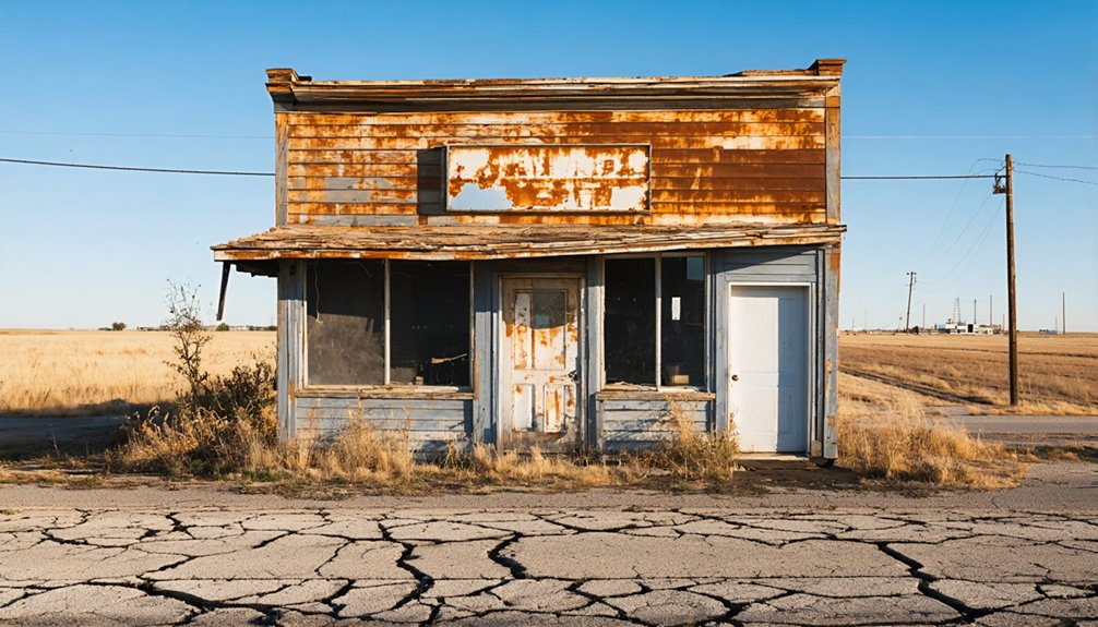
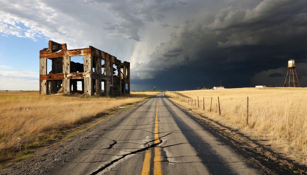
Today, this ghost town stands as a powerful reminder that even the most vibrant communities can simply vanish.
Where Juniata’s Ghost Town Site Is Located
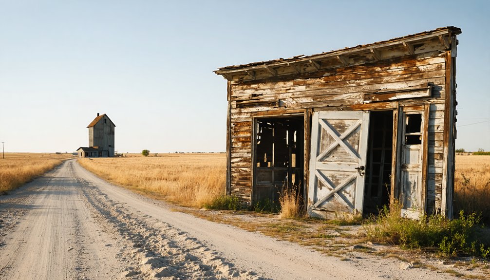
Tucked away in Pottawatomie County, Kansas, the ghost town site sits near the Big Blue River, buried beneath dense woodland and accessible only by 4WD roads.
You’ll find it covered under the Manhattan, KS US Topo Map quadrant, where thick trees guard what little ghost town history remains.
The old river crossing tells the most compelling story here. That bridge, built in 1855 at a cost of $10,000, occasionally surfaces when river levels drop low enough to reveal it.
It’s your clearest physical connection to Juniata’s past. Don’t expect easy access — foot travel through this restricted, overgrown terrain demands serious preparation.
Summer offers your best window, when Kansas weather cooperates and water levels give you a fighting chance at reaching the historic river crossing.
Why You’ll Need a 4WD to Reach Juniata
If you’re planning a visit to Juniata’s ghost town site, you’ll need a capable 4WD vehicle to navigate the rugged, grid 3 classified roads leading to it.
Dense woodland has reclaimed the area almost entirely, creating a tangle of overgrown terrain that’s nearly impossible to push through by car or truck.
When river levels run high, they’ll cut off your access to the old 1855 bridge altogether, so timing your visit for summer gives you the best shot at reaching what little remains.
Rugged 4WD Terrain
Reaching Juniata isn’t a Sunday drive—it’s a commitment. The terrain demands a capable 4WD vehicle, and there’s no negotiating with the grid 3 classification roads that cut through Pottawatomie County.
You’re traversing rugged landscapes where overgrown trails swallow paths whole and river levels can block your only access point entirely.
Off road adventures sound romantic until you’re staring down a waterlogged trail with no turnaround room. The site sits deep in heavily wooded, restricted terrain that’s nearly impossible to penetrate by standard car or truck.
High water levels on the Big Blue River shut down bridge access completely, so timing matters.
Come prepared with the right vehicle, the right season, and a solid sense of direction. Juniata rewards the determined, not the casual.
Dense Woodland Obstacles
Beyond the rutted 4WD roads, the real fight begins once you step into Juniata’s overgrown terrain. Dense vegetation has swallowed what little remains of this forgotten settlement, turning every step into a battle against nature’s reclamation.
The wooded trails aren’t maintained, marked, or forgiving — you’re pushing through tangled brush with no clear path guiding you forward.
Access challenges intensify as the landscape tightens around you. Trees crowd the site so densely that even foot travel becomes exhausting and disorienting.
You won’t find conveniently cleared walking paths or helpful signage pointing toward the old bridge. What you’ll find instead is raw, untamed Kansas wilderness that demands persistence, solid boots, and a sharp sense of direction.
Only those willing to fight through it earn the reward of discovery.
High River Level Challenges
The Big Blue River doesn’t negotiate. When water levels rise, your access to Juniata’s 1855 government-built bridge vanishes completely. That bridge cost $10,000 to construct and survived long enough to become the town’s last standing witness — but river safety must come first.
Don’t test your luck against a swollen current for the sake of exploration.
Even under ideal conditions, bridge conditions remain unpredictable and potentially unstable after decades of neglect. Your 4WD becomes essential here, not optional. High clearance lets you read the terrain, react quickly, and retreat safely when the river sends its warnings.
Summer visits offer the best odds of manageable water levels, but you’ll still need to assess conditions upon arrival. The river controls access. You don’t.
When River Levels Drop Low Enough to Access the Bridge
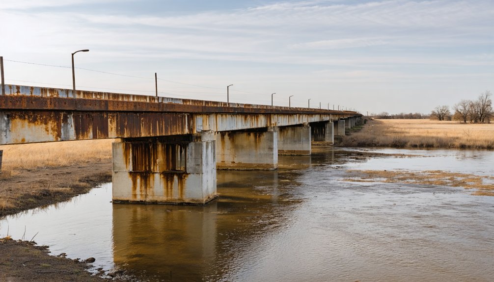
When river levels drop low enough, you’ll catch a rare glimpse of Juniata’s most tangible remnant — the old bridge, constructed in 1855 at a cost of $10,000 by the federal government.
This bridge once carried settlers, soldiers, and supplies along the Fort Leavenworth-Fort Riley Military Road, making it a lifeline for the entire region.
River access remains unpredictable, so you’ll need to monitor water levels before attempting your visit.
When conditions cooperate, the bridge emerges as a striking, silent witness to a community that once thrived here.
Its bridge history connects directly to Juniata’s brief but vibrant existence.
Standing on it, you’re touching something real — a structure that outlasted the town it served, quietly enduring long after the last resident moved on.
What You Can Still See at Juniata Today
Stepping back from the bridge, you’ll quickly realize that Juniata offers precious little else to anchor your eyes. Dense woodland has swallowed almost every trace of the settlement that once housed 50 families and hummed with frontier ambition. No markers, no foundations, no standing structures interrupt the tree line.
The ghost town significance here lies not in visible ruins but in absence itself — a silence that speaks louder than preserved monuments ever could.
The ghost town speaks not through ruins, but through absence — a silence more eloquent than any preserved monument.
Still, those historical remnants carry weight. The 1855 bridge, built at a then-staggering $10,000 government expense, remains your sole tangible connection to Juniata’s brief, remarkable life.
Pair that with your own research and imagination, and you’ll reconstruct something powerful — a community that thrived, competed, lost, and ultimately surrendered to the unstoppable momentum of westward expansion.
Why Juniata Disappeared While Manhattan Survived
When you trace Juniata’s collapse, you find three forces working in brutal unison: Manhattan’s superior road access, the devastating 1856 flood, and a grinding economic rivalry that Juniata simply couldn’t survive.
Once the main road shifted toward Manhattan, you can almost picture the town’s lifeblood draining away — merchants, families, and travelers all redirecting their steps toward the stronger hub.
The flood that washed out Juniata’s bridge in 1856 didn’t just destroy infrastructure; it sealed the town’s isolation and handed Manhattan an advantage it never relinquished.
Manhattan’s Superior Road Access
Though it may seem strange that a thriving community of 50 families could simply vanish, Juniata’s fate was sealed not by drought, disease, or conflict, but by something far more mundane: a road.
When the main trail shifted toward Manhattan, it took everything with it — commerce, travelers, and opportunity.
Manhattan’s infrastructure developed around that superior road access, pulling settlers and merchants away from Juniata’s riverside position. You can almost picture it: wagon wheels carving deeper ruts toward Manhattan while Juniata’s streets grew quiet.
The 1856 flood that destroyed Juniata’s bridge only accelerated the inevitable. Without reliable crossing points and a direct military road connection, residents simply followed the traffic.
Freedom, after all, requires mobility — and Juniata could no longer offer it.
The Flood’s Lasting Impact
The 1856 flood didn’t just wash away Juniata’s bridge — it erased the town’s reason for existing. That bridge connected travelers to the Fort Leavenworth-Fort Riley Military Road, making Juniata a crucial stop.
Once the flood damage severed that connection, isolation effects set in fast.
Meanwhile, Manhattan offered something Juniata couldn’t recover: reliable access. Settlers, merchants, and military traffic naturally redirected toward Manhattan’s superior road network.
You can almost picture it — wagons that once rolled through Juniata simply choosing a different path, never returning.
Juniata didn’t die from resource exhaustion or conflict. It died because geography stopped working in its favor.
The flood handed Manhattan a permanent advantage, and Juniata, stripped of its purpose, quietly emptied out within two years.
Economic Rivalry’s Fatal Outcome
Geography dealt Juniata a brutal blow, but economics finished the job. Manhattan’s growing infrastructure pulled settlers, merchants, and opportunity away from Juniata like a magnet pulling iron filings.
You’d have watched helplessly as wagon trains bypassed your town entirely, choosing Manhattan’s superior connections over Juniata’s increasingly isolated riverside position.
Ghost town dynamics rarely involve dramatic disasters. Instead, they’re quiet surrenders — one business closing, then another, until silence replaces commerce.
Juniata’s economic competition with Manhattan was hopelessly unequal once the main road shifted. Merchants couldn’t survive without customers, customers couldn’t thrive without merchants, and the cycle accelerated collapse.
Frequently Asked Questions
Who Founded Juniata, Kansas, and What Was His Profession?
Samuel D. Dyer’s your founder biography to explore! His professional background was as a ferry operator, establishing Juniata’s first river crossing on the Big Blue River in 1853, connecting freedom-seeking settlers across Kansas Territory.
How Much Did the Original Government-Built Bridge Cost in 1855?
You won’t believe it — that legendary bridge construction set the government back $10,000 in 1855! Its historical significance still echoes today, reminding you of Juniata’s bold, freedom-filled past waiting to be discovered.
What Other Name Was Juniata Known by in Its Early Days?
You’ll find Juniata’s early name was actually “Dyer’s Town” or “Junietta,” honoring founder Samuel D. Dyer. Its historical significance runs deep — it served as a crucial military road stop, embodying true frontier freedom and independence.
Were the Native American Tribes Near Juniata Considered Hostile or Peaceful?
You’ll find that the various roving Native American tribes near Juniata were generally peaceable. Their Native American relations and tribal alliances created a surprisingly harmonious atmosphere, letting early settlers pursue their dreams of freedom undisturbed.
What Major Weather Event in 1856 Contributed to Juniata’s Isolation?
Like a severed lifeline, the 1856 flood’s weather impact washed away Juniata’s bridge over the Big Blue River, cutting off your path to progress and cementing the town’s historical significance as a cautionary tale of nature’s power.
References
- https://www.ghosttowns.com/states/ks/juniata.html
- https://lostkansas.ccrsdigitalprojects.com/sites/lostkansas/files/private_static/2022-12/LT_PT_Juniata_French.pdf
- https://thewanderingpigeon.com/2015/10/03/day-of-kansas-ghost-towns/
- https://legendsofkansas.com/pottawatomie-county-extinct-towns/
- https://www.youtube.com/watch?v=8dtIPX7pIqI
- https://www.anyplaceamerica.com/directory/ks/pottawatomie-county-20149/locales/juniata-historical–481914/
- https://lostkansas.ccrsdigitalprojects.com/juniata-pottawatomie-county


