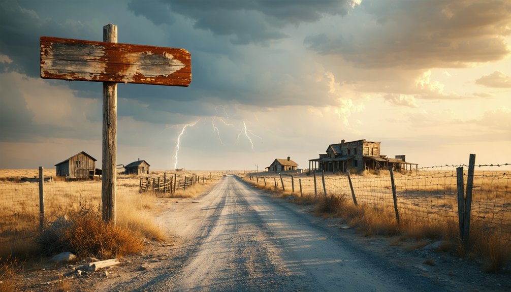
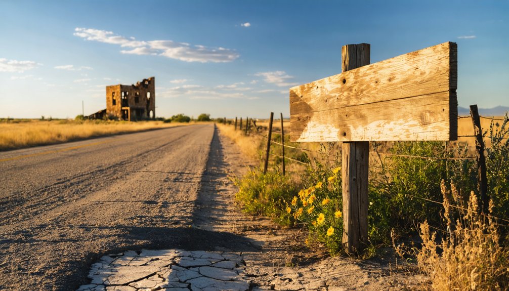
Take FM 1346 from La Vernia for 8.5 miles—fuel up first, since there’s nothing out there. At mile 6, you’ll spot Kicaster Cemetery‘s weathered headstones marking the Crows and Spiveys who settled here in the 1860s. The historical marker stands at the CR 324 crossroads where the Union School once taught 49 students. Watch for deer at dawn and download offline maps before cell service vanishes. The complete story of this vanished community awaits those who venture beyond the marker.
Key Takeaways
- Fuel up in La Vernia before the 8.5-mile drive on FM 1346, as no services exist along the route.
- Download offline maps beforehand, as cell service disappears in low-lying areas between La Vernia and Kicaster.
- Visit the Kicaster Cemetery at mile 6 to see weathered headstones of founding families like the Crows and Spiveys.
- Stop at the weathered historical marker at CR 324 intersection to learn about the 1872 Union School settlement.
- Watch for deer crossings from dawn to dusk, as these unpredictable animals frequently cross the backroads.
The Rise and Fall of Kicaster: A 19th Century Texas Settlement
The dusty crossroads where FM 3432 meets County Road 324 holds more stories than its weathered historical marker can tell. Back in the 1860s, Isaac Crow, R.T. Spivey, and other pioneering families carved out homesteads here, embracing agricultural diversification across the rolling Wilson County landscape. You’ll find that John James’s 1872 land donation—a generous 3.5 acres—became the community’s beating heart, hosting the Union School and Sunday services under one roof.
But environmental challenges tested these settlers’ grit. A devastating late-century hailstorm shredded crops and fences, while drought and unpredictable weather wore down their resolve. The Easterling post office opened in 1887, renamed Kicaster after the nearby creek, but closed just nineteen years later. By 1940, the school shuttered and churches relocated, leaving only the cemetery standing guard over abandoned dreams.
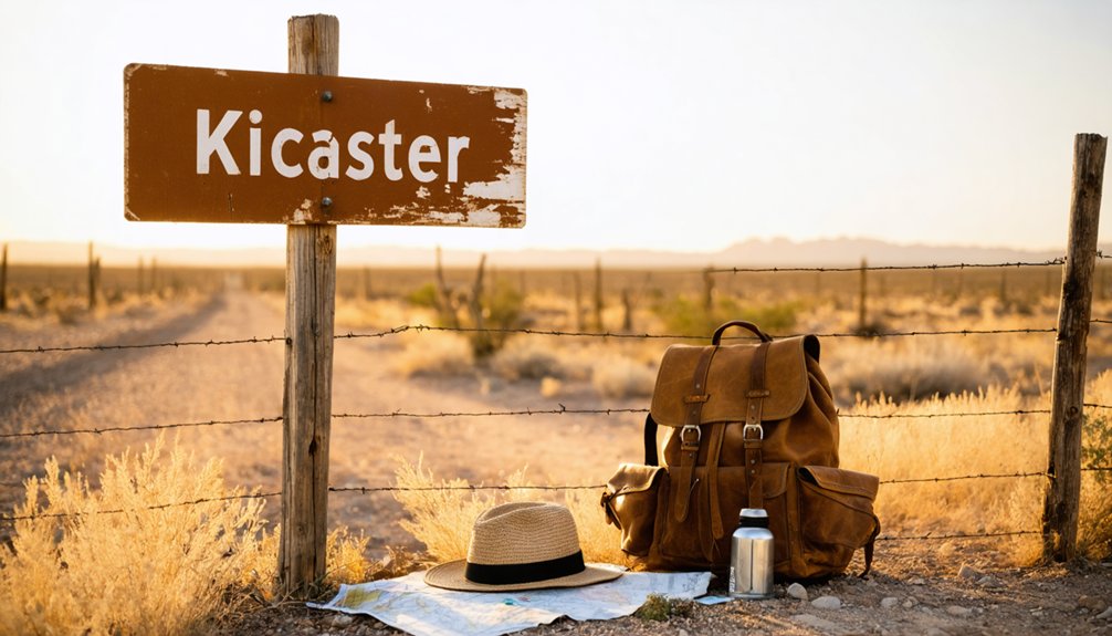
Getting to Kicaster: Detailed Driving Directions From La Vernia
Reaching Kicaster today requires traversing the same Wilson County terrain those 19th-century settlers once traversed by wagon, though your journey from La Vernia will take minutes instead of hours. Your modern adventure begins at GPS coordinates 29.3572° N, 98.1125° W, heading east on US 87 before cutting onto FM 1346’s ribbon of asphalt.
From wagon trails to GPS coordinates—modern explorers trace the same Wilson County paths in mere minutes that once demanded days.
Essential waypoints for your exploration:
- Fuel up at La Vernia’s stations—no services exist on FM 1346’s 8.5-mile stretch
- Watch for Kicaster Cemetery at mile 6—weathered headstones mark your proximity
- Navigate deer crossings dawn through dusk—these unpredictable creatures own the backroads
- Download offline maps—cell service vanishes in FM 1346’s low-lying areas
Route variations remain limited; this two-lane road offers solitary passage through ranch country where freedom-seekers escape suburban sprawl.
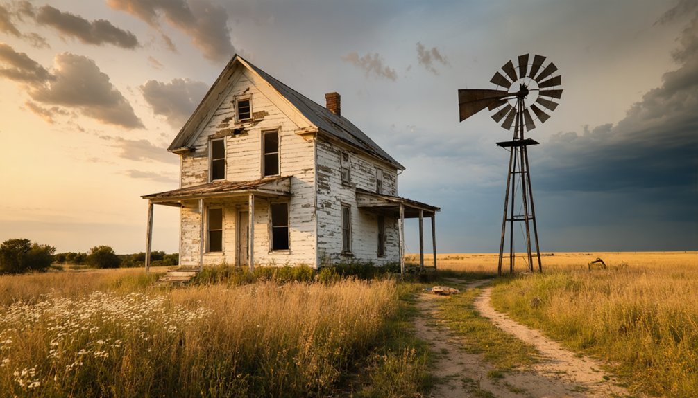
What Remains Today: Exploring Kicaster Cemetery and Historical Markers
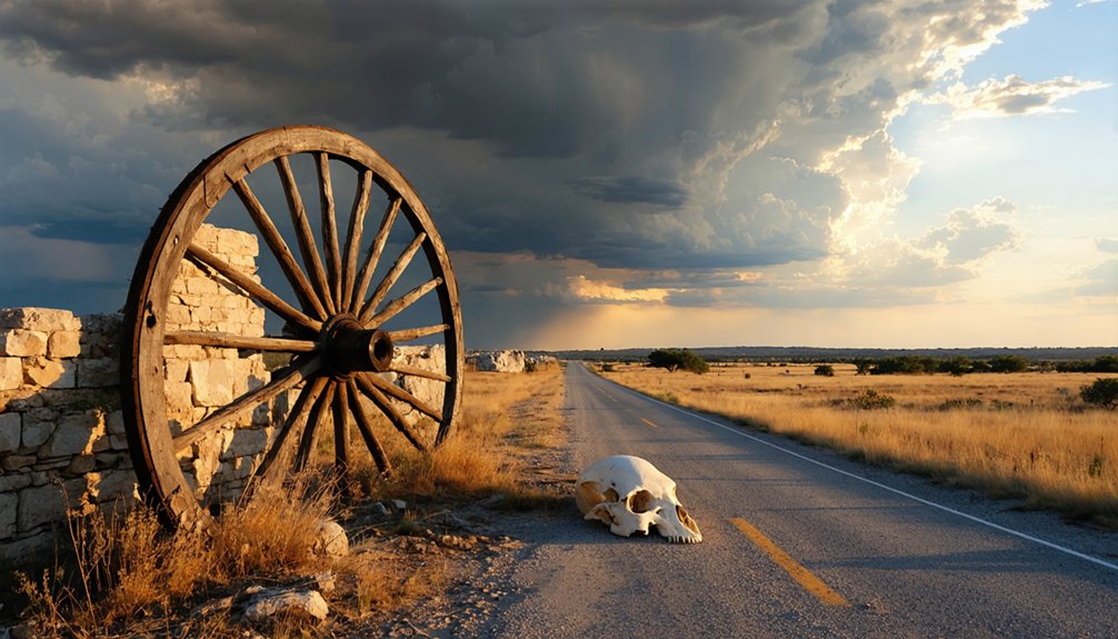
When your tires crunch onto the caliche parking area beside FM 3432, Kicaster’s weathered historical marker stands sentinel at the CR 324 intersection—an 18″ x 28″ bronze memorial erected in 1975 that’s become the ghost town’s most accessible landmark. The marker’s condition remains surprisingly intact, its raised lettering still legible despite decades of Hill Country weather.
Beyond it, the cemetery spreads across land donated by John James in 1872, headstones dating back to the 1870s testifying to founding families like the Crows, Spiveys, and Andersons. You’ll find this isn’t completely abandoned—community demographics shifted rather than vanished, with scattered dwellings and working farms still occupying the territory.
The Kicaster Corner store and volunteer fire department keep the name alive, even as San Antonio’s suburban sprawl gradually transforms surrounding pastures.
The Story Behind the Name: Kicaster Creek and the Post Office Era
You’ll find the town’s unusual name etched into the landscape long before any post office opened its doors—early settlers in 1860 recorded “Cacaista” in Wilson County documents, referencing the creek that wound through their land.
When William A. Gibbins applied for a post office in 1886, he proposed calling it “Tom,” but authorities established it as “Easterling” in 1887 before switching to “Kicaster” just one year later. The creek’s name had evolved through newspaper accounts from Cicaster to Kicaster by the mid-1870s, and the post office finally adopted this local pronunciation that ranchers and farmers already used when giving directions to their homesteads.
Creek’s Naming Origins
- Spanish missions used Cacaista’s watershed for grazing in the 1700s
- Early settlers navigated its 11-mile channel through Wilson County’s Sand Hills
- The post office transformed “Cacaista” into “Kicaster” by the settlement era
- This waterway still flows southeast into the San Antonio River today
- The 1975 historical marker documenting the settlement’s origins
- Kicaster Cemetery, continuously used since the 1870s
- Scattered foundations where the dual-purpose schoolhouse once stood
- Empty fields marking where multiple churches served the faithful
- Spring (March-April) – Bluebonnets frame abandoned buildings while 67°F-90°F temperatures keep exploration comfortable before peak crowds arrive
- Fall (October-November) – Golden light bathes rustic structures at 72°F with virtually no tourists wandering the dusty streets
- Winter (January-February) – Cold, clear nights reveal spectacular stars above ghost town silhouettes with zero competition for photographs
- Summer – Brave 100°F+ heat for absolute isolation, but pack serious sun protection and extra water
- Sutherland Springs – Historical significance runs deep here, with visible ruins telling stories of community abandonment
- Pandora – This barren site sits just minutes away, perfect for extending your freedom-seeking journey
- Kosciusko – Semi-abandoned structures await discovery via accessible local roads
- Graytown – County roads lead to this extinct settlement’s fascinating remnants
- Start early at Floresville’s courthouse to admire Alfred Giles’ 1884 Italianate masterpiece and Lady Justice statue
- Continue to the 1887 jailhouse museum when it’s open, exploring James Riely Gordon’s architectural work
- Head south to Rancho de las Cabras, part of UNESCO’s World Heritage designation
- Finish at Mueller Bridge near La Vernia, experiencing authentic Texas engineering heritage
Post Office Name Change
The transformation from Cacaista to Kicaster unfolded through bureaucratic quirks and frontier practicality. When William A. Gibbins navigated the application process in 1886, he proposed naming the post office “Tom” for the area’s 300-400 inhabitants. Washington rejected it.
Instead, post office establishment came in August 1887 as “Easterling”—a name that lasted just one year before officials changed it to “Kicaster” in 1888, finally matching what locals had called their creek for decades. You’ll find Chester Rockwall Pittman‘s fingerprints throughout this story—he served as postmaster, storeowner, and justice of the peace until the office closed in 1906. That nearby Pittman Road? Named for him, marking where frontier governance met community life.
Key Historical Sites: The Union School and Community Gathering Places
Standing at the weathered crossroads where FM 775 meets FM 3432 and CR 324, you’ll find a Texas Historical Commission marker that tells the story of what once thrived here. The Union School formed Kicaster’s beating heart—a two-room structure where 49 students studied by 1896. This wasn’t just about school infrastructure upgrades; it represented true community social centers where neighbors gathered for both education and Sunday services.
Where crossroads meet history, a weathered marker stands sentinel over Kicaster’s vanished heart—the Union School that bound a community together.
What remains of Kicaster’s gathering places:
You’re free to explore these remnants approximately 12 miles northwest of Floresville, tracing the footsteps of founding families who built something lasting from Texas soil.
Understanding Kicaster’s Decline: From Thriving Village to Semi-Abandoned
Between 1887 and 1906, Kicaster’s trajectory shifted from promise to abandonment—a pattern you’ll recognize if you’ve explored other ghost towns dotting South Texas. The post office’s closure in 1906 signaled irreversible decline.
Economic alterations hit hard when devastating hailstorms destroyed entire cotton and corn harvests, demolishing James McDaniel’s gin house and wiping out surrounding farms. Social upheaval added another layer—Richard Neasom’s 1880 murder spree, killing his uncle and Lavernia’s postmaster, reflected the frontier’s violent edge.
Best Time to Visit and What to Bring on Your Ghost Town Adventure
Planning your Kicaster ghost town adventure means timing it right—I learned this after shivering through an unprepared February visit, watching my breath fog the air as I explored crumbling structures.
You’ll find the sweetest window between late October and early November, when East Texas foliage paints the abandoned landscape in rust and gold, temperatures hover around a comfortable 72°F, and you’re likely to have the eerie streets entirely to yourself.
Pack layers for those crisp mornings, sturdy boots for traversing overgrown paths, and a quality camera to capture the haunting interplay of autumn light through broken windows.
Optimal Seasonal Visiting Conditions
When choosing the perfect season for your Kicaster ghost town adventure, you’ll find each brings its own character to the crumbling facades and weathered landscapes. Understanding seasonal visitor trends helps you decide between solitude and ideal weather conditions.
Your seasonal options:
Shoulder seasons deliver that sweet spot between accessible conditions and uninterrupted exploration freedom.
Essential Gear and Supplies
Since Kicaster’s crumbling remnants sit scattered across brush-choked farmland where services disappeared decades ago, your vehicle becomes a mobile basecamp carrying everything between you and an uncomfortable (or dangerous) afternoon. Pack sturdy boots for traversing uneven rural terrain around the cemetery and schoolhouse foundation.
The spotty cell signal means offline maps are essential—don’t rely on real-time guidance near the Bexar County boundary. I learned this the hard way, circling FM 3432 twice before finding the CR 324 intersection.
Load water, snacks, and a first aid kit; the nearest convenience store sits miles away in La Vernia. Bug spray battles the South Texas mosquitoes that swarm at dusk, while your camera captures the 1975 historical marker before fading light makes reading impossible.
Expanding Your Route: Nearby Extinct Villages Worth Exploring
Beyond Kicaster’s weathered structures and silent streets, Wilson County harbors a constellation of ghost towns that’ll transform your day trip into a proper expedition through Texas’s forgotten past.
Essential stops for remnant exploration:
You’ll find these villages clustered together, allowing efficient route planning without backtracking. Each location offers distinct character—some present foundation stones and overgrown cemeteries, others show weathered buildings still standing against the elements. Pack extra water and memory cards; you’ll need both.
The Land Donors: Johns James and the Andersons’ Legacy
While those extinct settlements scattered across Wilson County emerged through organic pioneer determination, Kicaster’s story hinges on two deliberate acts of generosity that shaped its identity. In 1872, legendary land speculator Johns James conveyed 3.5 acres specifically for school, religious, and moral meetings—a land donation significance that established the Union School as Kicaster’s beating heart.
You’ll find this wasn’t mere charity; James understood how purposeful giving creates lasting structure. Fifteen years later, A.C. and Mary Anderson amplified this vision with their own public land gift, demonstrating community legacy impact that transcended individual lifetimes. These donors didn’t just transfer property—they architected a settlement’s DNA.
Today, standing at the cemetery that marks Kicaster’s footprint, you’re witnessing how intentional generosity outlives the communities it builds.
Combining Kicaster With Other Wilson County Historical Destinations
You’ll want to map out a full-day circuit through Wilson County, since Kicaster stands among five ghost settlements—Mount Olive, Cottage Hill, Sandy Hills, Parita, and Utzeville—that once thrived with blacksmith shops and cotton gins before vanishing into the scrubland.
I’ve traced these routes on FM roads where historical markers barely outnumber the cattle, each cemetery offering a different chapter of 1870s frontier ambition.
Pack water and download offline maps, because cell service disappears between these abandoned crossroads just as completely as their post offices did a century ago.
Multi-Site Route Planning
Planning a Wilson County ghost town expedition opens up opportunities to string together multiple historic sites into a rewarding day trip. Your route sequencing should account for operating hours—the courthouse welcomes visitors weekdays 9am-4pm, while the jailhouse museum only opens second and fourth Saturdays. Site accessibility varies considerably across the county.
Strategic Multi-Stop Itinerary:
Call ahead for Rancho de las Cabras tours and confirm jailhouse repairs are complete before departing.
Nearby Extinct Settlement Stops
Several forgotten communities dot the landscape around Kicaster, each one a faded echo of Wilson County’s settlement boom. Mount Olive, Cottage Hill, Sandy Hills, Parita, and Utzeville once thrived alongside your main destination, sharing remarkable similarities between Kicaster settlements—mercantile stores birthing churches, cemeteries, blacksmith shops, schools, and post offices in predictable succession.
You’ll find these faded community relics clustered within driving distance, perfect for expanding your ghost town exploration. None survived into the modern era as functioning towns, leaving only traces for you to discover. The remote locations offer authentic solitude—no tourist crowds, just you and the weathered remnants of 19th-century ambition. Bring detailed county maps, since GPS won’t recognize these vanished names. You’re chasing whispers of communities that refused to surrender completely to time’s erosion.
As you venture deeper, you might come across ghost towns near Callahan City, where the remnants of a once-thriving gold rush still linger in the air. These sites tell stories of hope and hardship, waiting for those intrepid enough to unearth their secrets. Each visit offers a glimpse into the past, a tangible connection to the dreams that once filled these now-silent streets.
Frequently Asked Questions
Are There Any Facilities Like Restrooms or Water Available at Kicaster?
No facilities exist at this ghost town—you’ll find no restrooms or water here. You’re completely self-reliant in this abandoned landscape. Pack everything yourself, as parking availability is limited and local businesses are nonexistent in Kicaster’s weathered remains.
Is It Legal to Visit the Cemetery and Take Photographs?
Yes, you’re legally allowed to visit and photograph the cemetery. Texas law permits access to cemeteries on private land. However, you should respect cultural significance and obtain permission from authorities or landowners beforehand for hassle-free exploration.
How Long Should I Plan to Spend Exploring Kicaster?
Like a tumbleweed rolling past forgotten foundations, you’ll determine ideal time allocation of 30 minutes to 1 hour here. For extended exploration, identify nearby lodging options in La Vernia, just minutes away, where freedom meets comfort.
Are There Any Guided Tours or Local Experts Available for Hire?
No guided tours available exist for Kicaster—you’ll explore independently. Local historians accessible through nearby towns might share stories, but this forgotten settlement rewards self-directed wanderers who crave authentic discovery without structured schedules or crowds limiting their experience.
Is Overnight Camping Permitted Near Kicaster or the Cemetery Area?
No, you can’t pitch your tent among the tombstones—Smithville ordinance kills that romantic notion. However, nearby campgrounds welcome your rebellious spirit. Check local land regulations first, because Texas doesn’t mess around with trespassing freedom-seekers.


