Planning a ghost town road trip to Lehigh, Oklahoma means driving south along U.S. 75 into Coal County’s quiet, rolling countryside. You’ll find surviving landmarks like the Merchants National Bank Building, an old city hall, and traces of three former rail lines that once made this coal town boom. Download offline maps before you go, since GPS signals can drop on rural back roads. Keep exploring and you’ll uncover everything you need to make this trip unforgettable.
Key Takeaways
- Lehigh, founded in 1880 as a coal mining camp, declined rapidly in the 1920s due to mine closures, railroad abandonment, and boll weevil devastation.
- Key surviving structures include the Merchants National Bank Building, small city hall, and old fire department, offering authentic glimpses into Lehigh’s coal-era prosperity.
- Travel south along U.S. 75, download offline navigation apps, and carry a printed county map since GPS signals can be unreliable on rural roads.
- Pack a zoom lens, wide-angle option, extra batteries, sturdy boots, long sleeves, insulated layers, and a first-aid kit for safe and effective exploration.
- Extend your road trip to nearby ghost towns Picher, known for mining ruins and contamination, and Texola, a Route 66 landmark near the Texas border.
What Turned Lehigh, Oklahoma Into a Ghost Town
When coal was king, Lehigh thrived. Founded as a coal mining camp in 1880, this southeastern Oklahoma town built its identity around the industry fueling America’s growth.
Its historical significance lies in how quickly fortune reversed. The railroads that once carried Lehigh’s coal eventually abandoned it. When locomotives switched from coal to oil power, demand collapsed throughout the 1910s and 1920s. That economic decline hit hard and fast.
Then the boll weevil arrived, destroying cotton crops in the early 1920s and eliminating the agricultural fallback that might’ve softened the blow. Mines shut down. Businesses closed. Residents left.
Lehigh didn’t fade gradually — it unraveled in layers. Understanding that collapse is exactly what makes visiting the town such a powerful, sobering experience for anyone chasing American history on the open road.
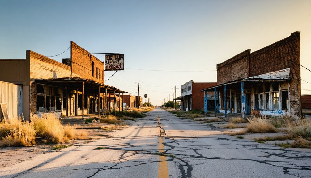
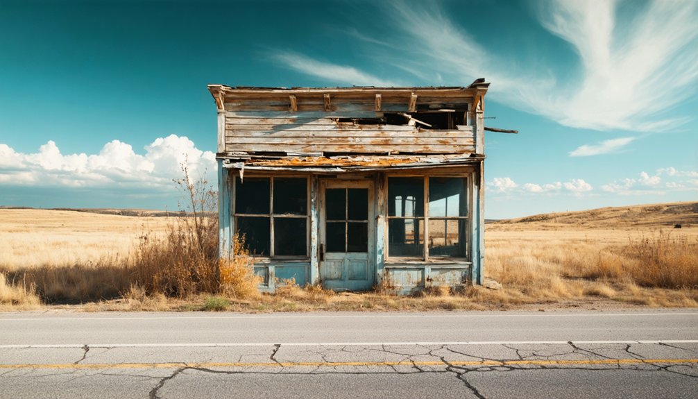
What’s Left of Lehigh and Whether It’s Worth the Drive
What survives in Lehigh is modest but striking. The Merchants National Bank Building anchors the downtown core, offering a vivid window into the town’s coal legacy and former ambitions.
You’ll also spot a small city hall, an old fire department, and the ghost of the railway corridor that once connected three separate rail lines.
Lehigh nostalgia hits hardest when you walk the quiet streets and imagine the bustle that coal money once sustained. The Main Street traces are faint but readable if you know what to look for.
Is it worth the drive? Absolutely, especially if you’re already moving along U.S. 75.
Lehigh rewards curious travelers who appreciate raw, unpolished history over manicured attractions. It’s honest, it’s faded, and it’s entirely authentic.
How to Reach Lehigh and What the Drive Looks Like
Reaching Lehigh takes only a straightforward drive south along U.S. 75, the old King of Trails Highway, which cuts directly through Coal County in southeastern Oklahoma.
The route itself sets the tone for rural exploration, pulling you through rolling countryside and small communities before delivering you into what remains of Lehigh.
You’ll notice the landscape thinning out as you get closer, with fewer structures breaking the horizon.
Once in town, the streets are quiet and easy to navigate on your own schedule.
There’s no rigid itinerary here, which suits anyone drawn to ghost town folklore and open-ended discovery.
You move at your own pace, stop where curiosity leads you, and leave when you’re ready.
That kind of freedom defines the whole experience.
Lehigh’s Surviving Buildings and What They Tell You
Few buildings survived Lehigh’s decline, but the ones that did speak clearly about the town’s former ambitions.
The Merchants National Bank Building stands as the most striking example of historic architecture still holding its ground. When you walk past it, you’re reading a chapter of coal-era prosperity written in brick and mortar.
The Merchants National Bank Building doesn’t just stand — it testifies to everything Lehigh once dared to build.
Local legends suggest the building once anchored a thriving Main Street lined with merchants, saloons, and boarding houses. The fire department and small city hall still exist along the highway corridor, quiet reminders that civic life once ran deep here.
You don’t need a guided tour to feel the weight of what’s left. Just slow down, look closely, and let the surviving structures tell you exactly what Lehigh once dared to become.
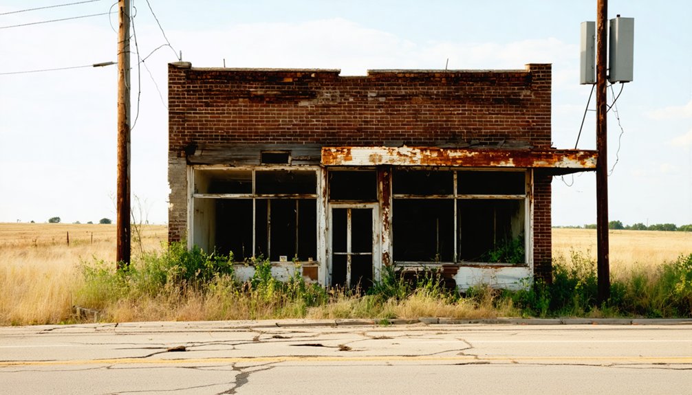
The Merchants National Bank Building Up Close
Standing directly in front of the Merchants National Bank Building, you’ll notice it carries a presence that still commands attention despite the empty lots surrounding it.
Its Merchants architecture speaks to a time when Lehigh’s coal economy made ambitious construction possible. The historical significance here isn’t abstract — it’s embedded in every brick.
Look closely for these details:
- Facade lines — deliberate, formal stonework reflecting early 1900s commercial confidence
- Window proportions — tall openings designed to project prosperity and permanence
- Structural integrity — walls that have outlasted the economy that built them
- Corner placement — a deliberate downtown anchor meant to signal stability
Photograph it from multiple angles.
You’re documenting something real — a town’s ambition frozen mid-sentence.
The Railroad Traces Lehigh Left Behind
Walk the old railroad corridor and you’ll feel the ghost of Lehigh’s busiest era pressing through the ground beneath you.
Three railroads once served this small coal town — the Missouri, Kansas and Texas Railway, the Chicago, Rock Island and Pacific Railway, and the Gulf, Colorado and Santa Fe Railway. That railroad significance shaped everything here, moving coal out and commerce in.
By 1905, those lines made Lehigh a genuine regional hub. Their economic impact kept merchants solvent, miners employed, and families rooted.
At its peak, Lehigh hummed with purpose — railroads keeping merchants busy, miners working, and families staying.
Then locomotives switched to oil, and the demand for local coal collapsed. The rails that built Lehigh fundamentally abandoned it.
Today, the former track corridor still marks the town’s historic core. Walk it slowly, and you’ll read the landscape like a timeline of rise and ruin.
What to Pack for Photographing a Rural Oklahoma Ghost Town
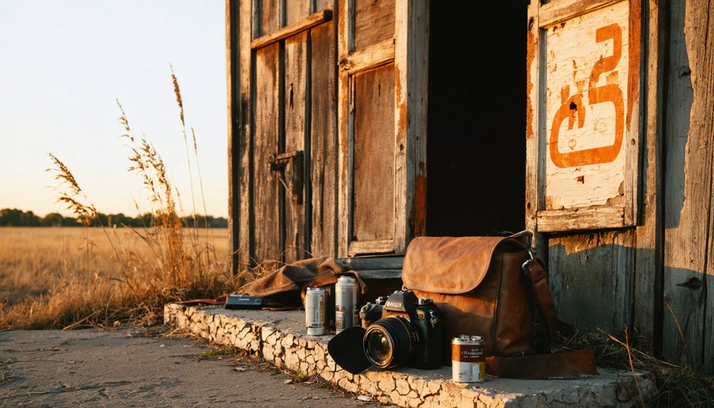
When you head out to photograph Lehigh’s weathered storefronts and abandoned rail corridors, you’ll want a camera with a versatile zoom lens, a wide-angle option for capturing crumbling facades, and extra batteries since rural stops offer no convenient recharging.
Wear long sleeves, sturdy boots, and light layers to handle Oklahoma’s unpredictable heat, brush, and uneven terrain around the old mining-era structures.
Toss a paper map, a first-aid kit, and a fully charged phone into your bag, because cell coverage gets spotty along the U.S. 75 corridor and self-reliance keeps the trip moving safely.
Essential Camera Gear
Photographing a place like Lehigh demands gear that’s both versatile and durable, since rural Oklahoma’s open skies, crumbling facades, and unpredictable weather can challenge even experienced shooters.
Smart lens choices and precise camera settings separate memorable shots from forgettable ones.
Pack these four essentials:
- Wide-angle lens – Captures the Merchants National Bank Building’s full facade and expansive prairie backdrops without distortion.
- Prime or telephoto lens – Isolates weathered architectural details and textures from a respectful distance.
- Extra batteries and memory cards – Remote locations offer zero resupply options.
- Polarizing filter – Cuts glare from Oklahoma’s intense midday sun and deepens those dramatic cloud contrasts overhead.
Travel light, but don’t compromise on these fundamentals—you won’t get a second chance at golden-hour light over Lehigh’s empty streets.
Protective Clothing Choices
Dressing for a ghost town shoot in rural Oklahoma isn’t glamorous, but it’s non-negotiable. Lehigh’s overgrown lots and crumbling structures demand layers you can move in freely.
Wear long sleeves and pants to block thorns, insects, and rough concrete edges. Sturdy, ankle-supporting boots keep you stable on uneven ground near the old railway corridor and abandoned lots.
Weather considerations matter greatly here. Oklahoma summers punish you with intense heat, so breathable fabrics and a wide-brimmed hat are essential.
Spring and fall bring unpredictable storms, so pack a lightweight rain shell. Winter shoots require insulated layers.
Always carry protective gloves when handling rusty metal fences, broken lumber, or debris near historic structures like the Merchants National Bank Building. Your hands stay functional, your shots stay focused.
Rural Oklahoma’s back roads don’t always cooperate with GPS signals, so you’ll want at least two navigation tools before heading into Coal County.
Download offline navigation apps before you lose cell coverage, and carry a printed county map as backup. Lehigh’s remote streets reward prepared explorers.
- Offline navigation apps – Download maps for Coal County before departing civilization.
- Printed road map – Paper never loses signal near abandoned rail corridors.
- Basic safety kits – Include bandages, antiseptic, and tweezers for overgrown exploration sites.
- Emergency supplies – Pack water, a flashlight, and jumper cables for isolated back roads.
These essentials keep your ghost town photography session running smoothly, letting you focus on capturing Lehigh’s historic Merchants National Bank Building without preventable interruptions.
Ghost Towns Near Lehigh Worth Adding to Your Route
If you’re already making the drive to Lehigh, you can extend your route to include some of Oklahoma’s most compelling ghost towns.
Picher, in the northeastern corner of the state, draws visitors with its haunting mining ruins and the toxic legacy of decades of lead and zinc extraction.
Texola, hugging the Texas border on old Route 66, carries its own strange history rooted in disputed state-line surveying that once left residents unsure which state they actually lived in.
Picher’s Mining Ruins
The chat piles of Picher, Oklahoma, rise from the landscape like pale gray mountains, and they’re unlike anything else you’ll encounter on a ghost-town road trip through the region.
Picher’s contamination from decades of lead and zinc extraction left the town uninhabitable, making it one of America’s most dramatic examples of a mining legacy gone wrong.
When you visit, watch for:
- Towering chat piles – massive zinc and lead waste mounds dominating the skyline
- Abandoned storefronts – empty buildings frozen in the town’s final years
- Sinkholes – ground collapses caused by undermined earth below
- Environmental fencing – marking contaminated zones still dangerous today
Picher pairs naturally with Lehigh, giving your route two powerful perspectives on Oklahoma’s mining past.
Texola’s State-Line History
Tucked along old Route 66 near the Texas border, Texola carries a quirk that sets it apart from other Oklahoma ghost towns: surveyors once drew the state line incorrectly, briefly placing the town inside Texas before a correction pulled it back into Oklahoma.
That boundary confusion adds an offbeat layer to an already compelling stop. You’ll find Texola landmarks like the crumbling jail and deteriorating storefronts frozen in time, giving you a raw, unfiltered look at Route 66’s forgotten stretches.
The state line proximity makes Texola feel like a place caught between two worlds, which honestly suits its history. If you’re already heading toward Lehigh through southeastern Oklahoma, swinging west to walk Texola’s quiet streets rewards any ghost town enthusiast chasing authentic, unpolished American history.
Regional Coal Town Routes
Southeastern Oklahoma rewards the curious traveler who strings coal-town ghost stops together into a single route rather than treating Lehigh as a stand-alone destination.
The region’s coal mining heritage runs deep, and historic preservation efforts scattered across these small communities make the detours worthwhile.
Build your route around these four stops:
- Lehigh – former three-railroad coal hub with surviving downtown structures
- Picher – dramatic mining contamination site with visible industrial collapse
- McAlester – active town preserving deep coal mining history and architecture
- Coalgate – Coal County seat offering context for the region’s extraction economy
U.S. 75 connects several of these locations, letting you move efficiently while absorbing the full story of Oklahoma’s coal-era rise and fall.
Frequently Asked Questions
When Did Lehigh’s Post Office First Open for Business?
Forget waiting in line — Lehigh’s post office history kicked off April 4, 1882! You’ll find this date marks a moment of true Lehigh significance, proving even small coal towns craved their own little slice of civilized connection.
What Was Lehigh Originally Named Before Being Renamed?
You’ll find that Lehigh was originally named Boone, a name carrying historical significance in its early town development. This founding identity reflects the pioneering spirit you’d expect from a coal mining camp established in 1880.
Which Pennsylvania County Inspired Lehigh, Oklahoma’s Current Name?
Lehigh County, Pennsylvania, inspired the name! With roots stretching back to 1880, you’ll find that Pennsylvania history runs deep here. Lehigh significance shines as this coal-mining gem transformed from a simple camp into Oklahoma’s unforgettable ghost town destination.
What Was Lehigh’s Recorded Population During the 2010 Census?
When you explore census data, you’ll find Lehigh’s population trends tell a quiet story — only 356 residents called it home during the 2010 census, reflecting decades of mining decline and outmigration shaping this resilient community.
How Many Railroads Did Lehigh Have by 1905?
By 1905, you’ll find it’s no coincidence that Lehigh’s Railroad History had expanded to three lines, creating a powerful Economic Impact that briefly made this small coal town feel unstoppably free and full of limitless possibility.
References
- https://www.redriverhistorian.com/post/lehigh-former-city-for-oklahoma-coal
- https://www.reddit.com/r/Urbex/comments/10d3qih/the_ghost_town_of_picher_oklahoma/
- https://en.wikipedia.org/wiki/List_of_ghost_towns_in_Oklahoma
- https://www.facebook.com/groups/historicroute66/posts/1797817030421147/
- https://www.ghosttowns.com/states/ok/lehigh.html
- http://okietreasurehunter.blogspot.com/2008/12/lehigh-oklahoma-ghost-town-with.html
- https://www.travelok.com/articles/oklahomaghosttowns
- https://www.myhauntedlifetoo.com/?p=2471
- https://www.youtube.com/shorts/tC6UJPODYHc


