You’ll cover roughly 770 miles of shifting terrain, from Shasta State Historic Park down through Bodie’s arrested decay to Calico Ghost Town in the south. Little Dixie sits within this corridor as a raw, unpolished detour that captures California’s boom-and-bust spirit without the tourist gloss. Plan for three to six days, check road conditions before each leg, and pack emergency supplies since services disappear fast. Everything you need to navigate this route is ahead.
Key Takeaways
- Little Dixie is an authentic, unpolished ghost town stop along a 770-mile California road trip spanning nine documented historic sites.
- The full route runs from Shasta State Historic Park to Calico Ghost Town, ideal for a 3-to-6-day drive.
- Visit between late spring and early fall for the best road conditions and full access to all stops.
- Carry emergency supplies, extra water, and offline maps, as remote stretches offer limited fuel and cell service.
- Bridgeport serves as a practical accommodation base, with dispersed BLM camping available along the US-395 corridor.
Why Little Dixie Belongs on a California Ghost Town Road Trip
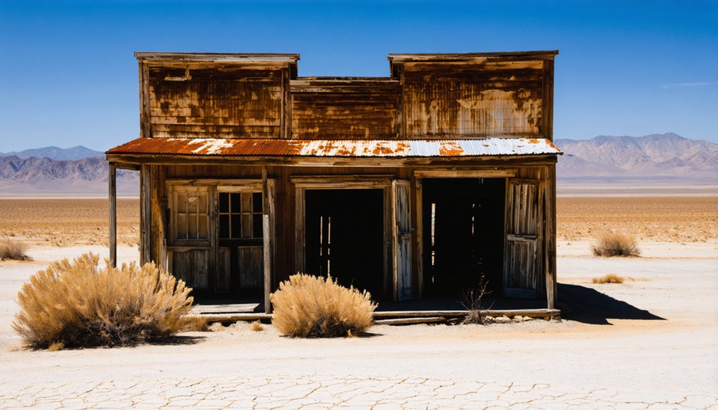
When you’re mapping out a California ghost town road trip, Little Dixie earns its place on the itinerary as a raw, unpolished stop that captures the boom-and-bust spirit defining so many of the state’s forgotten settlements.
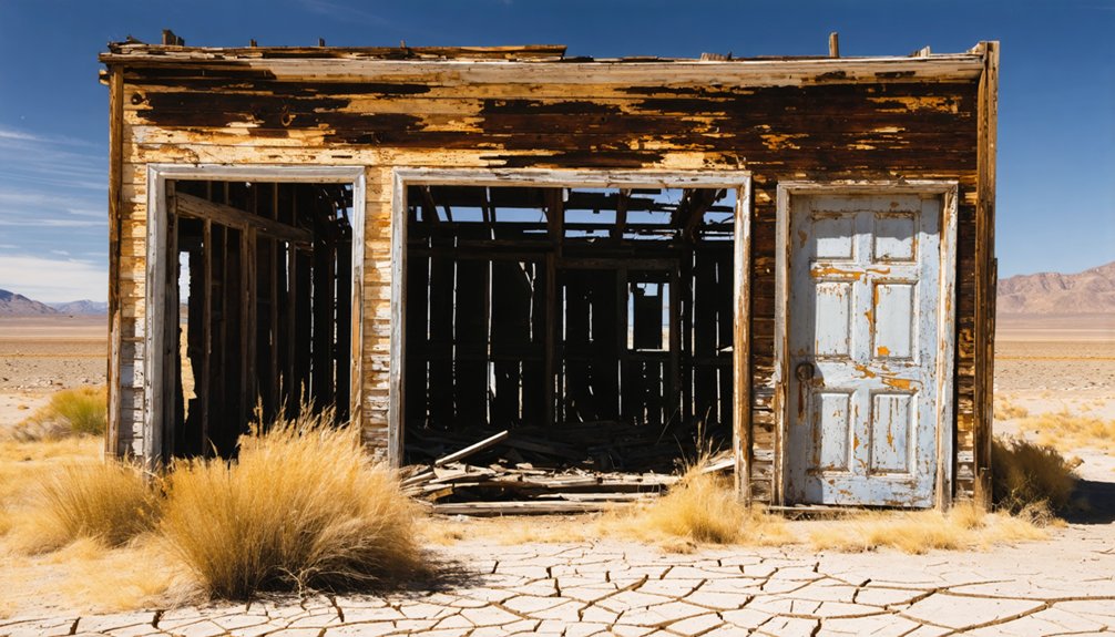
Unlike managed parks with paved lots and gift shops, Little Dixie pulls you into authentic ghost town culture where history hasn’t been sanitized for comfort. Its historical significance ties directly to California’s mining-era rise and collapse, mirroring the stories you’ll encounter at anchor stops like Bodie and Calico.
Local legends add another layer, giving the site a lived-in mystique that polished tourist destinations simply can’t replicate. If you crave roads less traveled and landscapes that still carry the weight of abandoned ambition, Little Dixie delivers exactly that.
How the Route Runs From Shasta State Historic Park to Calico
Your ghost town road trip kicks off at Shasta State Historic Park in Northern California and stretches roughly 770 miles south to Calico Ghost Town near Yermo, making it a logical 3-to-6-day drive with nine documented stops along the way.
You’ll navigate a mix of paved highways and rough back roads—including the final three unpaved miles into Bodie—so checking road conditions before each leg keeps the trip on track.
Pack ample supplies before heading into remote stretches, since services thin out fast once you leave the main corridors.
Route Overview And Distance
Three states of mind define this drive: anticipation, awe, and the satisfying ache of miles well spent.
You’ll cover roughly 770 miles across California’s most dramatic landscapes, tracing scenic routes from Shasta State Historic Park in the north down to Calico Ghost Town near Yermo in the south. This corridor cuts through Gold Rush country, Eastern Sierra high desert, and sun-baked Mojave terrain.
Every stretch rewards you with ghost town history etched into crumbling facades and rusted machinery. Plan for three to six days minimum. You’re not racing a clock — you’re reading a landscape.
Factor in remote roads, limited fuel stops, and rough final miles near certain sites. Little Dixie fits naturally into this corridor as a compelling detour worth building your day around.
Key Stops Along The Way
Knowing the miles is one thing — knowing where to stop is what turns a long drive into an actual ghost town expedition. Your route kicks off at Shasta State Historic Park, where Gold Rush remnants set the tone early.
Push south toward Bodie State Historic Park, California’s crown jewel of arrested decay, where mining history feels frozen mid-collapse. Bodie’s weathered saloons and rusting machinery carry genuine ghost town legends that no replica can match.
Continue through the Eastern Sierra, weaving past abandoned settlements before descending toward the Mojave. Little Dixie slots naturally into this corridor as a raw, unpolished detour.
Cap the journey at Calico Ghost Town, a structured park that contrasts sharply with the wild, untouched stops preceding it.
Road Conditions And Planning
Before you commit to the full Shasta-to-Calico run, understand what the road actually demands. This corridor stretches roughly 770 miles across dramatically shifting terrain, from Northern California’s forested highlands down through the Eastern Sierra and into the Mojave Desert.
Road safety isn’t optional here; it’s the whole game.
Vehicle preparation matters before you roll out. Check your tires, carry extra water, and pack emergency supplies because service stations disappear fast once you hit remote stretches near Bodie or the high desert.
That final three-mile unpaved approach into Bodie is manageable for most vehicles, but rough enough to punish neglect.
Always verify road conditions before departure, particularly on SR 270. Weather shifts quickly at elevation, and closures happen without much warning.
Plan your timing around summer months for the best access.
Best Time to Visit Ghost Towns Along the Eastern Sierra Corridor
Timing your visit to the Eastern Sierra ghost towns can make or break the experience. Prime seasons run from late spring through early fall, when roads are passable and daylight stretches long. Climate considerations matter here — winter snowfall regularly closes SR 270 to Bodie, cutting off access entirely.
- Summer (June–September): Peak visibility, full park hours (9 AM–6 PM at Bodie), and dry road conditions
- Spring/Fall: Fewer crowds, cooler temperatures, and dramatic light for photography — perfect for independent explorers
- Winter: Most remote sites become inaccessible; Bodie shifts to limited 9 AM–4 PM hours when reachable at all
Plan around Memorial Day through Labor Day for the most reliable access, and always check current road conditions before you roll out.
Nine Ghost Town Stops Worth Adding to Your Route
Once you’ve timed your visit around the Eastern Sierra’s seasonal windows, it’s worth stretching your itinerary to include nine stops that span California’s most compelling ghost-town corridor.
Each site brings something distinct to the route, from Bodie’s arrested decay and preserved frontier streetscapes to Calico’s organized park infrastructure and mining-era exhibits.
Plan your stop order strategically, moving north to south or anchoring around your base camp, so you’re not doubling back across remote stretches with limited fuel and services.
Top Stops To Consider
Whether you’re planning a three-day sprint or a full week behind the wheel, California’s ghost-town circuit rewards every mile with crumbling storefronts, rusting rail lines, and the kind of eerie silence that only abandoned boomtowns can deliver.
Nine stops anchor this route, blending ghost town preservation with raw mining heritage across a 770-mile north-to-south corridor.
- Bodie State Historic Park – Frozen in arrested decay, this Gold Rush relic sits seven miles southeast of Bridgeport off SR 270.
- Calico Ghost Town Regional Park – A structured park at 36600 Ghost Town Road, Yermo, open daily 9 AM–5 PM.
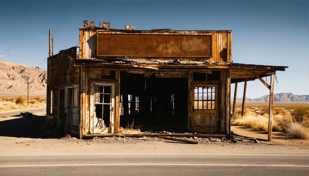
- Little Dixie – A thematic stop woven into the broader Eastern Sierra circuit, best explored alongside confirmed anchor sites.
Check road conditions before departing—remote stretches offer no services.
What Each Stop Offers
Nine stops stretch across California’s ghost-town corridor, and each one pulls you deeper into a different chapter of the state’s boom-and-bust history.
Bodie delivers arrested decay at its rawest, with abandoned structures frozen mid-collapse and local legends of lawless miners still circling the cold mountain air.
Calico offers organized visitor experiences, including guided tours and preserved civic buildings.
Shasta State Historic Park anchors the northern end with Gold Rush historical significance worth hours of exploration.
As you work Little Dixie into your scenic routes, treat it as a thematic extension of this broader circuit rather than a standalone destination.
Pack supplies, check road conditions, and research each stop before arriving.
The most rewarding ghost town travel tips always start with knowing exactly what you’re driving into.
Planning Your Route Order
Knowing what each stop offers is only half the work—sequencing them correctly saves you hundreds of backtracked miles. Start north at Shasta State Historic Park, then push southeast toward Bodie to absorb deep ghost town history before crowds arrive.
From Bodie, trace the Eastern Sierra south, folding in smaller settlements before finishing at Calico Ghost Town near Yermo. This north-to-south flow keeps drives manageable and visitor experiences cohesive.
- Drop Little Dixie into the Eastern Sierra segment where regional geography connects naturally
- Schedule Bodie early in the trip when energy is high and roads on SR 270 are easiest to assess
- End at Calico last since its full visitor infrastructure makes a comfortable final stop after rougher remote sites
Bodie State Historic Park: Fees, Hours, and Arrested Decay
Perched in Mono County about seven miles southeast of Bridgeport, Bodie State Historic Park stands as one of California’s most atmospheric ghost towns, preserved in a deliberate state of “arrested decay” — meaning the buildings and streets are left unrestored, aging naturally rather than being polished into a theme-park version of history.
Bodie history stretches back to the Gold Rush era, when booming mines drew thousands before the ore played out. Today, you’ll wander streets lined with ghost town architecture — weathered timber storefronts, collapsed rooftops, and rusting machinery frozen mid-abandonment.
The park opens daily at 9 AM, closing at 6 PM in summer and 4 PM in winter. Admission runs $8 for adults and $5 for children ages 4–17. Note that the final three miles require driving an unsurfaced road.
What the Road Into Remote Ghost Towns Actually Looks Like
Before you reach most California ghost towns, the pavement quietly disappears. You’ll trade smooth asphalt for rutted dirt tracks cutting through remote landscapes that feel genuinely forgotten.
Bodie’s final three miles run unpaved, rattling your gear and rewarding your patience with ghostly architecture frozen mid-collapse.
Pack before you roll out because services vanish fast once you leave the main highway:
- Water and fuel: Remote stretches offer nothing, so top off early
- Road conditions: Check SR 270 and similar routes before departure, especially after winter
- Vehicle clearance: Most ghost-town roads suit standard cars, but washboard surfaces demand slower speeds
That rough final stretch isn’t an obstacle — it’s the shift. The moment the road deteriorates, you know the real trip has begun.
How to Check Road Conditions Before You Leave
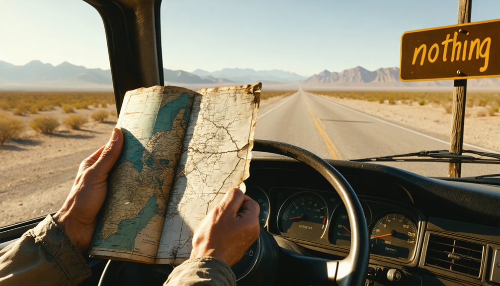
Dirt roads don’t care about your schedule, so check conditions before you commit to the drive. Call the local ranger station or county road department the morning you leave — conditions shift overnight after rain or wind.
For routes near Bodie, monitor SR 270 updates through Caltrans District 9, which covers the Eastern Sierra corridor.
Road safety starts with information, not assumptions. Check weather forecasts for the full corridor, not just your starting point. Desert stretches and mountain passes can hit different conditions within miles of each other.
Vehicle preparation matters equally. Confirm your spare tire is road-ready, carry extra water, and download offline maps before you lose cell service.
Remote ghost-town roads punish the unprepared and reward the methodical.
What to Pack for a Multi-Day Ghost Town Drive in California
Remote California ghost-town roads strip away convenience fast, so packing smart isn’t optional — it’s what keeps a mechanical hiccup from turning into a genuine emergency.
Services vanish quickly once you leave paved highways, and stretches near Bodie or Little Dixie offer little margin for error. Your packing essentials and food supplies determine whether the trip feels like freedom or frustration.
- Water and food supplies: Carry at least one gallon of water per person daily plus non-perishable snacks for unexpected delays
- Emergency gear: Pack jumper cables, a spare tire, basic tools, and a first-aid kit
- Navigation tools: Download offline maps since cell coverage drops frequently on remote desert routes
Pack deliberately, and the open road rewards you.
Where to Sleep Between Ghost Town Stops on the Eastern Sierra Route
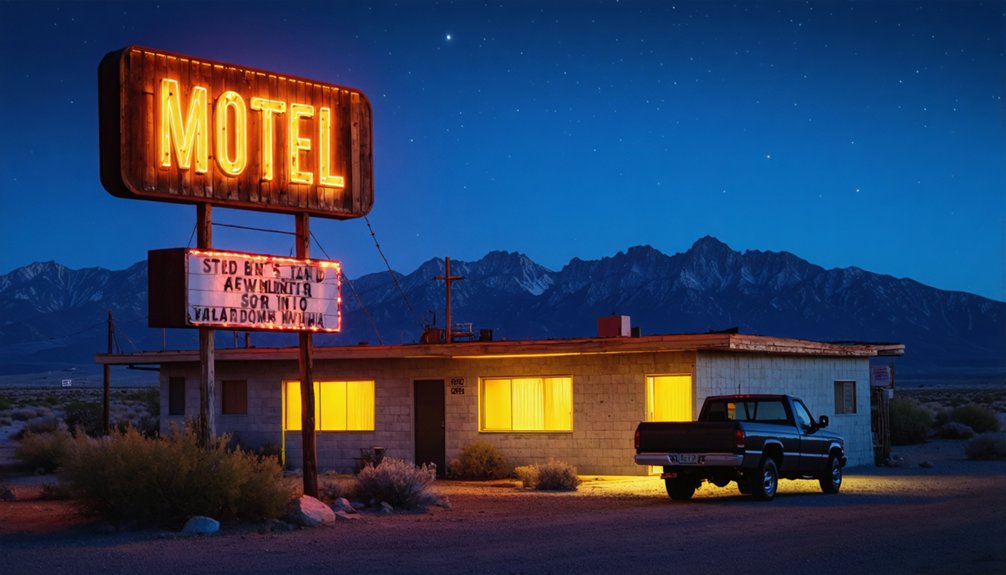
Gear loaded and snacks sorted, your next question shifts from what’s in the truck to where you’re laying your head when the sun drops behind the Sierra.
Eastern Sierra lodging runs the full spectrum — dusty roadside motels in Bridgeport, rustic cabins outside Lee Vining, and dispersed camping on Bureau of Land Management land where the only neighbors are jackrabbits.
Bridgeport sits closest to Bodie, making it a practical base for ghost town accommodations without sacrificing comfort entirely.
If you’d rather sleep under stars, free dispersed sites along US-395 corridors keep costs low and mornings wide open.
Book Bridgeport rooms early in summer — this corridor fills fast between Memorial Day and Labor Day, and you don’t want logistics killing your momentum.
Frequently Asked Questions
Is Little Dixie, California, Open to the Public Year-Round?
Like a door left ajar, Little Dixie’s ghost town history isn’t fully confirmed as year-round public access. You’ll want to check current visitor guidelines before hitting the open road toward this elusive California destination.
Are Pets Allowed at California Ghost Town Sites Like Calico?
Calico welcomes leashed pets, so you’ll navigate ghost town etiquette with your furry co-pilot in tow! Always check each site’s pet friendly policies beforehand, since rules vary across California’s wild, storied ghost towns.
Can Children Safely Explore Abandoned Ghost Town Buildings and Structures?
Keep children’s exploration supervised at ghost town safety hotspots—don’t let kids enter unstable abandoned structures. You’ll want to stick to marked paths, watch for hazards, and embrace the adventure responsibly while discovering history’s weathered remnants together.
Is There Cell Service Available Along the Eastern Sierra Ghost Town Route?
Over 70% of Eastern Sierra roads lack reliable coverage. Don’t count on cell service availability or eastern sierra connectivity out here — download offline maps, pack a satellite communicator, and embrace the liberating disconnection as you chase California’s ghost-town horizons.
Are Photography Permits Required at Any California Ghost Town Stops?
Most stops don’t require permits, but you’ll want to follow photography guidelines and ghost town etiquette—respect barriers, avoid disturbing artifacts, and always check with site staff before snapping shots at managed parks like Bodie or Calico.
References
- https://a.osmarks.net/content/wikipedia_en_all_maxi_2020-08/A/List_of_ghost_towns_in_California
- https://www.youtube.com/watch?v=4Li-p0y4zPU
- https://commons.wikimedia.org/wiki/Category:Ghost_towns_in_California
- https://www.youtube.com/watch?v=_HzKTSRR7IQ
- https://www.wikiwand.com/en/articles/List_of_ghost_towns_in_California
- https://nvtami.com/about/
- https://parks.sbcounty.gov/park/calico-ghost-town-regional-park/
- https://capitolmuseum.ca.gov/state-symbols/gold-rush-ghost-town-bodie/
- https://patch.com/california/banning-beaumont/13-ghost-towns-explore-california
- https://www.monocounty.org/places-to-go/bodie/


