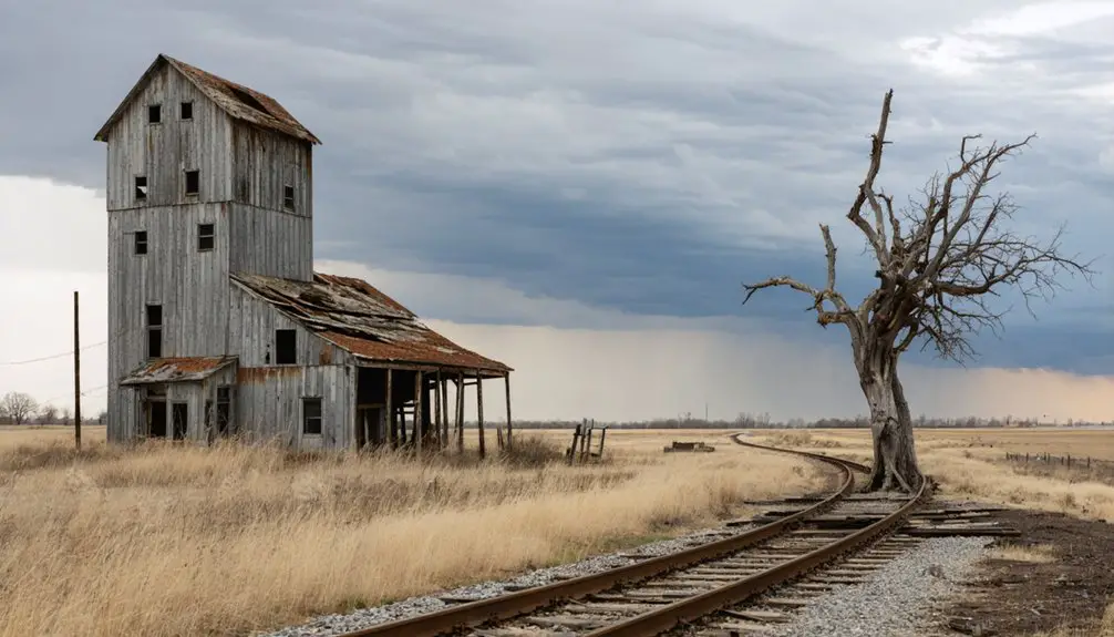
You’ll find Manganese’s haunting remnants 15 miles northeast of Brainerd, scattered across sections 23 and 28 of Wolford Township near Trommald. Summer offers the best access to explore weathered sidewalks splitting beneath forest growth, rusted mining equipment half-buried in brush, and faint street depressions marking where 41 miners perished in the 1924 Milford Mine disaster. Bring GPS coordinates, sturdy boots, and patience—complete solitude awaits in this nearly-erased landscape where civilization surrendered to nature’s relentless reclamation, though there’s much more to discover about traversing this ghost town adventure.
Key Takeaways
- Located 15 miles northeast of Brainerd near Trommald and Wolford, requiring GPS coordinates for navigation through sections 23 and 28.
- Visit during summer for best accessibility; spring thaw and winter snow create challenging exploration conditions.
- No buildings remain—expect only faint street depressions, crumbling foundations, weathered sidewalks, and rusted mining equipment in brush.
- Combine with nearby Cuyuna Country State Recreation Area featuring mountain biking, mine pit kayaking, and Milford Mine Memorial Park.
- Bring GPS and patience to locate scattered ruins; grid-pattern roads and railroad bed remnants barely visible through forest.
The Rise and Fall of a Cuyuna Range Mining Town
When Cuyuna Adams‘ drill bit struck manganiferous ore near Deerwood in May 1903, he triggered Minnesota’s second iron rush—thirteen years after the Merritt Brothers had uncovered the Mesabi Range’s riches. The Duluth Land and Timber Company platted Manganese in 1911, and by 1913, this 960-acre mining community was officially incorporated.
You’ll find fascinating migrant population demographics here—European immigrants descended 135-300 feet below surface, donning rain gear against constant water seepage from Foley Lake and surrounding bogs. These innovative mining techniques extracted high-grade manganese for stainless steel production through the 1920s.
Yet Manganese couldn’t escape tragedy: 41 miners drowned when Foley Lake breached the hastily-constructed Milford Mine in February 1924. By 1960, the town stood empty—another ghost marking Minnesota’s mining legacy.
What Remains of Manganese Today
If you venture into sections 23 and 28 of Wolford Township today, you’ll find nature has nearly erased Manganese from the landscape. Natural vegetation reclamation has consumed what civilization left behind—willow and aspen trees now tower where homes once stood, their roots heaving through cracked concrete sidewalks.
You’ll discover scattered remnants of a community that vanished:
- Crumbling building foundations buried beneath decades of growth
- Grid-pattern roads barely visible through encroaching forest
- Weathered sidewalks splitting under relentless roots and shrubs
- Modern debris—old tires, beer cans, clothing scraps—mingling with historical rubble
- Primitive campsites carved from wooded lots since 2017
Long term site preservation isn’t a priority here. Instead, you’re witnessing natural reclamation in action, where each season further obscures what remains of Minnesota’s cursed mining town.
Getting to the Ghost Town Site in Crow Wing County
You’ll find Manganese’s scattered ruins 15 miles northeast of Brainerd, tucked between the tiny crossroads of Trommald and Wolford along the historic Cuyuna Iron Range. The ghost town sits just off the region’s main arteries—Highway 371 and the scenic routes threading through central Minnesota’s lake country—making it an easy detour during a Brainerd-area adventure.
Once you’ve traced the overgrown streets where miners once walked, the nearby Cuyuna Country State Recreation Area offers striking red-water mine pit lakes that tell the broader story of this iron-rich landscape.
Locating the Manganese Remnants
Finding the scattered traces of Manganese requires a journey into the rural backroads of Crow Wing County, where the ghost town once thrived between Coles Lake and Flynn Lake on the Cuyuna Iron Range. Mapping remains proves challenging—no official markers guide you, and most structures vanished decades ago. You’ll need GPS coordinates for the lakes and patience to explore sections 23 and 28 of Wolford Township. Locating access points means following unmarked Wolford Township roads roughly two miles north of Trommald.
What you might discover:
- Rusted mining equipment half-buried in brush
- Faint depressions where streets once intersected
- Remnants of the Soo Line railroad bed
- Overgrown foundations peeking through forest floor
- Clay road traces barely visible through vegetation
Tread carefully—this landscape belongs to those seeking unguided exploration.
Nearby Cuyuna Range Attractions
Beyond the ghost town’s vanished streets, the Cuyuna Country State Recreation Area transforms this historic mining landscape into an outdoor playground where rusted relics meet crystal-clear waters. You’ll discover 70 miles of world-class mountain biking trails carving through red dirt—those old miner tracks now offering sustainable recreation opportunities for all skill levels.
The flooded mine pits reveal 40-foot underwater visibility, perfect for kayaking Portsmouth and Huntington Lakes in glass-bottom rentals from Cuyuna Outfitters.
Hike to Miner’s Mountain for panoramic lake views, or explore ecotourism developments like the Milford Mine Memorial Park, where a boardwalk leads to the 1924 disaster’s escape shaft. The Cuyuna Heritage Museum chronicles how this scarred earth became your gateway to adventure, proving abandoned doesn’t mean forgotten.
Best Times to Visit and What to Expect
Summer emerges as the ideal window for visiting Manganese, when the clay streets that once channeled nearly 600 residents through their daily routines have dried into navigable pathways. Seasonal weather patterns dictate your experience—spring thaw transforms roads into muddy obstacles, while winter snow buries what little remains. You’ll navigate accessibility challenges through unmaintained gravel routes two miles north of Trommald, so plan accordingly.
Expect profound emptiness where a mining community thrived until 1960:
- No structures survive; buildings vanished decades ago
- No facilities, services, or modern lighting exist
- Clay road remnants trace the former town layout
- Subtle foundations and landscape depressions mark history
- Complete solitude in an unsettling, nearly-erased landscape
Bring your imagination—this ghost town rewards those who appreciate whispered histories over preserved landmarks.
Nearby Attractions and Other Abandoned Towns to Explore

While Manganese offers little more than imagination fuel, Minnesota’s Iron Range spreads a constellation of abandoned communities across its forested landscape—each bearing distinct scars from industrial collapse.
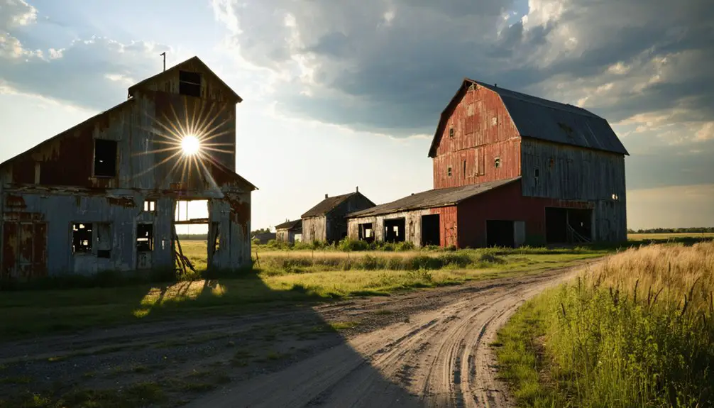
Head northeast to Taconite Harbor, where preserved cabin foundations and cracked basketball courts mark a 1950s company town swallowed by wilderness. You’ll find remnants of commercial buildings scattered throughout the region’s ghost settlements—Forestville’s wooden structures stand frozen in time, while Dorothy vanished almost entirely after its 1973 railroad abandonment.
Old Wadena offers reconstructed trading post buildings if you’re craving context beyond ruins. Sawbill Landing’s logging-camp origins left barely a trace. Each site demands off-pavement exploration, sturdy boots, and respect for private property. These aren’t theme parks—they’re authentic relics awaiting your discovery.
Tips for Documenting Your Ghost Town Adventure
You’ll want to pack your mirrorless camera and wide-angle lens to capture Manganese’s weathered structures as morning light rakes across collapsed mining buildings.
Before you arrive, research the town’s iron ore history and map out remnants like the old mill foundations and rusted equipment scattered through the forest.
Set your tripod low among the overgrown artifacts, using long exposures to reveal details the naked eye might miss in the dim, tree-filtered light.
Photography Equipment and Techniques
Since abandoned structures rarely offer adequate natural light, bringing the right photography gear transforms your Manganese ghost town documentation from frustrating snapshots into compelling visual stories. Pack a sturdy tripod for those 30-second exposures under Minnesota’s dark skies, and bring extra camera batteries since cold weather drains them fast.
Your essential kit should include:
- Wide-angle lens (14-24mm) for capturing entire main street scenes
- Fast f/2.8 aperture lens for high ISO shots with minimal noise
- Powerful LED flashlight for illuminating interiors and assisting focus
- Sensor cleaning kit—dust infiltrates everything in abandoned buildings
- Shutter release cable to eliminate shake during long exposures
Manual mode works best: try ISO 6400 at f/2.8 for starlit exteriors, or ISO 400 at f/4.0 with LED assistance inside structures. These ghost hunting techniques capture details other visitors miss.
Historical Research Before Visiting
Before you navigate the backroads to Manganese’s vanishing footprint, arm yourself with historical context that transforms overgrown foundations into vivid scenes from 1919, when nearly 600 residents crowded two bustling hotels and lined up at the barbershop on Saturday nights.
Your background research starts with the GNIS feature ID records, confirming Manganese’s March 13, 1912 official start and its 1961 dissolution into Wolford Township. Reviewing primary sources reveals why this “Hibbing of the Cuyuna Range” vanished—post-WWI mining slowdowns sent families trudging through spring’s notorious clay-mud streets toward more promising towns.
Track down 1919 census data, mining company records, and Crow Wing County archives. You’ll discover the water tower’s scrap metal fate, pinpoint where streetlights glowed until the early 1970s, and understand why no railroad connections sealed this community’s swift disappearance.
Mapping Remnants and Landmarks
When you step onto Manganese’s ghost-grid today, broken concrete sidewalks jutting through tangled willow roots become your primary navigation tools—these stubborn remnants still trace the original three north-south and five east-west streets that once channeled Saturday evening foot traffic toward now-vanished barbershops and mercantiles.
Mapping site boundaries requires interpreting mapped remnants beneath decades of natural reclamation:
- Foundation footprints reveal building sizes—the Fitger Hotel’s crumbling base marks the former commercial heart
- Graffiti-covered basements indicate residential clusters swallowed by brush
- Curbing fragments define property lines where aspen now grows
- Scattered mining equipment pinpoints industrial zones
- Cultural artifacts—old tires, clothing scraps, beer cans—cluster near former gathering spots
Since private ownership restricts casual exploration, attending Manganese Base Camp’s annual festival grants legitimate access for documenting this vanishing landscape.
Frequently Asked Questions
Are There Any Safety Hazards at the Manganese Ghost Town Site?
Yes, significant exposure risks await you—toxic manganese dust, contaminated water, and unstable ground threaten your health. Trespassing concerns add legal complications, while collapsing structures and hidden pit edges make exploration dangerous. Agencies strongly warn against visiting this hazardous abandoned site.
Is Camping Allowed Near the Former Manganese Townsite?
I don’t have specific information about camping regulations near the former Manganese townsite. You’ll need to research local land management policies, though the area’s scenic overlooks and nearby hiking trails suggest potential for backcountry exploration and overnight adventures.
What Photography Equipment Works Best for Documenting Ghost Town Visits?
Half of abandoned-place shots need tripods for long exposures capturing Manganese’s eerie stillness. You’ll want sturdy tripod recommendations for 2-30 second shots, plus quality flashlights meeting lighting requirements to illuminate forgotten corners and paint crumbling structures with off-camera flash.
Are There Guided Tours Available for Cuyuna Range Mining History?
You’ll discover guided mining museum tours at the Soo Line Depot and Croft Mine Historical Park, where you can explore authentic underground experiences. Historical interpretive signage throughout Milford Memorial Park lets you wander independently through mining tragedy’s haunting legacy.
Do I Need Permission to Explore the Manganese Site?
You’ll navigate a legal gray area—while clay roads remain open, private property concerns linger on former lots. No environmental regulations restrict access, but verify boundaries before exploring. Respect landowner rights while discovering this vanished mining community’s haunting remnants.