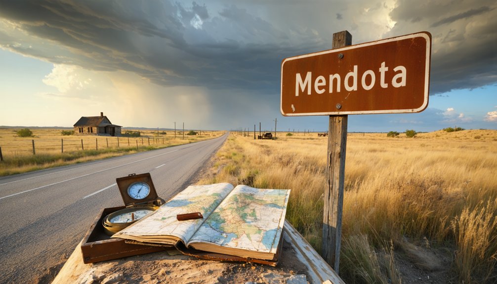
You’ll find Mendota’s ghost town remnants about 10-15 miles southeast of Canadian, Texas, accessible via US-60 from Amarillo before connecting to Panhandle routes. Plan your visit during March-April or September-November when temperatures stay comfortable and wildflowers paint the grasslands. Pack offline maps since cell service vanishes quickly, bring extra water, and download USGS 7.5′ topos beforehand—the crumbling foundations and faint street grids hiding in sandy soil reward prepared explorers who respect posted boundaries and understand what lies beneath this windswept landscape.
Key Takeaways
- Launch from Canadian, Texas; take US-60 east from Amarillo, then connect to Panhandle routes into Hemphill County.
- Download offline maps and USGS 7.5′ topo maps beforehand as cell service and road details disappear quickly.
- Visit March-April or September-November for ideal weather; avoid June-August extreme heat during outdoor exploration.
- Pack extra water and supplies; no facilities remain at this remote ghost town site requiring complete self-sufficiency.
- Expect only crumbling foundations and faint street layouts; no historic markers or preserved buildings mark Mendota’s location.
The Rise and Fall of a Missouri Settlement in the Texas Panhandle
When Missouri farmers arrived at Red Deer Creek in 1887, they carried dreams of transforming Hemphill County’s raw grasslands into productive farmland. You’ll find their story begins with ambitious advertisements promising “greener pastures” that lured 100 settlers westward. Early town planning decisions established essential infrastructure—a school, church, store, post office, and lumberyard—creating the framework for former economic stability.
But freedom comes with risks. Twenty years later, the town relocated toward the Panhandle and Santa Fe Railroad, chasing opportunity. Instead, they found their downfall. Sandy soil frustrated farmers, forcing a pivot to grain and cattle operations. Meanwhile, nearby Canadian, the county seat, drew away commerce and residents. By 1944, even the post office closed, leaving only cattle switches and scattered memories.
What Remains of Mendota Today
When you arrive at Mendota’s former townsite today, you’ll find little more than crumbling foundations scattered across the windswept Texas Panhandle grassland—the small school and cattle switch that once marked civilization’s last stand here have vanished into memory.
The sandy soil that doomed the town’s agricultural dreams now supports thriving deer populations, transforming the ghost town into prime hunting territory where sportsmen track wildlife across the same open ranges where homesteaders once struggled to cultivate crops.
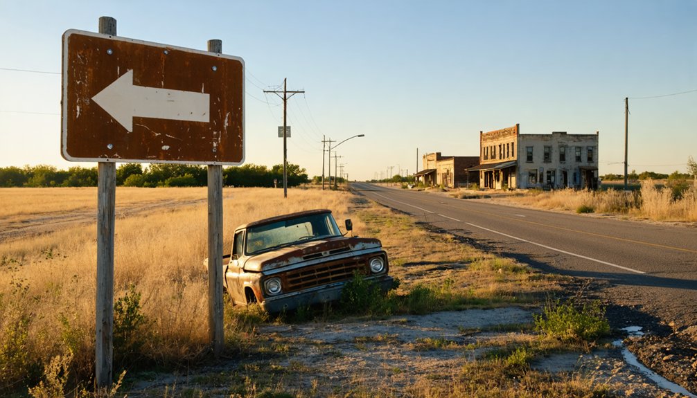
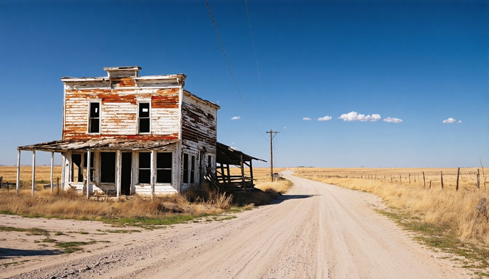
If you’re hoping to photograph weathered buildings like those at other preserved ghost towns, you’ll be disappointed; Mendota exists primarily as an absence, a story told through empty space rather than standing structures.
Scattered Structures and Landmarks
The windswept plains where Mendota once thrived now stretch endlessly under the Texas sky, revealing almost nothing of the community that housed 100 residents at its peak. You’ll strain to spot remnant foundations where the general store and church once anchored daily life. The faint street layouts emerge only when light hits just right across the sandy soil—those same conditions that ultimately strangled this settlement’s agricultural dreams.
The small rural schoolhouse stood longest after the 1944 post office closure, serving scattered ranching families until it too vanished. Today’s landscape offers pure openness, attracting deer hunters who appreciate the solitude. Don’t expect historic markers or preserved buildings—Mendota’s story lives in the vast emptiness itself, a record of Panhandle communities that couldn’t outlast nature’s harsh judgment.
Modern Recreational Land Use
Absolutely nothing connects modern Mendota, California—a small agricultural city in Fresno County—with the ghost town remnants scattered across the Texas Panhandle. Yet understanding recreational zoning changes in today’s West Texas landscape reveals how water scarcity shapes your exploration options. Water supply constraints have transformed potential recreation areas into restricted zones, affecting 40 million people and limiting your access to formerly open spaces.
You’ll find dredge-and-fill permits now govern even minor waterway modifications near ghost towns. The expiring 2026 allocation guidelines mean tighter environmental reviews ahead. Smart travelers scout LiDAR data beforehand to identify accessible natural areas.
While California’s agricultural districts manage 5.5 million irrigated acres differently, Texas ghost town visits demand self-sufficiency—pack extra water, respect posted boundaries, and embrace the isolation that defines authentic backcountry freedom.
Getting to Mendota: Directions and Route Planning
Traversing to Mendota requires some patience since you won’t find this ghost town on most GPS systems anymore. Your best bet? Use Canadian, Texas as your launching point—it’s roughly 10-15 miles southeast and serves as the gateway to this vanished settlement.
Exploring other ghost towns near Fort Holland can also yield fascinating stories of the past and the people who once lived there. Each site offers a unique glimpse into history, with remnants of buildings and roads that tell tales of forgotten lives. Make sure to prepare for some off-road adventures, as many of these locations are tucked away and not easily reached.
From Amarillo, you’ll take US-60 east before connecting to Panhandle routes into Hemphill County. Road network details get sparse here, so grab a USGS 7.5′ topo map beforehand.
Charting historical routes means following cattle switches and rural paths that once bustled with grain traders. The satellite imagery on Texas Escapes helps identify old streets and administrative boundaries. Pack offline maps, because cell service disappears fast.
This isn’t a turn-by-turn journey—it’s exploration where dusty roads lead you back through Texas Panhandle history.
Best Time to Visit the Panhandle Ghost Town
- March-April: Ideal weather with wildflowers blooming across the Panhandle landscape
- September-November: Mild temperatures with vibrant fall colors and minimal crowds
- February: Rock-bottom accommodation costs ($60-$120) and empty ghost town streets
- Late autumn: Post-rain clarity guarantees comfortable hiking and photography conditions
- Avoid June-August: Extreme heat makes outdoor exploration genuinely miserable
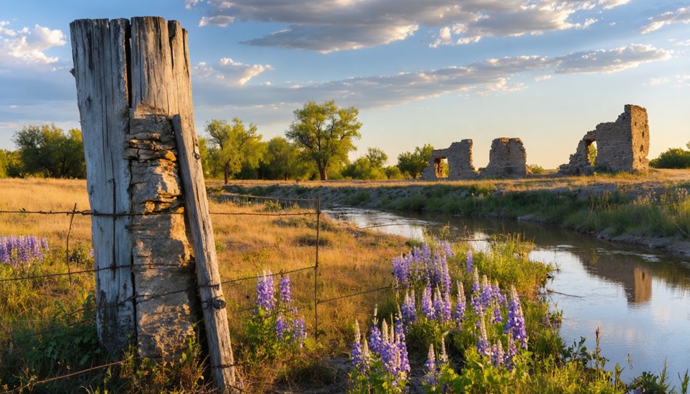
Exploring the Original Townsite and Red Deer Creek Area
When you arrive at Mendota’s original site in western Hemphill County, you’ll need to use topographic maps or GPS coordinates to pinpoint Red Deer Creek’s meandering path through the prairie—it’s the only reliable landmark left.
The town boundaries have vanished beneath decades of grass and erosion, but look for subtle depressions in the earth where buildings once stood and traces of the old road grid.
Walking the creekbanks at dawn reveals the settlement’s logic: early settlers chose this spot for dependable water access, though the sandy soil that doomed their farms still shifts beneath your boots today.
Locating Red Deer Creek
Finding Red Deer Creek today requires patience and a willingness to explore Hemphill County’s expansive Panhandle terrain, where the original Mendota townsite sits quietly along the creek’s banks. You’ll navigate flat landscapes where visibility stretches for miles, making regional water sources like this creek stand out against the prairie. The original creek location remains accessible through rural roads, though you won’t find signage marking your destination.
Tips for locating the creek:
- Study topographic maps before heading out to identify drainage patterns
- Look for slight depressions in the flat terrain indicating water channels
- Watch for cottonwood trees clustering near moisture sources
- Bring GPS coordinates and backup navigation tools
- Explore during early morning when light reveals landscape contours best
The adventure lies in the discovery itself.
Identifying Original Town Boundaries
Most visitors discover the original Mendota townsite bears little resemblance to the thriving agricultural settlement that once spread across Red Deer Creek’s banks in 1887. You’ll need USGS topographic maps—particularly the 1967 Mendota Quadrangle at 1:24,000 scale—for mapping town boundaries accurately.
The original plat encompassed the school, church, store, post office, and lumberyard before abandonment in 1907. When analyzing historical plats, you’ll notice the townsite’s western Hemphill County position clearly marked on these detailed surveys. The Portal to Texas History archives provide high-resolution reproductions that’ll help you pinpoint where those first Missouri farmers settled.
Don’t expect street signs or preserved structures—you’re tracking coordinates and creek contours to locate where this prairie community once thrived before railroad proximity lured everyone away.
Nearby Canadian, Texas: County Seat and Modern Amenities
While Mendota faded into obscurity, Canadian—just a short drive away—thrived as Hemphill County‘s seat of government since 1887. You’ll find this town’s founding history fascinating: E. P. Purcell and O. H. Nelson laid out the 240-acre townsite that spring, and within months, the Southern Kansas Railway bridge transformed a temporary tent city into a permanent settlement.
From tent city to county seat: Canadian’s transformation began when the Southern Kansas Railway bridge sparked permanent settlement in 1887.
Today’s Canadian offers essential modern day amenities for road-trippers:
- Gas stations and supplies along the main routes
- The historic 1890 Hemphill County Jail, now a Texas Historic Landmark
- Local library housed in the old Woman’s Christian Temperance Union building
- Restaurants serving hearty Panhandle fare
- Hotels replacing Nelson Peet’s original Log Cabin establishment
With 2,339 residents, you’ll experience authentic small-town hospitality while exploring nearby ghost towns.
Other Abandoned Settlements Worth Visiting in Hemphill County
Beyond Mendota’s vanished streets, Hemphill County harbors additional ghost towns that’ll reward your exploration with glimpses into the Panhandle’s ranching past. Gem stands out among these forgotten places—once a thriving ranching community until its post office closed in March 1954, sending residents elsewhere. You’ll find its story documented in *Cowmen and Ladies: A History of Hemphill County*.
East Mayfield’s historical significance is marked by a 1997 Texas Historical Commission plaque, offering tangible connection to settlement patterns. While the impact of Toledo Bend Reservoir on Robinson Bend occurred outside Hemphill County proper, it illustrates how infrastructure transforms landscapes. You’re free to roam these sites independently, photographing remnants and imagining the determination of pioneers who carved lives from unforgiving prairie.
Photography Tips for Capturing Panhandle Ghost Town Landscapes
Your camera becomes a time machine in these abandoned Panhandle spaces, preserving what another season’s windstorm might erase forever. Wide-angle lenses capture the isolation’s full scope while prime lenses reveal intimate details—rusted door handles, weathered signage, forgotten tools that define Mendota’s aesthetic mood.
Golden hour light transforms ordinary facades into haunting compositions, casting shadows that dance across peeling paint.
Essential shooting techniques:
- Bring tripods for stable long exposures in dim interiors
- Use flashlights to spotlight historical artifacts hidden in darkness
- Shoot during golden hour when soft light enhances texture
- Frame window reflections for layered, mysterious compositions
- Try black-and-white processing to amplify the desolate atmosphere
Pack extra batteries—Panhandle cold drains them fast. Document everything; these structures won’t wait for your return visit.
Safety Considerations and Land Access Permissions
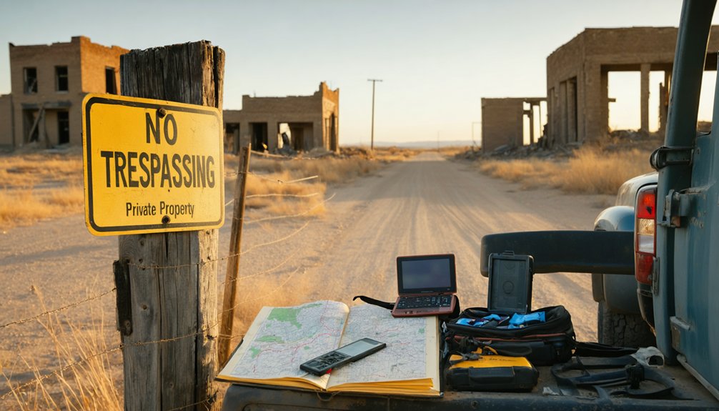
Before you step onto Mendota’s cracked sidewalks, understand that these ghost towns aren’t public parks—they’re privately owned land where trespass charges carry real consequences. You’ll need written permission from property owners, though tracking down descendants of original settlers often requires courthouse records and genealogical detective work.
Historic preservation laws might protect certain structures, restricting your movement through fragile buildings even with access. Zoning compliance matters less in abandoned areas, but don’t assume you’re free to roam. Without utilities, water, or emergency services, you’re genuinely on your own.
Smart explorers secure express easements through neighboring landowners before visiting, avoiding prescriptive easement battles requiring ten years of continuous use. Pack emergency supplies, share your location, and respect private property boundaries—your freedom depends on it.
Frequently Asked Questions
Are There Any Guided Tours Available for Mendota Ghost Town?
Like a tumbleweed rolling solo across prairie, you’ll explore Mendota independently—no guided tours exist here. You’re free to create your own self-guided tours through remnants, though virtual tours and historical maps help plan your untethered adventure beforehand.
What Hunting Licenses Are Required for Recreational Activities Near Mendota?
You’ll need a standard Resident Hunting License ($25) or Non-Resident ($315) to hunt near Mendota, plus required endorsements. Local wildlife regulations vary by species, so check hunting permit requirements beforehand. Feral hogs need no license—perfect for freedom-seeking hunters.
Can Visitors Camp Overnight at the Mendota Townsite?
Like tumbleweeds rolling freely across open plains, you can’t camp overnight at Mendota’s townsite without private landowner permissions. No overnight camping facilities exist here, and Texas law prohibits unauthorized public space camping—seek alternatives nearby instead.
Are There Any Historical Markers Identifying the Original Town Buildings?
No historical markers identify Mendota’s original buildings—the site’s completely barren today. You’ll find zero architectural remnants or plaques marking the school, church, or store’s historical significance. It’s raw, unmarked prairie reclaimed by time and nature.
What Wildlife Species Are Commonly Encountered in the Mendota Area?
You’ll spot an absolutely *endless* variety of native bird species like roadrunners and hawks soaring overhead. The scrubby local plant diversity attracts rabbits, coyotes, and rattlesnakes—so watch your step while exploring this wild, untamed Texas landscape.


