Planning a ghost town road trip to Mina, Kansas means heading to Marshall County, about 20 miles northeast of Marysville. Founded in 1889 along the Missouri Pacific Railroad, Mina once had a post office, grain warehouse, and a population of 38 before fading into farmland by 1925. You’ll need printed maps, GPS coordinates from LegendsOfKansas.com, and a full tank of gas. Stick to late spring or early fall for the best road conditions. There’s more to uncover about this forgotten Kansas railroad town.
Key Takeaways
- Mina, Kansas, located in Marshall County, is best visited in late spring or early fall to avoid muddy rural roads.
- The townsite is open farmland today, but its railroad history makes it a rewarding destination for ghost town enthusiasts.
- Use LegendsOfKansas.com for precise GPS coordinates, as Mina does not appear on most modern maps.
- Bring printed maps, a full gas tank, and essential supplies, as the nearest stations are in Axtell or Marysville.
- Pair your visit with nearby ghost towns like Summerfield and Axtell for a full day of historical exploration.
What Was Mina, Kansas: and Is It Worth the Drive?
Once a quiet trading hub tucked between Axtell and Summerfield in Marshall County, Kansas, Mina earned its place on the map in 1889 when W.G. Wooley and Newman Erb laid out the town. Named for J.R. Sittler’s wife, Mina’s significance stretched beyond sentiment.
Sittler had already built a grain warehouse the year before, and the Missouri Pacific Railroad had laid tracks in 1887, setting the stage for real commerce.
Historical anecdotes paint a town that punched above its weight. By 1917, grain and livestock shipping peaked despite a population of only 13. A church, general store, and brick depot kept things moving.
But the railroad eventually failed, the depot was razed, and the post office closed in 1925.
The Rise and Fall of Mina, Kansas’s Railroad Town
Few railroad towns rose and fell as quietly as Mina, Kansas, yet its arc tells a story that’s surprisingly sharp. When the Missouri Pacific Railroad laid tracks through Marshall County in 1887, it sparked real momentum. J.R. Sittler built a grain warehouse, a depot went up, and by 1889 the town had a name and a layout. That railroad heritage drew settlers, commerce, and a functioning community.
But the numbers tell an honest story. Population peaked at just 38 in 1910, then dropped to 13 by 1917, even as grain and livestock shipping hit their high point.
When the railroad eventually failed, everything followed. The depot sold and came down. The schoolhouse moved. The post office closed in 1925. Mina’s town legacy quietly dissolved back into farmland.
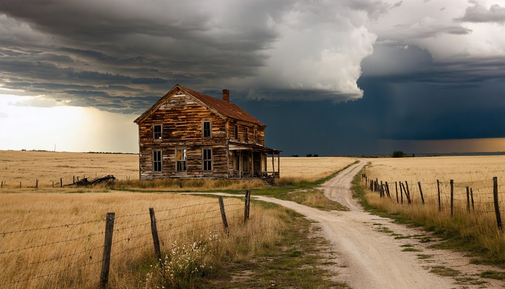
What’s Left to See at the Mina Townsite Today?
Arriving at the Mina townsite today, you’ll find little more than open farmland where a functioning community once stood. The brick depot was sold and razed long ago, the schoolhouse relocated, and the post office shuttered in 1925.
Mina remnants are fundamentally invisible to the untrained eye.
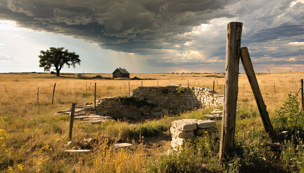
Still, ghost town exploration here rewards the curious traveler. The landscape itself tells a quiet story — flat Kansas terrain that once bustled with grain shipments, livestock drives, and a thriving church congregation.
Even empty fields hold stories — grain, livestock, and faith once filled this quiet Kansas horizon.
You’re standing where 38 souls once built a real community around a railroad dream.
Bring a good map, reference LegendsOfKansas.com for precise coordinates, and pair your visit with nearby Marshall County ghost town stops to make the journey worthwhile.
Where Exactly Is Mina, Kansas?
Mina sits in Marshall County, Kansas, roughly 20 miles northeast of Marysville — tucked between the small communities of Axtell and Summerfield along what were once Missouri Pacific Railroad corridors.
That Mina geography places it within a quietly dramatic stretch of northeastern Kansas farmland, where rolling plains meet forgotten crossroads.
You won’t find it on modern maps without some digging. Check LegendsOfKansas.com for exact coordinates before you head out, and download an offline map just in case your signal drops on those rural county roads.
Its historical significance stems from its role as a key grain and livestock shipping point connecting two small communities.
Once you understand that, standing on that empty farmland hits differently — you’re not just visiting a field, you’re standing inside a vanished economy.
How to Drive to Mina on Marshall County’s Back Roads
Getting to Mina means embracing the kind of drive where your GPS goes quiet and the county roads do the talking.
Position yourself between Axtell and Summerfield, roughly 20 miles northeast of Marysville, and follow Marshall County’s unmarked back roads toward where Mina’s legacy once thrived.
Before you head out for ghost town exploration, pack these essentials:
- Printed maps or screenshots — cell service disappears fast on rural county roads
- Coordinates from LegendsOfKansas.com — your most reliable reference for pinpointing the exact townsite
- A full tank of gas — nearest stations sit back in Axtell or Marysville
The farmland swallowing Mina’s old footprint won’t announce itself.
You’ll need sharp eyes, patience, and a genuine appetite for roads that reward the curious.
Best Seasons to Visit Mina Without Getting Stranded on County Roads
Once you’ve mapped your route between Axtell and Summerfield, your next decision carries just as much weight — picking the right season to make that drive without ending up axle-deep in mud or snowdrift.
For road trip safety on Marshall County’s unpaved stretches, late spring and early fall are your best travel seasons. May and September typically offer firm ground, mild temperatures, and clear sightlines across the farmland where Mina once stood.
Late spring and early fall keep Marshall County’s unpaved roads firm, mild, and clear for chasing Mina’s forgotten farmland.
Summer works too, though Kansas heat hits hard and afternoon storms can turn gravel roads slick fast.
Avoid late winter and early spring entirely. Snowmelt soaks those county roads deep, and you won’t find a tow truck waiting nearby.
Plan smart, travel light, and you’ll reach Mina’s forgotten townsite without a rescue call.
What to Pack for a Mina, Kansas Ghost Town Visit

Packing for a ghost town visit sounds simple until you remember you’re heading to an extinct farmland site miles from the nearest town, with no services, no shelter, and no cell signal guarantee.
Your packing essentials determine whether this adventure stays fun or turns frustrating fast.
1. Navigation tools – Download offline maps before leaving.
County roads near Axtell and Summerfield won’t forgive poor preparation.
2. Photography tips gear – Bring a wide-angle lens, extra batteries, and a polarizing filter to capture flat Kansas light beautifully against open farmland.
3. Survival basics – Pack water, snacks, a first-aid kit, and a portable charger.
You’re free out here, but freedom rewards those who prepare.
Best Ghost Towns to Pair With Your Mina Road Trip
Mina doesn’t have to be the only ghost town on your Marshall County itinerary, and frankly, it shouldn’t be. The region holds several forgotten communities worth exploring alongside Mina, each offering distinct layers of history and compelling ghost town photography opportunities.
Route your drive through Summerfield and Axtell, the two towns that once flanked Mina as trading points along the Missouri Pacific line. Watch for historical markers that reveal settlement patterns, failed railroad ambitions, and vanished communities that once bustled with grain commerce.
LegendsOfKansas.com maps multiple Marshall County extinct towns you can string together efficiently. YouTube channels like Travel with a Wise Guy also document these routes visually, helping you plan stops in advance.
Combining destinations transforms a single-site visit into a full-day journey through Kansas’s layered, often heartbreaking frontier past.
More Marshall County Ghost Towns Near Mina
Marshall County holds more ghost towns beyond Mina, so you can easily string together a full day of exploration along its county roads.
Towns like Axtell and Summerfield sit nearby, giving you natural anchor points as you trace the routes where old railroad stops once thrived.
Planning a cluster visit lets you cover more ground efficiently while deepening your sense of how dramatically this region’s small communities rose and faded together.
Nearby Extinct Town Clusters
Once you’ve explored Mina’s quiet farmland and faded footprint, Marshall County rewards curious ghost town hunters with an entire cluster of nearby extinct towns worth tracking down.
These extinct town clusters share similar railroad-era stories, making each stop a layered historical landmark experience.
Hit these three spots along your route:
- Axtell – A surviving small town anchoring the western edge of Mina’s old trading corridor, offering context for the region’s past commerce.
- Summerfield – Located east of Mina, this community marks the opposite end of the original trading point route.
- Additional Marshall County ghost sites – Cross-reference LegendsOfKansas.com for precise coordinates pinpointing forgotten townsites scattered across nearby rural sections.
Driving these county roads connects the dots between communities that once thrived and now quietly return to the land.
Marshall County Ghost Town Routes
Extending your route beyond Mina’s cluster of nearby stops opens up a broader network of Marshall County ghost towns worth tracking down.
Marshall County holds remarkable ghost town history, with numerous communities that rose and fell alongside railroad significance in the late 1800s and early 1900s. Like Mina, many of these towns depended entirely on Missouri Pacific and other rail lines for survival.
When those lines failed or shifted, towns vanished almost overnight. LegendsOfKansas.com provides coordinates and background details for multiple Marshall County sites, making it your most practical planning tool.
Pair that resource with YouTube compilations like *64 Kansas Ghost Towns* for visual references before you hit the county roads. You’ll cover more ground and gain a richer understanding of the region’s forgotten past.
Combining Multiple Town Visits
Pairing Mina with other Marshall County ghost towns lets you build a full day of exploration without backtracking unnecessarily.
The region rewards curious travelers who value ghost town exploration on their own terms.
Here are three nearby stops worth adding to your route:
- Summerfield – Just down the road from Mina, this quiet community carries genuine historical significance as a former thriving trade hub.
- Axtell – A natural bookend to Mina, offering visible remnants of early settler infrastructure worth photographing.
- Blue Rapids – Slightly farther but rich with Marshall County history, including limestone architecture that tells its own story.
Cross-reference LegendsOfKansas.com for exact coordinates before heading out.
Mapping these stops together maximizes your drive time and deepens your understanding of the region’s layered past.
How to Find Mina’s Exact Location Using Online Maps
Finding Mina’s exact location on modern maps takes a bit of detective work, but it’s entirely doable with the right online tools.
Start with LegendsOfKansas.com, which provides precise coordinates and ghost town mapping resources specifically covering Marshall County’s extinct settlements. Once you’ve got those coordinates, drop them into Google Maps or OnX Maps for satellite imagery that reveals the old townsite’s footprint within surrounding farmland.
Cross-reference historical significance by checking Marshall County plat maps through the Kansas Historical Society’s digital archives. These old surveys show where Sittler’s warehouse, the brick depot, and the grain elevator once stood.
You can also search “Mina Kansas” on YouTube to find Travel with a Wise Guy explorations that visually orient you before you ever leave your driveway. Preparation transforms a frustrating search into a confident, rewarding journey.
Frequently Asked Questions
Was Mina, Kansas Ever Officially Incorporated as a Town?
The available Mina history doesn’t confirm official incorporation — it’s simply laid out as a trading point in 1889. You’ll find its town status remained informal, making this ghost town’s humble origins even more intriguingly worth exploring!
Who Was Mina Sittler, and Did She Ever Live There?
Like a quiet dedication etched in stone, Mina history reveals she was J.R. Sittler’s wife, honored when the town was named in 1889. Whether she joined Mina residents remains unrecorded — her presence lives only in the name.
Did the Missouri Pacific Railroad Serve Other Marshall County Towns?
Yes, the Missouri Pacific Railroad didn’t stop at Mina! It connected multiple Marshall County towns, fueling railroad expansion across the region. You’d have watched this iron network transform the local economy, linking communities and driving commerce throughout northeastern Kansas.
Can Visitors Legally Access the Former Mina Townsite Property?
Legal access for ghost town exploration isn’t guaranteed — the former Mina townsite’s now private farmland, so you’ll need landowner permission before visiting. Always respect property boundaries to keep your adventure both legal and rewarding.
Were Any Photographs or Maps of Mina Ever Historically Documented?
You won’t find abundant photographic evidence, but historical significance is preserved through old railroad maps, county atlases, and Legends of Kansas records that document Mina’s layout, depot location, and township boundaries for your exploration.
References
- https://legendsofkansas.com/mina-kansas/
- https://www.onlyinyourstate.com/trip-ideas/kansas/kansas-ghost-town-road-trip
- https://www.youtube.com/watch?v=YQHVP21sYC8
- https://www.youtube.com/watch?v=KBXINX0xqnU
- https://www.youtube.com/watch?v=OyBXD18P_j4
- https://legendsofkansas.com/marshall-county-extinct-towns/
- https://www.travelks.com/kansas-magazine/articles/post/exploring-kansas-forgotten-roads/


