Planning a ghost town road trip to Monark Springs means heading five miles east of Neosho, Missouri, to discover a once-thriving railroad community frozen in time. You’ll find crumbling foundations, a 1940 tabernacle, historical markers, and a natural spring still flowing 500 feet southeast of the townsite. The town’s haunting decline traces back to a devastating 1956 typhoid outbreak that drove residents away for good. Stick around to uncover everything you need for the perfect visit.
Key Takeaways
- Monark Springs is located five miles east of Neosho, Missouri, making Neosho a convenient starting point for your road trip.
- The town declined due to reduced rail travel, urban migration, and a devastating 1956 typhoid outbreak affecting over 400 people.
- Historical remnants include crumbling foundations, a 1940 tabernacle structure, historical markers, and a natural spring still flowing today.
- Visit during spring or fall for mild temperatures and clear sightlines; avoid summer due to dense vegetation complicating navigation.
- Pack sturdy shoes, water, insect repellent, offline maps, and a first-aid kit for a safe exploration experience.
Monark Springs: Missouri’s Forgotten Railroad Town
Tucked along the north bank of Hickory Creek, about five miles east of Neosho in Newton County, Missouri, Monark Springs was once a thriving railroad town built around a natural spring.
In the early 1900s, Truman Elmore and the Missouri and North Arkansas Railroad established the settlement, drawing its name directly from that railroad heritage.
The town’s identity was inseparable from both the rails connecting it to the wider world and the spring’s significance as a reliable water source fueling agriculture and industry.
You can still picture it — a busy depot, travelers passing through, and a community anchored by that natural spring sitting just 500 feet southeast in the Hickory Creek floodplain.
What once buzzed with life has since faded into Missouri’s forgotten landscape.
The Rise and Fall of a Railroad Ghost Town
At its peak, Monark Springs wasn’t just a stop on the Missouri and North Arkansas Railroad — it was a genuine community hub. Railroad history shaped everything here, from commerce to culture.
Then, a 1956 typhoid outbreak during a Church of God camp meeting shattered that momentum permanently.
A single typhoid outbreak in 1956 didn’t just sicken people — it permanently erased a community’s future.
Three forces drove its decline:
- Reduced rail travel stripped away the town’s economic lifeline
- Urban migration pulled residents toward cities mid-20th century
- The typhoid outbreak destroyed community resilience and trust overnight
What you’re exploring today is a place that once buzzed with hundreds of visitors, regional religious gatherings, and interstate connections.
Understanding its rise and fall gives your road trip deeper meaning — you’re walking through living history, not just ruins.
The 1956 Typhoid Outbreak That Ended Monark Springs
In August 1956, health investigators traced a typhoid outbreak directly to a contaminated well used during Monark Springs’ national Church of God camp meeting, where over 400 attendees had gathered from as far as California and Kentucky.
The disease didn’t stay contained — authorities recorded 16 confirmed cases spreading across Missouri and Kansas as attendees returned home.
The outbreak shattered the community’s identity almost overnight, accelerating an abandonment that transformed a once-thriving railroad town into the ghost town you can visit today.
Contaminated Well Traced
What started as a summer gathering of faith turned into one of the most alarming public health crises in the region’s history. Investigators traced the contamination sources directly to a compromised well supplying water during the August 1956 Church of God camp meeting. Over 400 attendees unknowingly consumed contaminated water before anyone recognized the danger.
Public health officials documented:
- 16 confirmed typhoid cases spread across Missouri and Kansas following the meeting
- A single contaminated well identified as the primary outbreak source on the campgrounds
- Attendees traveling from California and Kentucky, carrying exposure across state lines before symptoms appeared
This wasn’t just a local tragedy — it was a regional crisis that permanently fractured the community’s foundation and accelerated Monark Springs’ descent into abandonment.
Cases Across State Lines
When the August 1956 camp meeting ended, hundreds of attendees packed their belongings and drove home — unknowingly carrying typhoid fever across state lines.
What began as a spiritual gathering in southwest Missouri quickly became a public health crisis stretching from Kansas to California and Kentucky.
Health officials documented 16 confirmed cases, but cross state contamination meant the true reach was likely broader. You can imagine the panic spreading alongside those travelers — families returning home, unsuspecting communities suddenly exposed.
The historical significance of this outbreak can’t be overstated. It didn’t just sicken people; it effectively killed Monark Springs as a functioning community.
The trust was shattered, attendance collapsed, and the town never recovered. One contaminated well erased decades of vibrant railroad-town history almost overnight.
Community’s Devastating Aftermath
The typhoid outbreak didn’t just sicken sixteen people — it gutted Monark Springs from the inside out. Trust evaporated overnight. Families stopped returning, attendance collapsed, and the railroad’s fading relevance sealed the town’s fate completely.
Three devastating blows followed the outbreak:
- Religious gatherings ceased permanently, stripping the community’s primary economic and cultural lifeline.
- Residents abandoned properties, accelerating the urban migration already threatening small towns across Missouri.
- The spring’s reputation collapsed, destroying the natural resource that originally justified Monark Springs’ existence.
You’re now standing at the intersection of community resilience and heartbreaking failure. Historical preservation efforts captured what remained — oral histories, photographs, scattered foundations.
The town couldn’t survive the combination of public health disaster and modernization. What you’ll explore today exists purely because someone cared enough to remember.
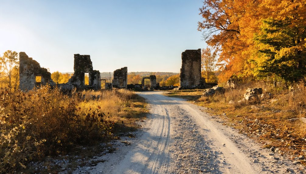
The Ruins, Markers, and Spring Still Standing at Monark Springs
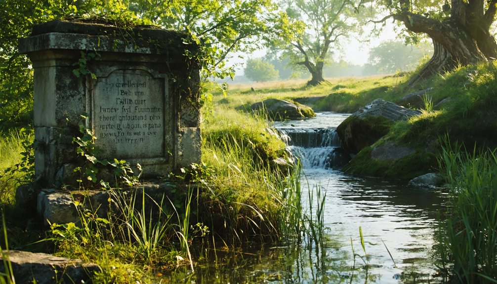
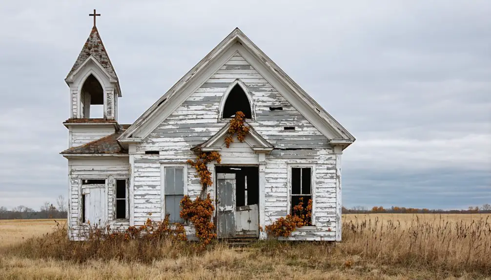
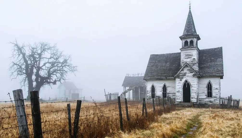
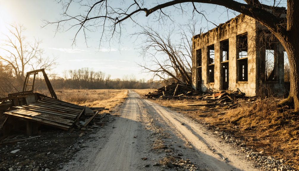
When you visit Monark Springs today, you’ll find scattered remnants that quietly tell the story of what once thrived here — crumbling foundations, weathered historical markers, and structural echoes of the 1940 tabernacle that once drew hundreds of worshippers.
Despite the town’s dark final chapter, the natural spring that originally drew settlers to this floodplain still flows 500 feet southeast of the townsite, a resilient reminder of why Truman Elmore and the Missouri and North Arkansas Railroad chose this spot in the first place.
You can walk the grounds, read the markers, and let the still-active spring ground you in a history that’s both haunting and surprisingly alive.
Remnants Worth Exploring
Despite its quiet desolation, Monark Springs still holds tangible pieces of its past worth seeking out. You’ll find remnants scattered across the landscape, each carrying historical significance and surrounded by natural beauty that makes the journey worthwhile.
Here’s what you shouldn’t miss:
- The Natural Spring – Located 500 feet southeast in Hickory Creek’s floodplain, this spring originally anchored the entire settlement and still flows today.
- The 1940 Tabernacle Structure – This open-air landmark once hosted massive Church of God camp meetings drawing hundreds from across the country.
- Historical Markers – Preserved signage and records document the town’s rise, railroad roots, and tragic 1956 typhoid outbreak.
Walk the grounds freely, absorb the silence, and let the remnants tell their story.
The Spring Still Flows
Among all the remnants you’ll encounter at Monark Springs, one stands out as the most enduring symbol of why this settlement existed in the first place — the spring itself still flows.
Tucked 500 feet southeast within the Hickory Creek floodplain, this natural source of spring water outlasted the railroad, the tabernacle, and the community it once sustained.
Standing beside it, you’ll feel the historical significance settle over you. This water drew settlers, powered agriculture, supported industry, and ultimately gave the town its identity.
Long after the depot fell silent and the camp meetings ended, the spring kept moving — indifferent to decline, unbothered by abandonment.
Visit it. Let the water remind you that some things endure regardless of what humanity builds or abandons around them.
How to Reach Monark Springs From Neosho
Reaching Monark Springs from Neosho takes just a few minutes, as the ghost town sits roughly five miles to the east along the north bank of Hickory Creek.
Head east from Neosho, staying close to U.S. Route 60, and you’ll arrive near this forgotten settlement without hassle. The scenic route rewards you with rolling Missouri countryside and local attractions worth a quick stop.
Follow these simple directions:
- Start in Neosho and drive east approximately five miles toward Hickory Creek.
- Look for U.S. Route 60, keeping it roughly 1.5 miles to your west as your reference point.
- Locate the north bank of Hickory Creek, where remnants and historical markers confirm you’ve arrived.
You’re now standing where history quietly unraveled.
When to Visit Monark Springs for the Best Site Access
Timing your visit to Monark Springs can make the difference between a rewarding exploration and a frustrating one.
Spring and fall offer the best seasons for exploration, giving you mild temperatures, manageable vegetation, and clearer sightlines to scattered remnants across the site. Summer’s dense growth can obscure historical markers and make navigation genuinely difficult.
Winter visits work well too, since bare trees open up the landscape considerably.
You’ll share the space with local wildlife year-round, so stay alert and respectful of your surroundings. Early mornings deliver quieter conditions and better light for photography.
Avoid visiting after heavy rainfall, as Hickory Creek’s floodplain gets muddy and potentially impassable. Check road conditions before heading out, since rural southwest Missouri roads can surprise even experienced travelers.
More Ghost Towns Near Monark Springs for a Full Day Trip
Southwest Missouri rewards ghost town hunters with several abandoned settlements within easy driving distance of Monark Springs, making it straightforward to build a full day of exploration.
Pack your camera for ghost town photography and hit these nearby stops:
- Jolly – A quietly forgotten community offering weathered structures perfect for capturing decay and historical preservation through your lens.
- Possum Trot – Its quirky name matches its character; you’ll find remnants that tell honest stories about rural Missouri’s vanished everyday life.
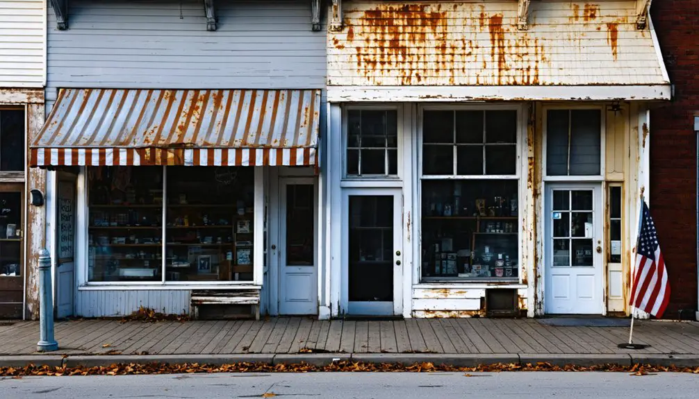
- Neosho – Just five miles west, this living town provides historical context, food, and fuel before or after your ghost town circuit.
String these locations together and you’ve got a rewarding route that respects the past while giving you complete freedom to explore.
What to Pack Before You Head Out

Before you leave for Monark Springs and its neighboring ghost towns, a few practical items will make the difference between a smooth trip and an unnecessary detour back to town.
Your packing essentials should include sturdy walking shoes, sunscreen, insect repellent, and plenty of water since these rural Missouri sites offer little shade or nearby stores.
Bring a charged phone with offline maps loaded, as cell service gets unreliable along Hickory Creek. A small notebook lets you document details tied to the area’s historical significance, from the 1956 typhoid outbreak to the railroad’s founding era.
Snacks, a first-aid kit, and a portable charger round out your kit. Pack light, stay mobile, and you’ll move freely between sites without friction slowing you down.
Frequently Asked Questions
Is There an Admission Fee to Visit Monark Springs Ghost Town?
Imagine pulling up freely, no ticket booth in sight. You won’t pay an admission fee to explore this ghost town history. For visiting tips, simply drive out and roam MoNArk Springs’ remnants independently.
Are Pets Allowed When Visiting Monark Springs and Nearby Ghost Towns?
The knowledge base doesn’t specify pet policies for Monark Springs. However, you’ll want to follow ghost town etiquette by keeping pets leashed, respecting the land, and ensuring your furry companions don’t disturb historical remnants.
Is the Monark Springs Site on Public or Private Property?
The knowledge doesn’t confirm whether Monark Springs is public or private property. Before exploring its rich Monark history, you’ll want to research current property rights to verify you’re visiting legally and respecting any landowner boundaries.
Are Guided Tours of Monark Springs Available for Booking?
No formal bookings exist, yet you’ll uncover rich ghost town history and local folklore independently. Explore freely, drive southwest Missouri’s open roads, and let Monark Springs’ haunting, vibrant past speak directly to your adventurous spirit.
Is Cell Phone Reception Reliable Near Monark Springs in Newton County?
Cell service reliability at Monark Springs can be spotty. You’ll notice significant signal strength comparison differences between carriers, so don’t rely solely on your phone. Download offline maps beforehand, embrace the freedom, and enjoy this remote ghost town adventure!
References
- https://www.youtube.com/watch?v=I_hjCY3hbVw
- https://en.wikipedia.org/wiki/Monark_Springs
- https://www.youtube.com/watch?v=wiF41PIwD74
- https://kids.kiddle.co/Monark_Springs
- https://alchetron.com/Monark-Springs
- https://www.ozarksalive.com/stories/ghost-towns-of-the-ozarks-both-haunted-and-historic
- https://monarksprings.com/History.htm