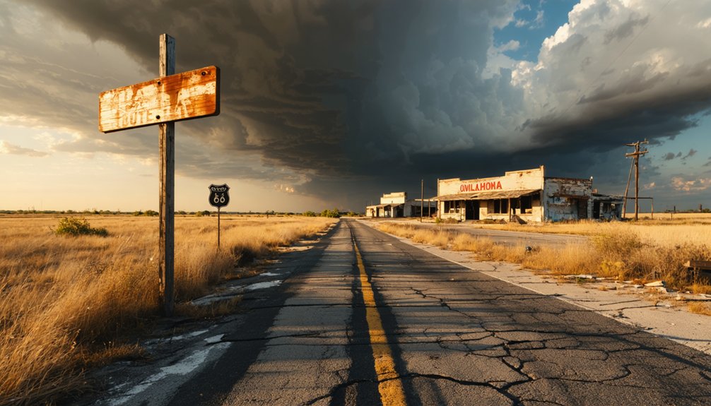
You’ll find Newby 8.5 miles south-southeast of Bristow, where pavement surrenders to gravel and towering chat piles mark your arrival at this toxic ghost town. Spring and fall offer the most comfortable exploration conditions, though you’ll need cut-resistant gloves, sturdy boots, and a respirator mask to safely navigate the contaminated site. Download offline maps before departing—there’s no signage or nearby amenities to guide you. This haunted industrial landscape reveals its secrets to those who come prepared for both historical discovery and environmental hazards lurking beneath Oklahoma’s reclaimed earth.
Key Takeaways
- Newby is located 8.5 miles south-southeast of Bristow, following N3740 Road to E0900 Road at coordinates 35.7114167, -96.3520333.
- Spring and fall provide ideal visiting conditions with comfortable temperatures, while summer heat challenges endurance and winter offers dreamlike scenery.
- Essential safety gear includes cut-resistant gloves, sturdy boots, respirator mask, headlamp, and multi-tool for navigating hazardous terrain.
- Expect no signage, amenities, or nearby services; download offline maps as backup for smartphone navigation apps.
- Toxic conditions include lead-contaminated dust, orange acidic water, unstable ground with sinkholes, and towering chat piles from mining operations.
The History Behind Newby’s Rise and Fall
Nestled along the banks of the Canadian River in Creek County, Newby emerged from Oklahoma’s territorial dust with the same fierce optimism that built a thousand other prairie settlements. You’ll find its story woven through the post-1889 land rush, when railroad promises drew notable townsfolk seeking fortune beyond society’s constraints.
General stores and modest homes displayed unique architectural features typical of boom-town pragmatism—functional structures built for hopeful permanence.
The town thrived through agriculture and trade during the early 1900s, its peak reflecting that intoxicating frontier independence. But railroads chose different paths, floods claimed riverside dreams, and competing towns won the economic lottery. By mid-century, Newby surrendered to abandonment, joining Oklahoma’s ghost town roster. Towns were often displaced by disasters like tornadoes, fires, and floods that reshaped the territorial landscape. Today, you’re chasing remnants of that vanished freedom. Stories like Newby’s populate the 26 chapters of Jim Marion Etter’s work on Oklahoma’s forgotten places and wild past.
What Remains at the Newby Ghost Town Site Today
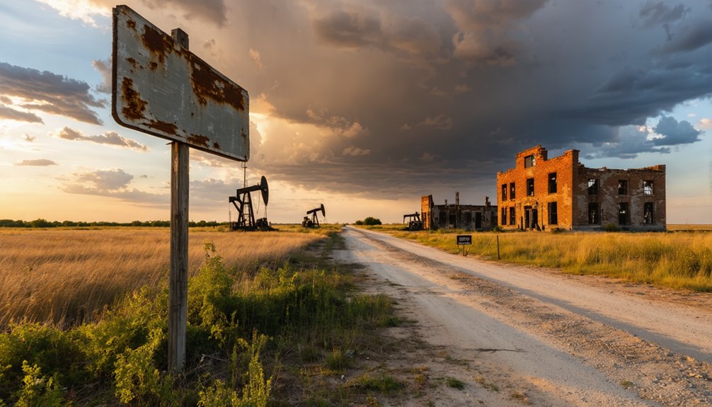
What greets you at Newby’s coordinates today isn’t the frontier settlement of railroad dreams, but a haunted industrial graveyard where nature battles toxicity for dominance. Towering chat piles—over 100 million tons of contaminated tailings—dwarf the few remaining structures still defying gravity.
You’ll trace an overgrown street grid visible only from above, where vegetation swallows former pathways and building foundations mark vanished lives. Orange water bubbles from thousands of abandoned mine shafts, while sinkholes threaten unstable ground. Children once played in these very chat piles, unknowingly exposing themselves to dangerous toxins and heavy metals.
The mining contamination here demands serious safety precautions: toxic dust carries lead and heavy metals, cave-ins lurk beneath innocent-looking earth, and cleanup remains decades away. Standing buildings deteriorate faster than memory preserves them—fewer exist now than five years ago, leaving you wandering among ghosts and poison.
Getting to Newby: Directions and Access Routes
Finding Newby requires abandoning well-traveled paths for Oklahoma’s rural back roads, where GPS coordinates become your lifeline through countryside that hasn’t changed much since mining days. You’ll navigate 8.5 miles south-southeast from Bristow, following N3740 Road until it intersects E0900 Road at coordinates 35.7114167, -96.3520333.
Road conditions shift from pavement to gravel as you approach the ghost town, manageable on street bikes though dual-sports handle it better. There’s zero signage marking your destination—just empty prairie and memories. Stock up on fuel and supplies in Bristow beforehand; nearby amenities don’t exist out here.
Your smartphone’s mapping app works, but download offline maps as backup. Converting the original township/range notations from historical records to modern GPS coordinates helps pinpoint these remote locations. This isn’t tourist infrastructure territory—it’s raw Oklahoma backcountry where self-reliance matters.
Best Times to Visit Oklahoma Ghost Towns
You’ll find Oklahoma’s ghost towns reveal different moods across the seasons, each offering distinct experiences as you wander through Newby’s silent streets and weathered structures.
From abandoned storefronts to crumbling churches, these ghost towns to explore in Oklahoma showcase a fascinating glimpse into the past. As you delve into their histories, you’ll uncover stories of hardships and triumphs that shaped these now-deserted communities. Each visit promises a unique encounter with time, providing a haunting yet beautiful experience that leaves a lasting impression.
Spring and fall deliver the most forgiving conditions—mild temperatures that let you explore for hours without battling summer’s scorching heat or winter’s biting winds. Plan your visit between March and May or September through November to walk comfortably through abandoned homesteads while capturing photographs in soft, golden light that brings out every texture in the crumbling wood and rusted metal. Winter visits transform these abandoned spaces into something magical, as snow blankets the fields and creates a dreamlike quality among the weathered structures, though you’ll need to prepare for harsh conditions and limited accessibility. December through February brings peaceful trails and fewer crowds, allowing you to explore at your own pace while temperatures average in the 50s during the day.
Seasonal Weather Considerations
When planning your ghost town expedition to Newby, the season you choose transforms the entire experience. Spring brings unpredictable weather patterns—sunny mornings at 70°F can shift to foggy afternoons with sudden showers. You’ll need preparation for variable conditions as temperatures plunge to the 40s overnight.
Summer’s 94°F heat and humidity challenge endurance but guarantee clear exploration days. Fall rewards adventurers with comfortable 50s-70s ranges and crisp visibility under mostly clear skies. Winter demands respect: icy roads, 28°F lows, and freezing precipitation create treacherous conditions requiring layered gear and cautious driving.
Year-round, winds between 5-12 mph sweep across open terrain, while morning fog patches before 9am can obscure crumbling structures. Current temperatures at nearby stations like Okmulgee Municipal Airport and Jones Jr. Airport hover around 50-52°F under clear skies. Before accessing detailed weather forecasts for your specific travel dates, you may encounter a brief image captcha challenge to verify you’re not a bot. Pack accordingly, embrace flexibility, and let weather intensity deepen your connection to Newby’s abandoned landscape.
Avoiding Extreme Temperatures
Oklahoma’s ghost towns reveal their secrets most generously when temperatures hover between 60-85°F—a sweet spot that transforms grueling expeditions into immersive journeys through abandoned history. You’ll find this ideal window during late April through early June and September through mid-November, when Newby’s crumbling structures welcome exploration without the punishing extremes that plague summer and winter months.
Your mitigation strategies should center on avoiding July-August peaks exceeding 100°F and January’s brutal sub-freezing winds. Packing clothing layers becomes essential during spring’s volatile swings—those 40°F mornings near Newby can surge to 80°F by afternoon.
Early fall offers freedom from oppressive heat while maintaining clear skies for photography. When planning your route through Oklahoma’s over 2000 ghost towns, timing becomes even more critical for maximizing your exploration across multiple abandoned sites. The Ouachita National Forest surrounding abandoned settlements like America provides additional scenic backdrops worth capturing during optimal weather conditions. Choose shoulder seasons wisely, and you’ll experience these forgotten landscapes without battling Oklahoma’s notorious temperature extremes that turn adventure into mere survival.
Essential Gear and Supplies for Your Exploration

Before you step into Newby’s crumbling structures and overgrown lots, you’ll need gear that stands between you and genuine danger. Cut-resistant gloves shield your hands from rusted metal and shattered glass. Sturdy boots with thick soles prevent puncture wounds from hidden nails. A respirator mask filters decades of accumulated mold and asbestos particles floating through abandoned rooms.
Your headlamp frees both hands for climbing through collapsed doorways while backup flashlights guarantee you’re never stranded in darkness. A multi-tool handles unexpected obstacles—pruners clear vegetation, duct tape patches torn gear mid-exploration. Pack a first aid kit, water purification tablets, and energy bars in your backpack for extended adventures.
Storing gear securely prevents equipment damage as you navigate unstable floors and narrow passages where freedom-seeking explorers discover Oklahoma’s forgotten history.
Before you step onto the weathered grounds of Newby, you’ll need to trace the invisible lines that separate public access from private land—a skill as essential as reading your map.
Most ghost town remnants rest on property someone still owns, which means you’re required to seek permission before crossing fence lines or exploring crumbling structures.
Oklahoma’s trespassing laws don’t disappear with abandoned buildings, and respecting these boundaries protects both your legal standing and the trust between explorers and rural landowners who hold these historical sites.
Identifying Property Boundaries
The crunch of gravel beneath your boots marks the threshold between public road and uncertain ground, where the romantic notion of ghost town exploration collides with the hard reality of property lines.
At Newby, physical markers have long since vanished into prairie grass and decades of neglect. You’ll need to conduct deed research through Cleveland County records before venturing forward, tracing ownership back through generations of transfers and abandonments.
When paper trails blur, surveyor consultation becomes essential—these professionals can interpret century-old section lines and quarter-quarter descriptions that mean nothing to untrained eyes. County GIS systems offer digital overlays, but ground truth demands verification.
Respecting boundaries isn’t just legal prudence; it’s the price of access to forgotten places that still belong to someone.
Requesting Landowner Permission
Standing at Newby’s perimeter with your research complete, you face the conversation most urban explorers dread: asking a stranger for access to land they likely inherited and rarely visit. Requesting landowner consent transforms trespassers into legitimate visitors—the difference between adventure and prosecution. Approach with transparency about your intentions: photographing structures, documenting history, respecting boundaries. Property owners appreciate directness over vague requests that trigger liability concerns.
Obtaining written permissions protects both parties. A simple signed note establishes your lawful presence and shields owners under Oklahoma’s recreational land use statute, which grants immunity for permissive entry. Include visit dates, acknowledge existing hazards you’ve observed, and accept responsibility for your safety. This documentation prevents misunderstandings with suspicious neighbors or patrolling deputies who might otherwise assume you’re trespassing on abandoned property nobody cares about anymore.
Oklahoma Trespassing Laws
After securing that signed permission slip, you’re still operating within a legal framework that extends far beyond a landowner’s handshake. Oklahoma’s trespass statutes draw sharp boundaries—criminal intent transforms innocent exploration into misdemeanor charges carrying $500 fines and six months behind bars. Even without “NO TRESPASSING” signs, willful entry onto yards, gardens, or fields remains illegal since 2021’s statutory shift eliminated mandatory postings.
Trespassing penalties escalate with damage: waste or theft triggers $50-$500 fines plus jail time. Yet implied consent defenses offer wiggle room on unposted land where custom suggests open access. Courts weigh context—your intent, property markers, local norms. Smart explorers document permissions meticulously, photograph entry points, and respect boundaries. Freedom demands responsibility; one careless step onto protected grounds transforms adventure into legal jeopardy.
Nearby Ghost Towns Worth Adding to Your Itinerary
Beyond Newby’s weathered facades, a constellation of forgotten settlements dots the surrounding counties, each whispering its own tale of boom and bust. You’ll find Skedee in Pawnee County, where abandoned schoolhouses stand sentinel over grasslands. Earlsboro beckons with its reputation as Oklahoma’s most haunted town—local folklore speaks of spirits lingering among oil-boom relics.
Blackburn survives through 25 families maintaining its whiskey-town heritage, complete with a crumbling gas station and church. Quay straddles county lines as a semi-abandoned relic perfectly positioned along your route. Further north, Old Kaw City’s drowned streets lie beneath reservoir waters, while Washunga and Uncas offer nearby cemeteries where pioneer graves tell stories railroads couldn’t save. Each stop rewards your wandering spirit with authentic decay.
Drumright and the Oil Boom Legacy
The earth cracked open in March 1912, and everything changed. Tom Slick’s Wheeler Number One well unleashed a torrent that transformed dusty prairie into America’s wildest industrial frontier.
When the earth split open that March day, Tom Slick’s gusher turned quiet prairie into America’s most untamed industrial battleground.
By mid-decade, 300,000 barrels daily—17% of the nation’s oil—surged from this ground, crowning it the world’s most productive field.
Drumright erupted overnight. Tent cities sprawled. Fortune-seekers poured in. Within three years, thirty oil companies staked their claims while gambling dens and dance halls thrived alongside derricks.
The lasting infrastructure endures: the 1915 Santa Fe Depot now houses histories of those fevered days. Railways carved permanent veins through Creek County soil.
The impact on Tulsa was seismic—transforming it into the “Oil Capital of the World” as black gold financed skyscrapers and dynasties that still shape Oklahoma’s landscape today.
Photography Tips for Capturing Historic Ruins
When light slants through shattered windows of Newby’s abandoned buildings, you’re witnessing the perfect convergence of history and haunting beauty. Pack your wide-angle lens and tripod—you’ll need both for those atmospheric long exposures that transform crumbling structures into ethereal landscapes.
Bracketing for HDR composition becomes essential when balancing Oklahoma’s harsh sunlight against deep interior shadows. Selective lighting techniques with your flashlight can illuminate forgotten chairs and scattered artifacts while preserving ambient atmosphere.
Shoot low angles upward to capture the disorienting vastness of these spaces. Focus on weathered textures—peeling paint, rusting machinery, decaying wood—that tell stories without words. Keep your gear minimal for traversing tight corridors, and always bring a companion.
Most importantly, photograph everything exactly as you find it, leaving no trace of your passage through these time-frozen ruins.
Combining Newby With Other Creek County Attractions

You’ll find Newby sits at the heart of Creek County’s oil heritage corridor, where ghost towns and living history merge within a 25-mile radius.
Twenty miles north in Drumright, weathered derricks still pierce the skyline above Main Street’s 1920s facades, while the annual Old Drillers Reunion brings former roughnecks back each summer to swap stories beneath those rusted monuments.
String together stops at Cushing’s digital oil museum and Bristow’s Route 66 relics, and you’ve crafted a full-day journey through boom, bust, and stubborn survival.
Historic Drumright Oil Sites
Just a few miles from Newby’s quiet abandonment, Drumright pulses with the living memory of America’s most explosive oil boom. You’ll stand where wildcatter Thomas Slick struck liquid gold in 1912, transforming Creek County into the world’s petroleum heartbeat.
Walk the streets where 310,000 barrels surged daily from 3,090 wells at peak production statistics that supplied two-thirds of the western hemisphere’s refinable crude. The economic and infrastructure impact still echoes through Cushing’s pipeline crossroads—23 lines converging where fortunes rose from red earth.
Explore the Drumright Dome sites where gushers like Big Bertha discharged 10,000 barrels per day. You’re tracing the wildcatter’s path, where risk-takers rewrote America’s energy independence and shaped the untamed spirit of Oklahoma’s oil patch.
Creek County Museum Stops
Beyond the derricks and gushers, Creek County holds a deeper narrative—one written in tribal council chambers rather than lease agreements. Twenty-five miles from Newby’s crumbling foundations, you’ll discover the Creek Council House Museum in Okmulgee—where the Muscogee Nation established its government in 1868.
The museum exhibits transform dusty artifacts into visceral stories: southeastern homelands abandoned, forced relocations endured, sovereignty reclaimed on Oklahoma soil. You’ll walk through the original council house, its walls adorned with photographs documenting survival and resistance.
Visitor operations run Monday through Friday, 10:00 am to 4:00 pm, giving you intimate access to guides who breathe life into relics. This isn’t sanitized history—it’s the raw counterpoint to your ghost town wanderings, proving that while boomtowns fade, nations endure.
Scenic Rural Photography Locations
Newby’s skeletal structures don’t exist in isolation—they anchor a twenty-mile radius of Creek County vistas begging for your lens. Chase golden hour at Lake Keystone State Park ten miles north, where water reflections amplify rural architectural decay against forested shorelines.
Spring transforms Drumright’s surrounding prairies into wildflower canvases—seasonal color variations that contrast beautifully with Newby’s monochrome ruins. You’ll find Bristow’s grain elevators creating stark vertical lines against endless skies, while Route 66 segments near town add retro road trip authenticity to your ghost town frames.
Don’t overlook unmarked Creek County pastures: hay bales, fence lines, and scattered farm ponds provide textured foregrounds that make Newby’s abandoned structures feel simultaneously isolated and connected to Oklahoma’s living agricultural heartbeat.
Frequently Asked Questions
Are There Any Guided Tours Available for Newby Ghost Town?
No guided ghost tours exist for Newby—apparently even tour operators won’t venture there. You’ll explore this forgotten relic independently, embracing true freedom. Check local visitor center details beforehand, though they’re likely as deserted as Newby itself.
Can I Camp Overnight Near the Newby Ghost Town Site?
No campgrounds exist directly at Newby Ghost Town, but you’ll find nearby campgrounds availability throughout Payne County. The feasibility of overnight stays improves at Lake McMurtry’s primitive sites, where you’re free to pitch your tent under starlit skies.
Is Cell Phone Service Available in the Newby Area?
You’ll likely encounter spotty cell tower coverage in Newby’s remote location, where Oklahoma’s rural areas show significant connectivity gaps. Mobile data speeds drop dramatically here, so download maps offline before your adventure into this untethered frontier.
Were There Any Notable Historical Figures Associated With Newby?
While Newby’s notable pioneer settlers left few preserved historical buildings behind, you’ll discover their legacy etched into Oklahoma’s wild landscape. The Newby family forged trails through untamed territory, embodying the freedom-seeking spirit you’re chasing today.
What Happened to Newby’s Original Residents After the Town Declined?
After Newby’s decline, you’ll find former residents scattered like tumbleweeds across Oklahoma. Reasons for population decline—railroad bypasses and economic collapse—drove relocation of former residents to thriving towns, abandoning their prairie dreams for survival elsewhere.
References
- https://www.youtube.com/watch?v=zTKa5i1czdE
- https://kids.kiddle.co/List_of_ghost_towns_in_Oklahoma
- https://www.beaversbendcreativeescape.com/se-oklahoma-ghost-towns/
- https://en.wikipedia.org/wiki/List_of_ghost_towns_in_Oklahoma
- https://www.okhistory.org/publications/enc/entry?entry=GH002
- http://www.ghosttowns.com/states/ok/newby.html
- http://sites.rootsweb.com/~oktttp/ghost_towns/ghost_towns.htm
- https://okgenweb.net/~okcreek/towns/shamrock.htm
- https://newforums.com/our-titles/best-of-the-region/places-routes/ghost-town-tales-of-oklahoma-unforgettable-stories-of-nearly-forgotten-places/
- https://okmag.com/blog/gone-but-not-forgotten/


