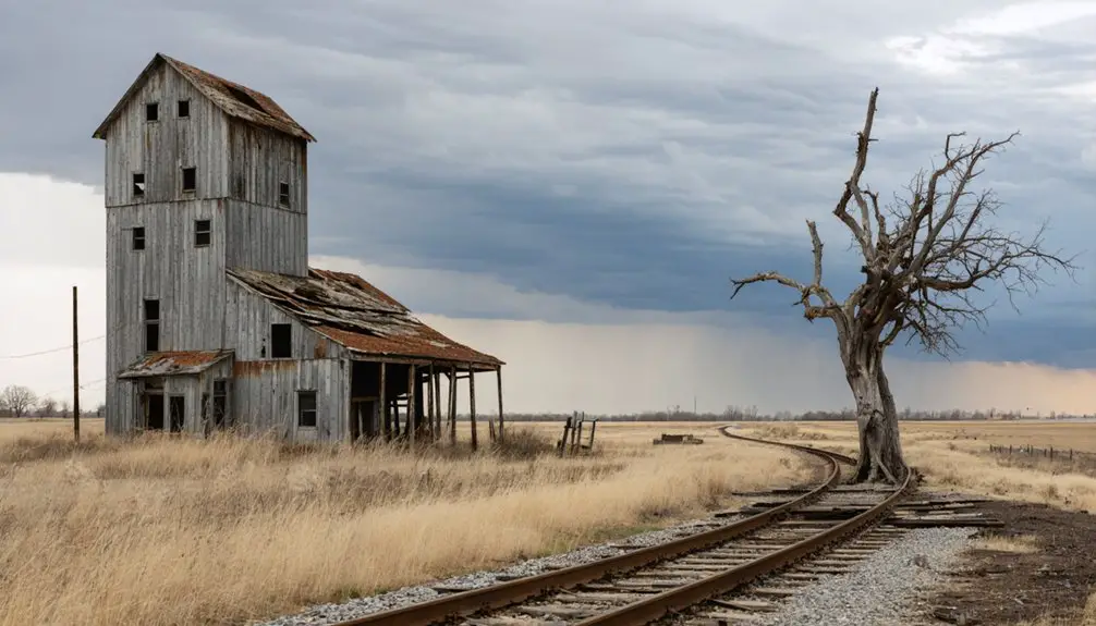
You’ll find Old Crow Wing at the Mississippi and Crow Wing rivers confluence in Fort Ripley Township, two hours north of the Twin Cities. Once Minnesota’s largest northern settlement with 700 residents, it vanished after the 1871 Northern Pacific Railway bypassed it for Brainerd. Today, you’ll explore the preserved 1849 Beaulieu Mansion, walk reconstructed boardwalks over cellar pits, and trace 18 miles of trails through Crow Wing State Park. The site reveals how one railroad decision erased an entire frontier community from Minnesota’s commercial map.
Key Takeaways
- Old Crow Wing is located at 46°16′38″N 94°20′15″W, two hours north of Twin Cities and ten miles from Brainerd.
- A $7 daily or $35 annual state park pass is required for access, with discounts available for tribal and disability permit holders.
- Nearby Brainerd, Baxter, and Pequot Lakes provide lodging options, while the park offers 47 drive-in campsites along the Mississippi River.
- The reconstructed boardwalk features interpretive signs at former building sites, with the 1849 Clement Beaulieu Mansion as the main historic structure.
- Visit features 18 miles of hiking trails, 6.5 miles of paved biking trail, kayak rentals, and seasonal activities from dawn to dusk.
Where to Find This Historic Settlement Along Minnesota’s Rivers
Nestled at the confluence of the Mississippi and Crow Wing rivers, Old Crow Wing occupies a historically significant position in Fort Ripley Township, Crow Wing County, Minnesota. You’ll find these historic river confluences approximately two hours north of the Twin Cities, ten miles from Brainerd at coordinates 46°16′38″N 94°20′15″W.
The settlement’s strategic location along former transportation routes made it the northernmost European-American outpost on the Mississippi for over a century. Today, you can explore this preserved site within Crow Wing State Park’s boundaries. Access requires a state park pass, but you’ll gain unrestricted exploration of peaceful forested trails leading to the river confluence.
Nearby Brainerd, Baxter, and Pequot Lakes provide lodging options for your independent journey into Minnesota’s authentic frontier past.
The Rise and Fall of a Frontier Trading Hub
Long before Minnesota achieved statehood, Crow Wing emerged as an essential node in the northern fur trade network when a British trader first wintered at the river’s mouth in 1771. The settlement’s social dynamics evolved through successive economic phases that shaped its destiny.
Crow Wing’s strategic position at the river’s mouth transformed it into a vital fur trade center long before statehood arrived.
Key developments that defined Crow Wing’s trajectory:
- American Fur Company established operations by 1823, with William Aitkin employing French Canadian and mixed-blood voyageurs through 1844
- East Woods Trail opening in 1845 transformed the settlement into a crucial ox cart caravan rest stop
- Logging operations commenced in 1847, attracting workers from Quebec, New Brunswick, and beyond
- Population swelled past 600 residents by 1860, becoming the largest community north of St. Paul
- Civil War, 1862 conflicts, and 1868 Ojibway removal to White Earth Reservation ended the fur trade permanently
Cultural integration between traders, voyageurs, and indigenous peoples created this frontier hub’s unique character.
Why the Railroad Sealed Crow Wing’s Fate
When James J. Hill routed the Northern Pacific Railway over the Mississippi River at Brainerd in 1871, he bypassed Crow Wing ten miles south, choosing wilderness rich with jack pine over the established trading hub. You’ll find this decision proved fatal for Crow Wing’s survival.
Northern Pacific’s Brainerd routing positioned the new town as a transcontinental hub with machine shops accommodating twenty-three locomotives simultaneously. Within a year, the county seat shifted from Crow Wing to Brainerd, triggering an immediate business exodus. Crow Wing’s population decline accelerated as its 600-700 residents followed the railway north.
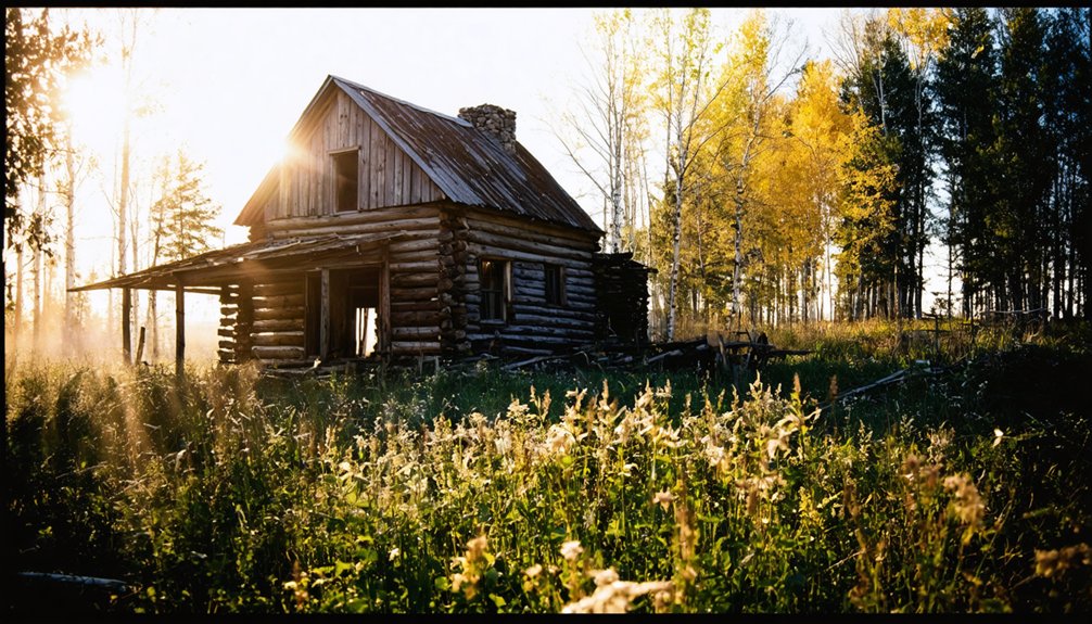
The Clement Beaulieu Mansion: Minnesota’s Oldest Northern Structure
While Brainerd’s railway boom erased Crow Wing from Minnesota’s commercial map, one structure survived to tell the settlement’s earlier story. The Clement Beaulieu Mansion stands as Minnesota’s oldest frame house north of St. Anthony Falls, preserving architectural integrity from 1849.
French-Canadian-Ojibwe fur trader Clement Beaulieu built this Greek Revival residence during the fur trade’s peak prosperity. The mansion’s journey reflects frontier resilience:
Built at the height of fur trade wealth, this Greek Revival mansion embodies the endurance of Minnesota’s frontier heritage.
- Dismantled in 1880, moved to Morrison County in two sections
- Occupied continuously until the 1980s
- Donated to Minnesota DNR by the Moran family
- Returned to original Crow Wing site in 1988
- Now overlooks the Mississippi River within the state park
You’ll discover cultural significance in every timber—this building witnessed territorial Minnesota’s transformation from wilderness to settlement.
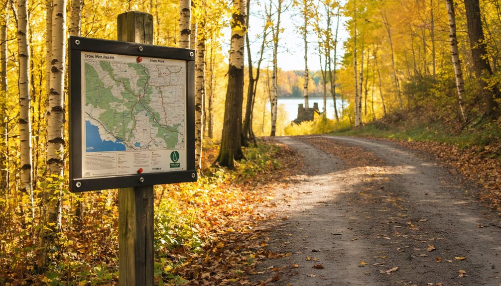
Walking Through History on the Boardwalk Trail
You’ll traverse a replica boardwalk that replicates the original commercial thoroughfare, constructed over the Mississippi River’s unstable banks where merchants once conducted business. Interpretive signs positioned at former building sites present firsthand accounts from settlers, allowing you to stand precisely where hotels, trading posts, and warehouses operated during the town’s 1850s-1860s peak.
The cellar pits of these vanished structures remain visible along the path, marked by placards that document the occupants and enterprises that defined this multicultural river settlement.
Reconstructed Boardwalk Path Details
From the upper parking lot, the reconstructed boardwalk follows the exact route of Old Crow Wing’s 1850s Main Street, a wide wooden pathway that winds through dense forest along the Mississippi River. This authentic recreation threads through the abandoned town site exactly as the original commercial district once stood.
Key Features Along the Boardwalk:
- Historical interpretive signs mark former building locations with posts
- Original church stones incorporated at Episcopal Church site
- Scenic river views throughout the self-guided trail
- Wide, accessible path suitable for easy exploration
- Connection to Ox Cart Trail after Main Street section
The boardwalk transforms into hiking trails linking Chippewa Lookout and the Paul Bunyan State Trail extension, completed in 2014. You’ll walk the same ground as 1850s fur traders and travelers.
Historical Placards and Accounts
As you proceed along the boardwalk, interpretive placards position themselves at precise intervals, marking former building sites with firsthand accounts drawn from 1860s diaries, government records, and missionary correspondence. You’ll discover this trading hub peaked at 700 residents—half Ojibwe, half European settlers—thriving since 1823 through symbiotic fur trade relations.
Signs detail Clement Beaulieu’s 1849 residence, the oldest standing structure where this Métis trader conducted business for decades. Cultural conflicts emerge through missionary narratives describing educational efforts alongside traditional Ojibwe governance. The 1867 presidential meeting preceded devastating relocation impacts: ten chiefs signed treaties forcing 1868 removal to White Earth Reservation. Population collapsed immediately.
When Northern Pacific Railroad bypassed the settlement in 1871 for Brainerd, remaining businesses departed, transforming the once-rowdy frontier headquarters into abandoned territory.
Former Building Site Locations
The reconstructed pine boardwalk guides your footsteps across the exact commercial corridor where six businesses operated during the 1850s boom, each location now marked by interpretive signage anchored into hard riverbank soil. Square nails secure pine planks where merchants once conducted fur trade transactions and settlers gathered provisions.
The self-guided trail reveals buried building foundations and foundation holes from long forgotten commercial establishments that served 600 residents.
Historic sites along the boardwalk include:
- Trading posts from the 1820s fur trade era
- Stores and taverns from the 1830s growth phase
- Warehouses that stored commercial goods
- Post office serving the territorial community
- Alan Morrison’s home where 10 children were raised
These eerie former spots overlook the Mississippi and Crow Wing Rivers confluence, marking where structures were dismantled after railroad construction bypassed the town in 1871.
What You’ll Discover at Each Building Site
Walking through Crow Wing State Park today, you’ll encounter five distinct building sites that reveal the settlement’s layered history as a multicultural frontier hub. The Beaulieu Mansion‘s Greek Revival foundations overlook the Mississippi River, marking where Minnesota’s oldest structure north of St. Anthony Falls stood since 1849.
Fort Ripley’s nearby location demonstrates military presence established in 1848 to maintain regional security. The Catholic Mission site, founded in 1852 by Father Pierz, and the 1856 Episcopal Mission showcase religious diversity among Ojibwe and settlers.
The reconstructed boardwalk connects commercial district foundations where 600-700 residents—half Ojibwe—traded furs and goods. These sites embody cultural influences that shaped this crossroads before the 1871 railroad bypass ended its prominence.
Outdoor Activities Beyond the Ghost Town Experience
Beyond preserving ghost town archaeology, Crow Wing State Park’s 2,000 acres encompass 18 miles of hiking trails that traverse four distinct biomes—prairie, hardwood forest, pineland, and savanna. You’ll find genuine freedom exploring these landscapes where rivers converge, creating exceptional wildlife viewing opportunities.
The park’s recreational infrastructure includes:
- 6.5 miles of paved biking trail extending the 115-mile Paul Bunyan State Trail
- Kayak rentals for paddling the gentle Crow Wing and Mississippi Rivers
- 47 drive-in campsites beneath towering trees along the Mississippi
- Swimming beach with shallow spots suitable for children
- Chippewa Lookout providing elevated river vistas
Whether you’re snowshoeing winter trails, tubing lazy summer currents, or cycling restored prairie paths, the park delivers authentic outdoor experiences. Fishing access and boat landings grant unrestricted waterway exploration beyond historical interpretation.
Essential Information for Your Visit to Crow Wing State Park
You’ll need a daily park permit ($7) or annual pass ($35) to explore Crow Wing State Park’s 2,000+ acres, accessible daily from 8 a.m. to 10 p.m.
The interpretive boardwalk and self-guided Main Street Crow Wing Trail provide year-round access to the historic townsite and three distinct biomes.
Seasonal facilities include a shower building, boat landing for Mississippi River access, and the 2014 Paul Bunyan State Trail extension connecting to regional routes.
Required Entry Pass Information
Planning your visit to Crow Wing State Park requires understanding Minnesota’s vehicle permit system, which funds the preservation and maintenance of 75 state parks and recreation areas across Minnesota. You’ll need a valid vehicle permit for entry, with several purchase options available.
Permit Options:
- One-day permit: $7 for single-day access (expires at 10 pm)
- Year-round permit: $35 for unlimited visits through 12 months from purchase date
- Overnight permit: Available with camping or lodging reservations
- Free entrance days: Four scheduled dates in 2026, including January 19 and April 25
- Discounted permit options: Available for federally recognized Minnesota tribal members and disability license plate holders
Purchase permits online through Yodel or Reserve MN before arrival, or visit the ranger station (Sunday-Thursday 9 am-3 pm, Friday-Saturday 9 am-6 pm).
Boardwalk and Trail Access
At Crow Wing State Park, the self-guided interpretive boardwalk serves as your primary gateway to exploring the Old Crow Wing town site, winding approximately one mile along the Mississippi River through remnants of the historic fur-trade era village. You’ll find multiple entry points: begin at the picnic area parking lot for direct boardwalk access, or start from the main gate through prairie lands connecting to the Paul Bunyan State Trail extension.
The boat landing offers stairs ascending to Chippewa Lookout, providing scenic river overlooks where the Mississippi and Crow Wing Rivers converge. Informative interpretive signs mark significant locations including the 1768 battle site, Catholic and Lutheran missions, and Red River Oxcart Trail segments.
The wide, flat boardwalk—constructed with period-authentic pine and square nails—protects sensitive archaeological resources while granting you unrestricted exploration of this ghost town landscape.
Seasonal Activity Options
Each season transforms Crow Wing State Park into distinct recreational landscapes, guaranteeing specific preparations for your ghost town exploration.
Spring through winter, you’ll discover:
- Spring: Migratory birds arrive (American Robin, Black-capped Chickadee), wood frogs emerge, and early wildflowers bloom along riverbanks—prime seasonal wildlife encounters for photographers
- Summer: Swimming and boating access on Mississippi and Crow Wing Rivers; bring DEET for post-dusk mosquitoes
- Fall: Managed hunts in select areas, spectacular foliage viewing across hardwoods and pineland biomes, plus seasonal foraging opportunities for Golden Chanterelle and Lobster Mushroom
- Winter: Cross-country skiing, snowshoeing, and snowmobiling with wildlife watching for deer and foxes
- Year-round: 6.5-mile paved Paul Bunyan Trail section for biking, off-leash dog park, dawn-to-dusk access
Dawn-to-dusk access permits unrestricted exploration throughout the year.
Frequently Asked Questions
Are There Any Paranormal Activities or Ghost Sightings Reported at Old Crow Wing?
No paranormal investigations or ghost sightings have been documented at Old Crow Wing. Despite its 1800s decline and violent history, you won’t find supernatural phenomena reported here. The site’s preserved as a historical park, not a haunted destination.
Can You Camp Overnight at Crow Wing State Park Near the Ghost Town?
Yes, you can camp overnight at designated sites in Crow Wing Campground with required reservations. Primitive camping opportunities exist on nearby county tax-forfeit land, letting you experience the historical significance of site independently within regulations.
How Long Does It Typically Take to Explore the Entire Ghost Town?
You’ll need 1-2 hours for extensive site exploration of the boardwalk and placards. Dedicated photography time at the Beaulieu house and river overlook could extend your visit to 3 hours, letting you freely absorb this preserved 1850s settlement’s authentic atmosphere.
Are Pets Allowed on the Boardwalk Trail and Throughout the Historic Site?
Yes, you’ll find pets welcome throughout Old Crow Wing’s historic site and boardwalk trail under standard pet policies. Keep your companion leashed within six feet, attend them constantly, and enjoy these preserved visitor amenities together freely.
What Are the Best Months to Visit for Optimal Weather and Trail Conditions?
Like nature’s own calendar marking freedom’s path, you’ll find May and September-October conducive—prime wildflower blooms grace spring trails, while autumn’s frost guarantees ideal trail maintenance. Both periods offer passable boardwalks, minimal mud, and reduced crowds for unfettered exploration.