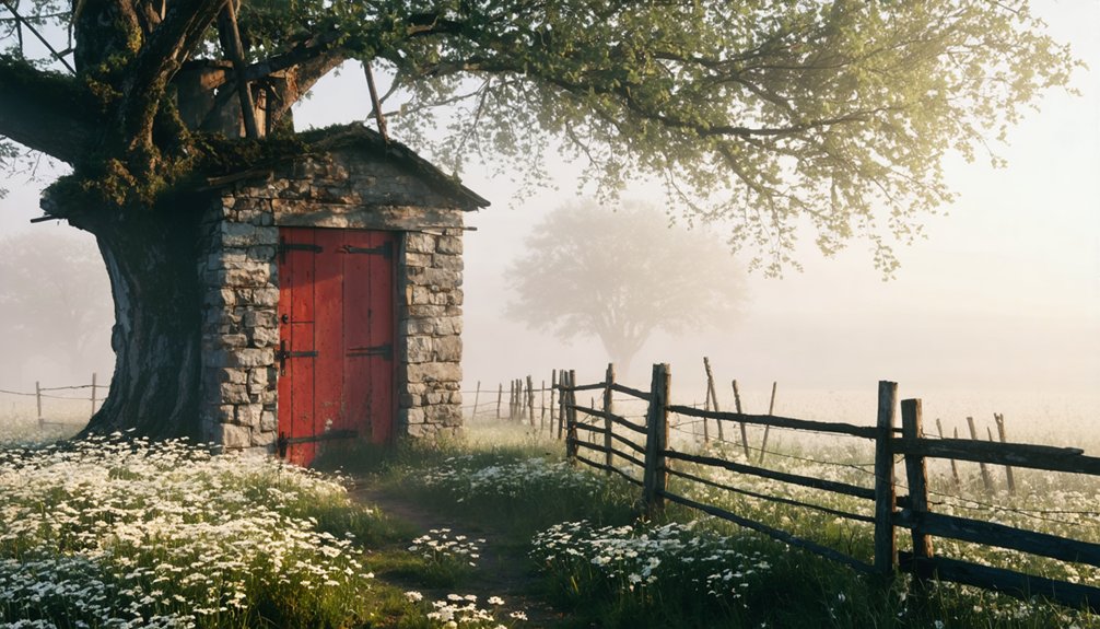
Start from Adel and venture west into Dallas County’s rural territory, where gravel roads lead to Ortonville’s vanished circus settlement. You’ll need old plat maps from 1889 township surveys and landowner permission, as this theatrical ghost town sits on private property without tourist infrastructure. Pack sturdy boots for debris-strewn foundations, a GPS device for navigation through cellular dead zones, and photography equipment for capturing the skeletal remains where five generations of Orton performers once wintered their big top. The converted railroad corridor now serves as the Raccoon River Valley Trail, connecting you to additional forgotten settlements throughout the region.
Key Takeaways
- Start from Adel and use old 1889 plat maps alongside Wikimapia reference 4059796 for accurate navigation.
- Obtain landowner permission before visiting, as Ortonville sits on private property with no tourist infrastructure.
- Bring sturdy boots, work gloves, GPS device, and headlamp for navigating debris fields and windowless structures safely.
- Explore the nearby 89-mile Raccoon River Valley Trail, which follows the former railroad corridor through the area.
- Pack for unpredictable weather and seasonal road challenges that may affect gravel path accessibility year-round.
Getting There: Directions and Accessibility
Finding Ortonville demands more detective work than GPS coordinates, as this vanished Iowa settlement left barely a trace on modern maps. You’ll need to start from Adel and venture into rural territory where township roads dissolve into gravel paths. The Wikimapia reference 4059796 offers clues, but road accessibility challenges make this journey unpredictable—seasonal weather transforms those country routes into muddy obstacles.
Before you set out, understand that land ownership concerns dominate these expeditions. What remains of Ortonville sits on private property, requiring you to secure permission from current landholders. There’s no maintained parking, no tourist infrastructure, just Iowa farmland reclaiming its past. Consult local historical societies for entry guidance, and bring old plat maps from the 1889 township surveys. This isn’t a roadside attraction—it’s archaeology on your own terms.
The Circus Village That Time Forgot
Once you navigate those rutted paths and secure access to the site, you’ll stand where America’s most unusual settlement once thrived—a village built entirely around sawdust and sequins.
Ortonville wasn’t merely winter quarters—it was home to five generations of Orton performers who chose freedom over convention. They constructed a complete infrastructure: café, grocery, post office, stockyard, even dual telephone companies serving circus families who wintered here for 66 consecutive years.
The fading circus nostalgia still whispers through abandoned foundations where children once trained for sway pole acts 110 feet high. That enduring community spirit sustained this peculiar town until Depression-era economics forced the big top’s final collapse in 1932, leaving behind Iowa’s most theatrical ghost town.
What Remains Today: A Modern Landscape
Unlike Rockville’s complete fade into farmland, you’ll find Ortonville’s skeleton still bears flesh—scattered houses mark where neighborhoods once thrived, their weathered frames evidence/proof/testament/witness to settlers who either stayed or left descendants behind.
The town’s industrial pulse has shifted: where grain elevators and creameries once anchored the economy, modern agricultural operations and small manufacturing facilities now occupy the footprint.
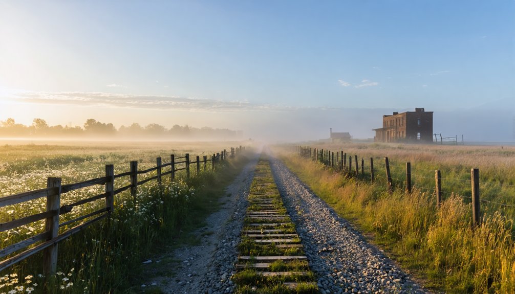
Most striking is the former railroad corridor that brought Ortonville into existence—the very tracks that gave it life have been pried up and paved over, transformed into a recreational trail where cyclists now glide through a landscape the Chicago, Milwaukee & St. Paul Railway once dominated.
Residential Houses Still Standing
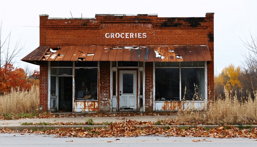
Today, few traces of Ortonville’s residential past survive along this windswept stretch of western Iowa. You’ll find a couple of houses scattered among modern industrial facilities where the old Milwaukee Railroad branch once ran. These remaining dwellings lack the architectural styles or historical significance that defined the circus settlement’s heyday. Highway 6’s expansion obliterated most landmarks, including the old gas station, making investigation difficult.
What’s left reflects rural dispersal rather than concentrated town planning. Houses stand alongside warehouse businesses on properties adjacent to the former railroad bed—now a bike trail. The Orton family’s winter quarters never spawned substantial residential growth, and what little existed has been demolished or obscured by road construction. Closer inspection might reveal artifacts, though decades of highway work have disturbed the archaeological record considerably.
Industrial Development Replaces History
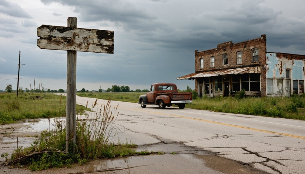
The remnants of Ortonville’s circus-era past have surrendered to warehouses, utility corridors, and industrial parcels that now define this stretch of Highway 6. You’ll witness the evolution of industrial land use where grain elevators once stood—replaced by designated business expansion zones pushing northward.
The impact of demolition on community identity is stark: sites that housed Iowa Steel and Iron Works since 1971 vanished in 2001, transforming into utilitarian spaces stripped of historical character.
Modern markers include:
- Ottertail Power Company’s 1949 lakeside plant, a record of utility infrastructure overtaking civic memory
- Northern industrial zones mapped for commercial growth, erasing stockyards and telephone exchanges
- Vacant lots where cafes and groceries anchored daily life before extensive planning prioritized business development over preservation
What remains feels deliberately forward-facing, reluctant to acknowledge its layered past.
Railroad-to-Bike Trail Conversion
Where iron rails once stitched Ortonville to distant markets, asphalt ribbons now wind through Iowa’s countryside. You’re riding what 1870s locomotives traversed—abandoned corridors transformed into the Raccoon River Valley Trail, linking 14 communities across 89 miles. This isn’t just recreation; it’s liberation from car-dependency. The trail draws 350,000 visitors annually, pumping tourism revenue into former rail towns like Perry and Adel, where depots became trailheads instead of demolition sites.
You’ll find Council Bluffs integrated into the 3,700-mile Great American Rail-Trail, proving local economic development doesn’t require industrial resurrection. These conversions preserve history while granting access—no trespassing signs, no barriers. Former High Trestle alignments offer elevated views where freight once rumbled. The rails-to-trails movement transformed Iowa’s post-industrial landscape into pathways you’ll explore freely.
Best Times to Visit and What to Bring

You’ll find Ortonville most rewarding in spring or fall, when mild temperatures let you comb the countryside without summer’s punishing heat or winter’s bite. Pack sturdy footwear for tramping across uneven ground near the old railroad bed, and bring water—there’s no shade among these scattered remains.
Your camera, binoculars, and a detailed map of the US 6 and County R16 intersection will prove essential for documenting what little survives of this vanished settlement.
Ideal Seasonal Visiting Conditions
While Ortonville’s crumbling foundations and weathered storefronts stand frozen in time year-round, the seasons dramatically reshape your experience of this prairie ghost town. Spring and fall emerge as prime windows for exploration, offering comfortable temperature trends between 40-70°F and liberation from summer’s oppressive heat and insect swarms. These seasonal highlights deliver ideal conditions for wandering abandoned streets without crowds constraining your discovery.
Each season presents distinct advantages:
- Spring brings dry 2WD-accessible roads and mild weather, though you’ll need layers for Iowa’s notorious shifts
- Fall provides photographer’s dream conditions with vibrant foliage framing decaying structures and lower humidity
- Winter demands serious preparation—ice-laden rural routes and sub-freezing temperatures restrict access but reward the determined with hauntingly snow-draped scenes
Summer remains viable despite 80-90°F heat, requiring sunscreen, water reserves, and repellent.
Essential Photography and Exploration Gear
Packing the right equipment transforms a casual drive-by into a documented exploration worthy of Ortonville’s forgotten history. Your camera bag should balance portability with capability—a DSLR or mirrorless body paired with a versatile 24-70mm lens captures both sweeping structural decay and intimate detail shots of rust-eaten hardware and peeling paint.
Wide-angle camera lenses for ruins reveal collapsed rooflines against prairie skies, while a lightweight 50mm prime excels in dim church interiors. Tripod selection matters—carbon fiber models won’t weigh you down across uneven terrain yet stabilize long exposures in shadowed doorways.
Beyond photography, pack sturdy boots for debris-strewn floors, work gloves for moving weathered boards, and a headlamp for windowless structures. A GPS device guarantees you’ll navigate unmapped backroads without surrendering to cellular dead zones.
Weather Considerations and Clothing
Winter transforms the ghost town into a desolate monochrome landscape, demanding serious preparation:
- Layering for weather changes proves essential—base layers, insulating fleece, and windproof shells combat Iowa’s notorious temperature swings
- Waterproof boots with ankle support navigate debris fields and sudden prairie mud
- Wide-brimmed hats and UV-protective clothing provide protection from elements during summer’s relentless exposure
Spring brings unpredictable storms; summer delivers oppressive humidity. Pack accordingly or risk cutting your expedition short.
Exploring the Converted Railroad Trail
As your tires hum along the smooth pavement where locomotives once thundered, the Raccoon River Valley Trail unfolds as Iowa’s tribute to railroad history transformed. You’ll traverse 89 miles of converted railbed spanning from Waukee to Jefferson, with an additional North Loop connecting Perry, Minburn, and Dallas Center. The Milwaukee Road’s standard-gauge line, which carried passengers until 1952 and freight until 1987, now welcomes cyclists and wanderers seeking unstructured exploration.
Trail amenities dot the route through Panora, Yale, and Dawson—places where community engagement breathes life into abandoned corridors. Since that first seven-mile section opened in 1989, locals have reclaimed these iron pathways as arteries of connection. You’re riding through deliberate preservation, where CIECO’s abandoned power plant dreams became Dallas and Guthrie Counties’ recreational freedom.
Nearby Ghost Towns and Related Attractions
Beyond Ortonville’s circus legacy, Guthrie County conceals a constellation of vanished settlements where Iowa’s pioneer ambitions collided with economic reality. Bear Grove, established 1854, earned its alternate name “Huddleville” when destitute families huddled together for survival. Dale City‘s Morrisburg Church stands sentinel over archaeological discoveries that reveal pioneer hardship. Wichita withered when railroads chose different routes, leaving stagecoach memories to prairie winds.
Your exploration extends into Ringgold County, where Knowlton and Caledonia disappeared without fanfare. At Lake Red Rock, six flooded towns including Fifield and Cordova emerge during low water—their remnants whispering beneath Iowa’s largest reservoir. Red Rock Cemetery’s 1847 burials remain preserved above the waterline, while the submerged Peace Tree sycamore once marked native american burial sites and treaty grounds, now claimed by progress.
Frequently Asked Questions
What Types of Circus Acts Performed in Ortonville During Winter Months?
During winter months, you’d witness training rather than seasonal performances in Ortonville. Circus families practiced trapeze, acrobatics, and animal acts while their temporary housing accommodations sheltered performers, horses, elephants, and big cats until spring touring resumed.
Are There Any Museums Displaying Artifacts From the Orton Circus?
The big top’s treasures have scattered like sawdust in wind. You won’t find museums displaying vintage posters or circus memorabilia in Ortonville itself, though Dallas County’s archives preserve documents about the Ortons’ spectacular legacy.
Did the Circus Settlement Have a Cemetery for Performers?
No dedicated cemetery exists for circus performer burials in Ortonville. The settlement functioned as seasonal circus training facilities where the Orton family prepared shows, but performers were likely buried in local graveyards rather than specialized resting places.
What Caused the Orton Circus to Fold in the 1930S?
When the curtain fell on Orton Circus in the 1930s, declining ticket sales during the Great Depression and suspected financial mismanagement sealed its fate. You’ll find few records documenting the specifics, leaving their final act shrouded in mystery.
Can Visitors Access Property Where Circus Winter Quarters Were Located?
You can’t access the property—it’s now private farmland under cultivation. Property access restrictions prevent exploration, but you’ll find the circus’s legacy preserved through local historical society archives, where photographs and documents keep Orton Brothers’ story alive.