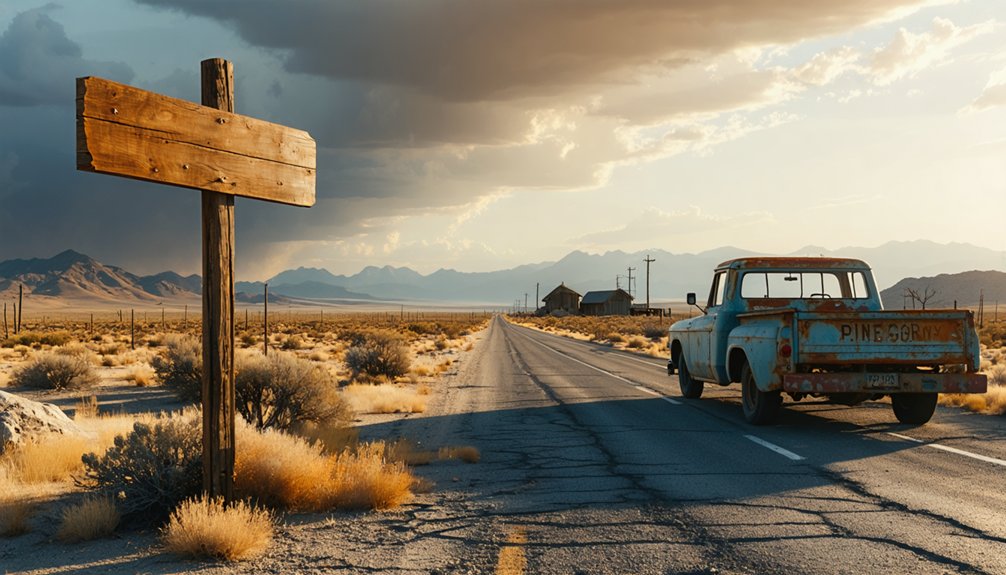
Plan your Pine Grove ghost town adventure by taking State Route 208 to Pine Grove Road, where pavement ends and unpaved mountain routes climb to 6,716 feet. You’ll need a high-clearance vehicle and should check Nevada’s 511 system for current conditions, especially after winter storms. Once there, you’ll discover authentic remnants including stamp mill foundations, a timber-framed schoolhouse, stone building ruins, and a hilltop cemetery overlooking Mason Valley—all marking where miners extracted $8 million in gold before abandoning this remote canyon settlement.
Key Takeaways
- Access Pine Grove from State Route 208 via Pine Grove Road; unpaved mountain routes require high-clearance vehicles and careful navigation.
- Check Nevada’s 511 system and weather forecasts before departure, especially after winter storms or summer monsoons affecting road conditions.
- Follow the historic Wellington-Pine Grove Wagon Road corridor, climbing to 6,716 feet through sagebrush and pinion-covered slopes.
- Explore remnants including rock foundations, timber schoolhouse, 5-stamp mill concrete base, and hilltop cemetery overlooking Mason Valley.
- This 1866 gold rush town produced $8 million in gold, peaking at 600 residents in the 1870s.
From Gold Rush Boomtown to Ghost Town: Pine Grove’s Story
When William Wilson stumbled upon gold-bearing rock in Pine Grove Canyon in June 1866, he couldn’t have imagined the transformation about to unfold in this remote Nevada wilderness.
Within two years, “Wilsonville” evolved into Pine Grove—a thriving settlement of 200 souls with its own post office and newspaper. Like other early mining communities, it grew rapidly, peaking at 600 residents by the 1870s.
Economic diversity kept the town alive: five saloons, three hotels, stamp mills, and freight lines served both miners and ranchers. The Wilson and Wheeler Mines extracted $8 million combined before the 1893 depression crushed production. By 1918, the last miners departed, leaving behind weathered buildings that still stand—silent witnesses to boom-and-bust freedom.
Getting There: Access Routes and Road Conditions to Pine Grove Canyon
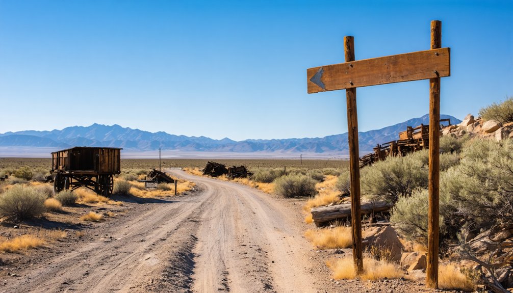
You’ll reach Pine Grove by following the historic Wellington-Pine Grove Wagon Road corridor, though today’s route trades wooden wheels for four-wheel drive along Forest Service roads.
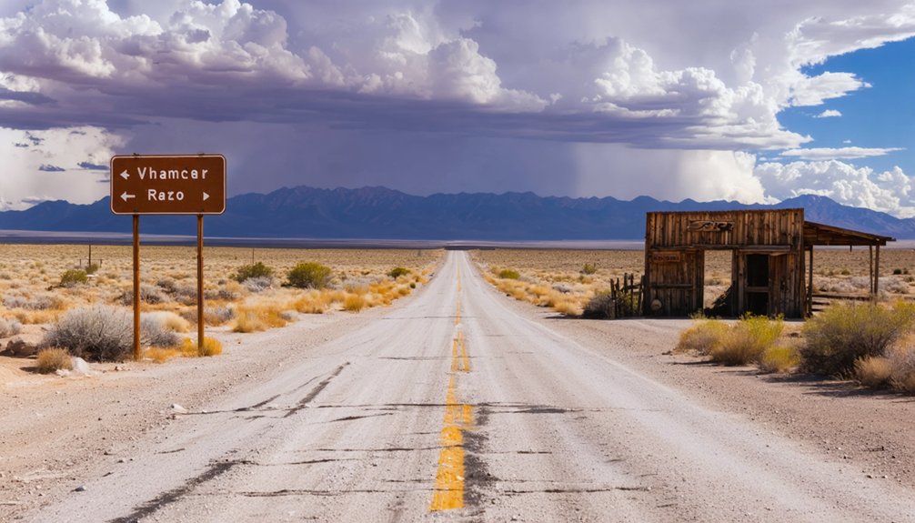
The eastern approach from State Route 208 remains the primary access—turn onto Pine Grove Road at the right-angle bend south of Mason Valley, then wind 10.2 miles through high desert canyons to USFS Road 059.
Current conditions demand respect: these unpaved mountain routes climb to 6,716 feet, requiring high-clearance vehicles and careful navigation, especially after winter storms or summer monsoons.
Wellington-Pine Grove Wagon Road
Reaching Pine Grove requires following the path of the historic Wellington-Pine Grove Wagon Road, a rugged freight route that once hauled ore and supplies across two demanding summits. You’ll trace the original 1866 alignment from Wellington northward, conquering Lodbell Summit before tackling Pine Grove Summit‘s steep grades and rough wagon conditions that tested early freighters.
The wagon road’s eastward spur drops into Pine Grove Canyon, delivering you straight to the townsite where miners first struck silver. Though a post-1904 eastern road now offers modern access, the historic route reveals the canyon’s mining legacy—tailings scattered across the north slope near Wilson Mine, Wheeler Mine‘s remnants visible southeast. High-clearance vehicles handle these dirt roads best, particularly during dry seasons when you’ll navigate between exploration pits and waste rock piles marking decades of determined prospecting.
Eastern Route History
Discovery transformed Pine Grove Canyon from a remote piñon-studded drainage into a bustling supply corridor almost overnight. When William Wilson struck gold in June 1866, freight lines quickly carved routes from Sacramento through indigenous gathering sites where Paiute peoples once harvested pine nuts.
You’ll still follow portions of these original supply roads today—East Walker Road traces the historic eastern approach that hauled ore and provisions during Pine Grove’s peak years.
Current Road Conditions
The ghost town lies beyond pavement’s end, where gravel roads wind through sagebrush flats before climbing into the piñon-covered slopes of Pine Grove Canyon. You’ll find current conditions through Nevada’s 511 system, though these backroads aren’t monitored like main highways.
Snow plowing happens on priority routes first—Pine Grove Canyon waits its turn, sometimes days after storms pass. Gravel road maintenance follows similar logic; washouts get addressed when crews arrive, not before.
Check nvroads.com before departure, but understand you’re heading where official data thins out. Winter demands traction devices during Sierra weather swings. Spring runoff reshapes gravel sections unpredictably.
The National Weather Service forecasts help, yet conditions shift faster than reports update. You’re responsible for your own route assessment once civilization fades behind—exactly what draws you here.
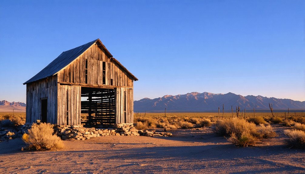
What to See: Historic Buildings and Structures Still Standing
Wandering through Pine Grove’s scattered remains, you’ll find weathered structures that paint a vivid picture of boom-town life in the 1880s. The rock store foundations stand near the entrance, their walls still defining spaces where 600 residents once traded goods.
Further in, you’ll spot the timber framed schoolhouse beside a 5-stamp mill’s concrete foundation—imagine children studying next to that industrial racket. The mill’s wooden wheel and cast iron parts remain surprisingly intact. Don’t miss the smaller rock building with square-nailed floorboards and possible basement.
Up on the hilltop, the cemetery overlooks Mason Valley, its informal layout marked by weathered fencing, stone markers, and marble headstones that’ve survived 136 years while others crumble into Nevada’s unforgiving soil.
The Wheeler and Wilson Mines: Legacy of $8 Million in Gold
When William Wilson struck gold in 1866 on the north side of Pine Grove Canyon, he couldn’t have known his discovery would eventually yield over $8 million in precious metal. The Wheeler Mine, discovered shortly after on the canyon’s south side, became equally legendary—its production records show 6,038 tons of ore worth $165,911 between 1873 and 1878 alone.
The geological features are fascinating: the Wheeler followed a northwest-trending fault through sheared granodiorite, with ore bodies forming as quartz stringers within a 200-foot-wide crushed zone. The richest paystreaks came from oxidized surface zones, while deeper sulfide ores ran 95% pyrite with chalcopyrite. Though mining declined after 1893’s economic depression, both mines saw sporadic work until 1918, leaving behind a maze of tunnels you can still explore today.
Exploring the Stamp Mill and Arrastras
You’ll discover the rusted bones of industrial ambition scattered across Pine Grove’s second townsite, where a 5-stamp Joshua Hendy mill still grips its concrete foundation—those empty slots marking five vanished stamps like missing teeth.
Before this steam-powered giant arrived in 1868, primitive arrastras ground oxidized ore worth $30-$90 per ton using nothing but animal power and stone drag-wheels. The contrast between technologies tells Pine Grove’s story: a camp that evolved from rough Mexican grinding methods to San Francisco-engineered steel, all chasing the same glittering prize.
Steam-Powered Processing Technology
The thunderous rhythm of Pine Grove’s stamp mills once echoed through these desert canyons at a relentless pace—stamps weighing up to 2,000 pounds dropped 20 to 40 times per minute, pulverizing ore into profitable dust. Understanding the steam powered crusher mechanics reveals ingenious frontier engineering: single-cylinder engines transferred power through four-to-five-inch solid steel shafts fitted with cams that lifted and released each stamp in precise succession.
The boiler and engine configurations varied by operation—Donovan Mill’s 40-horsepower boiler sustained a 15-stamp battery until 1959, while larger operations deployed 30 stamps across six batteries. You’ll find remnants of these systems today, including Joshua Hendy Iron Works castings. Gravity-fed ore bins held 40 tons above the batteries, ensuring continuous operation without human intervention—automation born of necessity in Nevada’s unforgiving landscape.
Primitive Arrastra Operations
Before Pine Grove’s thunderous stamp mills shook the canyon walls, miners relied on technology the Spanish had perfected centuries earlier—the arrastra, a deceptively simple grinding mill that could be built anywhere with little more than stones, timber, and determination.
Arrastra construction details reveal frontier ingenuity: a flat stone track ringed by low walls, a center post supporting a horizontal shaft, and heavy stones dragged in endless circles to pulverize ore into powder. You’ll find remnants of these operations throughout Pine Grove, where three arrastras worked alongside the stamp mills in 1869, processing oxidized ore worth $30-$90 per ton.
Arrastra power evolution transformed these mills from mule-driven circles to water-powered efficiency, though the fundamental crushing method remained unchanged—testament to technology that worked when you needed it most.
Original Foundation Remains
While arrastras could be assembled with rough stone and timber, Pine Grove’s expanding operations demanded something more substantial—industrial foundations built to last.
You’ll find the concrete stamp mill foundation in the town’s second section, near the schoolhouse ruins. Originally designed for ten stamps, it now displays only five intact—likely salvaged from the planned expansion. The Joshua Hendy Iron Works stamp castings from San Francisco still bear their maker’s marks, proof/evidence/indication of when this 1869 mill processed oxidized ore worth $30-$90 per ton.
The mill remnants stand prominently despite abandonment since the 1930s. Rock walls frame the concrete base where twenty stamps once thundered. Though most wooden structures vanished, these industrial foundations remain—monuments to an operation that contributed to Pine Grove’s $8 million production legacy.
Walking Among the Past: Pine Grove Cemetery
Perched on a windswept hilltop overlooking Mason Valley, Pine Grove Cemetery stands as a scattered memorial to the mining camp‘s brief moment of prosperity. You’ll navigate a steep, tight road accessible by Jeep, reaching graves marked by weathered fencing, wooden posts, and rocks. Historic headstones range from simple stone to engraved marble—some standing strong after 136 years, others crumbling into dust.
The most visited site belongs to fifteen-year-old Alice Maria Robinson. Her headstone bears poignant angel imagery from an 1845 hymn: “I want to be an angel…A crown upon my forehead, A harp within my hand.” Visitors leave angels, flowers, and painted rocks at her grave—tokens of connection across time. Though cleanup efforts in 2021 helped preserve this hilltop sanctuary, you’ll still encounter unmarked graves where wooden markers have surrendered to the elements.
Combining Your Visit: Rockland Ghost Town Side Trip
After paying your respects at Pine Grove’s hilltop cemetery, you’ll find another ghost town beckoning from the next canyon south. Rockland sits several miles southeast, discovered in 1869 and producing roughly $1 million in gold before its 1934 closure.
You’ll navigate USFS Road 059 to coordinates 38.70337 N, 119.06570 W, turning onto USFS 193. After 4.4 miles, mining machinery operations emerge—massive mill foundations cascading down the mountainside, scattered spoil heaps, and dark adit openings.
Safety considerations for visitors demand attention:
- Unfenced mine shafts drop into darkness
- Structural remains continue collapsing (thirteen-year photos document accelerating decay)
- Steep, rocky terrain requires cautious footing
Unlike preserved Bodie, Rockland’s active deterioration offers raw authenticity. The skeletal building frames and accessible tunnels reveal unvarnished mining history for those seeking genuine exploration beyond sanitized tourist sites.
Best Time to Visit and What to Bring
Summer beckons as Pine Grove’s prime visiting season, when July and August temperatures hover around a comfortable 75°F—cool enough for hiking the cemetery hills yet warm enough to explore without layered clothing.
Winter transforms these mountain roads into impassable corridors of snow and ice, particularly beyond Pine Grove Summit where travel advisory warnings become reality. Spring and fall offer moderate conditions without summer’s crowds.
Pack for Nevada’s unpredictability: high-clearance vehicles prove essential year-round, becoming mandatory for summit exploration. Bring cold-weather gear even in summer—elevation changes everything.
Rain protection matters despite the desert setting, as atmospheric rivers occasionally transform dusty tracks into muddy traps. Consider best seasonal accommodations in nearby towns, but arrive self-sufficient. Remote mining sites don’t forgive poor planning.
Photography Tips for Capturing Pine Grove’s Historic Character
Golden hour transforms Pine Grove’s weathered structures into photographer’s gold, when slanting sunlight rakes across splintered wood and rusted metal to reveal textures invisible at midday. You’ll want wide-angle glass (24-35mm) for capturing ruins against Nevada’s raw terrain, then switch to telephoto compression for isolating decay details that tell forgotten stories.
Essential gear for documenting this remote site:
- Sturdy tripod for sharp long exposure techniques that blur clouds while keeping structures razor-sharp
- Circular polarizer to cut glare and saturate those dramatic desert skies
- Extra batteries—civilization’s distant here
Aerial perspectives reveal spoil heaps’ true scale against the landscape. Frame adits using leading lines from abandoned roads, shoot low to emphasize forgotten grandeur, and don’t overlook macro opportunities in rust patterns. Post-processing demands restraint: boost contrast selectively, warm your tones, then dodge and burn historic character into existence.
Frequently Asked Questions
Are There Any Camping Facilities Near Pine Grove Ghost Town Site?
No official campgrounds exist, but you’ll find rustic campsites available along the valley’s Forest Service road with fire rings. You’re limited to 16-day stays, with nearby hiking trails beckoning exploration through this untamed, high-desert wilderness.
Is Cell Phone Reception Available in the Pine Grove Canyon Area?
Cell phone reception’s extremely limited in Pine Grove Canyon’s remote terrain. You’ll find minimal signal strength from major carriers, with Verizon offering the best coverage area at 78.5%. Don’t count on connectivity—embrace the off-grid freedom instead.
Are Pets Allowed When Exploring the Pine Grove Historic Buildings?
You’ll find visitor policies don’t specifically address pets at Pine Grove’s historic buildings, but pet-friendly guidelines require leashes and extreme caution around old mining hazards. Atlas Obscura warns these structures pose serious dangers for curious animals exploring.
What Is the Nearest Town With Gas Stations and Restaurants?
Baker, Nevada—your oasis on Highway 50’s endless ribbon—offers gas stations and seasonal restaurants. Though you won’t find Interstate highway convenience here, this nearest town with lodging options provides essential freedom-fueling stops before your remote adventure begins.
Do I Need a Special Permit to Visit Pine Grove?
You don’t need a special permit to explore Pine Grove’s haunting remains. Site accessibility depends on your vehicle and weather conditions, but permit requirements aren’t mentioned for visitation. Just bring survival gear and respect the protected historic structures during your adventure.


