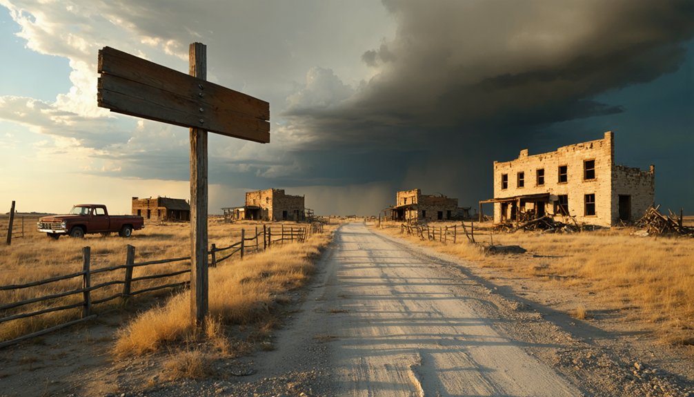
You’ll find Pittsville’s haunting remnants three miles north of Fulshear on FM 359—just a weathered cement cistern and wind-rustled trees marking where a bustling 1860s academy once stood. Plan your visit during spring or fall’s moderate temperatures, bringing sturdy boots and offline maps since cellular service disappears here. After the 1888 railroad bypassed this frontier settlement, residents drifted toward Fulshear, leaving only prairie whispers behind. The cistern stands as your gateway to understanding the Jaybird-Woodpecker Feud and Fort Bend County’s forgotten stories.
Key Takeaways
- Pittsville is located 3 miles north of Fulshear on FM 359, marked by a cement cistern and historic trees.
- Visit during spring or fall for moderate temperatures; midweek trips avoid crowds and offer off-season lodging discounts.
- Bring sturdy boots, layered clothing, documentation gear, offline maps, and fuel up beforehand due to limited services.
- Access Pittsville via I-10 west from Houston, Katy, or Fulshear, watching for landmarks like the Waller County Courthouse.
- Explore nearby George Ranch Historical Park and other Fort Bend County ghost towns to expand your historical road trip.
The Rise and Fall of Pittsville: From Prairie Settlement to Abandoned Townsite
Where the Texas prairie meets forgotten history, Pittsville once thrived as a bustling commercial hub before vanishing into the grass and mesquite. You’ll find this ghost town three miles north of Fulshear, where settlers chose elevated ground over fertile river bottoms in the 1840s.
By 1860, social and economic factors transformed it into a commercial powerhouse—240 residents supported general stores, a blacksmith shop, millinery, and photo studio. The architectural styles and structures reflected frontier ambition: a two-story academy rose above the prairie, while Confederate cavalry camped here during the war.
Then came 1888’s railroad, bypassing Pittsville entirely. Residents drifted toward Fulshear’s tracks, chasing easier commerce. By the late 1940s, the last stragglers abandoned their prairie sanctuary, leaving only memories.
Understanding the Jaybird-Woodpecker Feud and the 1888 Liberty Hope Church Shooting
When political power shifts overnight, it rarely happens quietly—and Fort Bend County’s transformation after Reconstruction ignited one of Texas’s bloodiest feuds. You’ll find the roots in an 80% black population that’d gained electoral strength, threatening the white planter class who’d once ruled unchallenged.
The Jaybirds—wealthy Democrats representing most whites—clashed violently with the Woodpeckers, forty officeholders backed by Republican freedmen.
Seven murders punctuated 1888-1889, culminating in the events surrounding the 1889 Battle of Richmond. Twenty minutes of courthouse gunfire left Sheriff Tom Garvey dead and Woodpeckers retreating.
The political consequences of the Jaybird-Woodpecker feud were devastating: Governor Ross imposed martial law, Woodpecker officials resigned, and black citizens lost voting rights for 64 years. Democracy died that August day.
What Remains at Pittsville Today: Locating the Cistern and Historic Trees
When you arrive at the site three miles north of Fulshear along Farm to Market Road 359, you’ll find that Pittsville has nearly vanished into the Texas prairie, leaving only a weathered cistern and a cluster of gnarled trees as witnesses to its past.
The stone walls of the old water storage structure rise unexpectedly from the grass, its masonry still intact despite decades of abandonment since Mrs. Nesbitt and her daughter left in 1947. These remnants demand a careful eye—suburban sprawl from Katy and Fulshear edges closer each year, threatening to swallow the last physical traces of this forgotten community.
Physical Remnants Still Visible
Very little survives of Pittsville today, but if you know where to look, you’ll spot the ghostly traces of this vanished settlement. At the junction of Farm Road 359 and Hunt-Jordan Road, three miles north of Fulshear, stands a solitary cement cistern—the town’s primary abandoned structure detail. This weathered monument has endured since 1947, when the last residents finally departed.
Nearby, a distinctive clump of trees marks where homes and businesses once clustered on the high prairie. These survivors tell the story of historic landscape changes that erased nearly everything else. The railroad’s 1888 bypass southward sealed Pittsville’s fate, transforming a thriving post office community into scattered memories. Now, as Fulshear and Katy expand outward, these humble remnants—cistern and trees—stand as your only tangible connection to a forgotten Texas town.
Finding Pittsville’s remains requires a sharp eye and precise directions—this ghost town won’t announce itself with roadside fanfare. Head three miles north from Fulshear on Farm Road 359 until you reach Hunt-Jordan Road. There, you’ll spot the historic site signage marking what’s left: a solitary cement cistern and a defiant clump of trees that’ve weathered decades since 1947.
The prairie stretches endlessly here, wind whispering through those survivor trees like forgotten conversations. You’re standing where settlers deliberately chose high ground over fertile but treacherous Brazos bottoms. Environmental preservation hasn’t really touched this spot—it’s simply been ignored long enough to remain authentic. Park carefully, walk the intersection’s edges, and you’ll feel history beneath your boots where Mrs. Alice Nesbitt once called home.
Photography and Exploration Tips
The cistern emerges from knee-high prairie grass like a weathered tombstone—cement walls sun-bleached to bone white, mortar crumbling where generations of Texas heat have worked their slow demolition. You’ll want to circle it slowly, capturing diverse photographic angles: the way afternoon light rakes across pitted surfaces, how wild mustard grows through foundation cracks.
The historic trees stand fifty yards west—gnarled live oaks that once shaded porches now gone to dust. For engaging storytelling techniques, shoot low to emphasize their scale against empty sky, or tight on bark patterns that’ve witnessed a century of silence. Dawn works best here, before suburban sprawl intrudes on your frame. Tread lightly—this ground remembers everything.
You’ll find Pittsville tucked into the piney woods of East Texas, requiring careful navigation since GPS alone won’t reveal the overgrown turnoffs where pavement gives way to red dirt. Whether you’re starting from Houston’s urban sprawl, Fulshear’s ranch country, or Katy’s suburban grid, your route funnels northward through I-45 and US-59 before landmark-based instincts replace digital maps.
The smell of pine needles and the sight of weathered fence posts become your true guides once you leave the highway’s hum behind.
Primary Routes and Highways
Whether you’re departing from Houston’s sprawling energy corridor, Fulshear’s newer subdivisions, or Katy’s bustling retail districts, Interstate 10 becomes your asphalt lifeline westward toward Pittsville’s skeletal remains. This 70-mph ribbon of concrete stretches through prairie grasslands, its highway design engineered for open-throttle freedom. You’ll feel civilization peel away mile by mile.
From Fulshear, FM-1093 feeds into I-10, while toll road options via TX-99 Grand Parkway let you bypass urban gridlock entirely. Katy drivers merge seamlessly at Sealy. Houston travelers navigate initial congestion before hitting rural straightaways near Rosenberg.
Beyond Exit 660, secondary arteries like US-90 and FM-2421 slice through Colorado County’s emptiness. Watch for eighteen-wheelers thundering past—they own these lanes. MapQuest’s live traffic updates become essential when construction chokes the interstate, rerouting you through forgotten farm roads toward your ghost town destination.
Once Buffalo Bayou Park‘s downtown greenery fades in your rearview mirror, you’ll know Houston’s urban grip is loosening its hold on your westward journey. Track the ExxonMobil Campus towers along I-10’s Energy Corridor—they’re your industrial compass point before suburban sprawl thins out.
From Fulshear, FM 1093‘s ribbon of asphalt guides you past Fry Road, where strip malls surrender to farmland. Katy travelers will recognize LaCenterra‘s bustle giving way to Pin Oak’s residential tranquility.
The real shift happens at Waller County Courthouse in Hempstead—this landmark preservation effort marks your metamorphosis into ghost town territory. Pittsville’s weathered historical significance of landmarks emerges subtly: rusted markers, collapsed foundations whispering stories the prairie wind carries. Trust your odometer and intuition equally here.
Best Times to Visit and What to Bring for Your Ghost Town Exploration
Planning ahead can make the difference between a frustrating drive through empty fields and an unforgettable journey into Texas’s forgotten past. You’ll find ideal exploration timelines during spring and fall when moderate temperatures won’t exhaust you while photographing crumbling structures.
Visit midweek—those Saturday crowds will ruin your solitary communion with history. September through November delivers off season lodging discounts and empty roads leading to Pittsville’s remnants.
Pack sturdy boots for traversing debris-strewn foundations, layers for unpredictable weather shifts, and documentation gear capturing architectural details before they vanish forever. Bring offline maps since cellular service disappears in these forgotten corners. Most importantly, fuel up beforehand—ghost towns don’t have gas stations, and you’re chasing freedom in places civilization abandoned long ago.
Nearby Attractions and Ghost Towns to Complete Your Fort Bend County Adventure
After your solitary walk through Pittsville’s weathered cistern and wind-rustled trees, you’ll crave more stories hidden in Fort Bend County’s soil. Richmond’s George Ranch Historical Park preserves resident histories through authentic homesteads where you’ll smell leather in working saddleries and hear cattle lowing across pastures.
The courthouse exhibits reveal the cultural impact of settlements like Pittsville—including that bloody 1888 church shooting that echoed through these prairies.
Want more ghost town freedom? Venture to Thurber’s lonely smokestack rising from central Texas grasslands, or trace Fort Griffin’s Wild West dust where outlaws once roamed. Terlingua’s sunbleached mining ruins and Indianola’s storm-swept coastal legends await. Each abandoned town whispers different secrets—you’re free to chase them all down backcountry roads stretching toward vanished horizons.
As you explore these forgotten landscapes, you’ll encounter haunting tales of Plummer Crossing, where the echoes of past lives linger in the wind. The remnants of a once-bustling settlement tell stories of hope and despair, drawing you deeper into the mysteries that time has left behind. Each stop along your journey reveals another chapter of the region’s rich history, inviting you to uncover the narratives woven into the fabric of the land.
Frequently Asked Questions
Is Permission Required to Access the Pittsville Ghost Town Site?
No permission’s typically needed for Pittsville—you’ll find freedom here without visitor restrictions or permit requirements. The dusty roads welcome spontaneous exploration, though you should respect any posted boundaries if private landowners have staked claims nearby.
Are There Safety Concerns Like Snakes or Wildlife at Pittsville?
Yes, you’ll face real dangers at Pittsville. Venomous rattlesnakes hide in ruins, while mountain lion sightings occur in remote areas. The scorching Texas sun creates potential dehydration risks. Pack water, watch your step, and stay alert—freedom demands preparation.
Can I Find Any Original Pitts Family Graves Near the Townsite?
Yes, you’ll discover the Pitts Family Cemetery at 200 Quitman Street with forty-four markers chronicling early settler information. Touch weathered stones from the 1850s during your family history research, connecting directly with Pittsburg’s founding pioneers.
Is Pittsville Suitable for Children or Wheelchair-Accessible Visitors?
You’ll find limited disabled visitor amenities across Pittsville’s rough terrain and sparse ruins. While over 1,100 children once played at nearby fairs, today’s crumbling foundations and uneven paths make family-friendly attractions challenging without proper mobility equipment and supervision.
What Happened to the Original Pitts Family Store Building?
The original Pitts store building’s fate remains undocumented—no records capture its architectural design features or final days. You’ll find no surviving photos preserving its building’s historical significance, leaving only imagination to reconstruct this vanished landmark of frontier independence.


