Planning a ghost town road trip to Ray, Kansas means heading to Doniphan County in northeastern Kansas, where quiet county roads lead you through a Missouri River valley landscape frozen in agricultural history. You’ll find faint grid patterns, pioneer cemeteries, and abandoned farmsteads that reward a patient, deliberate explorer. Bring offline maps, pack essentials, and expect gravel roads. There’s far more to discover about building the perfect Doniphan County backroads loop than you might expect.
Key Takeaways
- Ray, Kansas, located in Doniphan County, is a quiet ghost town with agricultural roots, pioneer cemeteries, and remnants of a once-thriving community.
- No public transit serves Ray; a personal vehicle is essential, and offline maps are strongly recommended due to spotty cell coverage.
- Look for faint road grids, weathered cemetery stones, and abandoned foundations to uncover Ray’s hidden historic remnants.
- Nearby ghost towns like Severance, White Cloud, and Wathena can be added to build a fuller Doniphan County road trip.
- Pack gas, water, snacks, a first-aid kit, and sturdy shoes, and always check road conditions before traveling, especially after rain.
Why Ray, Kansas Appears on Every Serious Ghost Town List
When ghost town enthusiasts start mapping out northeast Kansas, Ray keeps showing up — and for good reason. Ray’s history traces back to the agricultural and railroad expansion era that shaped dozens of small Doniphan County communities.
Like many of its neighbors, Ray eventually faded as farm consolidation and shifting transportation routes drained its population and services.
Farm consolidation and shifting transportation routes quietly drained Ray of its population, leaving behind only echoes of a once-functioning community.
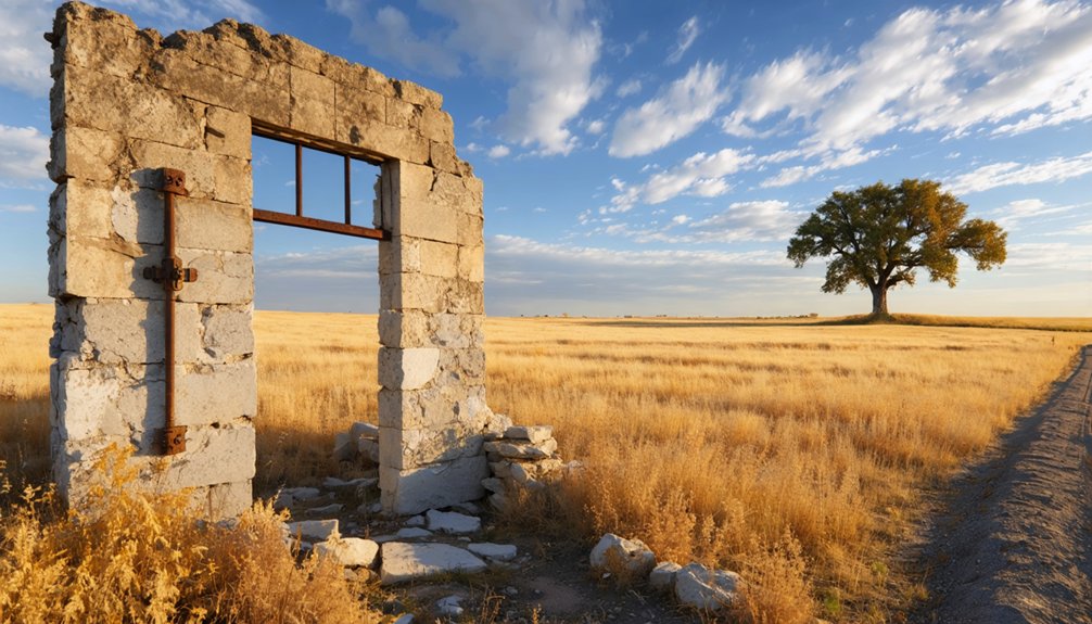
What gives Ray ghost town significance isn’t dramatic ruins — it’s the quiet authenticity of a place that once functioned and now simply endures.
You’ll find road traces, cemetery remnants, and rural landscapes largely unchanged by modern development. That untouched quality is exactly what serious ghost town explorers seek.
Ray rewards the curious traveler who values honest history over polished tourism, making it a genuine backroads discovery in far northeast Kansas.
Where Ray, Kansas Is and How to Get There
Ray sits in Doniphan County, tucked into the northeastern corner of Kansas where the state nudges up against both Missouri and Nebraska.
You’ll find it settled in the Missouri River valley region, surrounded by farmland, scattered homesteads, and quiet county roads that feel untouched by modern traffic.
Ray accessibility depends entirely on your own wheels — no public transit reaches this corner of Kansas.
County roads and rural routes connect Ray to nearby communities, though some stretches run on gravel and narrow lanes.
Download offline maps before you leave; cell coverage gets spotty fast.
Ray history is rooted in the railroad and agricultural expansion era of the late 1800s.
Understanding that context sharpens what you’ll notice when you finally roll through — and makes the drive itself feel purposeful.
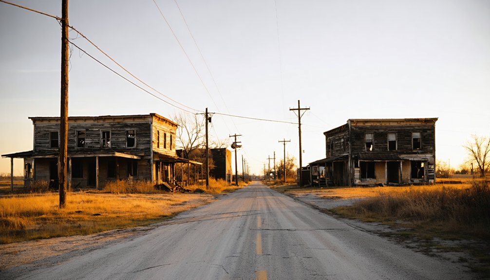
What You Can Still See at the Ray Townsite
Arriving at the Ray townsite, you won’t find a preserved main street or interpretive signs pointing you toward history — what’s left demands a slower, more deliberate eye.
Historic remnants hide in plain sight once you know what to read. Train your attention on these settlement clues:
- Road junctions and alignments — faint grid patterns in the landscape reveal where streets and commerce once organized daily life.
- Pioneer cemeteries — weathered stones mark early families and quietly anchor the community’s forgotten story.
- Abandoned farmsteads and foundations — collapsed structures and overgrown lots signal where homes and local businesses once stood.
Slow down, step out, and let the landscape speak.
Ray rewards patient explorers willing to piece together its quiet, vanished world.
Which Doniphan County Ghost Towns Belong on the Same Route?
Why stop at Ray when Doniphan County offers a loose string of faded communities worth threading into the same backroads loop? Several Doniphan Towns deserve space on your itinerary alongside Ray.
Look for forgotten crossroads, pioneer cemeteries, and remnants of old post office stops scattered across the county’s rural grid. Communities like Severance, Wathena, and White Cloud each carry distinct layers of Historic Sites, from river-era commerce to early settler graveyards.
You can build a flexible loop that follows county roads north toward the Missouri River bluffs or west through quieter agricultural stretches. Keep your route loose, carry an offline map, and let the landscape guide your pace.
Doniphan County rewards curious, unhurried travelers willing to slow down and look closely.
How Do You Build a Full Doniphan County Backroads Loop?

Building a full Doniphan County backroads loop starts with anchoring your route around a handful of fixed points, then letting the county road grid fill in the gaps.
Backroads navigation here rewards preparation — download offline maps before you leave cell range.
Preparation is your edge out here — pull those offline maps before the signal disappears and the gravel begins.
Structure your loop around these scenic stops:
- Start at Troy, the county seat, where courthouse architecture grounds your sense of the region’s history before you head into open farmland.
- Wind through forgotten crossroads like Ray and surrounding ghost towns, watching for cemetery markers and old foundation lines tucked beside gravel roads.
- Drop toward the Missouri River corridor to catch bluff views and border-region river towns before looping back northwest.
Keep your tank full and your schedule loose — that’s how you own this route.
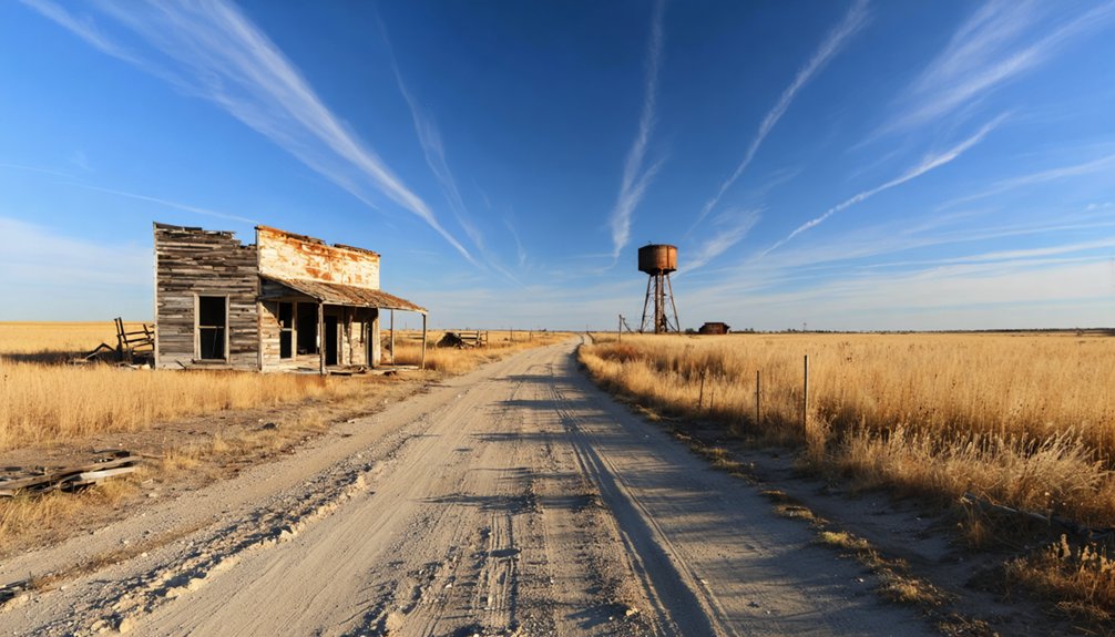
Road Conditions, Cell Coverage, and What to Pack for This Drive
Once you leave Troy’s paved streets behind, the roads shift fast — gravel takes over, cell bars drop, and the margin for being underprepared shrinks considerably.
County roads out here can turn slick after rain and downright impassable after spring flooding, so road safety means checking conditions before you go, not after you’re already sliding.
Download offline maps before departure — don’t count on a signal to save you.
For travel essentials, pack more than you think you’ll need: a full tank of gas, extra water, snacks, a basic first-aid kit, and a paper county map as backup.
Wear sturdy shoes in case you’re walking old townsites.
This corner of Kansas rewards self-reliance, and arriving prepared means you stay free to explore on your own terms.
Best Time to Visit Ray, Kansas and Nearby Ghost Towns
- Late April–May: Wildflowers soften crumbling foundations, and mild temperatures make outdoor exploration comfortable.
- September–October: Harvest-season light turns golden across empty fields, creating dramatic photography conditions.
- Avoid December–February: Ice and mud make rural gravel roads genuinely dangerous and obscure historic remnants beneath snow.
Summer works but brings heat and humidity.
Check local events in Doniphan County towns nearby—heritage days and county fairs occasionally surface overlooked history worth combining into your route.
Frequently Asked Questions
Is There an Official Historical Marker Specifically Dedicated to Ray, Kansas?
No official historical marker’s dedicated specifically to Ray, Kansas. You’ll uncover Ray history through scattered remnants and local lore. Explore Ray legends yourself by scouting old road junctions, pioneer cemeteries, and faded farmsteads across Doniphan County’s quiet backroads.
Can You Camp Overnight Near the Ray Townsite or Surrounding Farmland?
Under vast, star-filled skies, you won’t find designated campsites near Ray’s quiet farmland. Respect camping etiquette, watch for local wildlife, and secure landowner permission before pitching your tent on surrounding private property.
Are Guided Ghost Town Tours Available for Doniphan County Historic Sites?
You won’t find formal guided tours, but you can uncover ghost town legends and local folklore yourself by connecting with Doniphan County historical societies, who’ll point you toward fascinating self-guided historic site discoveries.
What Photography Permits Are Required When Shooting Abandoned Structures Near Ray?
Like Ansel Adams shooting freely across public lands, you don’t need permits for abandoned photography near Ray — but legal considerations matter. You must stay on public property and respect private boundaries always.
Do Local Historical Societies Sell Maps Focused on Ray and Nearby Townsites?
You won’t likely find maps dedicated solely to Ray history, but local archives and Doniphan County historical societies can point you toward regional townsite resources, old plat books, and custom route guides worth exploring.
References
- https://www.youtube.com/watch?v=LNAm0sZuNyw
- https://www.youtube.com/watch?v=YQHVP21sYC8
- https://www.onlyinyourstate.com/trip-ideas/kansas/kansas-ghost-town-road-trip
- https://www.reddit.com/r/kansas/comments/1oedkex/any_abandoned_places_to_explore_ghost_towns/
- https://www.facebook.com/groups/331294890628805/posts/1873048496453429/
- https://kansasreflector.com/2023/03/26/ruined-beauty-of-kansas-ghost-towns-and-buildings-splinter-under-weight-of-time/
- https://thedetoureffect.com/blog/northern-kansas-road-trip-stops/
- https://www.travelks.com/kansas-magazine/articles/post/exploring-kansas-forgotten-roads/
- https://shop.digicelgroup.com/xkickp/024953/7K489O4360/cexistw/ghost_towns__of_kansas-a__travelers__guide.pdf
- https://www.youtube.com/watch?v=Aa-_f4ThouQ


