When California’s reservoirs drop low enough, history climbs back to the surface. You can chase Whiskey Flats at Lake Isabella — a Gold Rush relic from the 1860s — then drive north to Lexington Reservoir near Los Gatos, where Alma’s logging past waits beneath receding water. Time your trip around drought conditions or maintenance drawdowns, and confirm capacity reports before you go. Everything you need to plan this journey through California’s drowned past is just ahead.
Key Takeaways
- Start your road trip at Lake Isabella, 35 kilometers from Bakersfield, then drive north through Sierra Nevada foothills to Lexington Reservoir near Los Gatos.
- Check reservoir capacity before departing; Whiskey Flats emerges when Lake Isabella drops below 8% capacity.
- Lexington Reservoir must reach 7% capacity or lower for submerged ruins, including a historic 1926 bridge, to reappear.
- Visit during summer months or planned dam maintenance periods when water levels are historically at their lowest.
- Pack waterproof boots, layered clothing, and a paper map, and confirm conditions via U.S. Army Corps of Engineers reports.
The California Ghost Towns That Surface During Drought
When California’s reservoirs shrink to skeletal levels, they surrender their secrets — and two ghost towns rise from the depths to prove it.
Drought impact has done what no historian could: pulled these submerged communities back into the light. At Lake Isabella, Whiskey Flats reappeared after 70 years underwater when the reservoir dropped to just 8% capacity.
Near Los Gatos, the twin towns of Alma and Lexington resurface beneath Lexington Reservoir during maintenance drawdowns, their foundations and a ghostly 1926 bridge emerging like memories refusing to stay buried.
The historical significance of these places runs deep — Gold Rush origins, logging industries, Wild West film sets.
You’re not just witnessing drought’s consequences; you’re witnessing California’s layered past clawing its way back to the surface.
When Lake Isabella and Lexington Reservoir Actually Expose the Ruins?
Timing your visit is everything — these ghost towns don’t wait for you. Exposure timing hinges on drought effects and reservoir management decisions beyond your control.
Timing your visit is everything — these ghost towns don’t wait, and neither do the reservoirs that hide them.
Watch for these conditions before you pack:
- Lake Isabella below 8% capacity — Whiskey Flats emerges from decades of silence
- Lexington Reservoir at 7% or lower — the 1926 bridge reappears like a memory
- Summer months — historically your best window for low water levels
- Active dam maintenance periods — Lexington deliberately lowers for repairs
- Prolonged drought cycles — climate change increases re-emergence frequency
Check current reservoir capacity reports before committing to either destination.
Both sites vanish without warning when rains return. You’re chasing windows, not guarantees — and that uncertainty makes every exposed rooftop and rusted hinge feel earned.
Whiskey Flats vs. Alma: What the Ruins Look Like Up Close
Once the waterline drops, two very different ghost towns claw their way back into the light — and they don’t look anything alike.
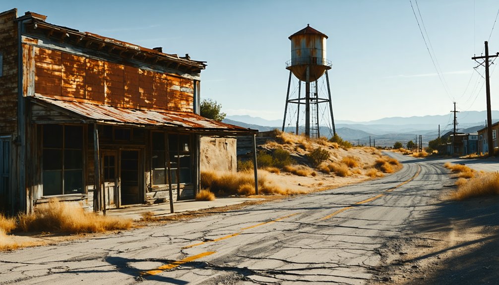
Whiskey Flats architecture emerges raw and skeletal — sun-bleached foundations, fractured walls, and ghostly outlines of a mining town that Hollywood once borrowed for its Wild West fantasies.
You’re walking through bones of the 1860s Gold Rush, preserved by mud and silence.
Alma history tells a quieter story. Beneath Lexington Reservoir, you’ll spot the remnants of a logging rail stop that once carried timber workers and coastal vacationers.
Alma’s foundations feel more domestic, more settled — like a community that actually believed it had a future.
Both reward the curious traveler willing to read ruins like sentences.
Each waterline retreat writes another paragraph you won’t find in any history book.
The Road Trip Route That Hits Both Ghost Towns
Chasing both ghost towns on a single trip means plotting a route that cuts through two very different slices of California — the sun-scorched Kern River basin near Bakersfield and the shadowy oak-lined corridor above Los Gatos.
Your route planning should move efficiently between these ghost town history landmarks:
- Start at Lake Isabella, 35 kilometers from Bakersfield, checking reservoir capacity before arriving.
- Walk Whiskey Flats when water sits at 8% or below.
- Drive north through the Sierra Nevada foothills toward Santa Clara County.
- Follow State Route 17 past Lexington Reservoir above Los Gatos.
- Time your Alma and Lexington visit around maintenance drawdowns or drought-low conditions.
Both destinations reward spontaneity and preparation equally — carry water, check current reservoir levels, and stay flexible.
California’s drought cycles write the real itinerary.
What to Check Before You Leave Home
Before you load the car and point it toward the Sierra Nevada foothills, reservoir capacity numbers are the single most important detail standing between you and a genuine ghost town walk.
Lake Isabella needs to sit at or below 8% capacity; Lexington Reservoir requires maintenance-level drawdowns. Check both figures the morning you leave.
Pull the current water capacity reports directly from the U.S. Army Corps of Engineers and Santa Clara Valley Water websites.
Then run your weather forecast, because exposed lake beds turn slick and dangerous after rain.
Your packing essentials should reflect both realities: waterproof boots, layered clothing, and a paper map in case signal disappears in those southern Sierra Nevada foothills.
Old towns don’t wait, but neither does bad weather.
Frequently Asked Questions
Are There Guided Tours Available at Whiskey Flats or Lexington Reservoir Sites?
No guided explorations are confirmed at either site. You’ll wander freely, uncovering historical significance on your own terms — tracing ghostly foundations, breathing forgotten air, and feeling the pull of towns time buried and drought’s hand resurfaces.
What Photography Equipment Works Best for Capturing Submerged Ghost Town Ruins?
For underwater photography of submerged ruins, you’ll want a waterproof wide-angle camera to capture historical context beautifully. A polarizing filter cuts glare, revealing ghostly foundations beneath the water’s shimmering surface, connecting you to forgotten lives below.
Can Visitors Legally Remove Artifacts Found at Exposed Ghost Town Locations?
You shouldn’t remove artifacts — legal considerations protect these relics. Artifact preservation laws mean those weathered bottles and rusted hinges belong to history. Leave them where they’ve rested for decades, letting others share that same breathtaking, nostalgic discovery.
Are There Nearby Campgrounds or Lodging Options Close to Both Ghost Towns?
You’ll find camping options near Lake Isabella and lodging amenities around Los Gatos. Pitch your tent under Sierra Nevada stars or rest near Route 17’s timeless hills, embracing the freedom these storied, drought-revealed landscapes quietly offer wandering souls.
What Wildlife Might Visitors Encounter When Exploring These Exposed Reservoir Ghost Towns?
Nature’s reclaimed canvas awaits you—ghost town ecology thrives here. You’ll spot migratory birds, deer, and coyotes during wildlife sightings among crumbling foundations, where life’s quietly rewritten history across these hauntingly beautiful, drought-exposed ruins.
References
- https://adventure.com/ghost-town-emerges-from-shrinking/
- https://www.watereducation.org/aquafornia-news/ghost-town-disappears-california-lake-fills-first-time-years
- https://en.wikipedia.org/wiki/Alma
- https://jasondanielshaw.com/blog/best-ghost-town-in-california-bodie
- https://www.youtube.com/watch?v=YrrzW-szYXk


