You’ll find Rexville six miles southwest of Sealy along the San Bernard River, where a railroad flag stop vanished so completely that only dirt roads and a triangulation station mark its existence. Take Farm Road routes from Sealy through open country, following Rexville and Mieth Roads to their intersection—the town’s former heart. There’s no depot, no foundations, just prairie grass reclaiming what railroad ambition abandoned. Bring your 4WD, because this ghost town rewards those who venture beyond pavement to discover Central Texas’s forgotten railroad dreams and the stories behind their complete erasure.
Key Takeaways
- Rexville sits six miles southwest of Sealy at coordinates 29.726°N, -96.213°W on the San Bernard River’s east bank.
- Access requires 4WD vehicles on unmaintained tracks branching from state routes; consult USGS Rexville Quadrangle maps beforehand.
- No structures, markers, or foundations remain—only the Rexville Road and Mieth Road intersection marks the former townsite.
- Nearby ghost towns like Belle Plain, The Grove, and Medicine Mound offer more visible ruins for extended exploration.
- Visit during dry seasons to navigate rural tracks safely; bring GPS coordinates as historical signage is nonexistent.
The Rise and Fall of a German Settlement in Austin County
When Johann Friedrich Ernst stepped onto his 4,000-acre land grant along Mill Creek in 1831, he couldn’t have imagined he’d spark one of Texas’ most significant migration waves. His letters home ignited dreams of liberty among Germans fleeing European tyrannies.
By 1834, prominent families like the von Röders established Cat Spring, building stone structures that still stand today—testaments to their determination. You’ll find these settlers weren’t just farmers; they created religious institutions, agricultural societies, and newspapers that shaped Austin County’s identity.
But Rexville tells a different story. This Anglo settlement from the late 1830s developed separately in the 1870s, standing apart from the German communities that dominated nearby Industry, Cat Spring, and Bellville—making it an intriguing outlier in this chiefly German landscape.
Finding Rexville: Location and Access Points
Unlike the well-preserved German settlements that dot Austin County with their historic markers and weekend festivals, Rexville demands a more deliberate search. You’ll find this vanished community six miles southwest of Sealy, where the San Bernard River‘s east bank once harbored dreams of farmstead history. Navigate to coordinates 29.726°N, -96.213°W—roughly 180 feet above sea level in southwestern Austin County.
The USGS Rexville Quadrangle marks your destination, though today only a triangulation station commemorates where rural community development once flourished.
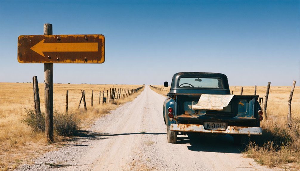
From Sealy, head southwest through open country. You’re in genuine backcountry now—4WD tracks branch from state routes toward the former townsite. Lake Virnau lies nearby, while Beard sits four miles southwest. This landscape rewards those who venture beyond maintained roads to discover Texas’s forgotten chapters.
Railroad History and the Town That Never Grew
The tale of Rexville begins with an Italian count’s audacious dream and ends with a whisper of wind across empty prairie. Count Telfer’s 1880 arrival aboard the Algeria launched his “macaroni line” from Rosenberg toward Mexico City, while Rexville emerged as a mere flag stop on the Gulf, Colorado and Santa Fe’s Sealy-Eagle Lake spur.
This wasn’t town planning—it was opportunity meeting speculation. Without Texas land grants after the 1870s policy shift, railroads and town planning diverged.
The factors impacting small town development here proved fatal: no depot, no services, just trains stopping when signaled. Italian laborers bought land parcels for maintenance work, but community never followed.
You’ll find Rexville represents Texas’s railroad fever stripped bare—ambition without foundation, leaving only traces.
What Remains Today at the Mieth and Rexville Roads Junction
At the crossroads where Rexville Road meets Mieth Road, you’ll confront absence more than artifact. The junction exists as open country where architectural remnants have surrendered to time and elements.
What draws you here isn’t preservation but erasure—the complete vanishing of a settlement that barely materialized.
You’ll find natural landscape features reclaiming their dominance: native grasses, mesquite, and the flat Texas prairie stretching toward distant horizons. No historical markers interrupt the view. No foundations peek through vegetation. The intersection itself serves as your only confirmation you’ve reached the right coordinates.
This emptiness tells Rexville’s story more authentically than any restored structure could. You’re standing where ambition met reality, where railroad promises dissolved into agricultural anonymity.
Exploring Nearby Ghost Towns and Rural Routes in Central Texas
Beyond Rexville’s vanished crossroads, Central Texas unfolds as a landscape of abandoned ambitions where dozens of ghost towns mark similar stories of promise and collapse. You’ll find Belle Plain forty minutes southeast of Abilene, where college ruins stand guard over an 1878 cemetery.
As you wander through the remnants of these forgotten places, you might feel a connection to the past, especially while exploring ghost towns in Texas. Each location tells a unique tale, inviting visitors to uncover the secrets that time has left behind. The echoes of laughter and the whispers of history linger, reminding us of the dreams that once flourished in these now-silent streets.
Near Gatesville, The Grove preserves its post office and saloon along Farm Road 1114, bypassed in the 1940s when locals refused progress. Medicine Mound’s dolomite hills overlook fire-scarred foundations, while St. Mary’s of Aransas survives as storm-battered houses along the coast.
These other remote sites lack Rexville’s complete erasure—historical signage details guide you through crumbling doorways and overgrown streets. Each route delivers solitary exploration through Texas’s relentless cycle of boom and abandonment.
Frequently Asked Questions
Are There Any Safety Concerns When Visiting Rexville’s Remote Location?
Yes, you’ll face real challenges: unpredictable weather, zero cell service, and wildlife presence demand respect. Your vehicle reliability becomes critical since help’s scarce. Pack emergency supplies, check your route, and embrace the wild independence this isolated adventure offers.
What Is the Best Time of Year to Visit Rexville?
You’ll find fall and spring offer the best exploration windows, with mild weather patterns perfect for wandering abandoned structures. These seasons deliver ideal lighting conditions for photography while you’re discovering Rexville’s haunting beauty without extreme temperatures hindering your adventure.
Can I Camp Overnight Near the Rexville Ghost Town Site?
You’ll find camping policies around Rexville pretty relaxed—meaning nonexistent, since nobody’s enforcing rules at abandoned ruins. Your local accommodation options? Nearby Terlingua offers full-hookup RV sites and primitive camping spots where you can experience true desert freedom.
Are There Any Guided Tours Available for Rexville and Nearby Towns?
No guided tours operate at Rexville itself, but you’ll discover local history tours in nearby Spring and Austin. Regional tourism events occasionally spotlight ghost towns, though self-guided exploration offers you complete freedom to experience Rexville’s haunting atmosphere independently.
What Photography Equipment Works Best for Documenting Ghost Town Remnants?
You’ll want wide-angle lenses capturing weathered facades, drone photography revealing skeletal structures from above, and sturdy tripods steadying long exposures. Pack spare batteries—Texas heat drains power fast. These tools immortalize Rexville’s forgotten stories through your adventurous lens.


