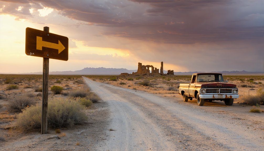
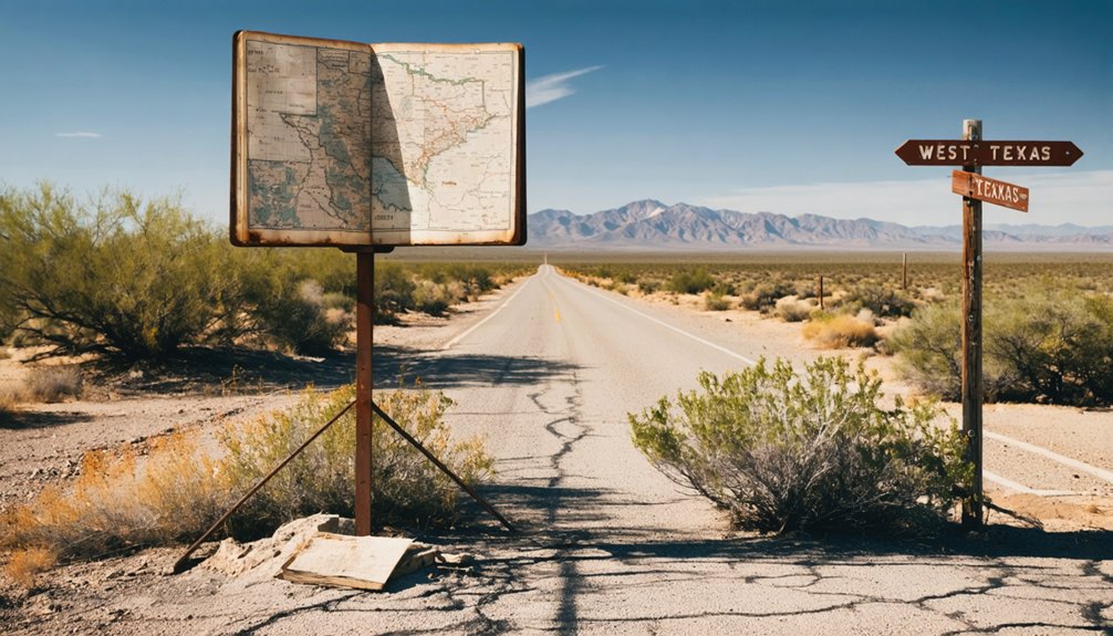
You’ll find Rustler Springs in Culberson County’s Trans-Pecos region at 3,490 feet elevation, where crumbling sulfur plant ruins and weathered storage tanks stand as monuments to industrial ambition. Plan your visit between March and May for mild temperatures, and navigate using the Rustler Hills USGS quad since unpaved ranch roads require dry conditions. The Atchison, Topeka & Santa Fe’s 30-mile spur once hauled molten sulfur from this remote outpost that carried four different names across its tumultuous existence, and there’s much more to discover about this hauntingly photogenic ghost town.
Key Takeaways
- Rustler Springs is located in remote Culberson County’s Trans-Pecos region at 3,490 feet elevation, accessed via unpaved ranch roads.
- Visit between March and May for mild temperatures and manageable precipitation; summer heat reaches 95°F with high humidity.
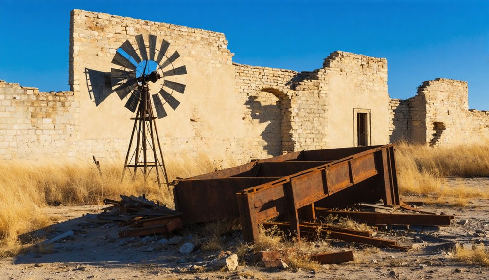
- The abandoned Duval Sulphur Plant features crumbling buildings, deteriorated storage tanks, and scattered weathered sulfur blocks from the 1980s.
- Navigate using the Rustler Hills USGS topographic quadrant; unpaved roads are generally passable during dry conditions.
- The town’s industrial legacy includes remnants of a 22-30 mile railroad spur built to transport molten sulfur.
The Fascinating History Behind Rustler Springs
Nestled in the dusty expanses of Culberson County, Rustler Springs carried four different names across its tumultuous existence, each reflecting a new chapter in its struggle for survival. You’ll trace its journey from Tovar through Sulphuria and Tarver before its final transformation to Rustler Springs in 1969.
These evolving town identities weren’t mere whims—they mapped directly onto industrial shifts that determined who stayed and who left. The sulfur plant anchored everything from the early 1900s onward, its fortunes rising when the Atchison, Topeka and Santa Fe Railroad punched a 22-mile spur through the harsh terrain.
You’ll find the Duval Sulphur Plant‘s skeletal remains still standing, monuments to an enterprise that once justified a post office, a railroad, and dreams of permanence in this unforgiving landscape.
Getting There: Directions and Road Conditions
You’ll find Rustler Springs nestled in the remote Trans-Pecos region of Culberson County, roughly 34 miles from the nearest towns of Mentone, Texas and Whites City, New Mexico. The journey takes you across desert terrain at approximately 3,490 feet elevation, where unpaved ranch roads are typical but generally passable with a standard two-wheel drive vehicle in dry conditions.
Navigate using the Rustler Hills USGS topographic quadrant, as cell service is unreliable in this isolated stretch of West Texas wilderness.
Remote Desert Route Access
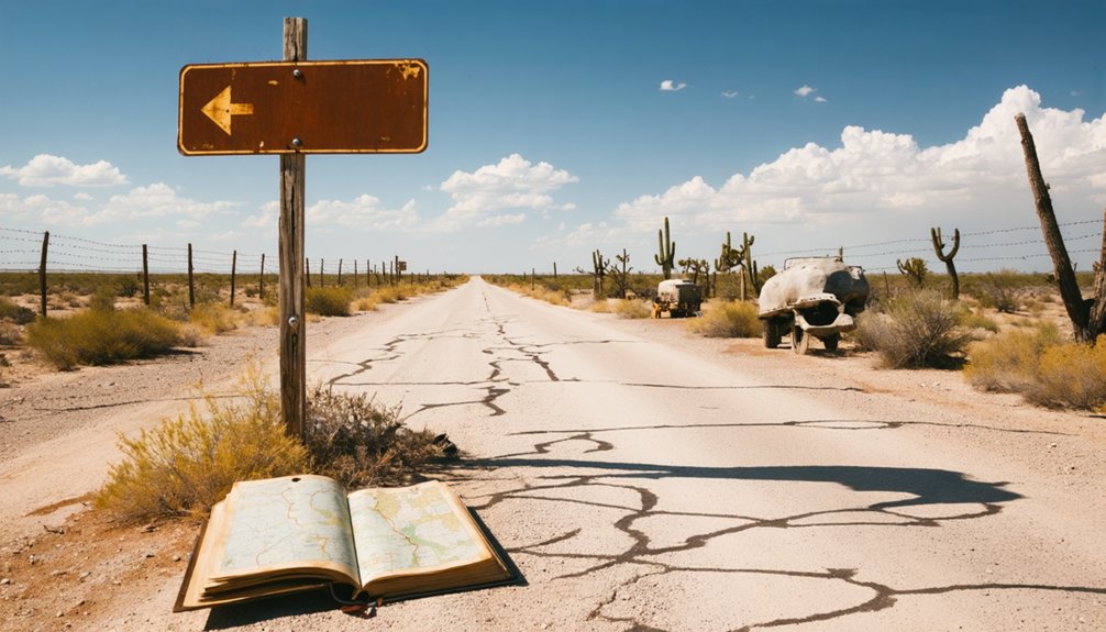
Reaching Rustler Springs demands careful planning and respect for the Chihuahuan Desert‘s unforgiving terrain. You’ll navigate graded dirt roads from Toyah on US Highway 80 or from Orla along US Highway 285, but these routes present significant remote transport challenges.
The 34-mile journey from Mentone requires self-reliance—there’s no cell service, no nearby services, and the nearest weather station sits 19 miles away at Red Bluff.
Seasonal muddy conditions transform passable ranch roads into impassable quagmires during wet weather. You’re traversing low ridges, buttes, and subsidence depressions across Rustler Hills‘ rugged landscape. Bring extra fuel, water, and supplies. Check forecasts carefully and avoid traveling alone.
This ghost town rewards those who embrace preparation over convenience.
Two-Wheel Drive Sufficient
Despite the remote desert challenges outlined earlier, the paved highways leading toward Rustler Springs country accommodate standard two-wheel drive vehicles without issue. You’ll find primary US routes maintained by TxDOT offering reliable paved road access throughout the Panhandle region. Your sedan handles these state highways perfectly—no lifted truck required.
Before departure, check DriveTexas.org for real-time conditions affecting your route. Their traffic cameras and district reports reveal accidents, construction, or closures that’ll impact your journey.
In all weather conditions, monitoring becomes essential; Texas Panhandle storms develop quickly, transforming roads from clear to hazardous within hours.
Standard vehicles reach ghost town country successfully when you stick to maintained highways and avoid unmarked desert tracks. Contact TxDOT at 800-452-9292 for specific route guidance.
What Remains of the Duval Sulphur Plant Today
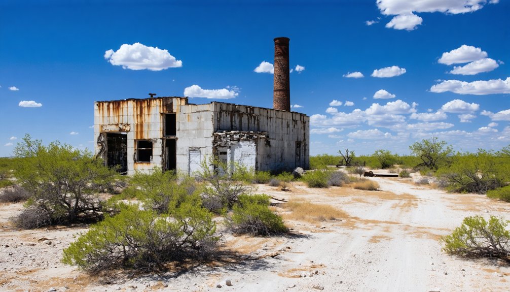
When you arrive at the former Duval Sulphur Plant site in Orchard, Texas, you’ll find little more than echoes of its industrial past scattered across the Fort Bend County landscape. The Frasch process operation shuttered during the 1980s market collapse, leaving behind crumbling plant buildings and deteriorated sulfur traces where superheated water once extracted underground deposits.
Your exploration may reveal:
- Abandoned storage tanks standing as skeletal monuments to the facility’s productive years alongside Texas Gulf Sulphur competitors
- Derelict structural foundations near the San Bernard River, gradually reclaimed by vegetation and time
- Weathered sulfur blocks scattered across the Boling Dome area, remnants of extraction activities
The site mirrors nearby Newgulf’s forsaken ruins, offering adventurous visitors authentic glimpses into Texas’s vanished sulfur mining era.
Best Time to Visit This Remote Ghost Town
You’ll find Rustler Springs accessible throughout the year, though the region’s extreme temperature swings—from winter lows near 37°F to blistering summer peaks of 95°F—will shape your exploration experience.
Spring months between March and May offer the sweet spot, delivering mild 71-78°F highs and manageable precipitation before the oppressive summer mugginess sets in.
Remember that this ghost town’s remote location means you’ll be exposed to the elements with little shelter, making seasonal planning essential for a comfortable journey into Texas’s forgotten past.
In addition to the historical sites, visitors will discover unique ghost town attractions in Huron that offer a glimpse into life during more prosperous times. From abandoned buildings to relics of the past, each location tells a story waiting to be uncovered. Make sure to bring your camera, as the haunting beauty of these sites provides ample opportunity for unforgettable photography.
Year-Round Accessible Climate
Rustler Springs enjoys a temperate climate that makes ghost town exploration possible throughout the year, with temperatures ranging from winter lows of 37°F to summer peaks of 95°F. You’ll encounter distinct seasonal shifts as you navigate this abandoned settlement, where microclimate variations create unique exploration conditions each month.
Consider these climate factors for your adventure:
- Winter months (December-February) bring mild highs of 60-64°F with 4+ inches of monthly rainfall, ideal for comfortable hiking through crumbling structures
- Spring winds peak at 13 mph in April, clearing desert dust for exceptional 9-mile visibility across the ghost town landscape
- Summer heat reaches muggy 95°F with 73% average humidity, demanding early-morning or sunset exploration sessions
The 101 annual precipitation days guarantee you’ll find adequate water access nearby while maintaining year-round road accessibility.
Remote Travel Considerations
Choosing the ideal window for your Rustler Springs expedition hinges on balancing extreme desert conditions with road accessibility and personal comfort. Spring and fall offer the most forgiving temperatures for exploring this abandoned sulfur mining outpost, though you’ll find no seasonal barriers blocking your path.
The remote location challenges demand thorough preparation—your packing lists should prioritize water, fuel, and emergency supplies since Toyah represents your last resupply point before venturing into isolation. Summer’s scorching heat intensifies the desolation, while winter brings surprising cold snaps across the high desert.
With 2WD access maintained year-round and no operational schedules restricting entry, you’re free to chart your course whenever adventure calls, provided you’ve secured self-sufficiency for this authentic backcountry experience.
The Railroad Spur That Changed Everything
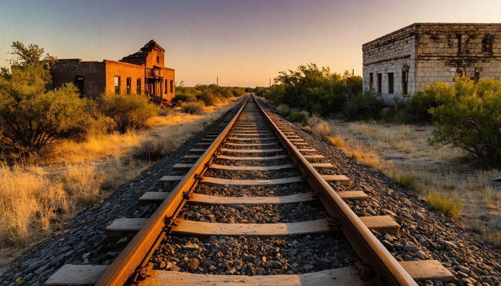
Deep in the sulfur-rich terrain of 1960s Texas, the Atchison, Topeka & Santa Fe Railway forged an audacious partnership with the Duval Corporation that would reshape the remote landscape around Rustler Springs. Where governmental land acquisition once dominated railroad infrastructure development in Texas, this venture represented pure capitalist ambition—a 30-mile branch line carved through wilderness to extract liquid gold from beneath the earth.
The transformation manifested through three revolutionary elements:
- Molten sulfur transportation system conveying superheated cargo directly from mine to Galveston’s maritime terminals
- Purpose-built industrial corridor serving extraction economics rather than passenger commerce
- Remote infrastructure network connecting isolated deposits to global markets
You’ll find remnants of this bold enterprise scattered across the landscape—testament to an era when private industry pushed railroad infrastructure into Texas’s most unforgiving territories.
Understanding the Sulfur Industry Legacy
Beneath the parched West Texas earth lay a chemical treasure that captivated industrialists for over a century, yet consistently defied their ambitions. You’ll discover that sulfur mining at Rustler Springs epitomizes the brutal economics of frontier extraction.
Early technological challenges—from flooded shafts to deadly poison gas that killed six workers in 1890—bankrupted the Louisiana Sulfur Company despite decades of effort. Evolving mining techniques brought marginal improvements, yet operations barely broke even, burning through local timber then imported Alabama coal just to boil water for processing.
The 1917 Michigan mine shipped a mere forty tons before market collapse ended the dream. What remains is a memorial to human persistence against geological obstinacy—a landscape where ambition met limitation, where freedom-seekers confronted nature’s indifference.
Nearby Landmarks and Points of Interest
While Rustler Springs itself stands as a memorial to failed industrial dreams, the surrounding Texas landscape offers vibrant counterpoints to its desolation. You’ll discover northeast Texas rewards adventurous travelers who venture beyond the ghost town’s boundaries.
Essential stops near Rustler Springs:
- Hopkins County Museum – Explore Civil War artifacts, Caddo Indian relics, and authentic period clothing that chronicle the region’s untamed past
- Cooper Lake State Park – Cast your line in trophy fishing waters just thirty minutes away, where bass and catfish await patient anglers
- Heritage Park – Wander eleven acres of relocated turn-of-the-century buildings, including a working blacksmith shop and authentic grist mill
These nearby water activities and local historic museums transform your ghost town pilgrimage into an extensive Texas adventure, blending abandoned industrial ruins with living cultural heritage.
What to Bring for Your Desert Exploration
The unforgiving Texas landscape demands meticulous preparation—what separates memorable exploration from dangerous misadventure is the gear you pack. Your protective equipment recommendations start with broad-brimmed hats, UV 400 sunglasses, and high SPF sunscreen. Layer loose cotton shirts over merino wool base layers for scorching days and frigid nights. Sand-resistant hiking boots with gaiters keep desert grit where it belongs—outside your shoes.
Your hydration and electrolyte needs escalate dramatically here: pack three liters minimum for day trips, doubling that for overnight adventures. Electrolyte powders aren’t optional—they’re survival essentials maintaining sodium and potassium balance. Don’t forget your basic first aid kit, headlamp, power bank, and navigation tools. Freedom means self-reliance, and self-reliance means carrying everything you’ll need when civilization disappears behind dusty horizons.
Photography Tips for Capturing Industrial Ruins
Capturing abandoned industrial sites separates casual snapshooters from dedicated ruin photographers—your equipment choices determine whether you’ll preserve history or return with mediocre snapshots.
Master these shooting techniques for Rustler Springs’ deteriorating structures:
- Embrace environmental factors: Overcast skies eliminate harsh shadows while moody weather creates atmospheric drama. Early morning and late afternoon deliver directional light that reveals weathered textures.
- Control your exposure: Keep ISO low, shoot RAW format, and use graduated ND filters to manage Texas’s intense sky. Bracket high-contrast scenes for maximum post-processing flexibility.
- Stabilize for authenticity: Mount your telephoto lens on a tripod, employ remote shutters for shake-free captures, and accept edge imperfections that preserve genuine character.
Long exposures with ND filters transform cloud movements into ethereal streaks across abandonment’s silent testimony.
Frequently Asked Questions
Are There Any Safety Hazards From Old Sulfur Processing Equipment?
You’ll find intriguing remnants from bygone mining days, though potential hazardous chemical residues linger near processing sites. Structural integrity concerns of abandoned buildings mean you’d best admire those weathered shafts and crumbling facilities from a respectful distance.
Can You Camp Overnight Near the Rustler Springs Site?
You’ll find primitive camping options through Hipcamp near Rocksprings, offering scenic vistas of rocky high desert terrain. These sites let you explore historical artifacts at your own pace while enjoying starlit freedom just miles from Rustler Springs.
Is Cell Phone Service Available in This Remote Area?
You’ll likely face severe signal quality issues in Rustler Springs—remote connectivity is virtually nonexistent there. No coverage data exists for this ghost town, so you’d better enable WiFi calling beforehand or pack satellite communication devices for true freedom.
Do You Need Permission to Access the Former Plant Property?
The former plant’s ownership status isn’t publicly documented, so you’ll need to research local landowner policies before exploring. Nearby mining operations may still control access. It’s wise to seek permission rather than risk trespassing charges in remote Culberson County.
Are There Restrooms or Water Sources Available at the Site?
No restrooms or water sources exist at this abandoned site. You’ll find no shade among the industrial ruins, only desert wildlife and stark exposure. Come completely self-sufficient—this ghost town offers absolute freedom but zero amenities.


