Drive WY 487 south from Casper to the Shirley Basin Rest Area, then take WY 77’s turnoff 22 miles north of Medicine Bow before following unmarked BLM route 3127 for 6.1 miles across windswept prairie. You’ll confront a dual ghost town where uranium-era trailers crumble atop ancient tipi rings, with 75 structures scattered across contaminated zones at 7,100-foot elevation. Check WYDOT 511 before departing, as winter wind chills plummet dangerously low, and discover how this archaeological treasure transforms abandoned industrial ruins into unexpected art installations.
Key Takeaways
- Take WY 487 south from Casper to WY 77 turnoff, then drive 6.1 miles to unmarked BLM route 3127.
- Check WYDOT 511 for road conditions before departure; extreme winter wind chills can reach 100 below zero.
- Explore 1,512 acres featuring 75 structure remnants, art installations, and ancient Native American archaeological sites at 7,100-foot elevation.
- Respect contaminated zones from uranium mining operations that produced 71 million pounds of ore between 1960s-1990s.
- Plan for Mountain Daylight Time (UTC-7) and note width restrictions on WY 77 between mileposts 122.1 and 144.2.
Getting There: Routes and Road Conditions to Shirley Basin
The wind hits you first on the approach to Shirley Basin—relentless gusts that rock your vehicle and send tumbleweeds cartwheeling across the asphalt like nature’s own warning system. You’ll navigate WY 487 south from Casper, marking your progress at the Shirley Basin Rest Area near mile marker 45.
From there, take the WY 77 turnoff 22 miles north of Medicine Bow, following it 6.1 miles to unmarked BLM route 3127. Check WYDOT 511 for road maintenance schedules before departing—winter wind chills plummet to 100 below zero in this exposed sagebrush country. The region operates on Mountain Daylight Time, running 7 hours behind UTC, so plan your arrival accordingly to maximize daylight hours for exploration. Be aware that size and weight restrictions may apply on certain sections of the route.
Width restrictions apply on WY 77 between mileposts 122.1 and 144.2. No visitor permit requirements exist for public roads, giving you unrestricted access to this desolate 7,100-foot elevation basin.
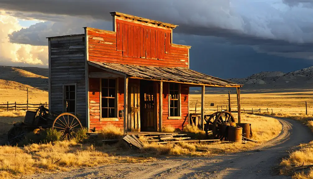
What to Expect When You Arrive at the Abandoned Town Site
After miles of empty highway and that final turn onto the unmarked county road, you’ll find yourself confronting a landscape that refuses easy categorization—part industrial graveyard, part archaeological treasure, part accidental art gallery.
At 7,100 feet, wind rakes across scattered mobile homes riddled with bullet holes, their rusted shells gradually collapsing into sagebrush. The engineered disposal cell containing uranium tailings dominates the 1,512-acre parcel, its 142 acres monitored annually under current environmental regulations.
Beyond the decay, you’ll discover mixed-media sculptures hidden among the ruins—Theresa Anderson’s, Alicia Ordal’s, and Julie Puma’s installations transforming abandoned trailers into unexpected art. The collectives plan to maintain and replenish the exhibition over the next few years, ensuring the art evolves alongside the decay. With virtually no abandoned town upkeep, exploration requires careful navigation around contaminated zones while respecting the ancient tipi rings and stone structures scattered across six miles of plateau. Researchers have documented approximately 50,000 artifacts from the original 1969 excavation, with remnants of 75 structures still visible across the basin.
The Rise and Fall of Wyoming’s Uranium Mining Community
When Teton Exploration’s drill bits punched through sagebrush-covered sandstone in 1955, they triggered an economic frenzy that would transform this desolate plateau into Wyoming’s second-largest uranium district.
You’re standing where Cold War paranoia fueled prosperity—where 71 million pounds of uranium ore fed America’s nuclear ambitions between the 1960s and 1990s. Utah Mining’s strip operations scarred the landscape while Petrotomics pioneered America’s first in-situ recovery techniques.
The 1969 onsite mill processed yellowcake until 1992, employing hundreds in this remote basin. Economic factors contributing to Shirley Basin’s decline followed the 1979 Three Mile Island accident, collapsing uranium prices despite abundant reserves. Shirley Basin in Carbon County ranked among Wyoming’s most productive uranium areas alongside Gas Hills and Crooks Gap in Fremont County. Uranium mineralization occurred where organic material from Eocene Forests created the reducing conditions necessary for roll-front deposits in Wind River Formation sandstones.
The history of shirley basin ghost town adds another layer of intrigue to the region’s narrative, showcasing the remnants of a once-thriving community that now stands largely abandoned. Over the decades, various attempts at revitalization have been made, but these efforts were often overshadowed by the unpredictable nature of uranium markets. As visitors explore the desolate streets of the ghost town, they are reminded of the boom-and-bust cycles that have defined the area’s legacy.
Today, 15.3 million tons of tailings remain—silent testimony to environmental impacts of uranium mining operations that once promised freedom through energy independence.
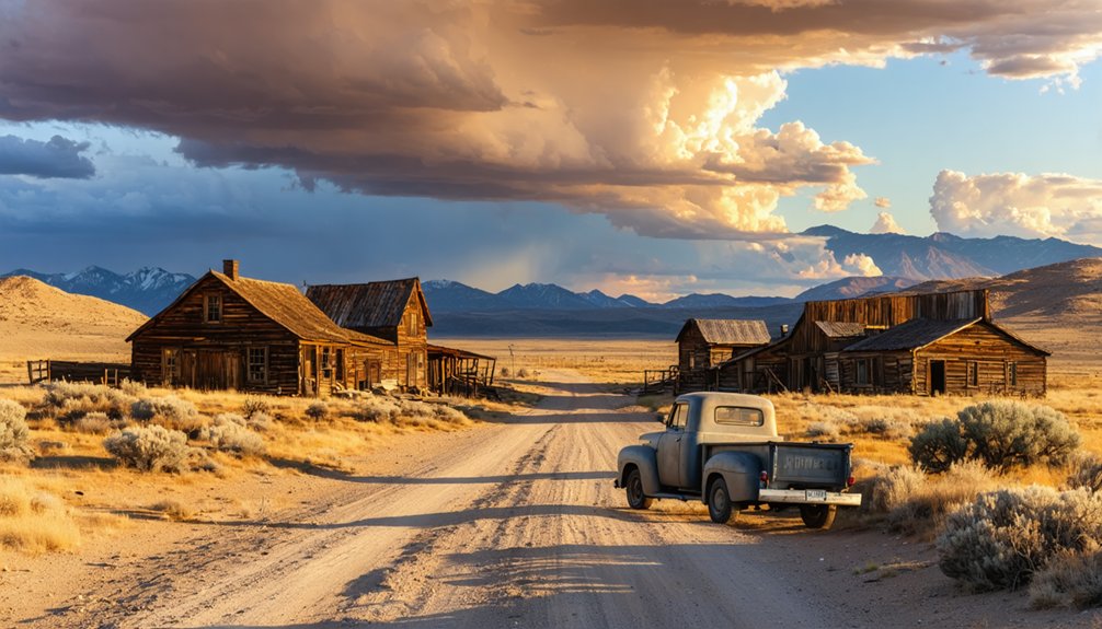
Exploring the Ruins: Trailers, Foundations, and Remaining Structures
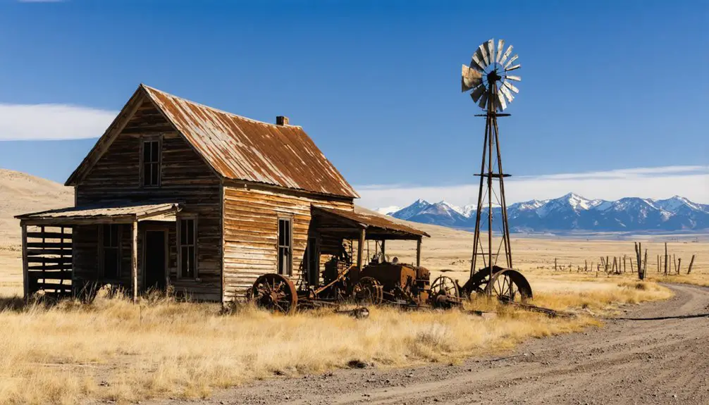
Scattered across wind-scoured prairie, bullet-riddled trailers lean at desperate angles—their aluminum skins peeling back like flesh from bone. You’ll navigate concrete slabs marking vanished lives, where dusty metal racks and weathered equipment tell stories of hasty departures.
The ramshackle architecture reveals three decades of target practice—perforations puncture trailer walls, truck beds, even the abandoned school bus rusting near the schoolhouse ruins. Unlike the false front façades that defined nineteenth-century Western boomtowns, Shirley Basin lacks any pretense of architectural charm.
Among this decaying infrastructure, you’ll discover unexpected art installations from the 2020 Re-Activate exhibit: pantyhose sculptures clinging to imploded trailers, neon-green yarn wrapped around wheel-less trucks. The town store—once post office, bank, and gas station—topples slowly while foundations mark where miners’ families built temporary lives. Each concrete slab represents dreams abandoned when uranium prices collapsed, leaving only wind and grasslands to reclaim Shirley Basin. Terry Lane’s drone video captures a bird’s-eye perspective of this abandoned landscape, offering viewers a haunting aerial tour of what remains.
Ancient Native American Village Beneath the Ghost Town
Beneath layers of uranium-era wreckage lies a revelation that reframes your ghost town exploration—long before miners hauled atomic-age ore from these hills, indigenous communities built stone-walled structures across six miles of Shirley Basin’s plateaus. You’ll find twenty-one core rock-walled shelters, far more permanent than nomadic camps, plus seventy-five tepee rings overlooking ancient drainage routes.
Radiocarbon dating places occupation around 1742 AD, though evidence suggests seasonal use from 2000 BC through 1850 AD. Tens of thousands of artifacts—chipped stones, steatite bowls, bison processing sites—still await full excavation. These high plains settlements connect to a broader pattern of habitation, as various Indian tribes occupied Wyoming’s western territories as early as 12,000 years ago. Stone tools recovered from the site reveal local sourcing and material from lower elevations, indicating trade networks and seasonal movement patterns.
Cultural preservation efforts now protect these windswept plateaus where Shoshone families once harvested pine nuts and tracked herds. Archaeological excavation plans promise deeper insights into Wyoming’s semi-settled mountain communities, challenging assumptions about purely nomadic lifestyles.
Photography Tips and Safety Considerations for Visitors
You’ll need a sturdy tripod and wide-angle lens to capture the haunting interiors where cross-light streams through broken windows, illuminating decades of decay.
Watch your step inside—bullet-riddled walls and sagging floors signal real collapse risks in structures that’ve weathered over half a century of Wyoming’s brutal freeze-thaw cycles.
Before you head down that unmarked county road east of Highway 487, pack extra water and tell someone your plans, because cell service disappears the moment you leave pavement behind.
Essential Camera Gear Setup
When the windswept ruins of Shirley Basin emerge from Wyoming’s high desert plains, you’ll need camera gear that matches the harsh beauty of this abandoned uranium mining town. Your mirrorless or DSLR body should handle low-light conditions while you explore decaying structures at dawn.
Pack a sturdy tripod—you’ll use it for long exposures capturing star trails over skeletal buildings and HDR bracketing in dim interiors. Wide-angle lenses (14-24mm) frame expansive abandonment, while fast primes like a 50mm f/1.8 capture intimate details in failing light.
Shooting technique considerations demand multiple spare batteries since Wyoming’s temperature swings drain power quickly. Camera gear maintenance becomes critical here—bring cleaning kits with blowers and sensor swabs to combat relentless dust infiltrating every crevice of your equipment.
Your camera gear won’t matter if you’re lying injured beneath a collapsed floor. Test each plank before transferring weight—rotted wood crumbles without warning. Watch for exposed rebar jutting from cracked concrete and hidden shafts concealed by debris. Structural hazard mitigation means studying walls for bulges and cracks before entering, then planning your exit route immediately.
Keep bear spray accessible while exploring—abandoned structures attract wildlife seeking shelter. Make noise approaching buildings to avoid surprise encounters with nesting animals. Those perfect interior shots aren’t worth a puncture wound or worse.
Stay alert for monitoring cameras protecting these historic sites. Disturbing artifacts, even rusted nails, violates preservation laws. Your freedom to explore depends on respecting boundaries and prioritizing survival over that killer Instagram shot.
Weather and Terrain Precautions
While Shirley Basin’s haunting landscapes promise dramatic photographs, the weather here weaponizes itself against unprepared visitors. You’ll face wind gusts hitting 60 mph that’ll rip tripods from the ground and wind chills plummeting to 0°F during 20-40% probability snow showers. At 7300 feet elevation, temperatures swing violently—48°F afternoons crash to 11°F nights within hours.
Layer aggressively and anchor your equipment against relentless southwest winds averaging 15-35 mph. The basin’s exposed terrain amplifies every gust across open sagebrush flats where wildlife management plans restrict certain areas seasonally. Before venturing off established roads, consult environmental impact assessments—some ghost town sites sit within protected zones. Schedule shoots during partly sunny windows when highs reach the upper 40s, but always pack emergency gear. This land doesn’t forgive complacency.
Current Revitalization Efforts and Future Access to the Site
You’ll find Shirley Basin caught between two futures—uranium companies like Ur-Energy planning to nearly double production capacity to 2.2 million pounds annually through revived in-situ recovery operations, while Maestro Wind LLC has filed preliminary plans for a wind farm sprouting meteorological towers across the center of the basin.
Four or five mining operations are already active in the district, re-drilling 1960s exploration wells that first made this the birthplace of modern uranium extraction. Access to the ghost town site itself remains open via WY-487, though increasing industrial traffic and transmission lines creeping south from Medicine Bow signal the basin’s quiet days may be numbered.
Proposed Mining Operations Return
The ghost town that once hummed with uranium extraction is stirring back to life. Ur-Energy’s breaking ground on their second in situ recovery facility here, with production targeted for early 2026. You’ll witness modern wellfield drilling operations transforming the landscape where historic mines once operated.
The satellite facility will leverage existing infrastructure while implementing contemporary environmental remediation standards far beyond what those 1960s operators ever imagined. Economic impacts are already rippling through the region—construction crews, equipment staging areas, and renewed purpose for abandoned roads you’re traveling.
Noble Plains Uranium’s secured adjacent claims, planning September 2025 drilling on 665 acres. This isn’t preservation—it’s resurrection. The basin’s 9 million pounds of uranium resources promise decades of renewed activity across these windswept plains.
Cultural and Artistic Projects
Among Shirley Basin‘s skeletal trailers and rust-streaked ruins, an unlikely art movement has taken root. You’ll discover the Re-Activate project, where artistic collaborations between Hyperlink and Land Report Collective transformed abandoned structures into open-air galleries.
Since 2020, artists like Theresa Anderson, Alicia Ordal, and Julie Puma have erected mixed-media sculptures throughout the only remaining copse of standing trailers.
You can explore these installations yourself—they’re intentionally placed among the decay, blending human creativity with industrial remnants. The collectives plan ongoing artwork preservation and replenishment over coming years, ensuring this remote cultural oasis endures.
Navigate the unmarked county road east of Highway 487, and you’ll find where uranium’s legacy meets contemporary expression, offering freedom-seeking visitors an authentic, off-grid artistic experience.
Frequently Asked Questions
Are There Any Lodging or Camping Facilities Near Shirley Basin?
You’ll find nearby campgrounds like Dugway and Westside along Alcova Lake, plus a unique 1920s sheep wagon on Airbnb. Local bed and breakfasts aren’t available, but Worland’s hotels offer comfortable alternatives twenty-five miles away.
What Is the Best Time of Year to Visit the Ghost Town?
Like wildflowers breaking through abandoned foundations, spring scenery awakens Shirley Basin’s ghost town best. You’ll find accessible roads, mild temperatures, and that untamed freedom you crave. Autumn foliage offers a stunning alternative when golden aspens frame weathered structures perfectly.
Do I Need Permission or Permits to Explore the Abandoned Site?
You’ll need permission to explore private ranch lands and NRC-regulated areas. Trespassing concerns and liability risks are real—federal sites have restricted access. Contact BLM and local landowners first; respecting boundaries protects your freedom to explore responsibly.
Are There Any Restaurants or Gas Stations Within Reasonable Distance?
You’ll find civilization’s scarce—Lovejoy’s Bar & Grill in Medicine Bow offers hearty grub about 30 miles north. Fuel up there too, as nearby amenities vanish fast. Plan ahead; this remote territory demands self-reliance before exploring local attractions.
Can I Legally Take Artifacts or Souvenirs From the Ghost Town?
No, you can’t legally take artifacts from Shirley Basin’s ghost town. Leave no trace principles apply—take nothing but photos. Permission’s required on private property, and removing historical items violates federal protection laws. Respect the site’s heritage.
References
- https://k2radio.com/the-ghost-town-of-shirley-basin-video/
- http://wyofile.com/ancient-town-yields-new-clues-early-life-wyoming/
- https://historicwyoming.org/profiles/carbon/
- https://southwestcontemporary.com/hyperlink-land-report-collective-wyoming/
- https://www.geowyo.com/shirley-basin.html
- https://www.wyohistory.org/encyclopedia/wyomings-uranium-drama-risks-rewards-and-remorse
- https://www.youtube.com/watch?v=2QZ65dNOsvA
- https://www.mapquest.com/us/wyoming/shirley-basin-wy-283598895
- https://map.wyoroad.info/511-map/?query=restrictions,memo_no,26-032
- https://www.topozone.com/wyoming/carbon-wy/basin/shirley-basin/