Planning a ghost town road trip to Strawn, Kansas means visiting a place that’s literally underwater. Located in Coffey County, Old Strawn was a thriving 1850s mining boomtown that a catastrophic 1951 flood — followed by reservoir construction — swallowed entirely by 1964. Today, three structures still stand, and submerged streets occasionally resurface during low water. Visit in late summer for the best access, and wear sturdy boots. There’s far more to this haunting story than meets the eye.
Key Takeaways
- Visit in late summer or early fall when water recedes, revealing submerged streets, foundations, and artifacts from the original townsite.
- Three structures remain standing: a historic church, schoolmaster’s house, and coal weighing foundation from the town’s mining era.
- The site is on U.S. Army Corps of Engineers land, making access free of charge for all visitors.
- Wear sturdy footwear and check reservoir conditions before visiting, as terrain is muddy, uneven, and seasonally flooded.
- Strawn was submerged after the catastrophic 1951 flood and construction of John Redmond Dam, completed by 1964.
What Happened to the Ghost Town of Strawn, Kansas?
Strawn, Kansas has a ghost town story unlike most others — it wasn’t abandoned gradually or left to decay quietly. In July 1951, catastrophic flooding submerged the entire town under six to eight feet of water after a devastating rainfall event. Twenty-four Kansans lost their lives, and the damage was staggering.
Rather than rebuild in place, residents made a bold collective decision: relocate entirely. Construction of the John Redmond Dam and Reservoir sealed old Strawn’s fate permanently, with remaining structures bulldozed in 1964. The original townsite now sits beneath the reservoir’s surface.
You won’t find much urban legends or local folklore romanticizing this loss — the history speaks starkly enough on its own. What you’ll find is a community that refused to simply disappear.
How Strawn Went From Boomtown to the Bottom of a Reservoir
Strawn once thrived as a booming mining settlement, drawing nearly 3,000 residents to its Coffey County streets after its 1855 founding.
In July 1951, everything changed when 8–16 inches of rain fell in a short period, sending floodwaters 6–8 feet deep through town and killing twenty-four people across Kansas.
That disaster triggered a relocation decision that ultimately handed Strawn‘s original site over to the John Redmond Reservoir, which swallowed the remaining structures by 1964.
Strawn’s Mining Boom Era
At its peak, Strawn wasn’t just another small Kansas settlement — it was a thriving boomtown of 3,000 residents fueled by active mining operations near the Neosho River. The town’s mining history shaped everything around it, from the coal weighing foundations scattered across the landscape to the town architecture that rose up to support a bustling workforce.
You can almost picture the streets filled with miners, merchants, and families building something real and lasting. The community developed infrastructure, character, and pride during this era.
Today, that coal weighing foundation remains one of the few physical traces of Strawn’s industrial past, standing as a quiet monument to the ambition that once defined this corner of Coffey County, Kansas.
The Catastrophic 1951 Flood
What the mines built up, the sky tore down. In July 1951, relentless rainfall hammered Kansas, and Strawn took the worst of it. You’d have watched your entire town disappear beneath 6–8 feet of water—a staggering flood recovery challenge that tested every resident’s will to survive.
The storm delivered brutal numbers:
- 8–16 inches of rain fell in a dangerously short period
- 24 lives were lost across Kansas
- Billions in damages devastated the region
- Strawn’s entire population faced displacement overnight
Community resilience defined what came next. Rather than scattering, residents made a remarkable collective decision—they’d rebuild together, somewhere safer. That choice transformed Strawn from a drowning boomtown into something rarer: a community that refused to simply disappear.
Reservoir Swallows The Town
Even after surviving the 1951 flood, Strawn couldn’t escape water’s reach. The construction of John Redmond Dam sealed the town’s fate, and by 1964, bulldozers leveled whatever structures remained standing.
The rising reservoir swallowed the original townsite entirely, burying streets, foundations, and decades of history beneath its surface.
Today, urban legends circulate about what lies submerged below — whispers of buried mining equipment and forgotten homesteads waiting for discovery. During unusually low water levels, archaeological findings occasionally emerge, offering rare glimpses into Strawn’s past.
You might spot tree lines marking old property boundaries or exposed foundations peeking through the silt.
The Corps of Engineers now owns this land, and the reservoir’s edge marks where a thriving community of 3,000 people once lived, worked, and built their lives.
What’s Still Standing at the Old Strawn Townsite?
Though time and floodwaters have claimed nearly everything, three original structures still survive at the old Strawn townsite: a historic church, the schoolmaster’s house, and a coal weighing foundation left over from the town’s mining days. These abandoned structures and scattered historical artifacts are all that remain above the silt.
When water levels drop, you can explore freely on Corps land:
- Walk the church grounds, one of the most intact surviving remnants
- Locate the schoolmaster’s house, standing quietly among overgrown trees
- Find the coal weighing foundation, a raw industrial relic from Strawn’s mining peak
- Park south near the old school site, your best entry point to the townsite
Foundations hide beneath silt, and high water can reclaim everything overnight.
Can You Visit Old Strawn Today?
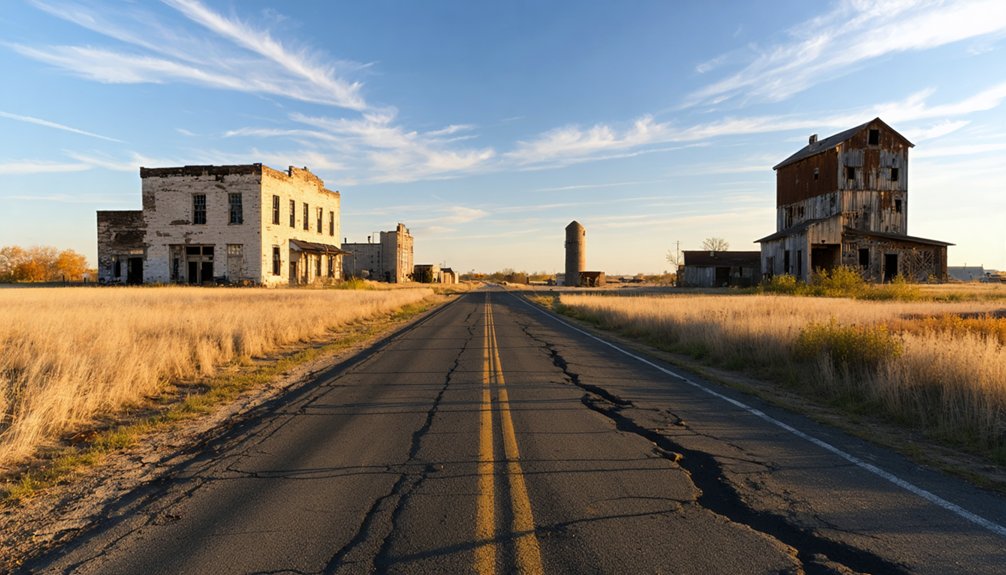
Yes, you can visit old Strawn today — but timing is everything. The site sits on U.S. Army Corps of Engineers land, so access is free, though high water from snowmelt or storms can literally turn Main Street into a river. When water levels drop, you’re free to explore what remains.
Don’t expect dramatic ruins. Surface features are mostly trees, with foundations buried under decades of silt. Still, local legends about the submerged town draw curious travelers willing to look closer. Hidden artifacts occasionally surface after water recedes, rewarding those patient enough to search.
A small parking area sits south of the site, near where the old Strawn school once stood. Come prepared, check water conditions before you go, and embrace the eerie quiet of a town swallowed by history.
When Is the Townsite Actually Above Water?
Your best chance of walking Old Strawn’s ghost streets comes in late summer and early fall, when water levels typically drop low enough to expose the townsite.
Spring visits are a gamble — snowmelt and heavy storms can transform what’s left of Main Street into a flowing river, swallowing any access you’d hoped to find.
If you’re planning the trip, check current reservoir conditions through the U.S. Army Corps of Engineers before you go, since high water can flood the site with little warning.
Seasonal Water Level Changes
Timing your visit to old Strawn is everything, because the townsite spends much of the year partially or fully submerged beneath John Redmond Reservoir. Water level fluctuations and seasonal flooding dictate when you can actually walk the grounds. Plan around these conditions:
- Late summer offers the most reliable low water, exposing more of the original townsite.
- Spring snowmelt triggers significant seasonal flooding, often turning Main Street into a navigable waterway.
- After heavy storms, water levels surge unpredictably, cutting off access entirely.
- Fall provides a secondary window when reservoir levels typically drop again.
Check current conditions before heading out — arriving to find the site underwater wastes your trip. The Corps of Engineers manages this land, so water levels shift based on upstream rainfall and reservoir management decisions.
Best Times To Visit
Since the townsite spends much of the year underwater, planning your visit around seasonal water levels dramatically improves your odds of actually walking the grounds. Late summer through early fall offers your best window — reservoir levels typically drop after spring runoff subsides, exposing foundations buried beneath silt and revealing traces of the town’s mining-era past.
Avoid visiting after heavy storms or significant snowmelt, when Main Street literally becomes a river.
Dry years create exceptional conditions, occasionally uncovering historical artifacts that high water conceals indefinitely.
Come prepared with sturdy footwear, since exposed ground stays muddy and uneven.
Local legends suggest longtime residents occasionally return during low-water years, making unexpected conversations part of the experience.
Check current reservoir conditions through the U.S. Army Corps of Engineers before committing to your road trip.
How Strawn Compares to Other Flooded Ghost Towns in Kansas
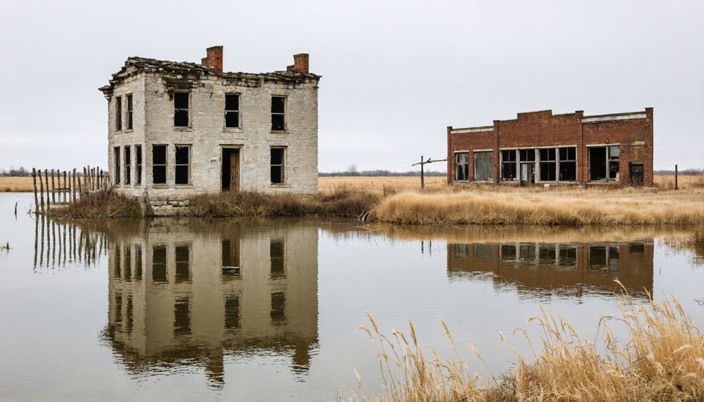
While Kansas has its share of flooded ghost towns, Strawn stands out because its community didn’t simply scatter—they relocated together and built an entirely new town. That collective resilience makes Strawn’s flood impact uniquely significant for historical preservation. Here’s what sets Strawn apart:
- Deliberate relocation – Residents chose community over convenience, founding New Strawn nearby in 1961.
- Visible remnants – Three original structures still stand, unlike many flooded towns swallowed entirely without a trace.
- Accessible site – You can walk the original grounds freely on Corps land when water levels drop.
- Documented catastrophe – The 1951 flood killed twenty-four Kansans and caused billions in damages, giving Strawn’s story statewide historical weight.
No other Kansas ghost town combines all four of these compelling elements.
Frequently Asked Questions
Is There an Entrance Fee to Access the Old Strawn Townsite?
Like an open door to the past, you’ll enter freely — no fee chains you here! Explore old Strawn’s haunted legends without cost. Bring your camera; photography tips: capture foundations and eerie tree lines beautifully.
Where Exactly Should Visitors Park When Exploring the Strawn Ghost Town?
You’ll find a small parking area to the south, near the old Strawn school site. It’s your gateway for historic preservation exploration and photography tips—capture those ghostly tree lines and buried foundations before floodwaters reclaim them!
What County Is the Ghost Town of Strawn, Kansas Located In?
You’ll find Strawn’s ghost town history nestled in Coffey County, Kansas, where abandoned structures and sunken memories await your exploration. It’s a hauntingly unique destination that’ll ignite your adventurous spirit and love of freedom!
When Was New Strawn Officially Incorporated as a Town?
You’ll find that New Strawn was officially incorporated in 1970, making it Coffey County’s newest town. Its historic preservation efforts and local legends keep the spirit of old Strawn alive for freedom-seeking explorers like you.
How Many People Originally Lived in Strawn During Its Peak Population?
Like a boomtown rising from the plains, Strawn’s historical population once soared to 3,000 residents at its peak. You’d have witnessed dramatic demographic changes as mining operations transformed this Kansas settlement into a thriving community.
References
- https://newstrawn.org/history/
- https://www.youtube.com/watch?v=dy7nLwjHkbY
- https://www.facebook.com/kansasghosttownhunter/posts/strawn-ks-a-coffey-county-ghost-townbulldozed-in-1964-to-make-way-for-john-redmo/10156419039110787/
- https://en.wikipedia.org/wiki/Strawberry
- https://www.youtube.com/watch?v=KBXINX0xqnU
- https://en.wikipedia.org/wiki/Stull