Troupville, Georgia, is a ghost town four miles north of Valdosta, where a once-thriving county seat has been reclaimed by wilderness at the confluence of the Okolocoochee and Withlacoochee rivers. At its peak, it supported three hotels, four stores, and multiple churches before the railroad’s arrival in nearby Valdosta drained its lifeblood. Today, collapsed buildings and eerie silence mark the landscape. Stick around to uncover everything you’ll need to plan your road trip here.
Key Takeaways
- Troupville, Georgia, sits four miles north of Valdosta at the confluence of the Okolocoochee and Withlacoochee rivers, making Valdosta the ideal starting point.
- Visit during late summer through early fall to avoid seasonal flooding that can make surrounding roads impassable and cut off access routes.
- Check river levels before departing and approach Troupville from either the east or west depending on current road and water conditions.
- Pack sturdy boots, insect repellent, waterproof bags, and offline maps, as cell service is weak and terrain is uneven near the river.
- Troupville is recognized as a Historic Township, featuring remnants of collapsed buildings that once included three hotels, four stores, and three churches.
What Was Troupville, Georgia?
Before Valdosta became the dominant city in South Georgia, Troupville was the region’s beating heart. Named after Georgia Governor George Michael Troup, this now-vanished town served as Lowndes County‘s seat from 1833 to 1860, replacing Franklinville as the area’s administrative center.
You’ll find Troupville history rooted at the confluence of the Okolocoochee and Withlacoochee rivers, just four miles north of modern Valdosta.
At its peak, the Troupville economy supported three hotels, four stores, multiple churches, and a local newspaper called the South Georgia Watchman. Business inventory climbed from $5,000 to $9,162 within a single decade.
The town also functioned as a gateway into the newly formed state of Florida, making it a critical hub for settlers and commerce moving southward.
Why Did Troupville Become a Ghost Town?
Like many 19th-century towns, Troupville didn’t collapse overnight—it was quietly strangled by progress. The railroad was the decisive blow. When rail lines favored nearby Valdosta, residents and businesses followed, triggering economic shifts that Troupville simply couldn’t survive.
Foot traffic dried up, commerce evaporated, and the town’s identity as a gateway to Florida became irrelevant.
The decline factors compounded quickly. Seasonal flooding regularly destroyed bridges, cutting off trade routes and frustrating merchants. Without reliable infrastructure, growth was impossible.
By 1874, travelers described the once-bustling county seat as “a deserted village…with scarcely a vestige remaining.” The municipal charter wasn’t officially repealed until 1995, but the town had fundamentally surrendered to nature a century earlier.
Freedom, it turns out, sometimes means knowing when to move on.
Where Exactly Is the Troupville Ghost Town Site?
If you’re planning a visit to the Troupville ghost town site, start your journey in Valdosta and head four miles north to reach the historic confluence of the Okolocoochee and Withlacoochee rivers, where the town once stood.
You’ll want to plan your trip carefully around the seasons, since winter and spring flooding can make the surrounding roads impassable and even sweep away bridges.
Keep in mind that the river crossings require you to navigate either the east or west river route, so checking current road conditions before you head out will save you a frustrating detour.
Valdosta Starting Reference Point
Four miles north of Valdosta marks your starting point for tracking down the Troupville ghost town site, placing it surprisingly close to the modern city that ultimately helped seal its fate.
Understanding Valdosta history actually sharpens your ghost town exploration experience, since the railroad’s arrival there directly pulled residents away from Troupville throughout the late 1800s.
Use Valdosta as your modern hub before heading north toward the confluence of the Okolocoochee and Withlacoochee rivers, where Troupville once thrived as Lowndes County’s seat of power.
The contrast between today’s bustling Valdosta and the abandoned townsite just minutes away makes the journey genuinely striking.
You’re fundamentally retracing the exact migration path that transformed a prosperous county seat into a deserted field within a single generation.
River Confluence Location
Troupville once stood at the confluence of the Okolocoochee and Withlacoochee rivers, and that meeting point of two waterways remains your most reliable landmark when searching for the ghost town site today.
The river ecology here hasn’t dramatically changed, meaning the natural geography fundamentally mirrors what early settlers encountered. You’re standing where Georgia’s 19th-century commerce once thrived, where traders, lawyers, and travelers crossed paths daily.
That historic significance runs deep — this confluence shaped why Troupville existed at all, offering fresh water, transportation routes, and natural boundaries that defined the settlement.
The Withlacoochee still flows nearby, providing a scenic backdrop as you explore. Let the rivers guide your orientation when steering through this quietly haunting landscape four miles north of Valdosta.
Once you’ve oriented yourself by the river confluence, getting your vehicle to the actual Troupville site means wrestling with road conditions that haven’t always cooperated with curious visitors.
Seasonal flooding historically swept away bridges, making winter and spring approaches genuinely risky. Smart travel tips start with checking water levels before heading out.
- Avoid visiting after heavy rainfall; flooding remains a real obstacle
- Four-wheel drive handles unpaved stretches more reliably
- Check current bridge conditions crossing the Little River toward Brooks County
- Start your approach from Valdosta, heading four miles north
- Download offline maps since cell coverage gets spotty in rural South Georgia
Road conditions here aren’t just inconveniences—they’re part of Troupville’s story, reminding you why this town eventually surrendered to isolation.
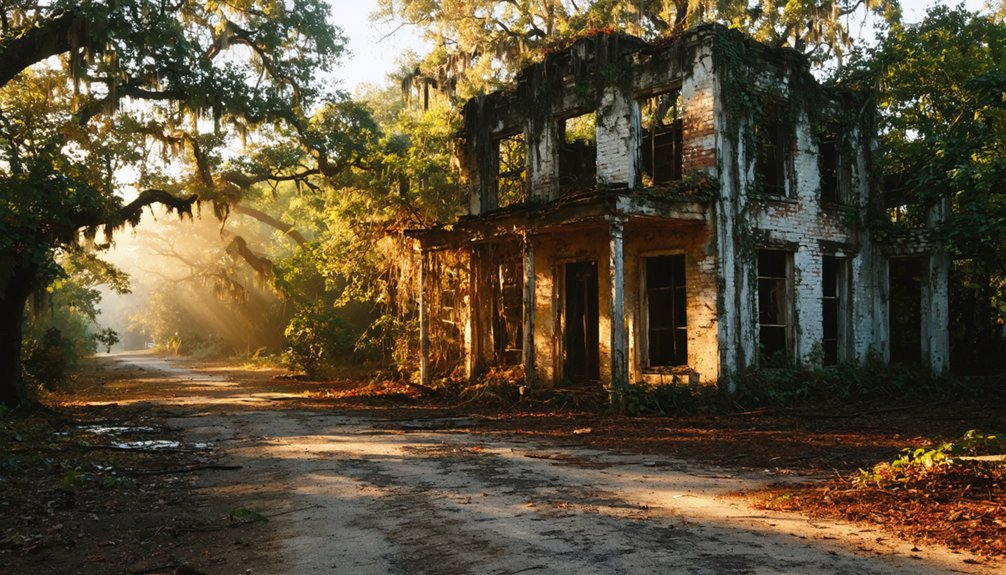
What Ruins and Remains Can You Still See at Troupville?
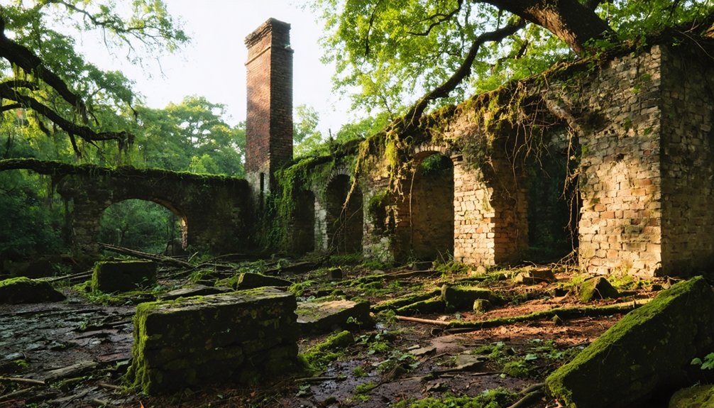
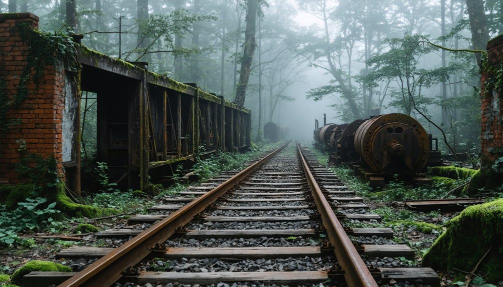
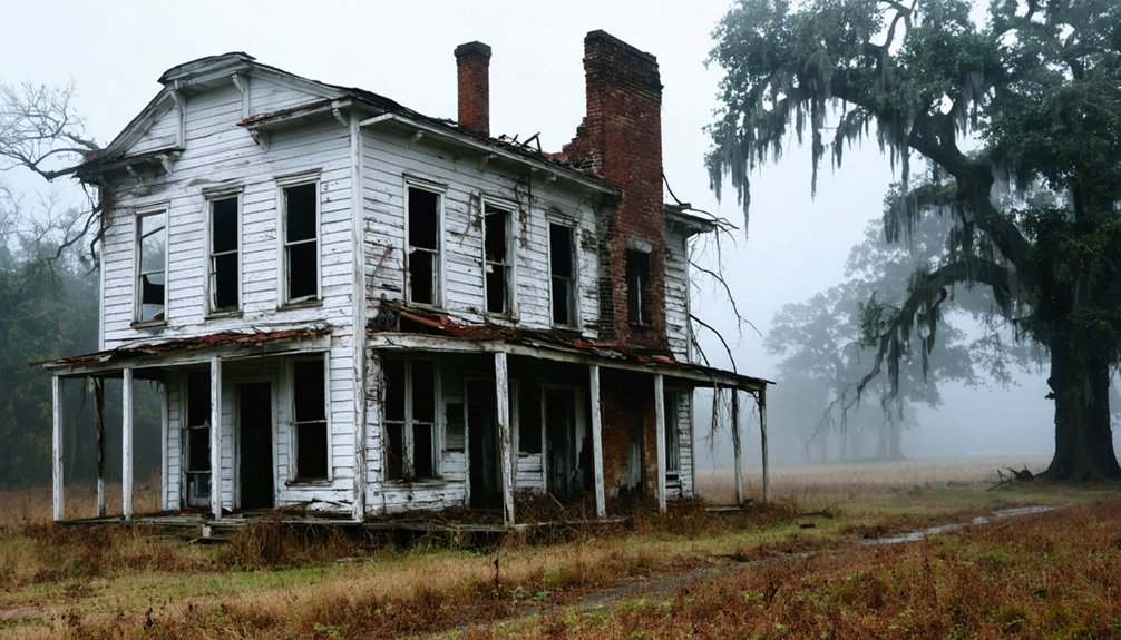
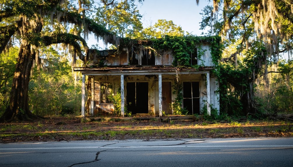
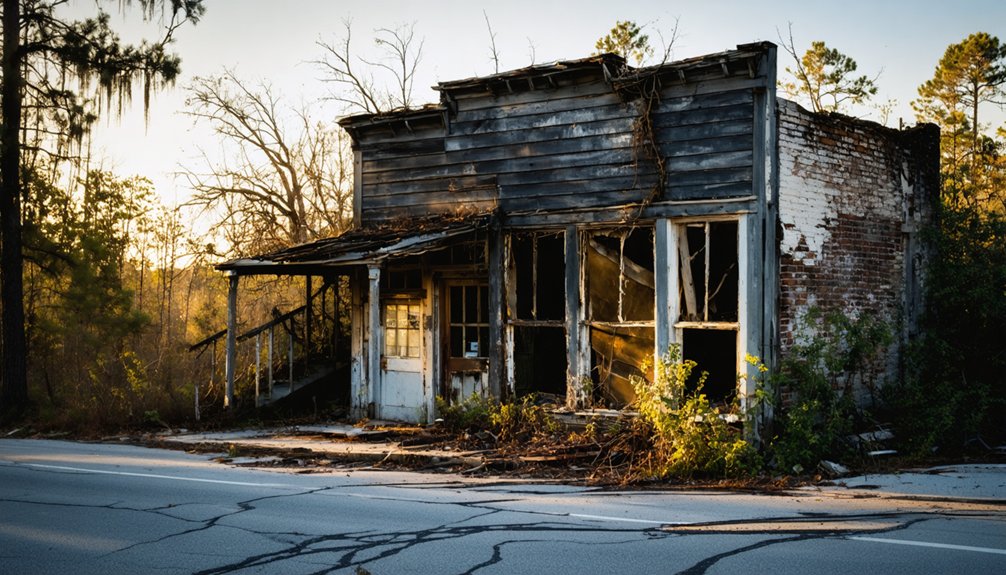
What’s left of Troupville isn’t much, but it’s enough to stir the imagination. You’ll find multiple collapsed buildings scattered across what was once a thriving county seat, their crumbling frames quietly testifying to the town’s historical significance.
Ruins exploration here means walking ground where three hotels, four stores, and three churches once stood, all abandoned after the railroad pulled life toward nearby Valdosta. The Withlacoochee River still flows nearby, offering a scenic backdrop that reminds you why settlers originally chose this confluence location.
Georgia’s Department of Community Affairs officially recognizes the site as a Historic Township, lending it formal acknowledgment despite its decay.
Don’t expect polished markers or guided tours — Troupville rewards the self-directed explorer willing to read the landscape itself.
How Bad Are the Roads and Access Conditions to Troupville?
Getting to Troupville isn’t simply a matter of plugging coordinates into your GPS and cruising down a smooth county road. Road conditions here have historically challenged even determined travelers, and access challenges remain real today.
Winter and spring flooding historically swept away bridges, cutting off the town entirely. Plan accordingly:
- Start from Valdosta and head four miles north as your baseline navigation
- Avoid winter and spring visits when flooding makes routes impassable
- Expect unpaved or poorly maintained stretches near the river confluence
- Watch for collapsed structures that may encroach on pathways
- Cross the Little River carefully, as infrastructure along this corridor remains minimal
Your freedom to explore this forgotten place depends entirely on respecting what nature still controls here.
How to Reach Troupville From Valdosta
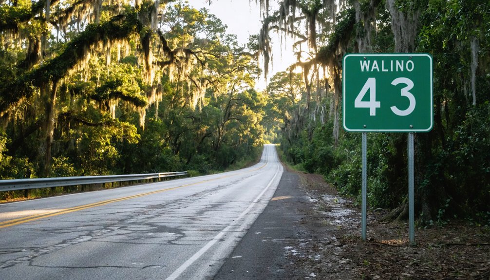
To reach Troupville, you’ll start in Valdosta and head north along the highway, covering roughly four miles to the historic townsite.
Keep in mind that river crossings along the route have historically challenged travelers, with winter and spring flooding regularly washing out bridges and making passage treacherous.
You’ll want to check current road and bridge conditions before you go, since the same geographic obstacles that plagued 19th-century settlers can still complicate your approach today.
Starting Point In Valdosta
Since Valdosta sits just four miles south of the Troupville site, it’s the perfect launching point for your ghost town adventure. Explore Valdosta attractions before heading north, and fuel up on local cuisine at one of the city’s many restaurants.
- Stock up on supplies and snacks before leaving Valdosta’s commercial district
- Fill your gas tank, since rural roads offer limited service options
- Download offline maps, as cell service weakens outside city limits
- Visit Valdosta’s tourism center for regional historical context
- Note your starting mileage to accurately track the four-mile drive north
Once you’ve prepared, head north from downtown Valdosta toward the Withlacoochee River corridor. The shift from modern city streets to forgotten backroads happens quickly, setting the mood perfectly for ghost town exploration.
Route North On Highway
Once you’ve left Valdosta behind, the route north unfolds straightforwardly along a short four-mile stretch that carries you from the city’s modern sprawl toward the ghost town‘s riverside setting.
Keep your eyes open for historical markers along the way, as they’ll orient you within the broader story of Lowndes County’s past. The drive itself moves quickly, but don’t rush it.
Scenic viewpoints near the Withlacoochee and Okolocoochee rivers reward anyone willing to pull over and absorb the landscape. These converging waterways defined Troupville’s original purpose and still shape the terrain you’ll navigate.
The road gives you a genuine sense of change, pulling you away from contemporary Georgia and dropping you into a quieter, older world waiting just beyond the city’s edge.
River Crossing Considerations
Reaching Troupville means confronting the same geographic obstacles that shaped the town’s history, because the river crossings that once frustrated 19th-century travelers still define how you approach the site today.
Accessibility issues remain real—winter and spring flooding historically swept away bridges, creating impassable conditions that isolated residents entirely. You’ll want to plan your visit during drier months to avoid similar frustrations.
- Check current river levels before departing Valdosta
- Approach from either the east or west river route depending on conditions
- Avoid late winter and early spring visits when flooding peaks
- The 1871 toll bridge crossing toward Brooks County offers historical context worth noting
- Confirm road conditions locally before committing to your route
Smart preparation separates a successful ghost town exploration from a wasted trip.
When Is the Best Time of Year to Visit Troupville?
When you visit Troupville matters more than you might think, since the same rivers that once made this ghost town a thriving gateway can make it nearly impossible to reach.
Winter and spring flooding historically swept away bridges and turned roads into impassable mud traps, so these seasons rank as your worst weather considerations for planning a trip.
Your ideal seasons are late summer through early fall, when water levels drop and roads become reliably accessible.
Georgia’s mild autumn temperatures also make outdoor exploration genuinely comfortable rather than exhausting.
Avoid December through April unless you’re willing to gamble on flooded crossings blocking your route entirely.
Check local weather forecasts before leaving Valdosta, since the Withlacoochee and Okolocoochee rivers can rise quickly after heavy rainfall.
Nearby Ghost Towns Worth Adding to Your Route
While you’re in the area, you can easily extend your road trip to include three nearby ghost towns that each tell a different story of abandonment.
Ebenezer stands out as a remarkable stop, where one of America’s oldest churches still holds active services amid the surrounding decay.
Grooverville and Berner round out the route — the former having its municipal charter officially revoked in 1995, and the latter maintaining a functioning post office all the way until 1957.
Ebenezer’s Living Church Legacy
Just a few miles from Troupville’s forgotten streets, Ebenezer offers something rare among ghost towns: a church that’s never stopped holding services, making it one of America’s oldest continuously operating congregations.
This Ebenezer church isn’t frozen in time — it’s living history breathing through every Sunday sermon.
When you visit, you’re stepping into something most ghost towns can’t offer: continuity.
- Walk the historic grounds surrounding the active congregation
- Compare Ebenezer’s preserved liveliness against Troupville’s complete abandonment
- Photograph the architectural details that have survived generations
- Research the congregation’s unbroken historical records
- Visit during a service to experience the community firsthand
Adding Ebenezer to your route transforms a simple ghost town excursion into a genuine exploration of how some communities endure while others completely vanish.
Grooverville’s Revoked Charter
Grooverville shares something with Troupville that most ghost towns don’t advertise: its municipal charter wasn’t just forgotten — it was formally revoked in 1995, making its ghost town status an official legal declaration rather than simply a matter of slow decay and departure.
Grooverville history mirrors a familiar South Georgia pattern — a community that once held enough significance to earn formal recognition, then gradually lost its population and purpose until the state made its abandonment permanent on paper.
That revoked charter transforms Grooverville from a sad footnote into something more compelling: proof that governments eventually acknowledge what residents already knew.
If you’re routing through this region, adding Grooverville to your itinerary gives you two officially designated ghost towns that bracket Troupville’s story with fascinating regional context.
Berner’s Last Post Office
Berner offers a different kind of ghost town marker than a revoked charter — it’s a post office that kept its doors open until 1957, making it one of the more recent abandonments in South Georgia’s collection of forgotten communities.
The Berner post office carries historical significance as a tangible timestamp, showing exactly when this settlement lost its last functional thread connecting it to the outside world.
When you add Berner to your route, keep these details in mind:
- The Berner post office operated well into the mid-20th century
- Its closure marks a historically significant turning point for the settlement
- South Georgia’s ghost town network sits within easy driving distance
- Valdosta works perfectly as your base hub
- Bring a camera — details tell the story here
Why Valdosta Is the Best Base for Ghost Town Exploration
Valdosta’s central location makes it the perfect launching pad for exploring South Georgia’s forgotten settlements. You’ll find comfortable accommodations, reliable fuel stops, and solid dining options before heading into territory where conveniences disappear fast.
Valdosta history runs deep, giving you meaningful context before you chase the region’s abandoned past. From here, Troupville sits just four miles north, Ebenezer and Grooverville lie within easy driving distance, and Berner’s quiet legacy waits just beyond that. You can hit multiple sites in a single day without backtracking unnecessarily.
Pack your camera because ghost town photography rewards patience and good morning light. Crumbling structures, overgrown lots, and river backdrops create compelling compositions.
Valdosta gives you the freedom to explore on your own schedule without sacrificing comfort or convenience.
What to Pack When Visiting Troupville and Nearby Ghost Towns
Troupville and its neighboring ghost towns reward prepared visitors and punish unprepared ones. These remote, overgrown sites demand smart packing essentials and solid photography tips before you hit the road.
- Sturdy boots — collapsed buildings and uneven terrain make ankle support non-negotiable
- Insect repellent — river confluences breed aggressive mosquitoes year-round
- Wide-angle camera lens — captures crumbling structures against the Withlacoochee River backdrop beautifully
- Waterproof bag — spring flooding risks make moisture protection essential for gear
- Detailed offline maps — cell service disappears fast in South Georgia’s rural corridors
Pack light but pack smart. You’re chasing history through forgotten landscapes, and nothing kills that freedom faster than soaked equipment or a twisted ankle.
Frequently Asked Questions
Was Troupville Named After a Famous Georgia Governor?
Yes, you’ll love uncovering Troupville history — the town was named after Governor George Michael Troup, who led Georgia from 1823 to 1827. Troupville legends honor his lasting legacy throughout South Georgia’s fascinating past.
Did Troupville Ever Have Its Own Newspaper Publication?
Yes, you’ll find that Troupville history includes its own publication! The town once published the *South Georgia Watchman*, later renamed the *Troupville Watchman*. Exploring these newspaper archives reveals a thriving community that’s since vanished into ghostly silence.
What County Was Troupville the Official Seat Of?
Imagine tracing Georgia’s roots — you’ll find Troupville served as the official seat of Lowndes County from 1833 to 1860, a role packed with historical significance and rich local legends worth exploring firsthand.
Is There a Horse Racetrack Near the Troupville Ghost Town?
You’ll discover a popular horse racetrack located just one mile north of Troupville. It’s a fascinating piece of local history that adds thrilling horse racing excitement to your ghost town exploration adventure!
Does Nearby Ebenezer Ghost Town Have a Still-Operating Church?
Yes, you’ll find Ebenezer’s history remarkably alive! Despite its ghost town status, this fascinating site boasts a church of incredible significance — one of America’s oldest still actively operating, making it a truly compelling stop on your exploration journey.
References
- https://ominous.app/browse/site/18622
- https://www.hrcga.org/grooverville-georgia-ghost-town-history/
- https://www.facebook.com/groups/valdostaheritagefoundation/posts/26029956899932514/
- https://vanishinggeorgia.com/tag/georgia-ghost-towns/page/2/
- https://www.youtube.com/watch?v=nAtgLQfY77o
- https://www.wwals.net/pictures/2024-02-15–wwals-webinar-tom-baird/Withlacoochee-PPT–webinar-2-15-24-0019.html
- https://en.wikipedia.org/wiki/Troupville
- https://en.wikipedia.org/wiki/List_of_ghost_towns_in_Georgia_(U.S._state)
- https://raycityhistory.wordpress.com/2010/10/18/more-about-troupville-ga-and-the-withlacoochee-river/
- https://www.facebook.com/SidestepAdventuresIntoHistory/posts/were-exploring-ghost-towns-and-forgotten-cemeteries-in-marion-county-georgia-we-/683308498086471/