You’ll find White Mountain City’s scattered ruins perched above 10,000 feet on the eastern slope of the White Mountains, accessed via the rugged Wyman Creek Road off Highway 168 east of Big Pine. Plan your visit between June and August when temperatures hover around 65°F, though you’ll still need layered clothing and emergency gear for sudden weather shifts. The ghost town offers minimal infrastructure—just subtle depressions and stone foundations where miners once extracted gold from the 1860s through early 1900s. This guide covers everything you’ll need for a successful expedition.
Key Takeaways
- White Mountain City sits at 37.41188, -117.99732 on the White Mountains’ eastern slope, accessed via Highway 168 and Wyman Creek Road from Big Pine.
- Visit between June and August when temperatures range from 65°F to near-freezing; winters bring extreme cold and impassable conditions.
- Expect minimal remains—no standing buildings or facilities, only scattered stone foundations, depressions, and debris slowly vanishing into the landscape.
- Pack layered clothing, wind-resistant shells, and emergency gear; consider acclimatizing at lower elevations before exploring the high-altitude site.
- Combine your trip with Deep Springs College, an unconventional educational community located 40 miles northeast in the same remote valley.
The Mining History of White Mountain City
When prospectors first combed through the White Mountains during the 1860s and 1870s, they worked the streambeds for placer gold, panning the canyon gravels concentrated along the range’s west flank. You’ll find their legacy carved into these unforgiving slopes, where they soon discovered notable lode deposits of gold-quartz veins threaded with sulfides through granite outcrops.
The Sacramento, Twenty Grand, and Southern Belle mines became the district’s heavy hitters, while the Poleta Mine diversified operations, pulling gold, silver, copper, lead, and zinc from the earth. When the Carson and Colorado Railroad punched through Owens Valley in 1883, Benton transformed into a shipping hub, though the easiest silver pickings had already vanished.
Later, ore concentration processes shifted toward nonmetallics—andalusite and sericite mining dominated from the 1920s onward.
Where to Find White Mountain City in Inyo County
The ghost town sits at coordinates 37.41188, -117.99732, perched on the eastern slope of the White Mountains in Deep Springs Valley. You’ll reach it by heading east from Big Pine on Highway 168, then turning onto Wyman Creek Road—a dirt route that demands respect but rewards you with scenic viewpoints along the drive.
In addition to exploring the ghost town experiences near Mammoth Cave, visitors can immerse themselves in the rich history that surrounds these abandoned places. Each structure tells a story of a bygone era, inviting adventurers to imagine the lives once lived there. As you wander through the remnants, keep an eye out for unique wildlife that has made this serene landscape its home.
The White Mountains flank one side while the Inyo Mountains rise across Westgard Pass. You’re in Inyo County’s second-largest California county, where 10,192 square miles stretch between the Sierra Nevada and Nevada border. Watch for local flora and fauna of the region as you navigate through White Mountain Wilderness.
Bishop, an hour away, serves as your supply hub before venturing into this remote cold desert territory.
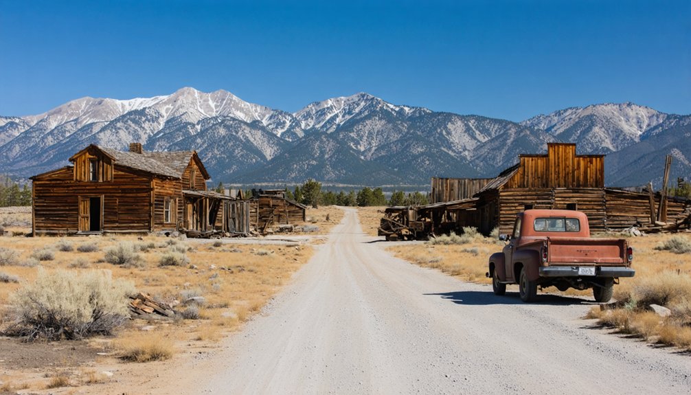
What Remains of the Ghost Town Today
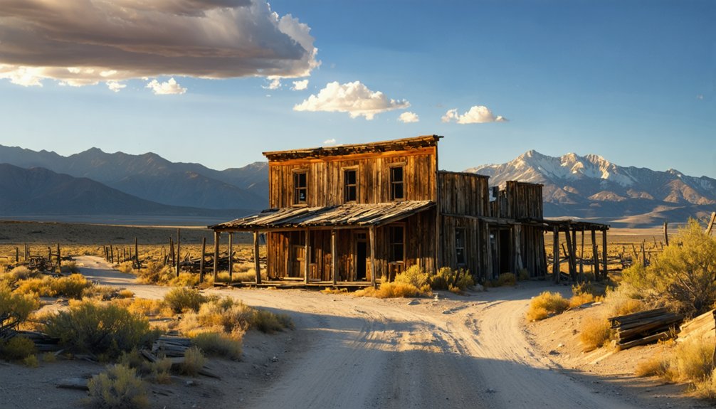
Very little greets visitors who make the challenging journey to White Mountain City today. Unlike restored sites such as Calico, this remote desert bowl along Wyman Creek banks shows minimal structural preservation after 160+ years of abandonment. You won’t find standing buildings, mining equipment, or tourist facilities—just scattered traces slowly disappearing into the harsh landscape.
The limited physical infrastructure that survived the 1860s-1870s boom has succumbed to erosion and time. When I explored Deep Springs Valley‘s isolation, the freedom of discovering unmarked history felt authentic, though frustrating. No plaques guide you. No museums preserve artifacts. What remains exists as subtle depressions in earth, occasional stone foundations, and debris fields only recognizable to trained eyes. You’re left interpreting whispers of a vanished settlement.
Exploring Deep Springs College and Surrounding Areas
Just forty miles northeast from where White Mountain City crumbled into memory, one of America’s most unusual educational experiments thrives in the same unforgiving valley. Deep Springs College operates where twelve to fifteen students each year trade conventional campus life for something radically different—milking cows at dawn, debating Plato by afternoon, irrigating alfalfa fields under desert stars.
The self governance model gives students control over admissions, faculty hiring, and curriculum decisions. You won’t find this level of autonomy elsewhere. Student experiences here mean shoeing horses before seminar discussions, branding cattle between philosophy papers. The ranch’s isolation—spotty internet, forty miles from Bishop—forces self-reliance that most colleges only theorize about. It’s educational freedom stripped to essentials: intellectual rigor meeting cowboy grit, where responsibility isn’t taught but lived daily.
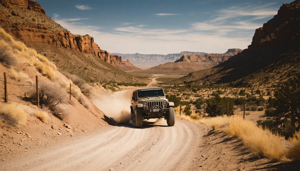
Leaving Deep Springs College’s philosophical debates behind means confronting the physical challenges that keep this valley isolated. You’ll shift from pavement to gravel as CA-168 narrows, demanding constant attention to your vehicle’s clearance and tire pressure. Standard sedans struggle here—four-wheel drive isn’t optional for reaching White Mountain City’s actual coordinates at 37.41165°N 117.99756°W.
Off road driving considerations become critical when traversing the deteriorating track toward the ghost town. Watch for washouts after summer thunderstorms and loose rock that can puncture sidewalls. Winter renders this route completely impassable.
Before departing Big Pine, your last supply point, complete essential vehicle maintenance: check fluids, inspect tires, and carry extra water for both radiator and drinking. The desert forgives nothing.
Best Time to Visit and What to Bring
While White Mountain City’s ghost town remnants sit at a relatively modest 10,000 feet, timing your visit requires understanding the brutal conditions that await nearby. June through August offers your best window, though you’ll encounter snow patches and temperatures swinging from 65°F to near-freezing.
Winter’s -26°F summits and 162-mph winds make December through February death traps for the unprepared.
Pack layered clothing—those temperature extremes aren’t suggestions. Wind-resistant outer shells protect against relentless gusts that’ll knock you sideways. You’re exposed above timberline with zero natural shelter.
Consider base camp locations at lower elevations for acclimatization requirements before pushing higher. Bring traction footwear, high-altitude sun protection, and emergency gear. The desert-dry conditions and thin air create an inhospitable environment where thorough preparation separates adventure from disaster.
Combining Your Trip With Nearby Historic Sites
Your White Mountain City exploration becomes exponentially richer when you venture into the surrounding historic corridor that shaped California’s eastern frontier. Head north to Bodie State Historic Park, where miners from nearby camps relocated during the 1870s boom—its preserved buildings stand frozen in time. The proximity to Bodie State Park makes this an ideal two-day adventure through authentic mining history.
Deep Springs Valley reveals the early settlers’ struggles along Wyman Creek’s banks, where ranchers defended against periodic attacks while carving out existence. Just five miles east lies the Nevada border, where Aurora once supplied these remote prospectors.
Mark Twain himself traveled these dirt roads between Aurora and White Mountain City, documenting the rugged determination that defined this unforgiving landscape where freedom-seekers chased silver dreams.
Frequently Asked Questions
Are There Any Accommodations or Camping Facilities Near White Mountain City?
You won’t find hotels at this remote ghost town, but you’ll discover nearby camping options in the surrounding White Mountains. Basic amenities are limited, so pack everything you need for true off-grid freedom and self-sufficient exploration.
Do I Need Special Permits to Explore the Ghost Town Ruins?
You won’t need special permits for White Mountain City’s ruins on public land. However, you’ll want to research property boundaries beforehand—navigating private property without obtaining permission could cut your exploration short and land you in trouble.
Is Cell Phone Service Available in Deep Springs Valley?
No, you won’t find cell phone service in Deep Springs Valley. The remote location has zero cellular coverage and poor signal strength. You’ll experience true disconnection here, so download maps beforehand and plan accordingly for your off-grid adventure.
Can I Visit White Mountain City Year-Round or Are Roads Seasonal?
You can’t visit year-round—White Mountain Road closes with snow from roughly December through June. Road conditions and weather patterns make summer your freedom window, typically late June to November, when adventure-seekers can explore this remote ghost town territory.
Are There Guided Tours Available for White Mountain City?
No guided tours serve White Mountain City—you’ll explore independently. This remote ghost town rewards self-guided tours where you’ll create your own walking tours through weathered structures. You’re free to wander at your pace, discovering hidden stories without crowds or schedules.


