Planning a ghost town road trip to Trapper City, Montana means heading to Interstate 15 Exit 93 near Melrose and trading pavement for rugged backcountry roads. You’ll need a 4WD vehicle or ATV for the final stretch through Beaverhead-Deerlodge National Forest. Once there, you’ll find cabin foundations and overgrown lots from a mining camp that rose and collapsed within six years. Pair it with Lion City, Hecla, and Glendale for a full 70-mile loop, and there’s far more to uncover ahead.
Key Takeaways
- Trapper City is accessed via Interstate 15 Exit 93 near Melrose, then Trapper Creek Road into Beaverhead-Deerlodge National Forest.
- A 4WD vehicle or ATV is required for the final five to six miles of unmaintained road.
- Remnants include empty cabin foundations and overgrown lots from a settlement abandoned by 1878.
- The ghost town loop covers roughly 70 miles, including Lion City, Hecla, and Glendale stops.
- Carry extra water and download offline maps before departing, as signal may be unavailable.
Trapper City’s Mining Boom and Why It Burned Out So Fast
Trapper City didn’t stumble into existence—it exploded into one. After trappers reportedly discovered the area in 1872, miners flooded the Pioneer Mountains, and a full camp materialized almost overnight. The Bryant Mining District buzzed with activity, drawing nearly 200 residents and supporting hotels, saloons, a general store, and more.
But economic factors hit hard and fast. Mining techniques of the era followed the ore wherever it ran richest, and when richer deposits appeared upslope on Lion Mountain, the camp simply chased them.
Businesses packed up. Residents relocated to Lion City. By 1878, Mose Morrison was the last man standing—and then he left too.
Trapper City’s boom wasn’t a failure. It was a launch pad that burned through its fuel in under a decade.
How to Get to Trapper City, Montana
Getting to Trapper City means committing to real backcountry travel—this isn’t a scenic pullout off the highway.
Start near Interstate 15 Exit 93 by Melrose, then head onto Trapper Creek Road into Beaverhead-Deerlodge National Forest. From there, access routes narrow quickly, and the final stretch demands a 4WD vehicle or ATV. The road beyond the main access point isn’t maintained, so don’t push it in a standard car.
The final stretch into Trapper City demands 4WD—unmaintained roads narrow fast once you leave Trapper Creek Road behind.
Plan for roughly five to six miles of rough travel once you’re off the paved surface.
A few solid travel tips: carry extra water, download offline maps before you leave cell service, and go during dry months when the road isn’t a muddy mess. The remoteness is part of the reward—embrace it.
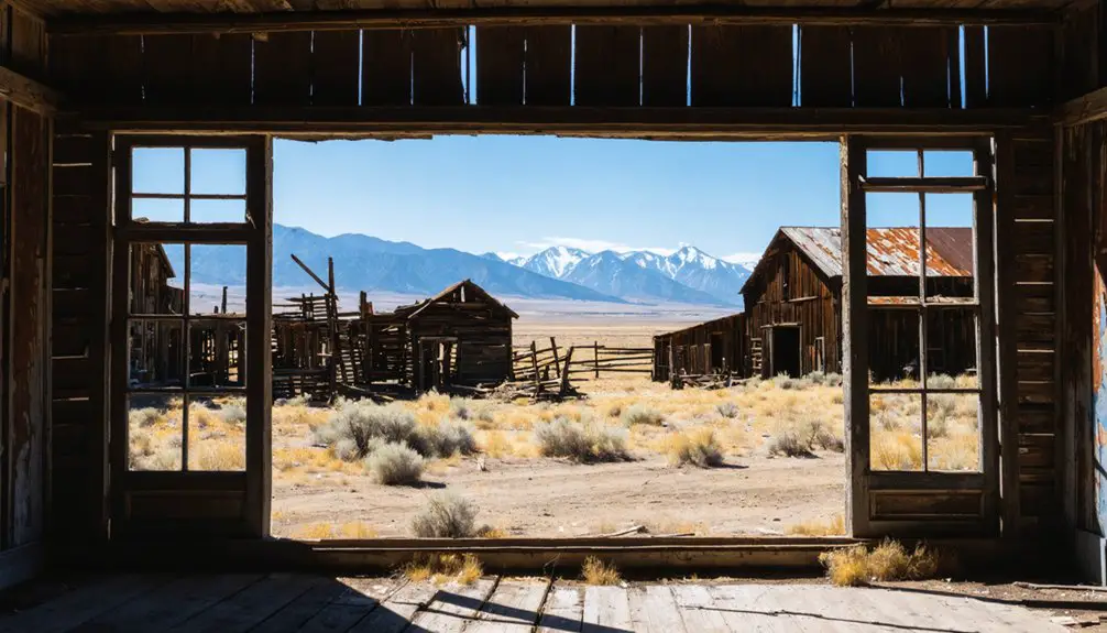
What You’ll Actually Find When You Arrive at Trapper City
Once you’ve made it through that rough final stretch, don’t expect a preserved frontier village waiting at the end.
Trapper City’s ghost town remnants are sparse — scattered traces of what was once a bustling camp of nearly 200 people. You’ll find empty cabin foundations, overgrown lots, and buried evidence of a settlement that vanished by 1878.
Still, the site carries real weight for anyone drawn to mining history. This was the Pioneer Mountains’ first camp in the Bryant Mining District, a place that once had saloons, a hotel, a butcher shop, and a livery stable.
Nature has reclaimed most of it, but standing there, you’re on ground where a short-lived boomtown rose and collapsed within a single decade.
Other Ghost Towns Worth Hitting on the Same Loop
If you’re already making the drive out to Trapper City, it’d be a shame to miss the other ghost towns scattered across this 70-mile loop in southwest Montana.
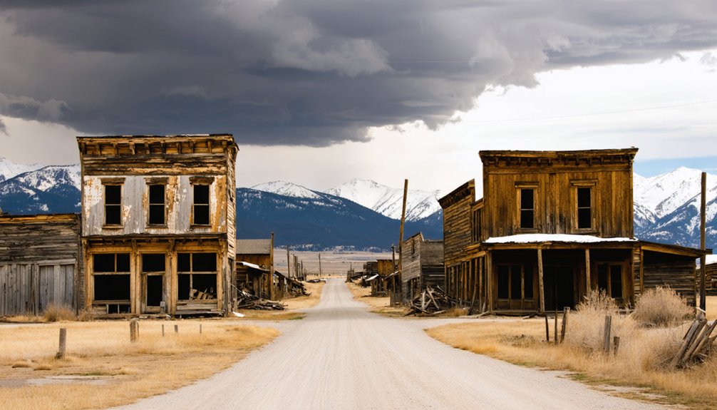
Lion City sits at the base of Lion Mountain and reportedly retains around 15 structures, making it one of the more intact stops you’ll find out here. It’s where the population shifted when richer ore pulled miners away from Trapper City.
Lion City holds roughly 15 surviving structures, making it one of the most intact ghost towns on the loop.
Hecla handled smelting operations for the district, adding another layer to the industrial story.
Glendale history rounds out the picture as a key connected townsite that helped drive the entire mining operation.
Hitting all four in a single day is doable, and each one adds context that makes the others more meaningful.
How to Plan the Full Pioneer Mountains Ghost Town Loop in One Day
Knowing which towns to hit is half the battle—the other half is sequencing them so you’re not doubling back on rough roads.
Start near Interstate 15 Exit 93 by Melrose, then work your way into the Beaverhead-Deerlodge National Forest via Trapper Creek Road. Hit Glendale and Hecla early while pavement still cooperates, then push deeper toward Lion City and Trapper City once you’ve switched to 4WD.
Each stop layers a different chapter of ghost town history—smelting operations, shaft mining techniques, and boom-to-bust cycles that played out within miles of each other.
Budget a full day, carry water, and download offline maps before you lose signal. The loop covers roughly 70 miles, so an early start keeps you ahead of fading daylight on those unmaintained stretches.
Frequently Asked Questions
Is Camping Allowed Near Trapper City Within Beaverhead-Deerlodge National Forest?
You’ll find camping regulations allow dispersed camping within Beaverhead-Deerlodge National Forest near Trapper City. Explore nearby campsites along Trapper Creek Road, where you’re free to set up camp and embrace Montana’s rugged, untamed backcountry wilderness.
What Wildlife Might Visitors Encounter Along Trapper Creek Road?
Like stumbling into a living painting, you’ll spot deer, elk, and black bears along Trapper Creek Road. Wildlife sightings are common, and animal behavior here feels unhurried — nature owns this backcountry trail as much as any ghost town explorer does.
Are There Any Guided Tours Available for the Pioneer Mountains Ghost Town Loop?
You won’t find formal guided tour options here — this loop rewards self-guided explorers! Research the historical significance of each site beforehand, grab a detailed map, and you’ll uncover Trapper City’s rich mining past on your own terms.
What Is the Best Time of Year to Visit Trapper City?
Summer’s your golden window—the best seasons for Trapper City are July through September, when weather conditions clear Montana’s mountain roads. You’ll navigate primitive trails freely without snow blocking your backcountry adventure into these remote Pioneer Mountains.
Are Permits Required to Access Trapper City or Surrounding Forest Roads?
You don’t need permit fees to explore Trapper City, but you’ll want a capable 4WD vehicle for road access into Beaverhead-Deerlodge National Forest. Roam freely through this remote Montana backcountry adventure!
References
- https://www.facebook.com/TheSeattleRVShow/videos/montana-ghost-towns-glendale-helca-lion-city-trapper-city/594451101496802/
- https://www.youtube.com/watch?v=FDNsRR_47bU
- https://www.glendalemontana.com/trapper-city
- https://rvlife.com/29368-2/
- https://www.mtmemory.org/nodes/view/117648
- https://southwestmt.com/pdfs/Southwest-Montana-Ghost-Towns-Printable-Map.pdf
- https://ghosttownfinder.com/towns/lion-city-montana
- https://treasurestate.com/ghost-towns/trapper-city/
- https://www.reddit.com/r/Montana/comments/oez0mi/ghost_towns_up_trapper_creek/
- https://www.facebook.com/ghosttownsandhistoryofmontana/photos/d41d8cd9/1430495375772861/