You’ll find Red House, New York’s haunting remnants along the Allegany River, where a mysterious crimson house inspired the town’s name in 1869. Once a bustling lumber empire with over 1,000 residents, three major railroads, and sawmills processing 20,000 feet of lumber daily, the town declined after the Kinzua Dam’s construction flooded portions of land. By 2000, only 38 residents remained, leaving behind ghostly tales of the Frecks family and unexplained phenomena along Buckout Road.
Key Takeaways
- Red House was a thriving lumber town in New York that declined from over 1,000 residents to just 38 by 2000.
- The construction of Kinzua Dam and Allegany State Park led to significant territory loss and population decline.
- Three major railroad lines serving Red House were abandoned following the collapse of the lumber industry.
- The last sawmill operated until 1997, marking the end of Red House’s prominent lumber economy.
- The town’s iconic red house became associated with supernatural activity and local legends, including the mysterious Frecks family story.
The Origins of a Crimson Landmark
A distinctive red-painted house, now lost to time, gave birth to both Red House Creek and the Town of Red House in Cattaraugus County, New York.
You’ll find its historical significance traced back to the Civil War era, when the structure served as an essential rest stop for weary raftsmen and lumberjacks traveling the Allegany River.
While the original owner remains a mystery, this crimson landmark spawned numerous community legends and haunted tales.
The house stood proudly until the early 1990s, watching as the town officially formed in 1868-1869.
For over a century, this sentinel of local history witnessed the birth and growth of the town it inspired.
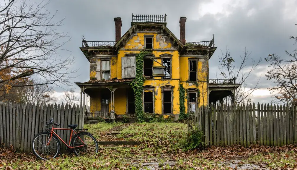
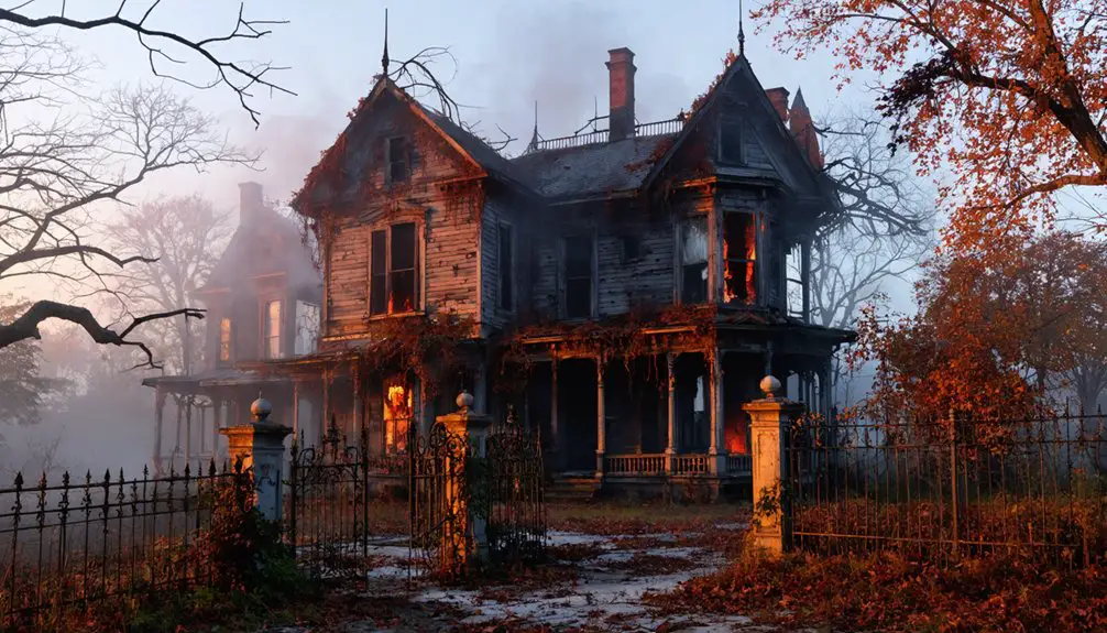
Local folklore paints it as a hub of tragic events, with stories of ghostly residents and mysterious deaths capturing imaginations for generations. Like the 1947 film The Red House, these tales blend elements of horror and mystery into the location’s legacy.
The journey downstream to Pittsburgh took three days for lumberjacks floating their logs, while the return trip required three weeks of arduous travel.
Though the building’s factual history may be sparse, its impact on the region’s identity proved lasting and profound.
Early Pioneers and Economic Growth
You’ll find the roots of Red House’s development in 1827 when Darius Frink established himself as the first permanent white settler near Little Red House Creek, followed by James Rosenberry in 1837 who cleared over 100 acres of farmland.
The area’s abundant forest resources quickly attracted lumber enterprises, with the first sawmill built in 1849 by Hubbard Clark and Marcus Frisbie, marking the beginning of the town’s primary industry. The construction of a 500-foot bridge across the Allegany River in 1871 significantly improved access to lumber operations. The Bay State Company established the town’s first store at their mills, though it would later close in 1875.
First Settlers Arrive
While much of Red House’s early history remains shrouded in wilderness, the town’s first permanent white settler, Darius Frink, arrived in 1827 and established his home along what would later become Red House Creek.
For years, Frink lived as the area’s sole white resident until James Rosenberry joined him in 1837, tackling the pioneer challenges of clearing 100 acres for farming.
You’ll find these early settlers chose their locations strategically, positioning themselves near the Allegany River and its tributaries for essential transportation and resources.
They carved out their existence within the boundaries of the Allegany Indian Reservation, where the best farming land was located.
Despite the isolated and rugged terrain, these hardy pioneers laid the foundation for what would officially become the Town of Red House in 1869.
Lumber Industry Takes Hold
Following the arrival of early settlers, Red House’s economic landscape transformed dramatically as the lumber industry emerged as its dominant force in the late 1800s.
The small settlement on the riverbank was named after a little red house that became a local landmark.
One notable operation was James Appleby’s mill, which could process an impressive 20,000 feet of lumber per day.
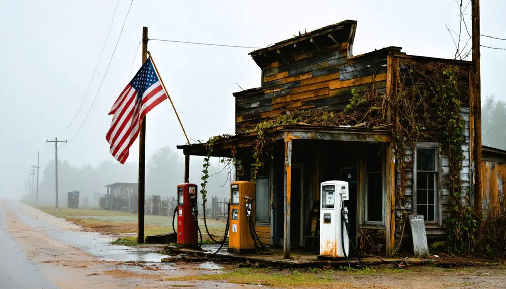
You’ll find that lumber production drove the establishment of crucial infrastructure, including multiple sawmills and a post office, turning this frontier town into a bustling timber economy.
At its peak in the 1880s, the town’s lumber industry supported:
- Three major rail lines for timber transport
- A 500-foot bridge spanning the Allegany River
- Multiple sawmills, including Marsh & Frisbie and Bay State Lumber
- A network of hotels, taverns, and stores serving over 1,000 residents
The industry’s success transformed Red House into a vibrant community, with most men finding employment in timber-related activities.
However, by the early 1900s, depleted forest resources forced mills to relocate, leading to the town’s eventual decline.
Railroad Networks Expand
As the lumber industry flourished in Red House during the late 1800s, an extensive railroad network emerged to serve the region’s growing transportation needs. You’d find at least three major railroads converging in this bustling town – the Atlantic & Great Western, Western New York and Pennsylvania, and Allegheny and Kinzua lines.
The railroad expansion transformed Red House into a crucial transportation hub, with the Erie Railroad station situated 421.3 miles from New York City and 577.2 miles from Chicago. Similar to the New York Central Railroad established in 1853, these rail connections played a vital role in regional development. The station operated as a frame structure measuring 18 by 68 feet, serving both passengers and freight operations.
The economic connectivity these rail lines provided was essential for the town’s development. You could spot the combination tower and station controlling traffic between mainlines, while infrastructure like water towers and handcar sheds supported the busy freight operations.
These railways weren’t just moving lumber – they were building Red House’s future through improved regional access and market connections.
The Rise and Fall of Lumber Empire
Since its permanent settlement in 1827, Red House rapidly evolved into a thriving lumber empire, with multiple sawmills transforming the landscape of this New York town.
You’d find major lumber mill operations like Marsh & Frisbie and Bay State Lumber Company driving the local economy by the mid-1800s.
The town’s economic shifts were supported by:
- A strategic 500-foot bridge across the Allegany River
- Multiple railroad stations at Red House, Shongo, and Freck’s
- Specialized facilities like L.J. Darling’s handle factory
- A network of post offices, hotels, and taverns
However, the construction of Kinzua Dam and expansion of Allegany State Park forced dramatic changes.
Through eminent domain claims and buyouts, the once-bustling lumber town lost its territory, and its population dwindled.
One of the last remaining sawmills in the area continued operations at Red House section of Allegany State Park until 1997.
The Mysterious Frecks Family Legacy
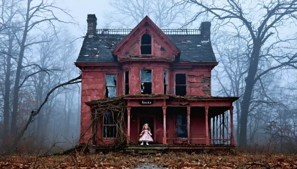
Deep within Red House’s history lies the enigmatic legacy of the Frecks family, whose story became intertwined with tragedy during the Civil War era.
While early landowners in the area, their connection to the famous Red House remains disputed, with historical records indicating they never actually resided there.
The family’s downfall began when Johnny Frecks died in the Civil War, leading to a scandalous affair between his widow and his brother James.
Their subsequent exile and suicide marked the beginning of the end for the Frecks dynasty.
Following these events and patriarch Jonathan Frecks II’s mysterious death, the family made substantial donations to the community before departing permanently.
Though local folklore claims their spirits haunt the Red House, skeptics note there’s no historical evidence supporting these supernatural tales.
The hamlet of Frecks in the southwestern corner of town is the only remaining testament to their presence.
Tales of Supernatural Occurrences
You’ll find the most chilling paranormal activity centered around the abandoned Frecks family homestead, where locals have reported seeing spectral figures in period clothing drifting through the overgrown property.
The house’s reputation for supernatural phenomena aligns with documented tragedies along Buckout Road, including unexplained disappearances in the 1920s and 1930s.
Ghost hunters and paranormal investigators continue visiting the area, drawn by EVP recordings and photographs showing mysterious orbs near the crumbling foundation of what was once Red House’s largest residence.
Frecks Family Ghost Story
A haunting tale from Red House, New York centers on the ill-fated Frecks family, whose tragic Civil War-era story has become deeply woven into local folklore.
The story tells of Johnny Frecks, who died in battle, and the scandalous affair between his widow and brother James that followed. When discovered, the lovers faced banishment, leading to their reported suicides and the mysterious death of patriarch Jonathan Frecks II.
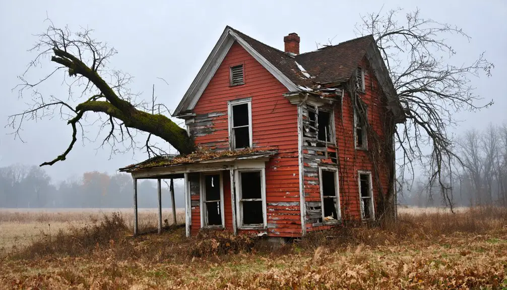
Local legend claims three ghostly apparitions haunted the distinctive crimson house by Red House Creek, though historical records don’t support the family scandal or supernatural claims.
The building’s documented history reveals:
- Served as lodging for lumbermen and river travelers
- Never actually housed the Frecks family
- Operated as a restaurant and hotel in its final years
- Demolished in the early 1990s after falling into disrepair
Haunted House Legends
Throughout its existence, the Red House building garnered a reputation for supernatural activity that drew both believers and skeptics to its crimson walls.
If you’d visited during its years as a restaurant and hotel, you might’ve encountered the three distinct spirits locals claim haunted the premises – believed to be members of the ill-fated Frecks family.
You wouldn’t have been alone in your ghostly encounters, as numerous visitors and staff reported unexplained noises, shadowy figures, and sudden temperature drops.
The haunting experiences proved so unsettling that potential buyers repeatedly abandoned plans to live there.
While many attributed the eerie atmosphere to the house’s dark history of tragedy and suicide, others connected it to earlier Native American influences and the dangerous logging era that shaped the region’s supernatural folklore.
Buckout Road Mysteries
While the Red House itself became known for its ghostly residents, Buckout Road’s supernatural legacy extends far beyond a single haunted building.
You’ll find the road steeped in dark history, from the tragic tale of Isaac Buckhout’s murderous rampage to reports of ghostly apparitions that continue to this day.
The most frequently documented supernatural encounters include:
- Mary Buckhout’s “woman in white” spirit roaming the road
- The mysterious Leatherman’s ghost in his signature leather suit
- Intelligent-moving orbs and mists along the roadway
- Restless spirits near the repeatedly robbed family cemetery
The area’s haunted reputation intensified after the 1870 Buckhout murders, with paranormal activity coinciding with mysterious fires and deaths.
Local eyewitnesses continue to reinforce Buckout Road’s status as a paranormal hotspot, tied directly to its violent past.
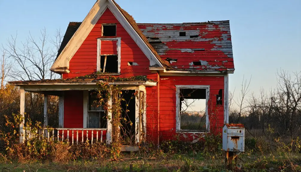
The Last Days of the Red House
During the late 20th century, Red House’s decline accelerated as its population dwindled to just 38 residents by 2000, making it New York’s least populous town.
The last days of this once-thriving community were marked by urban decay, as hotels, stores, and the iconic Red House itself succumbed to demolition in the early 1990s.
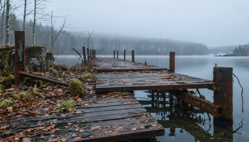
You’d find the town’s infrastructure crumbling as the Kinzua Dam project claimed significant portions of land, while the lumber industry’s collapse led to the abandonment of three railroad lines.
The local church was forced to relocate to Jimerson Town, leaving only an abandoned Roman Catholic chapel as a memorial to Red House’s religious past.
The demolition of the crimson-painted Civil War-era house, once a bustling hotel and restaurant, symbolized the final chapter of this vanishing town.
A Town’s Transformation Into History
Red House’s story begins with its 1869 formation from part of Salamanca, marking the start of a remarkable historical arc.
Born from Salamanca’s lands in 1869, Red House emerged to chart its own distinct path through history.
What you’ll discover is a tale of transformation from a bustling lumber town to a near-empty landscape, rich with supernatural folklore and historical significance.
The town’s decline was shaped by several key factors:
- Construction of the Kinzua Dam, which submerged essential town lands
- Expansion of Allegany State Park, consuming much of the remaining territory
- Loss of the lumber industry that once sustained the community
- Demolition of the iconic red house in the early 1990s, erasing a physical link to the past
Today, you’ll find Red House stands as New York State’s least populous town, its story preserved mainly through local legends and historical records rather than active community life.
Frequently Asked Questions
What Happened to the Residents Who Lived in Red House After 2000?
You’ll find most residents relocated to nearby Salamanca as Red House became increasingly isolated, with limited town services accelerating their departure. A few stayed behind, drawn to reported ghost sightings.
Were There Any Documented Paranormal Investigations of the Red House Building?
Like searching for shadows in an empty room, you won’t find documented paranormal activity or ghost sightings at Red House – the building vanished by 1879, long before modern investigation methods existed.
How Did the Kinzua Dam Construction Specifically Impact Local Families?
You’ll find that over 600 Seneca families endured devastating family displacement and economic repercussions, losing ancestral homes, farmland, and community ties when forced relocation shattered their traditional way of life.
What Native American Tribes Originally Inhabited the Red House Area?
You’ll find the Seneca people were the primary Native American tribe in the Red House area, with their rich tribal culture and Seneca history deeply rooted in the Allegany Indian Reservation lands.
Did Any Other Historical Buildings Survive Besides the Red House?
Peering through time’s misty veil, you’ll find only the abandoned Roman Catholic chapel still stands as a historical landmark. The relocated church in Jimerson Town represents the last vestige of Red House’s architectural preservation.
References
- https://en.wikipedia.org/wiki/Red_House
- https://enchantedmountains.com/taxonomy/term/238
- https://chriscarosa.com/2012/10/the-secret-of-new-yorks-smallest-town/
- https://www.onlyinyourstate.com/experiences/new-york/buckout-road-ny
- https://historicpath.com/history/red-house
- https://wyrk.com/the-smallest-town-in-western-new-york-on-the-brink-of-ghost-town-status/
- https://sites.rootsweb.com/~nycattar/1879history/redhouse.htm
- http://nycattar.org/1879history/redhouse.htm
- https://www.loe.org/shows/segments.html?programID=04-P13-00006&segmentID=3
- https://historicpath.com/municipality/red-house