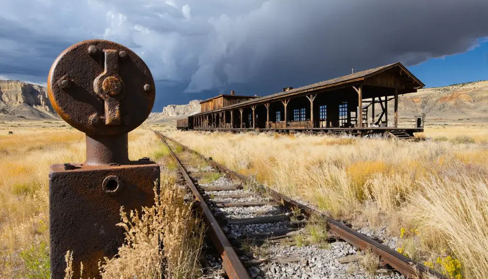
You’ll discover Rimrock’s historic ruins near Billings, Montana, where this former Great Northern Railway stop once bustled with activity. The site features dramatic sandstone cliffs and served as a strategic railroad siding until the Burlington Northern merger in the 1970s. While most structures have decayed to foundations, you can still explore the remnants year-round, surrounded by converted agricultural lands and native wildlife. The site’s rich history of transportation and farming holds fascinating details about Montana’s evolution.
Key Takeaways
- Rimrock began as a strategic railroad stop along the Great Northern Railroad in Yellowstone County, featuring a station and water infrastructure.
- The town transitioned from mining to agriculture after 1903, when the “big ditch” irrigation system transformed previously unsuitable land into fertile farmland.
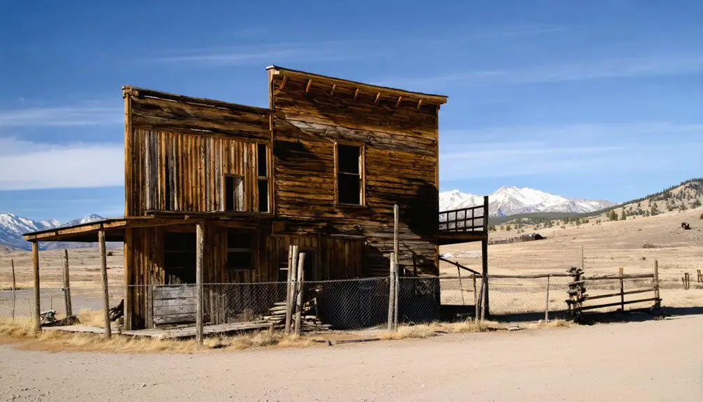
- Most original structures are now reduced to foundations, with minimal mining artifacts remaining and no interpretive signage for visitors.
- The site is accessible year-round for self-guided visits, though visitors must navigate rural roads and may need private landowner permission.
- The area features dramatic sandstone cliffs and geological formations, providing habitat for native hawks and falcons near Billings.
The Lost Railroad Stop
Three miles from the iconic sandstone cliffs that gave it its name, Rimrock emerged as a strategic stop along the Great Northern Railroad in Yellowstone County, Montana.
Perched at 3,468 feet elevation, you’ll find this ghost town‘s history deeply intertwined with the region’s agricultural and freight operations. The site served primarily as a siding and minor service point, where trains could briefly pause for maintenance and loading. Like many rail stations of the era, trains were limited to 25-30 mph speeds due to steep grades and harsh weather conditions. The line eventually became part of the Burlington Northern through the 1970 merger.
Nestled high in Yellowstone County, Rimrock’s railroad siding enabled vital agricultural transport and brief maintenance stops along Montana’s bustling rail network.
As rail transportation evolved in the early-mid 20th century, Rimrock’s significance diminished. The station’s closure came swiftly, leaving behind abandoned water tanks and deteriorating infrastructure.
Today, you’ll discover most of Rimrock’s former railroad grounds have been reclaimed by agriculture, with restricted access to the historic site – a silent reminder of Montana’s dynamic railroad era.
Natural Landmarks and Geographic Setting
Standing majestically near Billings in south-central Montana, Rimrock’s natural setting showcases dramatic sandstone cliffs that rise several hundred feet above the Yellowstone River valley.
You’ll discover a rugged landscape shaped by ancient seas and millennia of wind and water erosion, creating unique geological formations that define this striking ghost town’s character. Located near Junction City, the area exemplifies the stark beauty of Montana’s abandoned settlements.
exploring ringling’s ghost town history reveals intriguing stories of its former inhabitants, showcasing a once-thriving community now left to the whispers of the wind. As you wander through the remnants, remnants of dilapidated structures and rusting artifacts tell tales of resilience and abandonment. This site not only captures the imagination but also serves as a testament to the passage of time in this captivating corner of Montana.
- Weathered sandstone ridges and pinnacles from the Cretaceous period offer prime spots for geological exploration
- Panoramic vistas stretch across the Yellowstone River valley, best viewed at sunrise or sunset
- Natural beauty thrives with hardy sagebrush, juniper, and Ponderosa pines clinging to rocky slopes
- Cliff faces provide critical habitat for native hawks and falcons, perfect for wildlife observation
The semi-arid climate and elevated position between 2,900 and 3,300 feet create an environment where you’re free to explore untamed wilderness year-round.
From Transit Hub to Farmland
While the rugged cliffs and natural formations defined Rimrock’s landscape, its early history tells a tale of commerce and adaptation. You’ll find evidence of French traders who sheltered in sandstone crevices in 1832, marking the area’s role as a modest transport hub along Montana’s trade routes. Similar to how mining communities once dotted the Montana landscape, Rimrock served as a vital waypoint.
The economic shift began when mining towns like Bannack and Virginia City declined, pushing the region to reinvent itself. The construction of the “big ditch” in 1903 proved transformative, enabling an agricultural change that would reshape Rimrock’s destiny. Much like how gold price increases briefly revived other Montana ghost towns in 1934, Rimrock’s transformation showed the region’s resilience.
Through gravity-fed irrigation tunnels beneath the cliffs, previously unsuitable land became fertile farming ground. What you’re seeing today reflects this evolution – where miners once sought fortune, stable farming communities emerged, supported by engineered water systems that conquered Montana’s semi-arid climate.
Montana’s Transportation Legacy
When you trace Montana’s transportation development, you’ll find that the state’s early stage routes and tavern stops evolved into an intricate network of rail lines by the 1880s, with three transcontinental routes establishing essential east-west connections.
The Northern Pacific’s presence in Bozeman, marked by multiple depot iterations culminating in the 1924 remodel, exemplifies how railroad hubs transformed frontier towns into crucial transit centers. Modern passenger service through Amtrak’s Empire Builder continues this legacy by connecting twelve Montana stations to major cities across the northern United States.
Today’s transportation infrastructure still bears the imprint of these historical networks, from preserved stagecoach traces to active rail corridors operated by BNSF and Montana Rail Link.
Railroad Hub Evolution
As Montana’s railroad network expanded in the late 1890s, the Montana Railroad’s strategic eastward construction from Helena marked the beginning of a transformative era in the state’s transportation history.
You’ll find this railroad expansion revolutionized Montana’s landscape, connecting isolated communities and driving urban development in places like Harlowton and Lewistown. The Chicago Milwaukee Railway established its presence in 1905, further accelerating the region’s growth. The General Electric electrification in 1911 modernized rail operations across the region.
- The Montana Railroad reached Harlowton by 1900, transforming it into a crucial junction point
- Branch lines to Great Falls opened new freight corridors by 1913
- Through service to Tacoma was achieved by 1909, creating transcontinental connections
- Engineering feats conquered challenging terrain across rivers and mountain passes
The railroad’s influence reshaped settlement patterns across Montana’s vast prairies, turning modest camps into thriving commercial centers and creating reliable year-round transportation for mining, agriculture, and commerce.
Early Transit Networks
Before railroads dominated Montana’s landscape, a diverse network of transportation methods shaped the territory’s early development. You would’ve found steamboats maneuvering the Missouri and Yellowstone Rivers, connecting Fort Benton to St. Louis and eastern markets. These essential river navigation routes served as lifelines for freight and passengers until the 1880s.
Across the rugged terrain, you’d have encountered wagon trails that evolved from Native American paths and fur trading routes. These overland corridors became important arteries for migrants, mail carriers, and supply wagons.
While steamboats handled heavy cargo along waterways, wagon trails provided significant access to inland settlements. This dual transportation system remained important until railroads revolutionized Montana’s connectivity, making both river and trail transport largely obsolete by the late 1880s.
Transportation Infrastructure Legacy
Montana’s transportation legacy runs deep through the landscape, woven into the very fabric of its development.
You’ll find evidence of this transportation evolution everywhere, from Native American paths that guided Lewis and Clark to the ambitious Mullan Military Road that shaped modern interstate routes.
- The Montana Southern Railway transformed agriculture, moving over 20 million tons of products annually and establishing the prosperous Golden Triangle.
- Early cross-country routes like the Yellowstone Trail revolutionized tourism and regional connectivity.
- Infrastructure challenges didn’t stop progress – even when bridges faced steel shortages and weather delays.
- The conversion of wagon roads and cow trails to automobile routes demonstrates the resourceful spirit of early travelers.
These transportation networks have left an indelible mark, proving that infrastructure challenges couldn’t halt Montana’s drive toward progress and freedom of movement.
Historical Significance in Yellowstone County
While Rimrock’s exact founding date remains uncertain, this former settlement emerged during a pivotal period of Yellowstone County’s expansion between the late 1800s and early 1900s.
You’ll find its story intertwined with the region’s dramatic population surge, as the county grew from 2,000 to over 20,000 residents by 1910. The social dynamics of this era shaped Rimrock’s development, with the town serving as a microcosm of Montana’s settler experience.
As settlers flooded into Yellowstone County, Rimrock embodied Montana’s pioneering spirit during an era of unprecedented growth and change.
The town’s significance lies in how it reflected the economic shifts that defined early Yellowstone County.
Whether through agriculture, transportation, or resource extraction, Rimrock played its part in the county’s commercial network before ultimately succumbing to the centralization of population and commerce in Billings, mirroring the fate of many Montana ghost towns.
In addition to its economic decline, exploring Rimini’s rich history reveals the stories of pioneers who braved the frontier and the communities they built. Each remnant of its past serves as a testament to the resilience and spirit of those who once called it home. As visitors wander through the remnants, they are invited to reflect on the lives that thrived in this once-vibrant settlement.
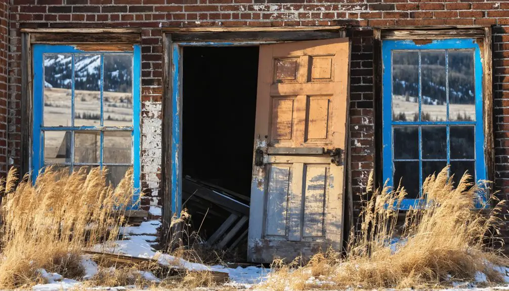
Preservation Status and Access
You’ll find Rimrock accessible via local roads, though you should expect minimal facilities and uneven terrain that may require a high-clearance vehicle.
While the site remains open year-round for self-guided visits, much of the surrounding land has been converted to agricultural use, limiting the explorable area.
The remaining historical structures lack formal preservation oversight, with only occasional volunteer efforts maintaining what’s left of this once-bustling mining settlement. Like other mining communities of the era, the initial structures were basic tents and shelters that housed the earliest prospectors.
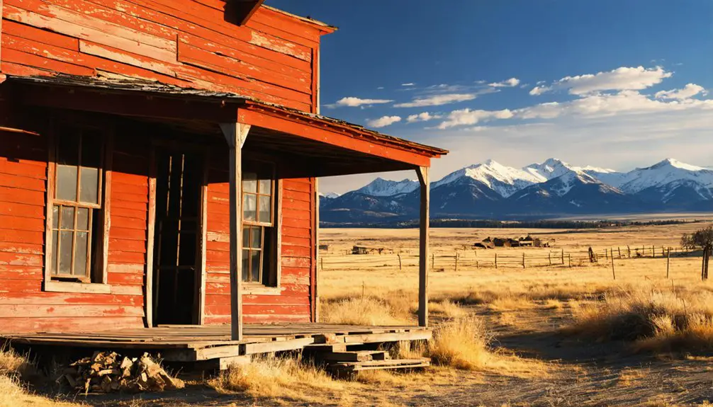
Current Access Restrictions
Since coming under Bureau of Land Management oversight in 1972, Rimrock’s access policies balance preservation with public visitation.
Current visitor policies allow you to explore residential areas and cabins 24/7, while commercial buildings maintain specific operating hours. You’ll find access guidelines that protect the site’s authenticity while ensuring your freedom to discover this historic treasure.
- You can visit the general site anytime, with unrestricted access to most outdoor areas.
- Parking fees of $10 may apply, though federal passes like America the Beautiful Senior Pass could waive these charges.
- Commercial buildings, including hotels and bars, follow set operating hours for safety.
- You’re welcome to explore on foot, but motorized vehicles aren’t permitted in core historic areas to prevent damage.
Agricultural Land Conversion
As efforts to preserve Montana’s agricultural heritage intensify, Rimrock’s surrounding farmland has become a focal point for conservation initiatives.
You’ll find local land trusts partnering with property owners to establish conservation easements, effectively protecting working farms and ranches from subdivision pressures.
These preservation efforts build upon the area’s rich agricultural foundation, where historic irrigation projects like the Big Ditch transformed prairie into productive farmland.
Today, you can support this legacy through programs like the Ravalli County Open Lands Bond, which helps maintain agricultural land values and prevents conversion to non-agricultural uses.
With Montana losing roughly 1,500 acres of farmland monthly to development, these conservation frameworks prove essential in protecting both the land’s agricultural heritage and the economic viability of local farming operations.
The region’s agricultural practices echo those of the Salish people, who first learned farming techniques from Jesuit missionaries at St. Mary’s Mission.
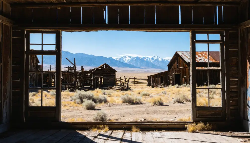
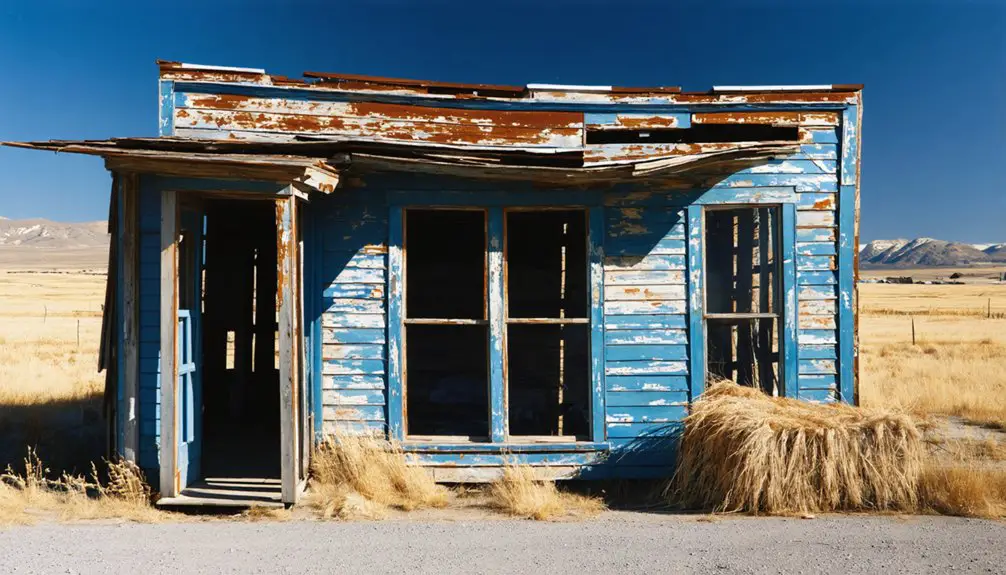
Historical Remnants Today
While agricultural preservation efforts flourish in the surrounding area, the physical remnants of Rimrock itself tell a different story.
Today, you’ll find the Rimrock ruins in a state of natural decay, with most original structures reduced to foundations and weathered walls. Unlike Montana’s well-preserved ghost towns like Bannack or Garnet, Rimrock lacks formal protection and maintenance programs.
- Limited mining artifacts remain on-site, with no interpretive signage to guide visitors
- Access requires navigation of rural roads that aren’t suitable for all vehicles
- Most areas may require private landowner permission to explore
- No visitor facilities or marked trails exist to assist your journey
The site’s raw, unpreserved state offers you an authentic glimpse into how time naturally reclaims these historic mining settlements when left untouched by modern preservation efforts.
Frequently Asked Questions
What Native American Tribes Originally Inhabited the Rimrock Area?
You’ll find the Crow (Apsáalooke) held primary historical significance in Rimrock, while other Native tribes including the Blackfeet, Sioux, Cheyenne, Gros Ventre, and Assiniboine also traversed this territory.
How Many People Lived in Rimrock During Its Peak Population?
You’ll find that historical records don’t provide exact numbers, but population dynamics suggest Rimrock likely reached several hundred to low thousands during its peak mining period of historical significance.
Were There Any Notable Crimes or Incidents at the Railroad Stop?
Through the misty lens of history, you won’t find documented railroad accidents or notable crimes at this stop. No ghost sightings or violent incidents appear in historical records from Rimrock’s operational period.
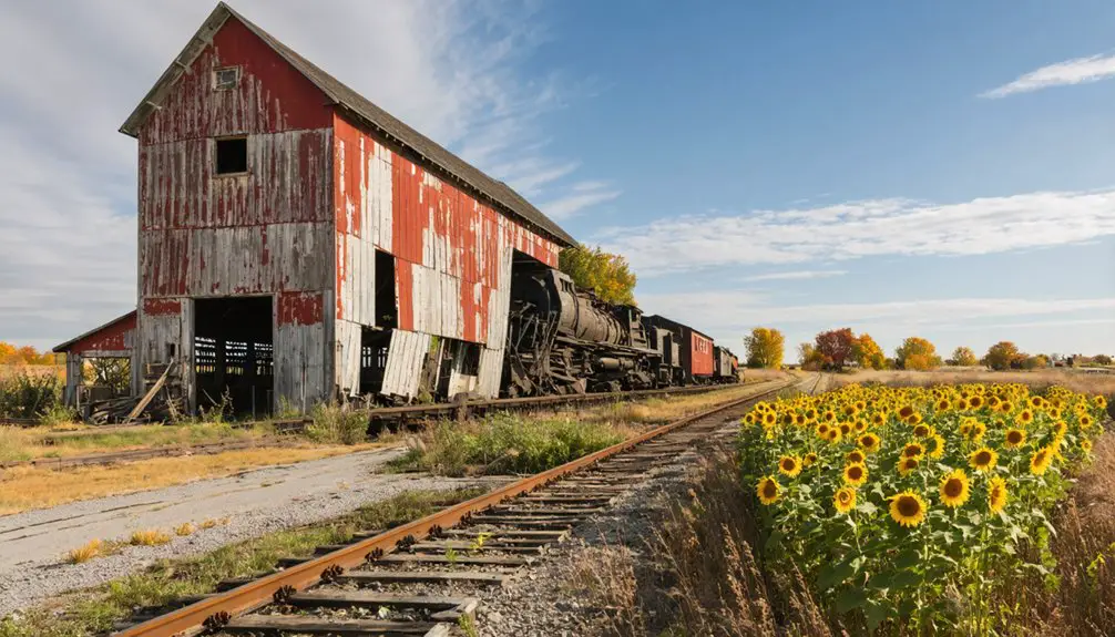
What Crops Are Currently Grown on the Agricultural Land in Rimrock?
You’ll find spring wheat dominates current agriculture around Rimrock, with alfalfa and perennial forage crops supporting local livestock. The area’s crop diversity includes summer fallow rotations and grazing lands.
Are There Any Surviving Photographs of Rimrock During Its Operational Years?
You won’t find confirmed historical photographs of operational Rimrock in any major archives. Despite extensive searches through photographic evidence collections, there’s no verified documentation of the town during its active period.
References
- https://virginiacitymt.com/Preservation/Area-History
- https://www.garnetghosttown.org/history.php
- https://discoveringmontana.com/montana/ghost-towns/
- https://www.blm.gov/sites/default/files/docs/2021-07/THE ROAD TO GARNET’S GOLD (002).pdf
- https://en.wikipedia.org/wiki/Rimrock
- https://pryormountains.org/-homestead-era/railroad
- http://mmrh.org/mt_rr_history.html
- https://www.youtube.com/watch?v=–B_r-skhPI
- https://mtbeyond.com/history/how-the-railroads-came-to-montana/
- https://www.fcvb.org/montana-scenery/