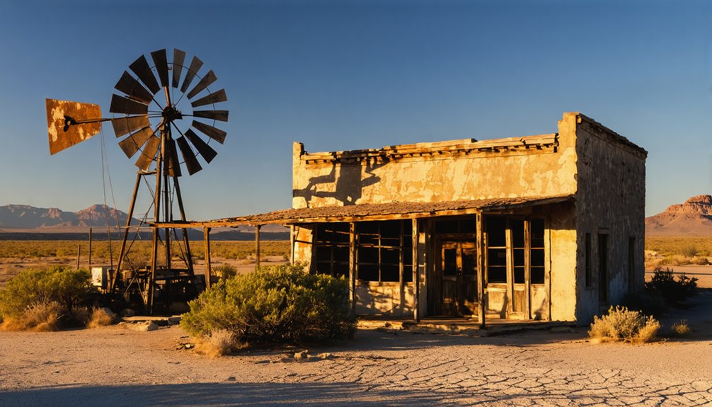
You’ll find Salt Flat along the historic highway between El Paso and Carlsbad Caverns, where it emerged as a bustling desert outpost in 1928. During its heyday, the town served travelers with competing stores, gas stations, and a post office, reaching a peak population of 125 residents by the 1960s. Today, you can explore its abandoned stone buildings, including the iconic cafe from the Butterfield Trail era, while the surrounding salt basin holds centuries of dramatic frontier history.
Key Takeaways
- Salt Flat emerged in 1928 as a highway stop between El Paso and Carlsbad Caverns, featuring a cafe, post office, and gas station.
- During its peak in the 1960s, Salt Flat supported approximately 125 residents through highway commerce and tourist services.
- The town’s historic stone building served travelers along the Butterfield Trail and remains a symbol of Texas frontier life.
- Salt Flat declined by the 1980s due to rising property taxes and alternate travel routes, transforming into a ghost town.
- Located at 3,730 feet elevation near the Guadalupe Mountains, Salt Flat preserves both natural beauty and early Texas settlement history.
The Ancient Salt Basin’s Legacy
Deep beneath the surface of what would become Salt Flat, Texas, ancient seas once covered the landscape, leaving behind valuable mineral deposits that would shape the region’s destiny for centuries to come.
You’ll find that these mineral resources, formed over 26 million years ago, created a stark landscape that’s still transforming today through wind and water erosion.
The salt deposits’ cultural significance emerged in the mid-1600s when Tigua Indians and Hispanic communities discovered their worth. These deposits served as crucial trade goods for thousands of years among native peoples across the Jornado Mogollon region.
Spanish explorers like Diego Romo de Vivar recognized the salinas’ potential, establishing trade routes that would fuel silver mining operations in Parral.
The basin’s resources weren’t just economically valuable – they became sacred to Indigenous peoples and essential for survival, offering both food preservation capabilities and trading opportunities that would define the region’s development.
Located 20 miles west of Pine Springs Visitor Center, these expansive salt flats stand as a testament to the area’s geological heritage.
Rise of a Desert Outpost
You’ll find Salt Flat’s origins deeply rooted in the area’s ancient salt deposits, which sparked territorial conflicts long before the town’s establishment.
When plans emerged in 1928 for a new highway connecting El Paso to Carlsbad Caverns, entrepreneurs seized the opportunity to establish a roadside community complete with a café, gas station, and post office.
While the salt flats had historically drawn Native Americans and settlers to the region, it was the promise of highway commerce that ultimately shaped Salt Flat into a modest desert outpost serving travelers bound for the Guadalupe Mountains. The area’s geological history stems from shallow rainwater lakes that formed the distinctive salt deposits. Ona and Ed Hammock opened the town’s first cafe in 1929, marking the beginning of commercial activity.
Highway Commerce Fuels Growth
As the newly constructed highway between El Paso and Carlsbad opened in 1929, Salt Flat emerged as an essential desert outpost through the entrepreneurial efforts of Ed Hammack and Arthur Grable.
These pioneering businessmen established competing stores and gas stations that quickly evolved into significant tourist attractions along the remote stretch of highway. A crucial emergency landing strip was constructed in 1932 to enhance transportation safety in the region.
The economic impact of highway commerce transformed Salt Flat into a thriving hub, offering:
- Key services like fuel, food, and lodging for travelers
- Regular bus line stops that connected the town to major cities
- Tourist courts and cafés catering to the growing motor traffic
You’d find Salt Flat bustling with activity by the 1930s, as highway travelers relied on its services.
The town’s strategic location and commercial development helped grow the population to approximately 125 residents by the 1960s.
Salt Drives Early Settlement
Salt Flat’s earliest identity emerged from the vast mineral deposits that gave the town its name.
You’ll find that these salt beds were more than just natural formations – they were lifelines for Native Americans, Spanish colonists, and Mexican settlers who harvested the precious mineral for centuries.
The salt trade became the backbone of regional commerce, with travelers braving harsh conditions and Apache raids to collect this important resource.
In the 1820s, early settlers were particularly drawn to the area by the abundant salt flats along Salt Stream and Salt Creek.
You’d be amazed at how this single commodity shaped the region’s development.
The Spanish colonists had been extracting salt from the area’s lakes since 1750, establishing a crucial resource gathering point in Hudspeth County.
The salt deposits weren’t just essential for food preservation – they were necessary for livestock maintenance and silver smelting operations in Mexican states like Chihuahua.
This economic significance even sparked the bloody El Paso Salt War, where competing claims over the salt beds led to a 12-year conflict that claimed 30 lives.
El Paso Salt War: A Bloody Chapter
During the late 1860s, tensions erupted in El Paso County over control of valuable salt deposits near the Guadalupe Mountains. When businessman Charles Howard tried enforcing payment for salt mining that had traditionally been free, you’d have witnessed fierce community resistance from local Tejanos who’d gathered their resources to fight back.
The conflict escalated into three dramatic events:
The salt war intensified through a sequence of violent confrontations that would forever change El Paso’s cultural landscape.
- A violent standoff between Howard’s forces and local citizens
- The siege of San Elizario, where Tejanos trapped Howard and Texas Rangers
- Howard’s surrender and execution by an angry mob
The Treaty of Guadalupe had placed these salt lakes under American jurisdiction years earlier, fundamentally altering access rights. The aftermath brought devastating consequences. Local residents formed community-based juntas to manage salt mining operations and resist Anglo control. You’d have seen Mexican families fleeing their homes, while others faced brutal retaliation from American troops.
The conflict permanently altered the region’s power structure, marking the end of free salt collection and shifting control to Anglo-American interests.
Native American and Colonial Heritage
Long before European settlers arrived in western Texas, indigenous peoples like the Apache and Tigua Indians recognized the immense value of the region’s natural salt flats.
You’ll find their indigenous practices deeply woven into the landscape, as they traveled great distances across the Trans-Pecos to harvest this precious resource for tanning hides and preserving food.
The cultural significance of these salt deposits extended well into the Spanish and Mexican colonial periods.
When Spanish colonizers arrived, they maintained the communal approach to salt collection established by native peoples. The relationship between settlers and natives would eventually deteriorate into violent raids across Texas.
After 1821, Mexican communities in the El Paso Valley relied heavily on these salt flats, hauling the mineral 70 miles from San Elizario and trading it throughout northern Mexico.
The salt’s importance grew even further when it became essential for silver smelting in Chihuahua.
Life Along the Butterfield Trail
You’d have encountered a well-organized network of relay stations every 10-15 miles along the Butterfield Trail, where fresh horses awaited your stagecoach journey through Texas’s rugged terrain.
Your westward passage would’ve included scheduled stops at these stations, which provided essential supplies, meals, and brief rest periods for weary travelers crossing the frontier.
At peak operations, you could expect to find nearly 800 workers maintaining the route’s 139 relay points, with approximately 1,800 horses and mules ready to keep the coaches moving on their ambitious 25-day timeline to San Francisco.
Historic Mail Route Operations
When John Butterfield secured a lucrative mail contract in 1857, he established one of America’s most ambitious transportation networks – a 2,700-mile overland route connecting St. Louis and Memphis to San Francisco.
You’d find his stagecoach operations running twice weekly, with coaches averaging 100 miles per day through challenging Texas terrain.
If you were traveling the route, you’d experience:
- Well-coordinated stage stops focused on swift team changes and mail handling
- Protected transport with armed guards watching over passengers and valuable cargo
- A relay system of horses and coaches maintaining precise schedules across established stations
The mail transport system integrated local infrastructure, utilizing existing settlements and ranch houses as stations while adapting to Texas’s harsh desert geography and securing essential water sources along the way.
Rest Stops and Supplies
Nearly 200 rest stops dotted the Butterfield Overland Mail Route, with Texas claiming about 50 of these essential waypoints.
Your rest stop experiences would’ve varied from basic relay stations to more developed facilities near water sources and military forts. You’d find hearty meals of pork, wild game, beans, and fresh coffee, with prices ranging from 40 cents to $1.
Supply challenges meant careful planning around water sources, especially in West Texas where you’d face stretches like the 33-mile waterless path to Deadman’s Hole.
You’d discover better provisions in eastern Texas, including oysters and sweet milk. At stops like the Sargent Hotel in Brackettville, you could enjoy hot cakes while the station crews changed horse teams and made minor coach repairs.
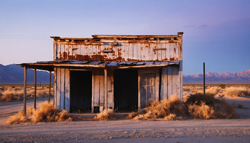
The Stone Building’s Untold Stories
Standing as a silent witness to over a century of frontier history, the stone building in Salt Flat, Texas harbors untold stories of conflict, survival, and cultural transformation.
Built during the Butterfield Trail era, this native stone structure reveals untold narratives of community resilience through some of the region’s most turbulent times, including the deadly El Paso Salt War of the 1860s.
You’ll discover three pivotal aspects of this historical landmark:
- Its role as a frontier haven, complete with advanced amenities like gravity-tank bathrooms
- Its connection to violent mineral rights disputes between Mexican, Native American, and Anglo settlers
- Its origins tied to Spanish Crown land grants, making it one of the area’s oldest surviving structures
Though deteriorating today, it remains a symbol of the rugged spirit of Texas’s western frontier.
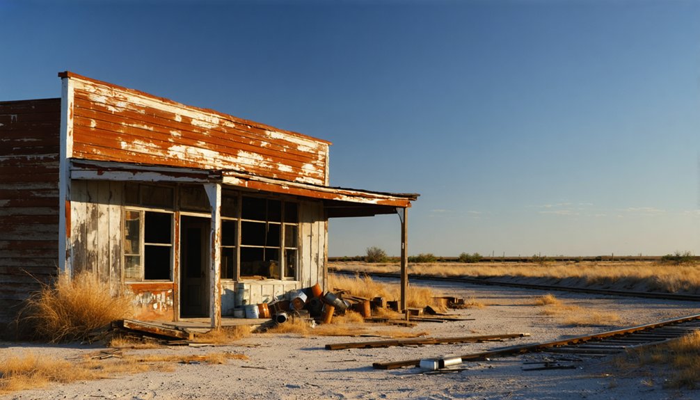
From Boom to Abandonment
The story of Salt Flat’s rise and fall begins in 1928, when vegetable farmer Ed Hammack spotted an opportunity along the newly constructed highway connecting El Paso to Carlsbad Caverns.
Despite the area’s historical significance for salt mining and indigenous use, the town’s growth centered on tourism rather than mineral extraction.
You’ll find that Salt Flat’s heyday was brief but promising. A cafe opened in 1929, followed by essential services like a post office and gas station.
Yet by the 1980s, you’d see only a handful of buildings standing, many abandoned. The town’s decline accelerated as alternate travel routes emerged and tourism dwindled.
Rising property taxes and costly maintenance drove away the remaining residents, including longtime locals George and “Chink” Temple, leaving Salt Flat to fade into ghost town status.
Natural Wonders and Geography
While ancient shallow lakes once covered the landscape, today you’ll find Salt Flat nestled within a sprawling dry salt pan at 3,730 feet above sea level.
The geological significance of this area stems from centuries of rainwater washing minerals from the Guadalupe Mountains into the Rio Grande Valley basins, creating a unique salt-laden terrain that’s shaped the region’s history and ecological diversity.
The natural wonders surrounding Salt Flat include:
- The dramatic rise of the Guadalupe Mountains, featuring the iconic El Capitan
- Seasonal pools that form in the flat muck, preserving the area’s ongoing hydrological activity
- Vast salt deposits that have sparked territorial conflicts and continue to define the landscape’s character
The striking contrast between mountain and basin creates an environment that’s both harsh and enchanting.
Preservation Challenges Today
You’ll find preservation efforts in Salt Flat considerably hampered by chronic funding shortages, which have stalled multiple restoration projects throughout the years.
The town’s remote location in far West Texas creates substantial logistical challenges for bringing in construction materials and skilled restoration workers.
These barriers to progress are further compounded by limited access to basic utilities and resources, making it difficult to maintain even the most essential preservation work.
Funding Shortages Halt Progress
Despite growing interest in preserving Salt Flat’s historic structures, severe funding shortages have brought restoration efforts to a near standstill.
You’ll find that traditional funding strategies have fallen short, with local governments struggling to allocate resources from their limited tax revenues. Current preservation initiatives face fierce competition for state and federal grants, while private investors remain hesitant due to the town’s remote location and minimal tourism potential.
Key funding obstacles include:
- Local heritage groups lack formal nonprofit status and broad fundraising networks
- Federal grant programs require matching funds that small communities can’t provide
- Private sector investors need guaranteed returns that ghost towns rarely deliver
Without sustainable funding solutions, Salt Flat’s remaining structures continue to deteriorate, leaving this piece of Texas history at risk of being lost forever.
Remoteness Complicates Restoration Work
Since its establishment in the 1920s, Salt Flat’s remote location in Hudspeth County has created significant obstacles for modern restoration efforts.
You’ll find this ghost town 90 miles east of El Paso, surrounded by harsh salt pans and the Guadalupe Mountains, where extreme conditions challenge every preservation strategy.
exploring the history of salt gap reveals the stories of its former inhabitants and the harsh realities they faced. The remnants of old structures and artifacts scattered throughout the area serve as a testament to their resilience. Visitors can often sense the echoes of the past as they wander through the desolate landscape.
The town’s isolation severely impacts restoration logistics. You’re looking at lengthy material transport over limited highways, difficult crew mobilization, and minimal access to emergency services.
The harsh environment – with its high salinity, extreme temperatures, and wind erosion – accelerates structural deterioration.
When you’re planning preservation work, you’ll face additional hurdles from poor communication infrastructure and limited skilled labor availability.
The remote setting also complicates regulatory oversight and reduces opportunities for preservation funding and expert involvement.
Hidden Gems of the Rio Grande Valley
Although Salt Flat lies north of the Rio Grande Valley proper, this remarkable ghost town serves as a gateway to several hidden treasures in the region’s northern reaches.
At an elevation of 3,730 feet, you’ll discover a landscape rich in cultural significance and natural wonders.
Perched high in the Texas wilderness, this cultural crossroads reveals nature’s grandeur alongside centuries of human history.
As you explore this historic settlement, you’ll find:
- The iconic stone cafe building, a remnant from the Butterfield Trail era that tells the story of early Texas settlement
- Ancient salt deposits that sparked the dramatic Salt Wars of the 1860s, showcasing the area’s contested history
- The majestic Guadalupe Mountains backdrop, offering spectacular photography opportunities and wildlife viewing experiences
The town’s strategic location near the national park makes it an ideal starting point for discovering the region’s blend of natural beauty and frontier heritage.
Frequently Asked Questions
Are There Any Permanent Residents Still Living in Salt Flat Today?
You won’t find current residents permanently living in Salt Flat, as it’s now a true ghost town. The last remaining inhabitants left years ago, with only occasional travelers passing through.
What Are the Closest Modern Amenities and Services to Salt Flat?
Need gas? You’ll find the nearest gas stations and grocery stores in Dell City, 15 miles northwest. For more extensive services, head to Sierra Blanca (43 miles southwest) or El Paso (90 miles west).
Can Visitors Legally Explore the Abandoned Buildings in Salt Flat?
You can’t legally explore most abandoned buildings since they’re on private property. For ghost town exploration without legal restrictions, you’ll need explicit permission from property owners first.
What Temperature Extremes Does Salt Flat Experience Throughout the Year?
You’ll experience dramatic temperature fluctuations, from scorching 97°F summer days in June to chilly 33°F winter nights in December. Seasonal averages range between 68°F to 74°F throughout the year.
Is There Cell Phone Service or Internet Connectivity in Salt Flat?
You’ll find limited cell coverage, with AT&T offering the best service at 80.8%. For internet access, your most reliable options are satellite providers like HughesNet, covering 98.7% of the area.
References
- https://blog.txfb-ins.com/texas-travel/city-spotlight-salt-flat/
- https://www.youtube.com/watch?v=0es4BPUPS68
- https://en.wikipedia.org/wiki/Salt_Flat
- https://www.mrt.com/news/article/Danger-lurks-in-West-Texas-salt-flats-9285261.php
- https://www.tshaonline.org/handbook/entries/salt-flat-tx
- https://www.texasescapes.com/TOWNS/Texas_ghost_towns/SaltFlatTexas/SaltFlatTx.htm
- https://nuttyhiker.com/ghost-town-salt-flat-texas/
- https://texastimetravel.com/directory/salt-flats-near-guadalupe-mountains-national/
- https://www.texasbeyondhistory.net/trans-p/images/he3.html
- https://www.marfapublicradio.org/show/nature-notes/2019-01-24/beneath-the-guadalupe-mountains-traces-of-an-ancient-salt-road


