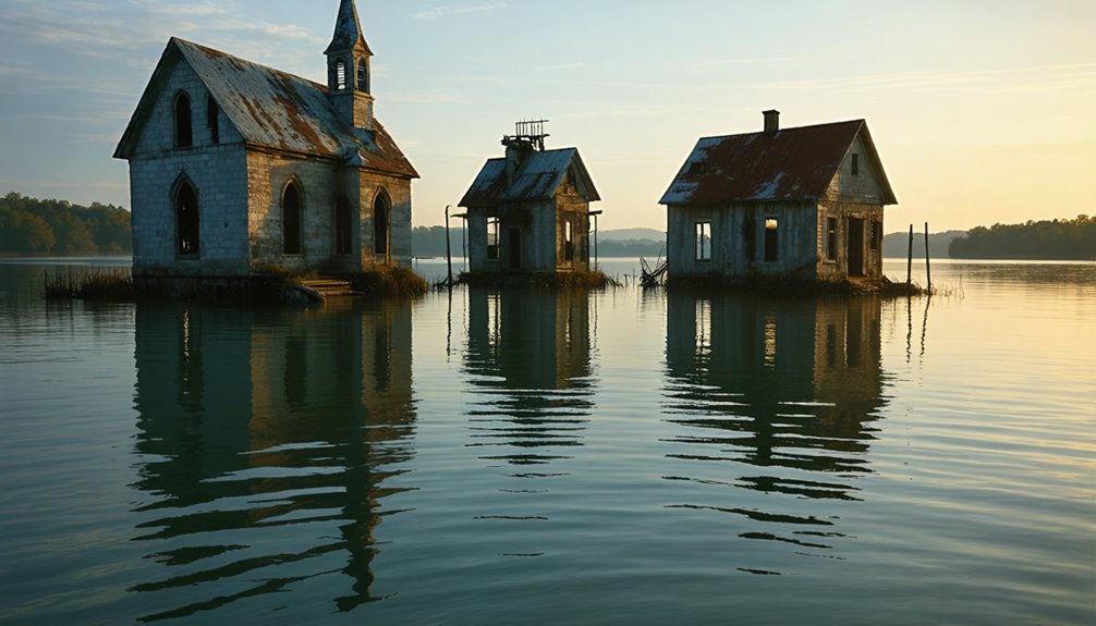
America’s underwater ghost towns exist beneath reservoirs created by TVA and Army Corps dam projects. You’ll find communities like St. Thomas that occasionally resurface during droughts, revealing buildings and artifacts from displaced settlements. These submerged towns represent significant cultural losses, particularly for indigenous communities whose sacred fishing traditions were severed. Modern preservation efforts document these lost communities through projects like the Atlas of Drowned Towns. The stories beneath these waters hold profound lessons about progress and sacrifice.
Key Takeaways
- Drought conditions occasionally reveal submerged communities like St. Thomas, offering temporary glimpses into America’s flooded past.
- Historic preservation organizations document remains of drowned towns through photography, mapping, and artifact collection during low water periods.
- The Atlas of Drowned Towns project catalogs submerged settlements nationwide, preserving histories that would otherwise be lost.
- Some structures from flooded communities were relocated to higher ground, creating partial “survivor” towns above reservoir waterlines.
- Archaeological research during drought exposures helps document the layout and artifacts of these underwater ghost towns.
The Birth and Death of America’s Underwater Communities

As the American landscape transformed throughout the 19th and 20th centuries, numerous vibrant communities became unintended casualties of progress and modernization.
While we celebrate American progress, we must remember the forgotten towns that drowned beneath its waters.
You’ll find that these towns—once established along rivers for agriculture, trade, and transportation—vanished beneath artificially created lakes and reservoirs.
Native American settlements, pioneer outposts, and industrial villages that had existed for generations were sacrificed for hydroelectric power and flood control initiatives.
When massive dam projects commenced, residents were displaced, buildings demolished or abandoned, and community memories systematically erased from the physical landscape.
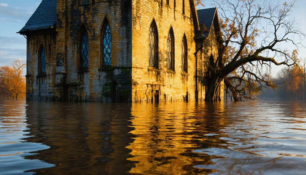
The flooding process didn’t happen overnight; waters gradually claimed streets, homes, and businesses—creating submerged legacies that persist today.
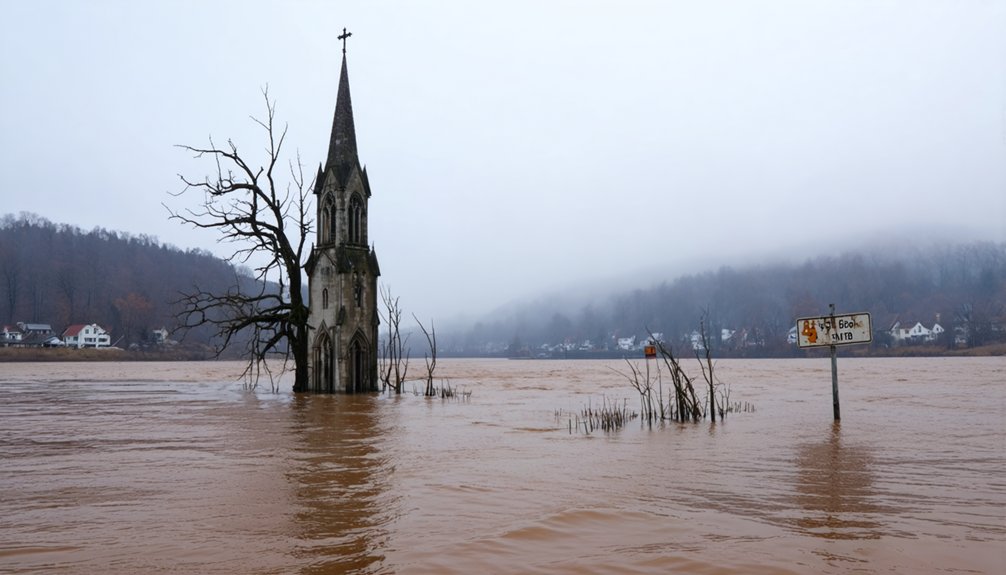
During droughts, these ghost towns occasionally resurface, revealing foundations and remnants of America’s submerged history—brief windows into communities that paid the ultimate price for national development. The Cherokee settlement of Chota, once a principal diplomatic and cultural center, now lies beneath Tellico Lake along with other historically significant sites.
Before the creation of many North Georgia lakes, the region featured only natural rivers and streams as North Georgia previously lacked lakes prior to modern flooding efforts.
TVA and Army Corps: The Great Submersion Projects
When Franklin D. Roosevelt’s New Deal established the Tennessee Valley Authority in 1933, it initiated one of America’s most extensive landscape transformations. The TVA projects fundamentally reshaped the region through a systematic dam-building campaign that began with Norris Dam, breaking ground in October 1933 and completing in 1936.
You’re living with the legacy of decisions that submerged entire communities. Approximately 72,000 people were displaced as TVA constructed 16 hydroelectric dams in just eleven years, creating submerged landscapes that permanently altered the valley’s geography. TVA’s dams were built not only for flood control but also to provide affordable electricity rates throughout the Tennessee Valley region. The agency’s River Forecast Center now operates 24/7 monitoring of the 41,000-square-mile watershed that includes portions of seven states.
While these underwater ghost towns represent a cultural loss, the system prevents roughly $300 million in annual flood damage and generated critical power during World War II, providing 60% of elemental phosphorus for munitions.
No other American river system experiences this level of coordinated control, with the Tennessee River’s flow managed through 49 strategically placed dams.
St. Thomas: The Desert Town That Drowns and Resurfaces
When you examine St. Thomas, Nevada, you’ll encounter a Mormon settlement founded in 1865 that was repeatedly submerged beneath Lake Mead following the completion of Hoover Dam in the 1930s.
The town’s ruins, including building foundations and the ice cream parlor’s chimney, have periodically reemerged during drought conditions—most significantly in 1945, 1963, and continuously since 2012.
These exposures provide researchers and tourists with rare access to a preserved early 20th-century desert community that alternates between submersion and visibility as Lake Mead’s water levels fluctuate with climate conditions. The final resident, Hugh Lord, dramatically departed his home by rowing a canoe as the rising waters claimed the town in 1938. The town once thrived with five hundred residents and featured essential community buildings until the impending flood forced evacuation.
Mojave’s Underwater History
Beneath the azure waters of Lake Mead lies the remarkable ghost town of St. Thomas, established in 1865 by Mormon Pioneers along the fertile banks of the Muddy River.
You’re witnessing history cycling through submersion and exposure as Lake Mead’s fluctuating levels reveal this once-thriving settlement.
The town’s drowning resulted from systematic governmental acquisition:
- The 1928 Boulder Canyon Project Act authorized Hoover Dam construction
- Federal eminent domain seized properties with minimal compensation
- Most residents dismantled their homes before relocating by 1932
- Complete submersion occurred by 1938, with water rising 60 feet above structures
When drought conditions prevail, you’ll find the concrete foundations, cisterns, and irrigation networks emerging like archaeological specimens—tangible remnants of a community that refused evacuation until water literally reached their doorsteps. The Gentry Store, which served as the central post office, was among the first structures to resurface when water levels began dropping in 2002. Today, visitors can access the site via a winding dirt road that leads to this dusty landscape of historical significance.
Drought Reveals Ruins
The cyclical resurrection of St. Thomas demonstrates how severe drought impacts reveal historical artifacts previously hidden beneath Lake Mead’s waters. As precipitation patterns shift and water consumption increases, the reservoir’s levels have dropped dramatically since the early 2000s, exposing foundations, irrigation systems, and structural remnants.
You’ll find the once-submerged archaeology accessible when lake levels recede. The ice cream parlor chimney stands as the tallest remaining structure, while concrete canals and remnants of the Arrowhead Trail emerge from the silt. These artifacts provide critical insights into early Western settlement patterns and adaptation strategies. The site was first established in 1865 as part of Mormon leader’s directive to settle the fertile Muddy River Valley. The town once supported a thriving community with a population that reached 600 residents and featured cottonwood-lined streets.
This periodic resurfacing offers a rare opportunity to examine an American ghost town typically hidden beneath water. The site’s visibility fluctuates with drought intensity, creating limited windows for observation before potential resubmersion occurs.
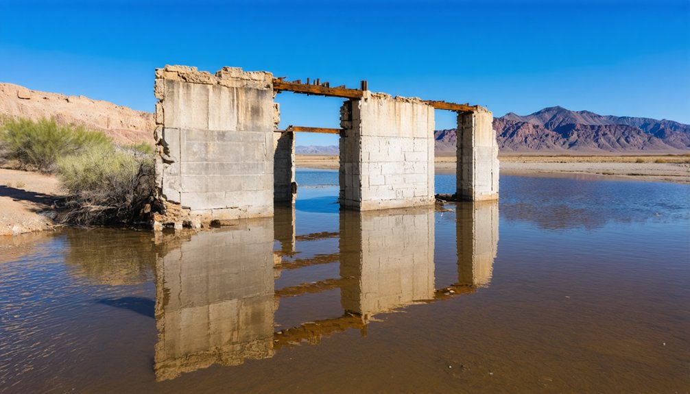
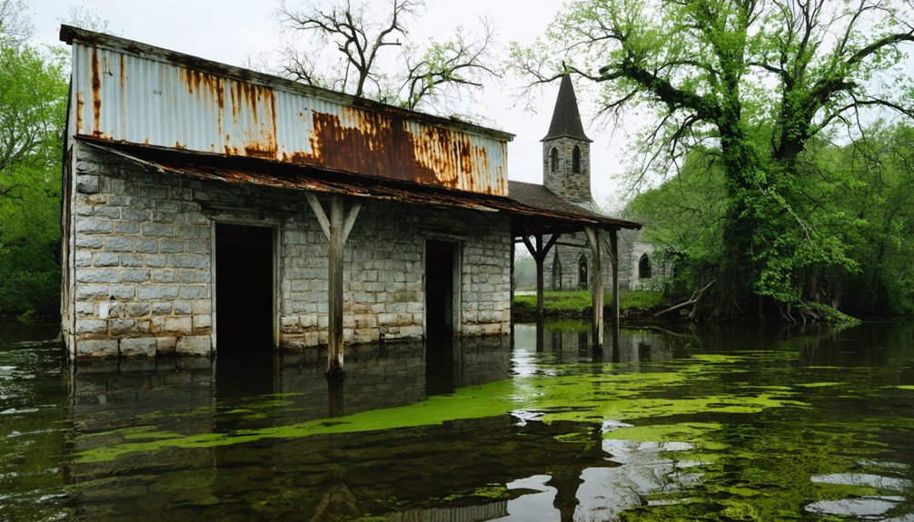
Exploring ghost towns in the United States reveals stories of past communities, often left behind as economies shifted and populations moved. Each visit to these towns provides a glimpse into the lives once lived there, as dilapidated structures and forgotten landscapes tell tales of resilience and change. As nature reclaims these spaces, the juxtaposition of their faded history against the vibrant environment creates a hauntingly beautiful scene.
Indigenous Heritage Lost Beneath the Waters
You’ll find that indigenous communities’ sacred fishing traditions were severed when ancestral waters transformed into government-controlled reservoirs.
The submersion of sites like Elbowoods and the Coosawattee Valley permanently disconnected Native peoples from territories where they’d practiced sustainable fishing for generations.
This forced displacement not only eliminated physical access to traditional fishing grounds but also disrupted the intergenerational transfer of ecological knowledge and spiritual practices tied to specific river ecosystems.
Sacred Fishing Traditions
For thousands of generations before modern infrastructure transformed river landscapes, Indigenous communities maintained a profound spiritual relationship with waterways and their aquatic inhabitants, particularly salmon.
These sacred waters weren’t merely fishing grounds but conduits to the spirit world where ceremonial fishing reinforced cultural identity.
Four elements characterized these traditions:
- First Salmon ceremonies honored the initial catch, ensuring spiritual and ecological balance.
- Sustainable harvesting practices followed lunar cycles and traditional ecological knowledge.
- Ritual locations along riverbanks served as sites for purification and ancestral communion.
- Artistic expressions depicted salmon in tribal regalia, storytelling, and ceremonial attire.
When dams flooded ancestral fishing grounds, they didn’t just alter ecosystems—they submerged living spiritual practices that had maintained harmony between humans and rivers for millennia.
Ancestral Land Displacement
When waters rose behind Grand Coulee Dam in the 1940s, they didn’t merely create a reservoir—they systematically erased Indigenous cultural landscapes that had sustained tribal communities for millennia.
You’ll find eleven settlements submerged beneath Lake Roosevelt, including Inchelium on Colville Reservation—direct appropriation of tribal lands. The submersion of Kettle Falls eliminated sacred fishing grounds central to cultural resilience.
This pattern repeated nationwide: Lake Mead drowned Anasazi sites, Jordan Lake consumed Tuscarora territories, and the Cahawba site’s Mississippian culture evidence disappeared underwater.
The aftermath included widespread looting of evacuated homes and gravesites before complete inundation. Community remembrance now depends on archaeological documentation and oral histories.
What remains beneath these artificial lakes isn’t just infrastructure—it’s ancestral knowledge, spiritual connections, and community bonds forcibly disconnected from those who maintained them.
Drought Revelations: When History Emerges From the Depths

As prolonged droughts grip regions across the United States, the falling water levels of man-made lakes and reservoirs reveal ghostly remnants of communities long submerged beneath their surfaces.
These drought impacts facilitate historical rediscovery of settlements sacrificed for infrastructure development decades ago.
Nature’s recession reveals the ghosts of progress—communities flooded for development now resurfacing as silent testimonials.
Four significant drought-revealed sites include:
- Cedar Mills and Woodville under Lake Texoma (Texas, 2011) – exposed gravestones and structural foundations
- St. Thomas beneath Lake Mead (Nevada) – buildings and streets emerging as water recedes
- Submerged cemeteries along major waterways – providing genealogical connections for descendants
- Pre-flood community layouts at Lake Hartwell – revealing architectural patterns of former townships
These temporary revelations offer rare opportunities to document lost heritage while prompting critical examination of water management policies that prioritized development over established communities.
The Human Cost of Progress: Displaced Communities and Their Stories
The construction of dams and reservoirs throughout the United States has exacted a profound human toll, displacing entire communities and erasing their physical presence from the landscape.
You’ll find stories of displacement across America—from the 735 families forced from their homes by North Dakota’s Garrison Dam to the 2,500 residents evacuated from New England’s disincorporated villages.
Beyond mere statistics lies the emotional reality: families watching generational orchards bulldozed, communities witnessing their churches demolished, and thousands seeing ancestral graves exhumed or submerged.
Despite these losses, community resilience emerges in preservation efforts like the Atlas of Drowned Towns.
The psychological impact requires ongoing emotional healing, as displaced residents grapple with severed connections to heritage and place—sacrifices demanded in the name of national development and resource management.
Preserving What Remains: Documentation Efforts of Vanished Towns
While communities vanish beneath rising waters, extensive documentation initiatives work to preserve their stories for future generations. The Atlas of Drowned Towns project employs rigorous historical methodologies to record these submerged settlements across the American West, creating publicly accessible digital archives.
Community documentation efforts continue through several approaches:
- Archaeological field research at sites like Ashokan Reservoir, where teams documented 500 homes and numerous community buildings.
- National Park Service preservation techniques at Lost City, where crews worked until water reached excavation sites.
- Interactive mapping systems allowing public exploration of drowned town locations.
- Digitization partnerships with the U.S. Army Corps of Engineers ensuring long-term storage and accessibility.
These initiatives capture vanishing cultural landscapes before permanent inundation, maintaining a connection to communities sacrificed for infrastructure development—preserving histories that might otherwise be lost forever beneath the waves.
Climate Change and America’s Submerged Past
Increasingly severe climate change impacts now threaten to create a second wave of America’s submerged past, expanding beyond intentionally flooded towns to communities abandoned due to rising waters.
You’re witnessing this transformation as catastrophic flooding events have tripled since the 1980s, forcing 3.2 million people to flee and creating climate abandonment zones.
The historical preservation challenge intensifies with infrastructure vulnerability—half of major coastal cities are built on subsiding land.
Black communities and vulnerable populations face disproportionate climate impact as marshes sink at over 3mm annually, compromising natural storm protections.
Finding Your Flooded Ancestry: Resources for Descendants
For descendants of those displaced by America’s submerged towns, tracing family history presents unique genealogical challenges requiring specialized research approaches.
When applying genealogy strategies to uncover your flooded ancestry, focus on repositories that document these submerged communities.
- Begin with the Atlas of Drowned Towns database, which catalogs histories, photographs, and archival maps of submerged settlements nationwide.
- Request cemetery relocation records from state water authorities, as grave disinterments were typically documented during reservoir creation.
- Examine eminent domain filings and property compensation records in state archives to track family displacement patterns.
- For indigenous ancestry, consult tribal enrollment documents and relocation records, particularly for communities along the Missouri River basin.
State historical societies often maintain specialized collections documenting the physical and cultural landscapes lost beneath reservoir waters.
Frequently Asked Questions
Can Visitors Scuba Dive to Explore Underwater Ghost Towns?
Yes, you can pursue scuba diving at multiple underwater ghost towns including Summersville Lake, Lake Jocassee, and Lake Mead, where specialized shops facilitate underwater exploration of submerged historical structures.
Are There Laws Protecting Artifacts Found in Resurfaced Ghost Towns?
Like ancient treasures guarded by dragons, artifacts from resurfaced ghost towns are heavily protected. You’ll face federal and state laws defining archaeological resources and restricting collection without proper permits, regardless of your freedom-seeking spirit.
How Accurate Are Maps of Underwater Towns for Treasure Hunters?
Maps of underwater towns exhibit poor accuracy for treasure hunting purposes. You’ll find historical documents often misplace settlements by miles, requiring archaeological verification and local knowledge to locate submerged artifacts effectively.
Do Former Residents Hold Reunions Near Submerged Hometown Sites?
Like salmon returning to birthplaces now impossible to reach, you’ll find limited documentation of reunion gatherings. While drought-exposed cemeteries occasionally trigger nostalgia events, formal homecomings near submerged towns remain scientifically unsubstantiated.
Can Land Ownership Be Reclaimed if Towns Reemerge Permanently?
You’ll face significant legal barriers reclaiming reemerged land rights. Ownership disputes would require challenging established water law precedents, contending with environmental regulations, and overcoming decades of title abandonment complications.
References
- https://openrivers.lib.umn.edu/article/ghost-streams-and-redlining/
- https://www.tnmagazine.org/tennessees-underwater-ghost-towns/
- https://en.wikipedia.org/wiki/List_of_flooded_towns_in_the_United_States
- https://www.neh.gov/article/atlas-drowned-towns
- https://www.kosu.org/history/2022-08-26/drought-has-dried-up-rivers-and-lakes-revealing-abandoned-towns-and-shipwrecks
- https://www.americanrivers.org/wp-content/uploads/2022/04/MER2022_Report_Final_03302022_reducedsize.pdf
- https://www.wef.org/publications/news/wef-news/ghost-town-emerges-from-the-depths-of-lake-mead/
- https://www.geotab.com/ghost-towns/
- https://www.blueridgeoutdoors.com/go-outside/sunken-secrets-the-underwater-ghost-towns-of-the-blue-ridge/
- https://yesterdaysamerica.com/history-submerged-georgias-drowned-towns/