When uncovering coastal fishing village relics, focus on shell middens with dark, ashy sediments and charcoal fragments. Look for fishing artifacts like bone hooks, net weights, and processing tools near land-water interfaces. Examine architectural remnants with raised living quarters and bright facades. Survey for harbor infrastructure including breakwaters and bulkheads. Analyze pottery fragments for trade network evidence. Map settlement clusters near freshwater sources. These key indicators will reveal ancient maritime lifeways beneath your feet.
Key Takeaways
- Shell middens with dark, ashy sediments and charcoal fragments indicate ancient cooking sites and seasonal resource exploitation patterns.
- Look for fishing technology artifacts like bone hooks, lead sinkers, and notched stones that served as depth control devices for nets.
- Ancient settlements were typically positioned at land-water interfaces near reliable freshwater sources and productive fishing grounds.
- Harbor infrastructure may include breakwaters, bulkheads, and remnants of trestle bridges, often extending from natural landmarks.
- Pottery fragments with non-local clay compositions and distinctive glazes provide evidence of maritime trade networks and exchange patterns.
Identifying Shell Middens and Fish Bone Assemblages
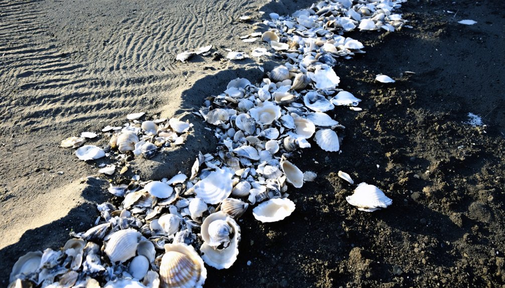
When exploring coastal archaeological sites, you’ll need to recognize shell middens by their distinctive composition of mollusk shells mixed with human activity debris. Look for dark, ashy sediments with charcoal fragments—clear indicators of cooking fires and human occupation.
True middens contain cultural materials embedded throughout: stone tools, bone artifacts, and household goods. These deposits range from thin layers to impressive mounds nine feet high and three hundred feet across, revealing their midden significance through time. The damp, anaerobic conditions in many coastal middens often preserve organic materials that would otherwise decompose in typical archaeological contexts.
Archaeological middens tell human stories through their embedded artifacts, ranging from shallow layers to monumental mounds marking centuries of settlement.
For proper shell analysis, distinguish cultural from natural deposits by examining processing patterns. Deliberately opened shells with consistent fracture patterns indicate human harvesting, while natural beds contain water-rolled shells in various sizes.
Cultural middens typically feature blackened shells from cooking exposure and contain diverse faunal remains including fish bones, indicating seasonal resource exploitation patterns. Scottish middens show remarkable variability in size and content, with some being primarily limpet or oyster-dominated while others contain diverse marine resources.
Recognizing Ancient Fishing Technology Through Artifacts
Archaeological identification of ancient fishing technologies requires careful examination of both portable artifacts and physical structures left behind by maritime communities.
Look for grid-like patterns on engravings that represent ancient nets, as seen in the 15,800-year-old slate artifacts from Gönnersdorf. These provide vital evidence of sophisticated fishing practices.
When examining coastal sites, you’ll find fishing hooks evolved from bone and shell to bronze with remarkable consistency over millennia.
The Ulu Burun shipwreck demonstrates Bronze Age hook sophistication, while Roman-era assemblages reveal complete fishing kits.
Identify lead sinkers and notched stones as depth control devices—essential for effective net placement.
For trap evidence, examine rock art, as organic materials rarely survive in the archaeological record.
Apply RTI imaging techniques to reveal previously invisible details on recovered artifacts.
The archaeological site at Gönnersdorf stands as one of Europe’s richest late Ice Age locations, offering exceptional insights into prehistoric fishing methods through its artistic depictions.
While documenting artifacts, be aware that modern AI scraping tools may affect the availability of online research resources.
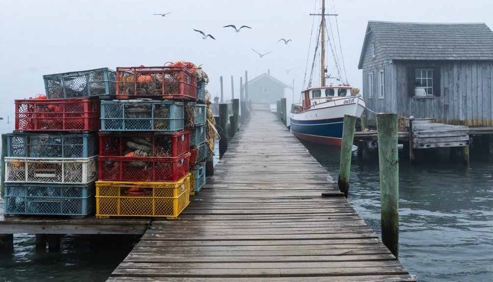
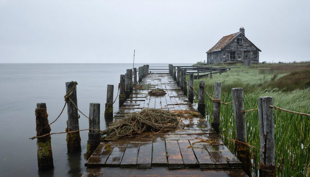
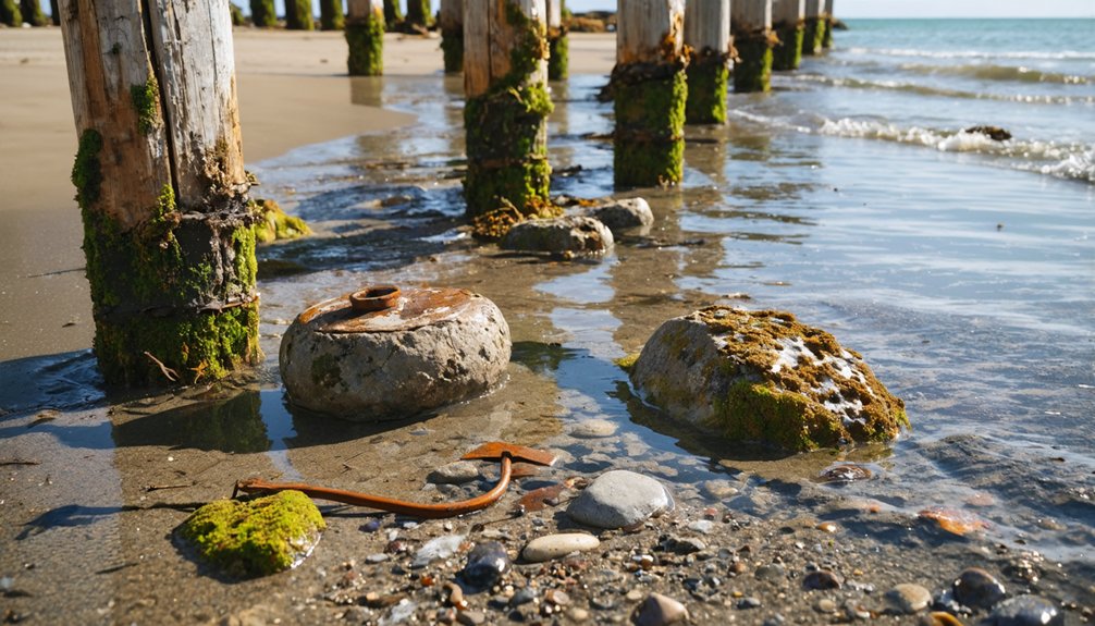
Locating Harbor Infrastructure and Protective Structures
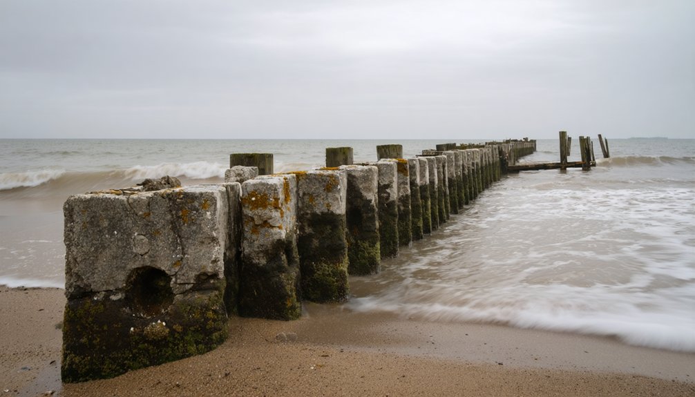
Locating the remnants of harbor infrastructure in coastal fishing villages requires systematic examination of both visible and submerged features along the shoreline.
Look for north and south breakwaters extending from natural landmarks, which establish harbor access and shield against waves. These protective designs typically connect to sandspits or rock outcrops.
Harbor entrances reveal themselves where breakwaters extend from natural features, creating protective passages against coastal forces.
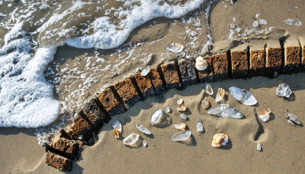
Survey for bulkheads made from wood, stone, or concrete that demonstrate maritime adaptations to local conditions.
Remnants of trestle bridges using native materials often reveal historical transport routes.
Check structural integrity of breakwaters and seawalls for evidence of storm damage and repairs. Be aware that many early harbor structures faced significant challenges due to strong winds and tides that complicated navigation and caused structural damage.
Consult historical maps and local oral histories to identify submerged structures.
Remember that harbor infrastructure integrates with the natural environment, adapting to tides, currents, and sediment movement patterns unique to each location.
In communities like Gig Harbor, look for historic waterfronts with marine railways and docks that once supported Croatian fishermen who established these maritime communities in the mid-1800s.
Mapping Processing Stations and Storage Facilities
To effectively map processing stations and storage facilities in coastal fishing villages, you’ll need to identify distinctive archaeological signatures in shell deposits and spatial patterns.
Look for dense concentrations of shellfish remains and feature-rich zones with pits and posts along shell ring edges.
Processing features typically include fire-cracked rocks, specialized lithic tools, and early fiber-tempered ceramics. You’ll find these artifacts spatially distributed in zones distinct from habitation areas. When surveying these zones, search for remnants of semi-permanent traps which were commonly used throughout the eastern seaboard for aquatic resource exploitation.
Storage indicators include subfloor pits, especially large, deep ones showing evidence of repeated use or lining. These facilities often cluster in specific site areas near processing stations. The proximity between storage and processing zones reflects efficient resource management strategies.
Analyze the circular arrangement of habitation zones with central plazas to understand how villagers organized their processing and storage activities within the broader social structure. Evidence of mass capture technology like finely woven net remnants can provide insights into fishing practices and processing requirements.
Detecting Settlement Patterns Near Marine Resources
When mapping ancient coastal settlements, you’ll find them consistently positioned at strategic land-water interfaces that maximize access to marine resources while minimizing exposure to harsh conditions.
Analyze shell midden formations—these accumulations of discarded shells, bones, and artifacts—to reveal long-term occupation patterns and resource utilization strategies that aren’t visible through surface surveys alone.
Focus your investigation on settlement clusters near reliable freshwater sources, as these represent the intersection of two critical survival requirements: access to potable water and proximity to exploitable marine biomass.
Historical records show that European fishermen established early settlements in locations that provided both access to productive fishing grounds and abundant wood supplies for constructing and maintaining fishing infrastructure.
Look for evidence of settlements positioned on narrow beaches or terraces due to the steep topography that characterized many Northwest Coast indigenous habitation sites.
Land-Water Interface Positioning
Successful detection of coastal fishing village patterns requires understanding how settlements position themselves at the critical juncture where land meets sea.
When examining potential sites, focus on land-water integration characteristics that reveal settlement dynamics across centuries of maritime adaptation.
Look for these critical positioning elements:
- Narrow beaches or terraces adjacent to steep terrain where communities maximized limited space while maintaining direct water access
- Intertidal zones and shallow waters that provided reliable shellfish harvesting areas, visible through shell middens and processing sites
- Curving coastlines or mosaic landscapes where diverse marine and terrestrial resources converge, allowing for multiple subsistence strategies
You’ll find most productive sites where the interface between ecosystems creates natural harbors, sheltered coves, and headlands that protected vessels while facilitating rapid access to fishing grounds.
Midden Formation Analysis
Shell middens serve as critical archaeological markers revealing ancient coastal settlement patterns through their distinctive formation processes.
You’ll encounter significant midden diversity analysis opportunities as these deposits range from small shell scatters (5-10m diameter) to impressive conical mounds reaching 5m high and 30m long.
When examining shell composition variation, look for vertebrate bones and burnt ceramics indicating multifunctional campsites.
Apply GIS and 3D modeling techniques to calculate precise volumes rather than assuming standard geometric forms.
Note that middens typically form in circular or oval footprints on sloped, concave landforms facing the ocean. Their distribution isn’t random—high-density clusters (up to 3.93 sites/km²) reveal intensive resource exploitation zones.
Ring-shaped middens generally surround dwelling areas, while dome-shaped varieties appear more widely distributed across coastal ridges.
Freshwater Proximity Patterns
Freshwater proximity represents a key determinant in coastal settlement patterning, complementing the shell deposit evidence found in middens. When searching for undocumented fishing villages, focus on the intersection of marine and freshwater ecosystems—these areas supported ecological sustainability through diversified resource management.
Archaeological evidence consistently shows settlements prioritized locations with reliable freshwater access while maintaining efficient marine resource harvesting.
Identify potential sites by looking for:
- Narrow beach terraces where freshwater streams meet sheltered harbors
- Estuaries and river mouths with extensive intertidal zones
- Natural springs near shallow coastal waters with diverse marine biomass
You’ll discover that settlements near these freshwater-marine interfaces typically exhibit higher population density, more permanent structures, and evidence of complex freshwater resource management systems that supported long-term habitation despite seasonal fluctuations.
Understanding Chronology Through Layered Occupation
Deciphering the chronological record of coastal fishing settlements requires careful examination of stratigraphic layers that accumulate through centuries of human occupation.
You’ll identify distinct occupation phases by analyzing changes in artifact assemblages, shellfish species, and refuse composition within each stratum. Look for horizontal versus mounded shell deposits as indicators of shifting construction methods over time.
Obtain radiocarbon samples from charcoal and organic remains across different layers to establish precise dating frameworks. Apply Bayesian modeling to enhance chronological accuracy.
Note how environmental adaptations are reflected in the archaeological record—sea level fluctuations and climate changes often correspond with layer formation patterns and resource exploitation shifts.
Villages frequently relocated or altered subsistence strategies in response to ecological pressures, creating distinctive stratigraphic signatures that you can interpret as evidence of community resilience and adaptation.
Analyzing Faunal Remains for Subsistence Strategies
When examining coastal fishing villages, the analysis of faunal remains provides essential insights into historical subsistence patterns and resource exploitation strategies.
To effectively analyze these remains, you’ll need to implement systematic sorting protocols and fine-mesh screening techniques that capture smaller bone fragments often missed by standard methods.
For meaningful interpretation of subsistence patterns:
- Compare fish species diversity and abundance (using NISP and MNI) across stratigraphic layers to identify ecological shifts and seasonal exploitation.
- Examine post-cranial to cranial bone ratios to determine specialized fishing and processing techniques.
- Analyze terrestrial mammal and shellfish remains alongside fish bones to understand dietary breadth and resource diversification strategies.
Your sampling strategy must account for taphonomic processes and preservation biases that might skew representation of certain species in the archaeological record.
Investigating Fresh Water Sources at Coastal Sites
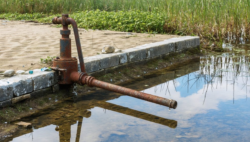
When conducting coastal site investigations, you’ll need to distinguish between salt and fresh water sources by measuring salinity levels and observing water clarity changes.
Look for coastal spring indicators like stone-lined wells (*puna*), water collection structures (*taheta*), or areas where groundwater visibly discharges during low tide.
These freshwater access points often correspond with settlement patterns and monument placement, providing critical evidence of past water management strategies.
Salt vs. Fresh
Although coastal villages are surrounded by water, the vital distinction between salt and fresh water sources has shaped human habitation patterns throughout history.
When investigating archaeological sites, you’ll find that freshwater sources were essential for coastal ecology and settlement viability.
Identify potential freshwater sources by looking for:
- Coastal groundwater discharge zones where potable water emerges, especially visible at low tides
- Submerged peat-bottomed pond sites that preserve evidence of prehistoric freshwater environments
- Paleo-river channels and springs now underwater due to sea-level rise
You’ll frequently discover monument clusters and settlement patterns aligned with these freshwater access points.
Ancient coastal inhabitants weren’t drinking seawater as early European accounts suggested—they were exploiting groundwater discharge points where freshwater meets the ocean, providing vital potable water in seemingly inhospitable coastal environments.
Coastal Spring Indicators
Identifying coastal spring indicators requires systematic archaeological and geomorphological investigation to locate ancient freshwater sources that supported maritime communities.
When exploring coastal sites, examine archaeological wells positioned within 200 meters of present coastlines—these structures serve as reliable freshwater markers.
Look for plastered cisterns with drainpipe systems, which indicate engineered collection of spring-fed water.
Analyze sediment deposits to identify zones where spring discharge altered coastal depositional patterns. Pay attention to liquefied sediment layers and subsidence evidence marking former discharge zones.
Don’t overlook tidal control mechanisms, particularly fish tank and inlet canal systems carved into bedrock. These features, with typical depths of 45 centimeters at Roman sites, demonstrate sophisticated management of freshwater during tidal fluctuations.
Examining Architectural Features of Fishermen’s Dwellings
The distinctive architecture of fishermen’s dwellings represents a harmonious blend of practicality and regional identity, shaped by centuries of adaptation to coastal environments.
When examining coastal design elements, notice how structures maximize protection while embracing their maritime setting. Fishing architecture typically features narrow, vertical layouts with raised living quarters that safeguard against flooding and optimize limited space.
Look for these key identifiers:
- Bright colored facades (yellows, blues, pinks) that distinguish properties while adding visual character
- Functional features like ground-floor storage areas for nets and equipment
- Adaptive elements including louvered windows and courtyards designed for both work and community life
Materials tell stories too—local stone foundations provide thermal mass, while terracotta tiles shed rainwater efficiently, demonstrating how builders ingeniously utilized available resources to withstand coastal conditions.
Documenting Evidence of Maritime Trade and Exchange
When you’re investigating a coastal fishing village‘s trade networks, examine any exotic artifacts that differ from local material culture, as these often indicate long-distance maritime connections.
Carefully document pottery fragments with non-local clay compositions, distinctive glazes, or foreign stylistic elements, since ceramic evidence provides essential insights into historical exchange patterns.
You’ll strengthen your research by creating an extensive catalog of imported goods, including their probable origins and approximate dates, to reconstruct the village’s position within broader maritime trade systems.
Exotic Artifacts Reveal Networks
Archaeological treasure troves from ancient coastal fishing communities provide definitive evidence of extensive maritime trade networks spanning millennia. When you’re excavating such sites, exotic materials offer essential insights into prehistoric trade routes.
Chinese porcelain at Kingany, obsidian tools in Jōmon sites, and Persian Gulf artifacts along the East African Coast demonstrate impressive interregional connectivity.
To identify trade networks effectively, you’ll need to:
- Document co-occurrence of fishing implements with non-local materials
- Apply Bayesian statistical models to accurately date exchange patterns
- Analyze shell deposits for evidence of processing activities related to trade
Shell-ring villages often functioned as institutional trade hubs where marine resources were procured, processed, and exchanged.
The introduction of ceramic technology around 4500 cal BP revolutionized storage methods, dramatically expanding potential trade reach for coastal communities.
Pottery Tells Trade Stories
Pottery fragments discovered at coastal fishing settlements serve as powerful narrators of ancient maritime trade networks when you know how to interpret their stories.
You’ll want to analyze compositional characteristics through techniques like LA-ICP-MS to determine pottery origins and distinguish imported wares from local production.
Examine stratigraphic contexts carefully—they’ll reveal chronological sequences of exchange patterns. When you find non-local ceramics alongside indigenous types, you’re looking at evidence of sustained trade relationships.
Map the distribution of specific pottery types across multiple sites to reconstruct ancient trade routes and identify commercial hubs.
Don’t overlook manufacturing techniques—differences in clay composition, temper, and firing methods signal external origins.
For thorough analysis, correlate pottery finds with associated artifacts like fishing implements, exotic goods, or marine remains to substantiate maritime exchange networks.
Frequently Asked Questions
How Do Archaeologists Distinguish Ritual Deposits From Ordinary Fishing Waste?
You’ll distinguish ritual deposits through ceramic analysis and bone identification, examining spatial context, complete articulation patterns, unusual objects, selective species presence, and taphonomic signatures that diverge from typical discard patterns.
What Role Did Women Play in Ancient Fishing Village Economies?
You’ll find women’s roles centered on processing catches through salting, drying, and smoking—activities that directly determined product quality and market value. Their economic contributions often reached 48% of household income through these specialized skills.
How Did Coastal Communities Adapt Fishing Techniques During Climate Fluctuations?
You’ll find coastal communities historically employed two primary adaptive strategies: relocating fishing grounds to follow species migrations and modifying catch portfolios by targeting emerging species—both demonstrating climate resilience through tactical flexibility rather than regulatory dependence.
Can Ancient Fishing Village DNA Reveal Migration Patterns of Maritime Peoples?
Yes, you’ll discover that fish DNA from ancient villages provides migration analysis through genetic markers, revealing maritime peoples’ movement patterns, trade networks, and long-distance connections across coastal regions throughout time.
How Did Religious Beliefs Influence Fishing Village Spatial Organization?
You’d think religion plays second fiddle in coastal towns, but it’s central. Religious beliefs create hierarchical spiritual zones and sacred spaces, organizing village life around centralized worship areas for maximum community cohesion.
As communities evolve, some find their spirit in the remnants of the past, leading adventurers to explore ghost towns to explore in Delaware. These abandoned places offer a glimpse into history, revealing stories of those who once thrived there. Each visit not only uncovers forgotten tales but also invites reflection on the resilience of community and the passage of time.
References
- https://www.tehrantimes.com/news/517025/6-000-year-old-fishing-village-reveals-ancient-maritime-diet
- https://scarf.scot/regional/higharf/highland-archaeological-research-framework-case-studies/sarclet/
- https://www.nature.com/articles/s41598-024-55047-z
- https://www.nps.gov/articles/aps-19-1-8.htm
- https://www.californiaprehistory.com/Vol34N2/342Noah.pdf
- https://archaeology.org/issues/march-april-2020/features/remembering-the-shark-hunters/
- https://snr.org.uk/the-mariners-mirror-podcast/the-lost-fishing-village-of-hallsands/
- https://whc.unesco.org/en/tentativelists/5785/
- https://globalvolunteers.org/ancient-fishing-town-is-cultural-base-for-peru-volunteers/
- https://en.wikipedia.org/wiki/Midden