You’ll find hundreds of American towns submerged beneath reservoirs, sacrificed during the dam-building era (1900-1960). These underwater ghost towns—like Detroit, Oregon and Celilo Falls—reveal themselves during drought periods, exposing foundations, bridges, and cultural artifacts. Modern preservation techniques using LiDAR, sonar, and digital archives now document these lost communities. Visiting exposed sites or exploring underwater via scuba diving offers a tangible connection to this forgotten chapter of displacement and progress.
Key Takeaways
- Drought conditions reveal foundations, bridges, and structures of towns submerged by dam projects from 1900-1960.
- Underwater archaeology teams use LiDAR, sonar, and aerial imagery to map and reconstruct submerged settlements.
- Towns like St. Thomas and Old Bluffton occasionally resurface during low water levels, providing glimpses into pre-flood communities.
- Many American towns were sacrificed for hydroelectric dams, including Preston, Hagerman, Andersonville, and Proctor.
- Digital preservation efforts like the “Atlas of Drowned Towns” and VR applications document these lost communities.
The Dam Projects That Swallowed Communities (1900-1960)
As the United States entered the 20th century, federal agencies initiated an ambitious campaign of dam construction that would permanently alter America’s riverine landscapes and displace entire communities in the process.
You’ll find the remains of Detroit, Oregon beneath reservoir waters, where from 1949-1953, government priorities—hydropower, irrigation, and flood control—trumped residents’ rights to remain.
The devastating St. Francis Dam failure of March 1928 that killed at least 431 people ironically accelerated dam building as officials sought safer, more controlled water management systems across the country.
Similar community displacement occurred along the Snake River when Brownlee Dam (1957) forced permanent evacuations. Before flooding, crews systematically dismantled or burned homes, businesses, and orchards to prevent hazardous floating debris.
The consequences extended beyond physical displacement. At Celilo Falls, the Dalles Dam reservoir (1957) drowned sacred Native American fishing grounds, erasing centuries of cultural heritage with inadequate compensation.
The Pueblo of Cochiti experienced similar cultural devastation when sacred lands were inundated by the construction of one of America’s largest earthen dams in the 1970s.
These projects exemplify how infrastructure development often sacrificed community autonomy for national objectives.
Iconic American Towns Now Beneath the Waves
While America’s landscape appears fixed and permanent on modern maps, dozens of once-thriving communities now exist only in historical records and the memories of former residents, their physical remains submerged beneath reservoir waters.
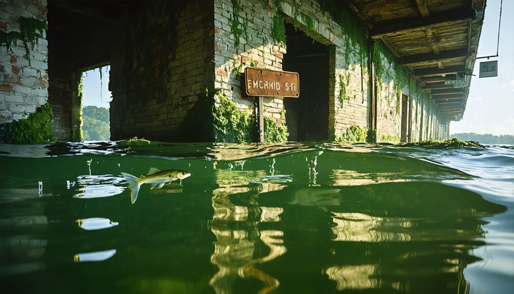
You’ll find Preston and Hagerman beneath Lake Texoma’s surface, their underwater archaeology revealing Texas border towns sacrificed in 1944. During droughts, like 2011’s, gravestones emerge—tangible connections to these hidden histories.
Beneath placid waters lie forgotten communities, their existence marked only by tombstones revealed during nature’s driest moments.
In Appalachia, Andersonville and Loyston succumbed to Lake Hartwell and Norris Dam, respectively, erasing regional trading centers and separating families from ancestral burial grounds. The town of Proctor, named after Moses Proctor, was completely submerged beneath Fontana Lake when the dam was built in the 1940s.
California’s gold rush town Kennett disappeared under Shasta Lake, while in New England, entire communities—Enfield, Dana, Greenwich—were methodically dismantled for Boston’s water supply, with 1,200 graves relocated and others abandoned to the rising waters.
Cedar Mills, once prosperous with a population of 500, joined the fate of these submerged towns when the Red River mills that gave the settlement its name were flooded by the creation of Lake Texoma.
Cultural Heritage Lost to Reservoir Waters
The cultural costs of America’s reservoir construction extend far beyond the physical displacement of towns and buildings described previously.
You’re witnessing the systematic erasure of Indigenous heritage when examining sites like Celilo Falls, where sacred fishing grounds used for centuries disappeared underwater in 1957. The Glen Canyon Dam similarly obliterated sacred landscapes of the Diné, Hopi, Nuwuvi, and Ute peoples without proper consultation.
Beyond Indigenous cultural erasure, countless family cemeteries now lie beneath reservoir waters. In Old Bluffton, Texas, many residents couldn’t evacuate before the town was rapidly submerged due to excessive rainfall following the Buchanan Dam’s completion. A.A. McGraw documented this displacement in his manuscript What Went Under, preserving stories of families forcibly relocated. While some remains were relocated—like those around Toledo Bend Reservoir—others remain submerged and forgotten.
The compensation offered—sometimes as little as $15 per grave—never addressed the severing of ancestral connections. Digital preservation efforts like the “Atlas of Drowned Towns” now race to document these submerged histories before they’re lost forever.
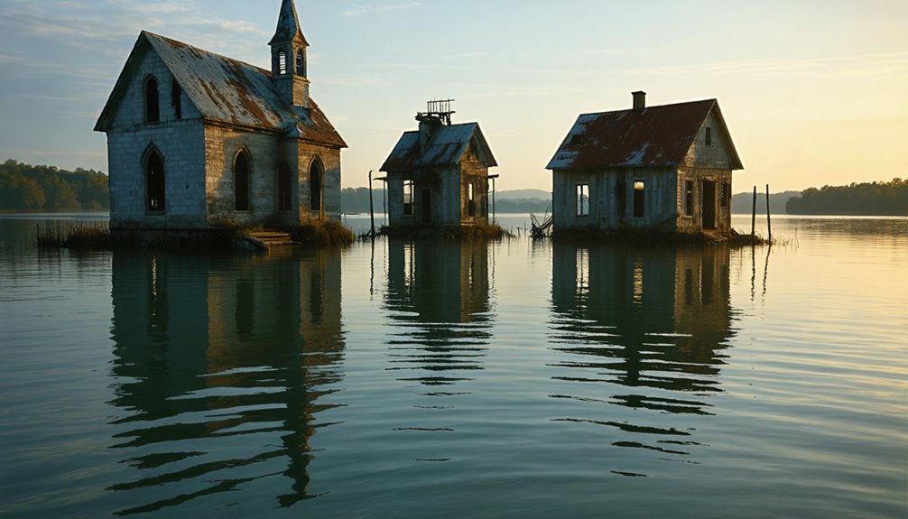
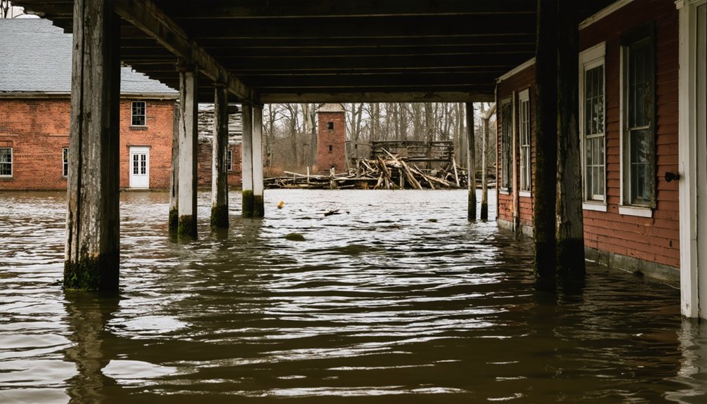
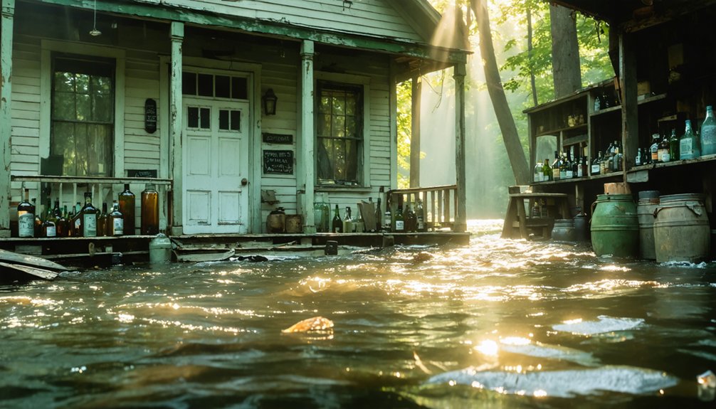
When Drought Reveals the Past: Exposed Remnants
Severe drought conditions across American reservoirs periodically reveal the ghostly remnants of towns once deliberately submerged beneath engineered waters.
As lake levels plummet—sometimes dropping 26 feet below normal—foundations, bridges, and structural skeletons emerge from their watery tombs.
These drought cycles transform submerged ruins into temporary archaeological discoveries.
At Old Bluffton, researchers document pre-flood settlement patterns during exposure events.
St. Thomas reveals its Mormon heritage through roughly 40 buildings, including the hotel foundation once visited by Herbert Hoover himself.
You’ll find these windows into history appearing with increasing frequency during extreme climate events, as at Lake Isabella’s original Kernville settlement and Pennsylvania’s Somerfield village.
Each emergence offers fleeting opportunities to witness tangible evidence of communities sacrificed for water management—historical fragments typically hidden from public access and scientific study.
The remnants of old Lemoyne town, flooded in the late 1930s to create a 30,000-acre Lake McConaughy reservoir, have resurfaced in Nebraska due to recent drought conditions.
Portions of St. Thomas are especially significant, with visible remains of the Hannig Ice Cream parlor offering glimpses into everyday life before the 1938 flooding.
Mapping and Preserving the Stories of Submerged Settlements
Beneath murky reservoir waters, extensive mapping techniques now illuminate the forgotten geographies of America’s drowned towns with unprecedented precision.
You’ll find underwater archaeology teams deploying sophisticated combinations of LiDAR, sonar scanning, and aerial imagery to create detailed reconstructions of settlements like Alamo Crossing and Gad.
The preservation battle continues through meticulous documentation projects.
When drought exposes ruins at Summersville Lake or Lake Mead’s St. Thomas, teams rush to capture photogrammetric 3D models before waters return.
Community engagement drives these efforts, with oral histories from displaced residents helping interpret sonar findings.
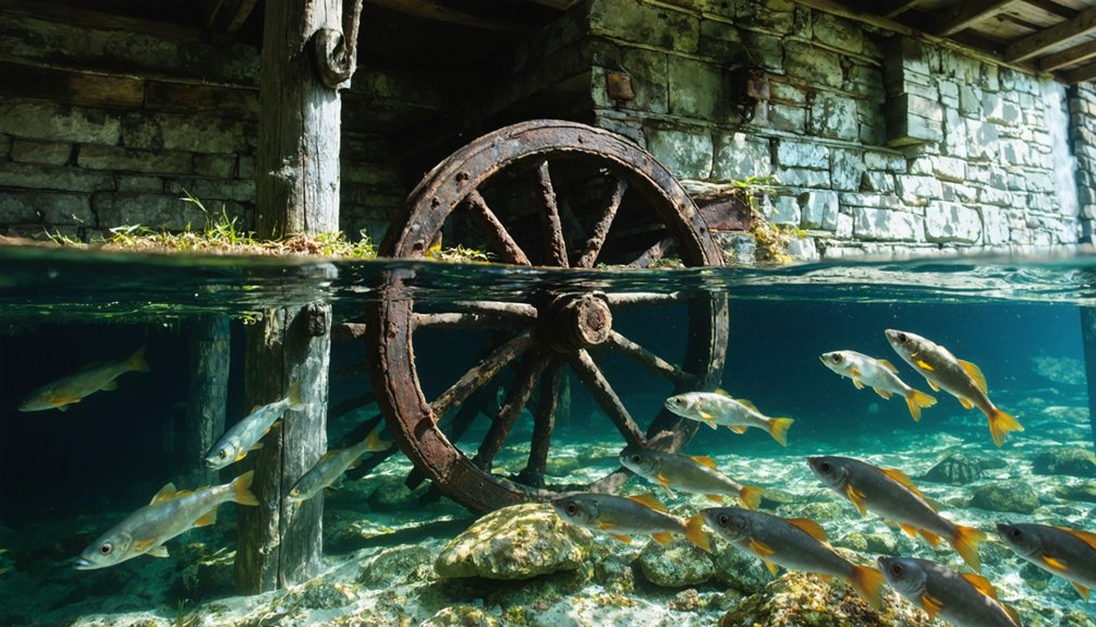
Among these submerged locations, the town established in the 1890s near Alamo Lake offers adventurous visitors a chance to explore a well preserved ghost town through scuba diving at depths of up to 80 feet.
As divers navigate the eerie underwater landscape, they often share ghostly tales from abandoned towns that echo the lives once lived there. These stories add an extra layer of intrigue to the expedition, drawing in those with a fascination for the past. Each dive unveils not only the remnants of structures but also the whispers of history that linger in the depths.
Summersville Lake’s underwater ghost town draws scuba divers seeking to explore the remains of Gad which was sold to the Army Corps in the early 1960s.
GIS-based story maps integrate these testimonies with digital archives, while VR applications allow you to virtually walk streets long submerged.
These technological tools preserve cultural heritage despite physical inaccessibility, ensuring these forced displacements aren’t erased from memory.
Frequently Asked Questions
Can Divers Legally Explore Sunken Towns and Remove Artifacts?
You can legally explore sunken towns with proper permits, but diver regulations prohibit artifact removal. You’ll need to document your findings while maintaining artifact preservation according to heritage protection laws.
How Did Flooding Affect Property Values in Neighboring Unsubmerged Areas?
You’ll find homes near flood zones lose 4-12% value without ever being underwater. Flood impact radiates outward, causing property depreciation through reduced demand, infrastructure concerns, and market stigmatization throughout entire neighborhoods.
What Wildlife Ecosystems Formed in These Flooded Ghost Towns?
You’ll find these submerged habitats transform into complex wetland ecosystems, where dead trees create “ghost forests” supporting aquatic biodiversity through marsh grasses, salt-tolerant shrubs, and new niches for amphibians and predatory fish.
Were Any Communities Successfully Saved From Planned Submersion?
No communities achieved full preservation. You’ll find only partial successes through historical significance documentation, artifact recovery, and selective structure relocation—technical compromises when community preservation faced inevitable submersion by governmental authority.
How Accurate Are Underwater Maps of These Submerged Towns?
Just as underwater technology has advanced, so has mapping accuracy, though you’ll find precision varies dramatically based on water turbidity, sediment accumulation, and whether structures were demolished before flooding.
References
- https://www.neh.gov/article/atlas-drowned-towns
- https://cedarbayoumarina.com/four-ghost-towns-under-lake-texoma/
- https://www.thewanderingappalachian.com/post/the-underwater-towns-of-appalachia
- https://clui.org/newsletter/spring-2005/immersed-remains-towns-submerged-america
- https://www.youtube.com/watch?v=E0mfoxW3XIs
- https://en.wikipedia.org/wiki/List_of_flooded_towns_in_the_United_States
- https://www.kcur.org/news/2022-08-25/drought-and-history
- https://www.wef.org/publications/news/wef-news/ghost-town-emerges-from-the-depths-of-lake-mead/
- https://en.wikipedia.org/wiki/Floods_in_the_United_States_(1900–1999)
- https://nmindepth.com/2013/a-dams-painful-history/